Ohio History Journal
THE OLD NATIONAL ROAD-THE HISTORIC
HIGHWAY OF AMERICA.*
BY ARCHER BUTLER HULBERT.
I.
"THE MIDDLE AGE."
"The middle ages had their wars and
agonies, but
also their intense delights. Their gold
was dashed with
blood, but ours is sprinkled with dust.
Their life was
intermingled with white and purple; ours
is one seam-
less stuff of brown." - RUSKIN.
A person can not live in the American
central west and be
acquaintance with the generation which
greets the new century
with feeble hand and dimmed eye without
realizing that there
has been a time which, compared with
to-day, seems as the Middle
Ages did to the England to which Ruskin
wrote-when "life
was intermingled with white and
purple."
The western boy, born to a feeble
republic-mother with
exceeding suffering in those days which
"tried men's souls,"
grew up as all boys grow up. For a long
and doubtful period
the young west grew slowly and changed
appearance gradually.
Then, suddenly, it started from its
slumbering, and, in two
decades, could hardly have been
recognized as the infant which,
in 1787, looked forward to a precarious
and doubtful future. The
boy has grown into the man in the
century, but the changes of the
last half are not, perhaps, so marked as
those of the first, when
a wilderness was suddenly transformed
into a number of imperial
commonwealths.
When this west was in its teens and
began suddenly outstrip-
ping itself, to the marvel of the world,
one of the momentous
factors in its progress was the building
of a great National
Road, from the Potomac river to the
Mississippi river, by the
* Copyrighted 1901, by Archer Butler
Hulbert.
(405)
406 Ohio Arch. and His. Society Publications.
United States Government - a highway
seven hundred miles in
length, at a cost of seven millions of
treasure. This ribbon of
road, winding its way through Maryland,
Pennsylvania, Ohio,
Indiana and Illinois, toward the
Mississippi, was one of the most
important steps in that movement of
national expansion which
followed the conquest of the west. It is
probably impossible for
us to realize fully what it meant to
this west when that vanguard
of surveyors came down the western
slopes of the Alleghanies,
hewing a thoroughfare which should, in
one generation,
bind distant and half-acquainted states
together in bonds of com-
mon interest, sympathy and ambition.
Until that day travelers
spoke of "going into" and
"coming out of" the west as though
it were a Mammoth Cave. Such were the
herculean difficulties
of travel that it was commonly said,
despite the dangers of life
in the unconquered land, if pioneers
could live to get into the
west, nothing could, thereafter, daunt
them. The growth and
prosperity of the west was impossible,
until the dawning of such
convictions as those which made the
National Road a reality.
But if it meant something to the
wilderness of the west,
how much more it meant to the
east-opening for its posses-
sion the richest garden on the planet,
the four million square miles
in the Mississippi basin. For this same
prize two great powers
of the old world had yearned and fought.
France and England
had studded the west with forts, and
their arms had been reflected
in every stream from Presque Isle to the
Holston, but neither
of them could conquer the Alleghanies. A
century had proven
that the west could not be held by water
ways. The question,
then, was, could it be held by land
approaches? The ringing of
woodmen's axes, the clinking of
surveyors' chains, the rattle of
tavern signs and the rumble of stage
coach wheels, thundered
the answer - Yes!
So patriotic and so thoroughly American
is the central west
to-day, that it is also difficult to
realize by what a slender thread
it hung to the fragile republic east of
the mountains, during the
two decades succeeding the Revolutionary
war. The whole world
looked upon the east and west as realms
distinct as Italy
and France, and for the same
geographical reason. It looked
for a partition of the alleged
"United States" among the powers
The Old National
Road. 407
as confidently as we to-day look for the
partition of China, and
for identically similar reasons. England
and France and Spain
had their well defined "spheres of
influence," and the populated
and flourishing center of the then west,
Kentucky, became, and
was for a generation, a hotbed of their
wily emissaries. Through
all those years, when Burr and others
"played fast and loose with
conspiracy," the loyalty of the
west was far less sure than one can
easily believe. The building of the
National Road was, undoubt-
edly, one of the influences which
secured the west to the Union,
and the population which at once poured
into the Ohio valley
undoubtedly saved the western states in
embryo from greater
perils, even, than those they had known.
This road, conceived in the brain of
Albert Gallatin, took its
inception in 1806, when commissioners to
report on the project
were appointed by President Jefferson.
In 1811 the first con-
tract was let for ten miles of the road
west of Cumberland,
Maryland, which was its eastern
terminus. The road was opened
to the Ohio river in 1818.
In a moment's time an army of emigrants
and pioneers were
en route to the west over the great
highway, regiment following
regiment as the years advanced. Squalid
cabins, where the hunter
had lived beside the primeval
thoroughfare, were pressed into
service as taverns. Indian fords, where
the water had oft run
red with blood in border frays, were
spanned with solid bridges.
Ancient towns, which had been
comparatively unknown to the
world, but which were of sufficient
commercial magnetism to
attract the great road to them, became,
on the morrow, cities of
consequence in the world. As the century
ran into its second
and third decades the National Road
received an increasingly
heterogeneous population. Wagons of all
descriptions, from the
smallest to the great "mountain
ships" which creaked down the
mountain sides and groaned off into the
setting sun, formed a
marvelous frieze upon it. Fast
expresses, too realistically per-
haps called "shakeguts," tore
along through valley and over hill
with important messages of state. Here,
the broad highway
was blocked with herds of cattle
trudging eastward to the
markets, or westward to the meadow lands
beyond the mountains.
Gay coaches of four and six horses,
whose worthy drivers were
408 Ohio Arch. and His. Society Publications.
known by name even to the statesmen who
were often their pas-
sengers, rolled on to the hospitable
taverns where the company
reveled. At night, along the roadway,
gypsy fires flickered in
the darkness, where wandering minstrels
and jugglers crept to
show their art, while in the background
crowded traders, huck-
sters, peddlers, soldiery, showmen and
beggars-all picturesque
pilgrims on the nation's great highway.
It is a fair question whether our
western civilization is more
wonderful for the rapidity with which
new things under the sun
are discovered, or for the rapidity with
which it can forget men
and things to-day which were
indispensable yesterday. The era
of the National Road was succeeded in a
half a century by that
of the railway, and a great
thoroughfare, which was the pride
and mainstay of a civilization, has
almost passed from human
recollection. A few ponderous stone
bridges and a long line
of sorry looking mile-posts mark the
famous highway of our
middle age from the network of
cross-roads which now meet it
at every step. Scores of proud towns,
which were thriving cen-
tres of a transcontinental trade, have
dwindled into comparative
insignificance, while the clanging of
rusty signs on their ancient
tavern posts tell, with inexpressible
pathos, that
"There hath passed away a glory
from the earth."
II.
THE WASHINGTON AND BRADDOCK ROADS.
In considering the rise and fall of the
National Road, it is
necessary to describe briefly the three
great routes from the east
to the west which served before its
building, and particularly
the historic route upon which it was
itself built.
It was for the buffalo, carrying a
weight of a thousand pounds
and capable of covering two hundred
miles a day, to mark out
the first continental highways of
America. The buffalo's needs -
change of climate, new feeding grounds
and fresher salt licks -
demanded thoroughfares. His weight
demanded that they should
be stable, and his ability to cover
great distances, that they should
be practicable. But one such course was
open for passage for
the buffalo, and that on the summits of
the hills. From the
The Old National Road. 409
hilltops the water was shed most
quickly, making that the dryest
land; from the hilltops the snows of
winter were quickest blown,
lessening the dangers of drifted banks
and dangerous erosions.
There were three great routes of the
buffalo from the sea-
board to the central west; first,
through northern New York;
second, through southern Virginia and
Kentucky; third, through
northwestern Maryland and southwestern
Pennsylvania.
Route one was practically the present
course of the New York
Central railway. It was the old overland
route on the lakes.
Route two ran southwest, through
Virginia, between the
Alleghanies and Blue Ridge, and turned
westward through Cum-
berland Gap. This old route of the buffaloes
was first marked
out for white man's use by Daniel Boone,
who was engaged in
1774 to mark out a road to lands in
Kentucky purchased from
the aborigines by the Transylvania
Company. This route through
the Gap became known as the Wilderness
Road. Kentucky took
up the matter of improving and guarding
the Wilderness Road
in 1793, a year after her admission into
the Union. The two
main thoroughfares of Kentucky were
along buffalo "traces";
one, diverging on Rockcastle creek, led
to the Blue Grass country,
where Lexington was built, (Boone's
route); another led to
Harrodsburg, Danville and Louisville,
and westward to Vin-
cennes and St. Louis on the Mississippi
(Logan's route).
Route three was a course from the
Potomac to the Ohio
river, marked for the first Ohio
Company, before the French
and Indian War by Nemacolin, a Delaware
Indian. It was later
the general course of Washington's road
and of Braddock's
road -the first great road built westward.
Each of these three routes found its
terminus on a body of
water; the first at Buffalo on Lake
Ontario, the second at St.
Louis on the Mississippi, the third at
Pittsburg on the Ohio.
As for the Indians and whites they were
merely portage paths.
The fact that when men ascended these
American streams to
the portages, and found there already
deeply worn, trails of
the buffalo, is interesting evidence
that the brute had found the
great continental paths of least
resistance (least elevation) with
marvelous accuracy. This must be judged
one of the most won-
derful exhibitions of the utilitarianism
of animal instinct. If
410 Ohio Arch. and His. Society Publications.
the proposed great highway from the
Atlantic to the Pacific is
built, wherever there is need of careful
choice of route, it will
inevitably follow the general alignment
of a buffalo trace.
Each of these three American continental
routes were of the
utmost importance at one time or
another. The first great tide
of immigration which set westward went
largely over Boone's
blazed road through Cumberland Gap.
Later the Wilderness
Road was eclipsed by the National Road,
which served until the
mountains were spanned by the railways.
The most northerly
route, through the state of New York,
the least used and known
of the three, will probably entirely
eclipse its southern rivals in
importance in the days to come. This
route became well known
in the days of lake and land emigrations
to the west. Hundreds
of pioneers of the Connecticut Western
Reserve went up this
old route to Buffalo and passed on
westward, traveling along
the beach of Lake Erie.
The course of the buffalo through
Maryland and Pennsyl-
vania to the Ohio is the most historic
route in America, and one
of the most famous in the world.
Undoubtedly the route of the
buffalo and Indian were identical, for
at least the length of the
portage between Cumberland on the
Potomac and Brownsville
(Redstone Old Fort) on the Monangahela
river. This was prob-
ably the main traveled path. From it,
however, diverged (on
the summit of Laurel Hill) what was,
undoubtedly, the original
buffalo trace, which coursed in a
northwesterly direction toward
the site of Pittsburg on the Ohio river.
This trace of the buffalo and portage
path of the Indian
from the headwaters of the Potomac to
the headwaters of the
Youghiogany had no name of which record
has been made, until
it took the name of a Delaware Indian,
Nemacolin, who first
"blazed it" for white man's
use. In 1749 a company of Virginia
gentlemen received from the King of
England a grant of land
in the "Ohio country," on
condition that they would settle it
within seven years. The first two
necessary duties of the com-
pany were quickly undertaken.
Christopher Gist, a reliable moun-
taineer, was sent into the Ohio valley
to pick out the land for the
pioneers of the company, and a Captain
Michael Cresap, who
lived on the upper Potomac, was
entrusted with the work of
The Old National Road. 411
marking out a road thither - " to
lay out and mark a road from
Cumberland to Pittsburg."l The road
to the Ohio had already
been laid out for centuries, but it was
not "marked." Cresap
employed Nemacolin to "blaze"
the old route.
Thus at the middle of the eighteenth
century, as the curtain
of one of the greatest dramas in history
was about to rise, a
line of gashed trees led into the west,
for the possession of which,
the two enemies, France and England,
were about to transfer
their immemorial war to the new
continent.
To those who love to look back to
beginnings and read great
things in small, this line of wounded
trees, leading across the
first great "divide," into the
rich empire of the central west,
is worthy of contemplation. Each tree,
starred whitely by the
Indian's axe, speaks of Saxon conquest
and commerce, one and
inseparable. In every act in the drama
that so quickly followed,
this Indian path with its blazed trees
lies in the foreground. Over
it came the young surveyor Washington,
on his way to the
haughty St. Pierre, to ask that
exceeding formal question why
the French were building forts on
western territory (which was
legally theirs, and to which no people
other than the French have
ever had a better right!) Then, the
trail having been widened,
on came Washington's little Virginian
army, the first conflict
of the war, and the erection of Fort
Necessity near the broad-
ened Indian path.2 Soon
after, the route became immortalized
by the advent of Braddock's army, which
was annihilated upon
it. The reader will recall that one of
the three plans of the
British in the campaign of 1775, in the
French and Indian War,
was the attempt of General Braddock to
capture the French Fort
Duquesne, at the junction of the
Alleghany and Monongahela,
in order to sever the line of French
forts from Quebec to Louis-
iana, and break the "backbone of
New France."
This important expedition landed at the
port of Alexandria,
in Virginia, February 20, 1755. With the
same dense ignorance
of the continent, which existed in the
day when letters were
addressed to the "Island of New
England," no thought was taken
1Jacob's Life of Captain Michael Cresap, p. 28.
2 Washington's Journal,1754 (Toner),
pp. 42, 48, 50, 62, 95.
|
412 Ohio Arch. and His. Society Publications. |
|
|

The Old National Road. 413
as to how this army was to march through
the dense wilderness
to the fort it was to capture. The port
of debarkation, which
settled, necessarily, the matter of
route, was decided upon, like
everything else, with little knowledge
of the herculean task to
be accomplished.3 The road
question was left to the colonies
through which the army was to march, and
the first that Gov-
ernor Morris of Pennsylvania knew of
Braddock's need of a road
was four days after the landing at
Alexandria, instead of four
months before, as should have been the
case.
On the twenty-fourth of February he
received a letter from
Braddock's Deputy Quartermaster General,
Sir John St. Clair,
urging him to "open a road toward the
head of Youghheagang
or any other way that is nearer to the
French forts."4 Morris
immediately replied that there was no
"wagon road" but only
a "horse path" through his
colony by way of Carlisle to the Ohio.
But by the twelfth of the next month,
Morris was empowered
by his colony to appoint a commission to
open a road "through
Carlisle and Shippensburg to the
Yoijogain, and to the camp
at Will Creek."5 In the
meantime Braddock's army had passed
by various courses to the headwaters of
the Potomac, to Fort
Cumberland, the eastern terminus of the
path blazed by Nemaco-
lin and widened by Washington. The
commissioners appointed
by Governor Morris had "run their
road to the Yoijogain" and
came home by way of Fort Cumberland
without "running" the
road thither.6 Here they
found St. Clair raging over the alleged
dilatory and unpatriotic policy of
Pennsylvania. St. Clair imme-
diately sent a party forward to
"find a road from there (Fort
Cumberland) to the point on the
Youghiogany, which the road
being built by Pennsylvania would
strike."7 No road was found
3 Cf. Woodrow Wilson's "George Washington," p. 85.
4Pennsylvania Colonial Records. Vol. VI, pp. 300, 378.
5 Idem Vol. VI, p. 318.
6"Pennsylvania Magazine of History," Vol. IX, p. 7.
7 From Ormes' Journal it would seem that
Braddock always intended
to march by way of Washington's road;
for he says Morris was asked to
build a road that would "fall into
his road at the great meadows, or at
the Yoxhio Geni" which would serve
for reinforcements and convoys.-
Orme's Journal in "History of
Braddock's Expedition," p. 315.
414 Ohio Arch. and His. Society Publications.
and the alternative of following the old
route of Washington
was all that was left.
Thus it happened that the historic
trail, made famous by
Washington's first expedition and battle
in the Ohio valley,
became the course of Braddock's
ill-starred army. On the thir-
tieth of May, having abandoned all idea
of making a new road,
Sir John St. Clair, set out from Fort
Cumberland with a body
of six hundred choppers to widen and
improve Washington's
road. Behind it, often within sound of
the axes, the van of
the army daily encamped.8 Indian
trails were only wide enough
for but a single traveler. The path,
though widened for hauling
Washington's swivels, would not have
answered the needs of
Braddock's army. For this army, a
roadway, averaging probably
twelve feet in width, was cut,
over which the guns and wagons
were hauled with exceeding difficulty.9
It has been a matter of interest to the
writer to know how
largely the Indian trail became the
identical course of Braddock's
Road. It is more than probable that the
two courses were gen-
erally identical. In Mr. Atkinson's most
valuable study of Brad-
dock's route we read: "For reasons
not easy to divine the
route across Wills mountain * * * was
selected."10 Such
evidences as this, that the road
followed the invariable laws of
Indian trails, is the strongest
circumstantial proof that can be
asked. "Steep rugged hills were to
be clomb," wrote one who
followed the army, "headlong
declivities to be descended, down
which the cannon and wagons were lowered
with blocks and
tackle."
On into the Alleghanies the little army
marched through
8 "History of Braddock's
Expedition," p. 355
9 Idem p. 203.
10 Atkinson's "Braddock's Route to
the Battle of the Monongahela,"
Olden Time Vol. II, p. 544.
"There was but one practicable
passage-way across the land for either
beast or man, and that, on the summits
of the hills. Here on the hilltops,
mounting on the longest ascending
ridges, lay the tawny paths of the
buffalo and the Indian. They were not
only highways, they were the
highest ways, and chosen for the best of
reasons." -Red Men's Roads,"
p. 8.
The Old National Road. 415
the narrow aisle freshly hewn each day,
unmindful of its doom
There is something doubly tragic in
Braddock's defeat. The
army had undergone such exhaustive
trials and was so near the
goal when it was suddenly swept by the
lurking blast of fame!
The army followed the Indian trail until
after the sixteenth
encampment. On the morning of the
seventh of July, Braddock
"left the Indian track which he had
followed so long,"11 and
started for the fort in more direct line
across country. Arriving
at Turtle Creek, he gave up the attempt
and turned back to the
Monongahela and the death trap.
Braddock's Road was com-
pleted, full twelve feet wide, to the
northern bank of the Monon-
gahela, where the city of Braddock,
Pennsylvania, now stands.
It was rough, winding swath of a road
mowed by British grit,
ending at a slaughter pen and charnel
ground, only seven miles
from Fort Duquesne.
III.
NATIONAL LEGISLATION.
For three score years Braddock's Road
answered all the
imperative needs of modern travel,
though the journey over it,
at most seasons, was a rough experience.12
During the winter
the road was practically impassable.13
But with the growing importance of Pittsburg,
the subject
of roads received more and more
attention. As early as 1769
a warrant was issued for the survey of
the Manor of Pittsburg,
which embraced 5766 acres. In this
warrant an allowance of
six per cent. was made for roads.l4
Six years later, or the first
11History of Braddock's Expedition pp. 203, 351.
12 An obituary notice which has come
into the possession of the writer
dated 1796, reads: "Alligany
County, Marriland July the 14th 1796 died
John P. Allen at the house of John
Simkins at atherwayes bear camplain
broaddags old road half way between fort
Cumberland & Union town."
13 Colonel Brodhead, commanding at Fort
Pitt, wrote Richard Peters:
"The great Depth of Snow upon the
Alleghany and Laurel Hills have
prevented our Getting every kind of
Stores, nor do I expect to get any
now until the latter End of April."
- "Pennsylvania Archives " Vol. VIII,
p. 120.
14 Craig's
"History of Pittsburg," p. 104.
416 Ohio Arch. and His. Society Publications.
year of the Revolutionary War, court met
at Pittsburg, and
viewers were appointed to report on a
large number of roads,
in the construction of which all males
between the ages of sixteen
and forty-five, living within three
miles of the road, were required
to work under the supervision of the
commissioners. One of
these roads became, nearly half a
century later, incorporated in
the National Road.15
The licensing of taverns by Youghiogheny
county in 1778,
and of ferries about the same time,
indicate the opening and use
of roads. Within ten years, the post
from New York to Pittsburg
was established over the treacherous
mountain road.16 In 1794
the Pittsburg postoffice was
established, with mails from Phila-
delphia once in two weeks.17
Through all these years, the contest for
the west was being
waged. The armies of the United States,
after many defeats, had
won their final victory, and at
Greenville, in 1795, General An-
thony Wayne wrung, from the disconcerted
allied Indian nations,
a treaty, which secured to the whites
the Ohio country. During
these years, a stream of pioneers had
been flowing westward;
the current dividing at Fort Cumberland.
Hundreds had wended
their tedious way over Braddock's Road
to the Youghiogany
and passed down by water to Kentucky,
but thousands had jour-
neyed south over Boone's Wilderness
Road, which had been
blazed through Cumberland Gap in 1775.
All that was needed
to turn the whole current toward the
Ohio was a good thorough-
fare. When would it be built? Who would
build it? These
15 History of Washington County, Pennsylvania, pp. 20-22. Cf. The
Old Pike, p. 244.
16Pittsburg Gazette of September 30, 1788.
17 Craig's "History of
Pittsburg," p. 226. The mail route estab-
lished at this time had its destination
at Louisville, Kentucky, and came
to Pittsburg over the road opened by
Governor Morris through Pennsyl-
vania via Bedford, Pittsburg, Limestone
(by Ohio river) Paris, Lexing-
ton, Frankfort, Harrodsburg, Danville,
Bardstown to Louisville. It
is interesting to note that mail for the
settlements at the end of the Wil-
derness Road (Kentucky) always came
westward over the Pennsylvania
roads. Mr. James Lane Allen has
unfortunately confounded the Wilder-
ness Road and the Old National Road in
his delightful volume, In the
Blue Grass Country p.-.
The Old National Road. 417
were the questions that were being
asked, when the eighteenth
century closed.
With the nineteenth century came the
answer. The thou-
sands of people who had gone, by one way
or another, into the
trans-Ohio country soon demanded
statehood. The creation of
the state of Ohio is directly
responsible for the building of the
National Road. In an act passed by
Congress April 30, 1802,
to enable the people of Ohio to form a
state government and
for admission into the Union, section
seven contained this pro-
vision:
"That one-twentieth of the net
proceeds of the
lands lying within said State sold by
Congress shall be
applied to the laying out and making
public roads lead-
ing from the navigable waters emptying
into the
Atlantic, to the Ohio, to the said
state, and through the
same, such roads to be laid out under
the authority of
Congress, with the consent of the
several states through
which the roads shall pass."18
Another law passed March 3 of the
following year, appro-
priated the three per cent. of the five
to laying out roads within
the state of Ohio, and the remaining two
per cent. for laying
out and making roads from the navigable
waters, emptying into
the Atlantic, to the river Ohio to the
said state.19
A committee, appointed to review the
question, reported to
the Senate December 19, 1805.
At that time, the sale of land
from July, 1802, to September 30, 1805,
had amounted to
$632,604.27, of which two per cent.,
$12,652, was available for
a road to Ohio. This sum was rapidly
increasing. Of the routes
across the mountains, the committee
studied none of those north
of Philadelphia, or south of Richmond.
Between these points
five courses were considered:
1. Philadelphia - Ohio
river (between Steubenville and Mouth
of Grave Creek) ..................................... 314
miles.
2. Baltimore - Ohio river (between
Steubenville and Mouth
of
Grave Creek)
.....................................
275 miles.
18 United States at Large, Vol. II, p. 173.
19 United States at Large, Vol. II, p. 226.
418 Ohio
Arch. and His. Society Publications.
3. Washington
- Ohio river (between Steubenville and Mouth
of Grave
Creek) ..................................... 275 miles.
4. Richmond
............................................... 317 miles.
5. Baltimore-Brownsville ................................... 218 miles.
There were
really but two courses to consider, those which
have already
been described as the Wilderness Road and Brad-
dock's Road.
The former led through a thinly populated part
of the country
and did not answer the prescribed condition, that
of striking
the Ohio river at a point contiguous to the state of
Ohio.
Consequently, in the report submitted by the committee
we read as
follows:
"Therefore
the committee have thought it expe-
dient to
recommend the laying out and making a road
from
Cumberland, on the northerly bank of the Potomac,
and within the
state of Maryland, to the Ohio river, at
the most
convenient place on the easterly bank of said
river,
opposite to Steubenville, and the mouth of Grave
Creek, which
empties into said river, Ohio, a little below
Wheeling in
Virginia. This route will meet and accom-
modate roads
from Baltimore and the District of Colum-
bia; it will
cross the Monongahela at or near Brownsville,
sometimes
called Redstone, where the advantage of boat-
ing can be
taken; and from the point where it will
probably
intersect the river Ohio, there are now roads,
or they can
easily be made over feasible and proper
ground, to and
through the principal population of the
state of
Ohio."20
Immediately
the following act of Congress was passed,
authorizing
the laying out and making of the National Road:
AN ACT TO
REGULATE THE LAYING OUT AND MAKING A ROAD FROM
CUMBERLAND, IN
THE STATE OF MARYLAND, TO THE STATE
OF OHIO.
SECTION I. Be
it enacted by the Senate and House of Rep-
resentatives
of the United States of America in Congress assem-
20Senate
Reports, 9th Cong., Sess., Rep., No.
195.
The Old Natioual Road. 419
bled, That the President of the United States be, and he is
hereby
authorized to appoint, by and with the
advice and consent of
the Senate, three discreet and
disinterested citizens of the United
States, to lay out a road from
Cumberland, or a point on the
northern bank of the river Potomac, in
the state of Maryland,
between Cumberland and the place where
the main road leading
from Gwynn's to Winchester, in Virginia,
crosses the river, to
the state of Ohio; whose duty it shall
be, as soon as may be,
after their appointment, to repair to
Cumberland aforesaid, and
view the ground, from the points on the
river Potomac herein-
before designated to the river Ohio; and
to lay out in such
direction as they shall judge, under all
circumstances the most
proper, a road from thence to the river
Ohio, to strike the same
at the most convenient place, between a
point on its eastern bank,
opposite to the northern boundary of
Steubenville, in said state
of Ohio, and the mouth of Grave Creek,
which empties into the
said river a little below Wheeling, in
Virginia.
SEC. 2. And be it further enacted, That the aforesaid road
shall be laid out four rods in width,
and designated on each side
by a plain and distinguishable mark on a
tree, or by the erection
of a stake or monument sufficiently
conspicuous, in every quarter
of a mile of the distance at least,
where the road pursues a
straight course so far or further, and
on each side, at every point
where an angle occurs in its course.
SEC. 3. And be it further enacted, That
the commissioners
shall, as soon as may be, after they
have laid out said road, as
aforesaid, present to the President an
accurate plan of the same,
with its several courses and distances,
accompanied by a written
report of their proceedings, describing
the marks and monuments
by which the road is designated, and the
face of the country over
which it passes, and pointing out the
particular parts which they
shall judge require the most and
immediate attention and amelio-
ration, and the probable expense of
making the same possible
in the most difficult parts, and through
the whole distance; des-
ignating the state or states through
which said road has been
laid out, and the length of the several
parts which are laid
out on new ground, as well as the length
of those parts laid out
on the road now traveled. Which report
the President is hereby
420 Ohio Arch. and His. Society Publications.
authorized to accept or reject, in the
whole or in part. If he
accepts, he is hereby further authorized
and requested to pursue
such measures, as in his opinion shall
be proper, to obtain consent
for making the road, of the state or
states through which the
same has been laid out. Which consent
being obtained, he is
further authorized to take prompt and
effectual measures to cause
said road to be made through the whole
distance, or in any part
or parts of the same as he shall judge
most conducive to the
public good, having reference to the sum
appropriated for the
purpose.
SEC. 4. And be it further enacted, That
all parts of the road
which the President shall direct to be
made, in case the trees are
standing, shall be cleared the whole
width of four rods; and
the road shall be raised in the middle
of the carriageway with
stone, earth, or gravel or sand, or a
combination of some or all
of them, leaving or making, as the case
may be, a ditch or water
course on each side and contiguous to
said carriage-way, and in
no instance shall there be an elevation
in said road, when finished,
greater than an angle of five degrees
with the horizon. But the
manner of making said road, in every
other particular, is left to
the direction of the President.
SEC. 5. And be it further enacted, That
said commissioners
shall each receive four dollars per day,
while employed as afore-
said, in full for their compensation,
including all expenses. And
they are hereby authorized to employ one
surveyor, two chain-
men and one marker, for whose
faithfulness and accuracy they,
the said commissioners, shall be
responsible, to attend them in
laying out said road, who shall receive
in full satisfaction for
their wages, including all expenses, the
surveyor, three dollars
per day, and each chainman and marker,
one dollar per day, while
they shall be employed in said business,
of which fact a certificate
signed by said commissioners shall be
deemed sufficient evidence.
SEC. 6. And be it further enacted, That
the sum of thirty
thousand dollars be, and the same is
hereby appropriated, to
defray the expenses of laying out and
making said road. And
the President is hereby authorized to
draw, from time to time,
on the treasury for such parts, or at
any one time, for the whole
of said sum, as he shall judge the
service requires. Which sum
The Old National Road. 421
of thirty thousand dollars shall be
paid, first, out of the fund of
two per cent. reserved for laying out
and making roads to the
state of Ohio, and by virtue of the
seventh section of an act
passed on the thirtieth day of April,
one thousand eight hundred
and two, entitled, "An act to
enable the people of the eastern
division of the territory northwest of
the river Ohio to form a
constitution and state government, and
for the admission of
such state into the Union on an equal
footing with the original
states, and for other purposes."
Three per cent. of the appro-
priation contained in said seventh
section being directed by a
subsequent law to the laying out,
opening and making roads
within the said state of Ohio; and
secondly, out of any money
in the treasury not otherwise
appropriated, chargeable upon, and
reimbursable at the treasury by said
fund of two per cent. as the
same shall accrue.
SEC. 7. And be it further enacted, That
the President be,
and he is hereby requested, to cause to
be laid before Congress,
as soon as convenience will permit,
after the commencement of
each session, a statement of the
proceedings under this act, that
Congress may be enabled to adapt such
further measures as may
from time to time be proper under
existing circumstances.
Approved March 29, 1806.
TH. JEFFERSON.
In execution of this act President
Jefferson appointed
Thomas Moore of Maryland, Joseph Kerr of
Ohio, and Eli Wil-
liams of Maryland commissioners to lay
out the National Road.
Their first report was presented
December 30, 1806. It is a
document of great importance in the
historical development of
road building on this continent,
throwing, as it does, many inter-
esting side lights on the great task
which confronted the builders
of our first national highway.21
The suggestion contained in the act of
Congress, that the
road might follow, in part, the previous
route across the moun-
tains, was undoubtedly taken to mean,
that so far as possible,
this rule should guide the commissioners
in their task. Starting
21 Appendix No. 1.
|
422 Ohio Arch. and His. Society Publications. |
|
|

The Old National Road. 423
from Cumberland the general alignment of
Braddock's Road
was pursued, until the point was reached
where the old thorough-
fare left the old portage trail, on the
summit of Laurel Hill.
The course was then laid straight toward
Brownsville (Redstone
Old Fort) probably along the general
alignment of the old Indian
portage path, and an earlier road. From
Brownsville to Wash-
ington was an old road, possibly the
course of the Indian trail.
Albert Gallatin, father of the road, was
at this time Secretary
of the Treasury, and property holder in
Pennsylvania near the
probable route of the National Road. He
was accused of attempt-
ing to bring the road near his lands.
Mr. Gallatin immediately
wrote to the President asking him to
decide the matter of route
between Brownsville and the Ohio river.
Mr. Gallatin wrote to
Mr. David Shriver, the Superintendent of
the National Road,
as follows: "You are authorized to
employ a surveyor to view
the most proper road from Brownsville to
Washington in Penn-
sylvania, and thence to examine the
routes to Charleston, Steuben-
ville, mouth of Short Creek and Wheeling
and report a correct
statement of distance and ground on
each. If the county road
now established from Brownsville to
Washington is not objec-
tionable, it would be eligible to prefer
it to any other which might
be substituted."22 The
National Road between Uniontown and
Brownsville followed a road laid out
before the Revolutionary
War.23
As has already been suggested, there was
a dispute
concerning the point where the road
would touch the Ohio river.
The rivalry was most intense between
Wheeling and Steubenville.
Wheeling won through the influence of
Henry Clay, to whom a
monument was erected at a later date
near the town on the old
road.
On the fifteenth of January, 1808, the
commissioners ren-
22 "The Old Pike," p. 373.
23 The country south of the Ohio from
Steubenville and Wheeling
was historic ground, the first paths
being well-worn routes of travel long
before the coming of the National Road.
The main primeval thorough-
fares were the Monongahela trail and
Girty's old trail southward from
Girty's Point on the Ohio River. See "Red
Men's Roads " p. 17; also
DeHass' History of West Virginia, p.
342, note 1.
424 Ohio Arch. and His. Society Publications.
dered a second report in which it
appears that timber and brush
had already been cleared from the
proposed route and that con-
tracts were already let for the first
ten miles west of Cumberland.24
Permission to build the road was gained
of each of the states
through which it passed,25 Pennsylvania
making the condition that
the route of the road should pass
through the towns of Wash-
ington and Uniontown.
Iv.
POTOMAC TO THE OHIO.
The second report of the commissioners,
as noted, assured
Congress that the preliminary work on
the great road had begun.
This was in 1808, and contracts had been
made for clearing the
surveyed route of brush and trees. This indicates that the
National Road was not built on the bed
of Braddock's road.
Though the two crossed each other
frequently, as Mr. Middle-
ton's map shows, the commissioners
reported that the two road-
beds were not identical in the aggregate
for more than one mile
in the entire distance.26
Contracts for the first ten miles west
of Cumberland were
signed April 16 and May 11, 1811.
They were completed in
the following year. Contracts were let in 1812, 1813, 1815.
In 1817 contracts brought the road to
Uniontown. In the same
year a contract was let from a point
near Washington to the
24 Appendix No. 2.
25 Pennsylvania April 9, 1807; Maryland
1806, Chap. IX, "An act
vesting certain powers in the President
of the United States." Ohio,
1824, XXII, 87, "An act to concede
to the government of the United
States the power of extending the
Cumberland Road through this state."
Chase, p. 1961.
26 Braddock's Road and the National Road
were originally one as
they left Cumberland. The course met again
at Little Meadows near Tom-
linson's Tavern and again at eastern
foot of Negro mountain. The courses
were identical at the Old Flenniken
tavern two miles west of Smithfield
(Big Crossing) and on summit of Laurel
Hill, at which point Braddock's
Road swung off northwesterly toward
Pittsburg, following the old buffalo
trail toward the junction of the Ohio
and Alleghany, and the National
Road continued westward along the course
of the old portage path toward
Wheeling on the Ohio.
The Old Natioual
Road. 425
Virginia line. In the
following year United States mail coaches
were running from
Washington, D. C., to Wheeling, and 1818
is considered the
year of the opening of the road to the Ohio
river.
The cost of the
eastern division of the road was enormous.
The commissioners in
their report to Congress estimated the cost
at $6,000 per mile,
not including bridges. The cost of the road
from Cumberland to
Uniontown was $9,745 per mile. The cost
of the entire
division east of the Ohio river was about $13,000
per mile. Too liberal
contracts was given as the reason for the
greater proportional
expense between Uniontown and Wheeling.
An idea of the
difficulties of putting the great road through
the Pennsylvania
mountain ranges can be gained from a table
of heights (above
Cumberland) which the road crossed, given
by the commissioners
in their report of 1808:
FEET.
Summit of Savage mountain .................................. 2,022-24
Savage river
..................
........................... ... 1,741-6
Summit Little Savage
mountain ............................... 1,900- 4
Branch Pine Run,
first western water ......................... 1,699- 9
Summit of Red Hill
(afterward called Shades of Death)....... 1,914- 3
Summit Little Meadow
mountain............................. 2,026-16
Little Youghiogeny
river ...................................... 1,322- 6
East Fork of
Shade Run ...................................... 1,558-92
Summit of Negro
mountain, highest point ................... 2,328-12
Middle branch of
White's creek, at the west foot of Negro
mountain
............................................... 1,360- 5
White's creek
................................................ 1,195- 5
Big Youghiogheny
........................................... 645-
5
Summit of ridge
between Youghiogheny river and Beaver waters. 1,514- 5
Beaver Run
................................................. 1,123- 8
Summit of Laurel Hill
....................................... 1,550-16
Court House of Uniontown
...................................
274-65
A point ten feet
above the surface of low water in the Monon-
gahela river, at the
mouth of Dunlap's creek ..............
119-26
A flood of traffic
swept over the great highway immediately
upon its completion.
As early as the year 1822 it is recorded that
a single one of the
five commission houses at Wheeling unloaded
1,081 wagons, averaging 3,500 pounds each, and paid for
freight-
age of goods the sum
of $90,000.
426 Ohio Arch. and His. Society Publications.
But the road was hardly completed when a
spectre of con-
stitutional cavil arose, threatening its
existence. In 1822 a bill
was passed by Congress looking toward
the preservation and
repair of the newly built road. It
should be stated that the road
bed, though completed in one sense, was
not in condition to be
used extensively unless continually
repaired. In many places
only a single layer of broken stone had
been laid, and, with
the volume of traffic which was daily
passing over it, the road
did not promise to remain in good
condition. In order to secure
funds for the constant repairs
necessary, this bill ordered the
establishment of turnpikes with gates
and tolls. The bill was
immediately vetoed by President Monroe
on the ground that
Congress, according to his
interpretation of the constitution, did
not have the power to pass such a
sweeping measure of internal
improvement.
The President based his conclusion upon
the following
grounds, stated in a special message to
Congress, dated May 4,
1822:
"A power to establish turnpikes,
with gates and
tolls and to enforce the collection of
the tolls by pen-
alties, implies a power to adopt and
execute a complete
system of internal improvements. A right
to impose
duties to be paid by all persons passing
a certain road,
and on horses and carriages, as is done
by this bill,
involves the right to take the land from
the proprietor
on a valuation, and to pass laws for the
protection of
the road from injuries; and if it exist,
as to one road,
it exists as to any other, and to as
many roads as
Congress may think proper to establish.
A right to leg-
islate for the others. It is a complete
right of juris-
diction and sovereignty for all the
purposes of internal
improvement, and not merely the right of
applying
money under the power vested in Congress
to make
appropriations (under which power, with
the consent
of the states through which the road
passes, the work
was originally commenced, and has been
so far exe-
cuted). I am of the opinion that
Congress does not
possess this power- that the states
individually cannot
The Old National Road. 427
grant it; for, although they may assent
to the appro-
priation of money within their limits
for such purposes,
they can grant no power of jurisdiction
of sovereignty,
by special compacts with the United
States. This power
can be granted only by an amendment to
the constitu-
tion, and in the mode prescribed by it.
If the power
exist, it must be either because it has
been specially
granted to the United States, or that it
is incidental to
some power, which has been specifically
granted. It has
never been contended that the power was
specifically
granted. It is claimed only as being
incidental to some
one or more of the powers which are
specifically granted.
The following are the powers from which
it is said
to be derived: (1) From the right
to establish post
offices and post roads; (2) from the right
to declare
war; (3) to regulate commerce; (4) to
pay the debts
and provide for the common defense and
the general
welfare; (5) from the power to make all
laws necessary
and proper for carrying into execution
all the powers
vested by the constitution in the
government of the
United States, or in any department or
officer thereof;
(6) and lastly from the power to dispose
of and make all
needful rules and regulations respecting
the territory
and other property of the United States.
According to
my judgment it cannot be derived from
either of these
powers, nor from all of them united, and
in consequence
it does not exist."27
During the early years of this century,
the subject of inter-
nal improvements relative to the
building of roads and canals
was one of the foremost political
questions of the day. No
sooner were the debts of the
Revolutionary war paid, and a
surplus accumulated, than a systematic
improvement of the
country was undertaken. The Old National
Road was but one
of several roads projected by general
government. Through
the administrations of Adams, Jefferson
and Madison large
27 Richardson (Ed) Message and Papers of the Presidents, Vol. II,
p. 142. (May 4, 1822.)
428 Ohio Arch. and His. Society Publications.
appropriations had been made for
numerous improvements. The
bill authorizing the levying of tolls
was a step too far, as Pres-
ident Monroe held that it was one thing
to make appropriations
for public improvements, but an entirely
different thing to assume
jurisdiction and sovereignty over the
land whereon those improve-
ments were made. This was one of the
great public questions
in the first half of the present
century. President Jackson's course
was not very consistent. Before his
election he voted for internal
improvements, even advocating
subscriptions by the government
to the stock of private canal companies,
and the formation of
roads beginning and ending within the
limits of certain states.
In his message at the opening of the
first Congress after his
accession, he suggested the division of
the surplus revenue among
the states, as a substitute for the
promotion of internal improve-
ments by the general government,
attempting a limitation and
distinction too difficult and important
to be settled and acted upon
on the judgment of one man, namely, the
distinction between
general and local objects.
"The pleas of the advocates of
internal improvement," wrote
a contemporary authority of high
standing on economic questions,
"are these: That very extensive
public works, designed for the
benefit of the whole Union, and carried
through vast portions
of its area, must be accomplished. That
an object so essential
ought not to be left at the mercy of
such an accident as the
cordial agreement of the requisite
number of states, to carry such
works forward to their completion; that
the surplus funds accru-
ing from the whole nation cannot be well
employed as in pro-
moting works in which the whole nation
will be benefitted; and
that as the interests of the majority
have hitherto upheld Congress
in the use of this power, it may be
assumed to be the will of
the majority that Congress should
continue to exercise it.
The answer is that it is inexpedient to
put a vast and increas-
ing patronage into the hands of the
general government; that
only a very superficial knowledge can be
looked for in members
of Congress as to the necessity or value
of works proposed to
be instituted in any parts of the
states, from the impossibility or
undesirableness of equalizing the amount
of appropriation made
to each; that useless works would be
proposed from the spirit
The Old National Road. 429
of competition or individual interest;
and that corruption, co-ex-
tensive with the increase of power,
would deprave the functions
of the general government." * * *
*
* * "To an impartial observer it appears that Congress
has no constitutional right to devote
the public funds to internal
improvements, at its own unrestricted
will and pleasure; that
the permitted usurpation of the power
for so long a time indicates
that some degree of such power in the
hands of the general
government is desirable and necessary;
that such power should
be granted through an amendment of the
constitution, by the
methods therein provided; that, in the
meantime, it is perilous
that the instrument should be strained
for the support of any
function, however desirable its exercise
may be."
"In case of the proposed addition
being made to the consti-
tution, arrangements will, of course, be
entered into for the deter-
mining the principles by which general
are to be distinguished
from local objects or whether such
distinction can, on any prin-
ciple, be fixed; for testing the utility
of proposed objects; for
checking extravagant expenditure,
jobbing and corrupt patron-
age; in short, the powers of Congress
will be specified, here
as in other matters, by express
permission and prohibition."28
In 1824, however, President Monroe found an excuse to
sign a bill which was very similar to
that vetoed in 1822, and
the great road, whose fate had hung for
two years in the balance,
received needed appropriations. The
travel over the road in the
first decade after its completion was
heavy and before a decade
had passed the road-bed was in wretched
condition. It was the
plan of the friends of the road, when
they realized that no revenue
could be raised by means of tolls by the
government, to have the
road placed in a state of good repair by
the government and
then turned over to the several states
through which it passed.29
The liberality of the government, at
this juncture, in insti-
tuting thorough repairs on the road was
an act worthy of the
road's service and destiny.
28 Harriet Martineau's "Society
in America " Vol. II, pp. 31, 35.
29 See Appropriation No. 27, p. 143.
430 Ohio Arch. and His.
Society Publications.
In order to insure efficiency and
permanency these repairs30
were made on the Macadam system; that is
to say, the pave-
ment of the old road was entirely broken
up, and the stones
removed from the road; the bed was then
raked smooth, and
made nearly flat, having a raise of not
more than three inches
from the side to the centre, in a road
thirty feet wide; the ditches
on each side of the road, and the drains
leading from them,
were so constructed that the water could
not stand at a higher
level than eighteen inches below the
lowest part of the surface
of the road; and, in all cases, when it
was practicable, the drains
were adjusted in such manner as to lead
the water entirely from
the side ditches. The culverts were
cleared out, and so adjusted
as to allow the free passage of all
water that tended to cross
the road.
Having thus formed the bed of the road,
cleaned out the
ditches and culverts, and adjusted the
side drains, the stone was
reduced to a size not exceeding four
ounces in weight, was spread
on with shovels, and raked smooth. The
old material was used
when it was of sufficient hardness, and
no clay or sand was
allowed to be mixed with the stone.
In replacing the covering of stone, it
was found best to lay
it on in strata of about three inches
thick, admitting the travel
for a short interval on each layer, and
interposing such obstruc-
tions from time to time as would insure
an equal travel over every
portion of the road; care being taken to
keep persons in constant
attendance to rake the surface when it
became uneven by the
action of wheels of carriages. In those
parts of the road, if any,
where materials of good quality could be
obtained for the road
in sufficient quantity to afford a
course of six inches, new stone
was procured to make up the deficiency
to that thickness; but
it was considered unnecessary, in any
part, to put on a covering
of more than nine inches. None but
limestone, flint or granite,
were used for the covering, if
practicable; and no covering was
placed upon the bed of the road till it
had become well compacted
and thoroughly dried. At proper
intervals, on the slopes of hills,
30 For specimen advertisement for
repairs on National Road see Ap-
pendix No. 4.
The Old National Road. 431
drains or paved catch-waters were made
across the road, whenever
the cost of constructing culverts
rendered their use inexpedient.
These catch-waters were made with a
gradual curvature, so as to
give no jolts to the wheels of carriages
passing over them; but
whenever the expense justified the
introduction of culverts, they
were used in preference, and in all
cases where the water crossed
the road, either in catch-waters or
through culverts, sufficient
pavements and overfalls were constructed
to provide against the
possibility of the road or banks being
washed away by it.
The masonry of the bridges, culverts and
side-walls were
ordered to be repaired, whenever
required, in a substantial man-
ner, and care was taken that the mortar
used was of good quality,
without admixture of raw clay. All the
masonry was well
pointed with hydraulic mortar, and in no
case was the pointing
allowed to be put on after the middle of
October. All masonry
finished after this time was well
covered, and pointed early in
the spring. Care was taken, also, to
provide means for carrying
off the water from the bases of walls,
to prevent the action of
frost on their foundations; and it was
considered highly import-
ant that all foundations in masonry
should be well pointed with
hydraulic mortar to a depth of eighteen
inches below the surface
of the ground.
By the year 1818 travel over the first
great road across the
Alleghany mountains into the Ohio basin
had begun. The sub-
sequent history of this highway and all
the vicissitudes through
which it has passed, has, in a measure,
perhaps, dimmed the
lustre of its early pride. The subject
of transportation has
undergone such marvelous changes in
these eighty years since
the National Road was opened, that we
are apt to forget the
strength of the patriotism which made
that road a reality. But
compare it with the roadways built
before it to accomplish similar
ends, and the greatness of the
undertaking can be appreciated.
Over the beginnings of great historical
movements there often
hangs a cloud of obscurity. Over this
heroic attempt, to make
a feeble republic strong through unity,
there is no obscurity.
America won the west from England as
England had won it from
France - by conquest. Brave men were
found who did what
neither England nor France did do,
settle the wilderness and
|
432 Ohio Arch. and His. Society Publications. |
|
|

The Old National Road. 433
begin the transformation of it. Large
colonies of hardy men
and women had gone into the Ohio valley,
carrying in their hands
the blessed Ordinance and guided by the
very star of empire.
Old Virginia had given the best of her
sons and daughters to
the meadow land of Ken-ta-kee, who
were destined to clinch
the republic's title to the Mississippi
river. The Old Bay State
had given her best blood to found the
Old Northwest, at historic
Marietta. New Jersey and
Connecticut had sent their sons
through vast wildernesses to found
Cincinnati and Cleveland,
names which to-day suggest the best
there is in our American
state. Without exaggeration, the
building of the National Road
from the Potomac to the Ohio river was
the crowning act of
all that had gone before. It embodied
the prime idea in the
Ordinance of 1787, and it proved that a
republic of loyal people
could scorn the old European theory that
mountains are impera-
tive boundaries of empire.
v.
OHIO TO THE MISSISSIPPI.
The stories of those who knew the road
in the west and those
who knew it in the east are much alike.
It is probable that there
was one important distinction-the
passenger traffic of the road
between the Potomac and Ohio, which gave
life on that por-
tion of the road a peculiar flavor, was
doubtless much smaller on
the western division.
For many years the centre of western
population was in the
Ohio valley, and good steamers were
plying the Ohio when the
National Road was first opened. Indeed
the road was originally
intended for the accommodation of the
lower Ohio valley.31
31 The early official correspondence
concerning the route of the road
shows plainly that it was really built
for the benefit of the Chillicothe and
Cincinnati settlements, which embraced a
large portion of Ohio's popula-
tion. The opening of river traffic in
the first two decades of the century,
however, had the effect of throwing the
line of the road further north-
ward through the capitals of Ohio,
Indiana and Illinois. Zane's trace,
diverging from the National Road at
Zanesville, played an important
part in the development of southwestern
Ohio, becoming the course of
the Lancaster and Maysville pike.
434 Ohio Arch. and His. Society Publications.
Still, as the century grew old and the
interior population became
considerable, the Ohio division of the
road became a crowded
thoroughfare. An old stage driver in
eastern Ohio remembers
when business was such that he and his
companion Knights of
Rein and Whip never went to bed for
twenty nights, and more
than a hundred teams might have been met
in a score of miles.
When the road was built to Wheeling its
greatest mission
was accomplished-the portage path across
the mountains was
completed to a point where river
navigation was almost always
available. And yet less than half of the
road was finished. It
now touched the eastern extremity of the
great state whose public
lands were being sold in order to pay
for its building. Westward
laythe growing states of Indiana and
Illinois, a per cent.of the sale
of whose land had already been pledged
to the road. Then came
another moment when the great work
paused and the original am-
bition of its friends was at hazard.
In 1820 Congress appropriated $141,000 for completing
the
road from Washington, Pennsylvania, to
Wheeling. In the same
year $10,000 was appropriated for laying
out the road between
Wheeling, Virginia, and a point on the
left bank of the Missis-
sippi river, between St. Louis and the
mouth of the Illinois river.
For four years the fate of the road west
of the Ohio hung in the
balance, during which time, the road was
menaced by the spectre
of unconstitutionality, already described.
But on the third day
of March, 1825, a bill was passed by
Congress appropriating one
hundred and fifty thousand dollars for
building the road to Zanes-
ville, Ohio, and the extension of the
surveys to the permanent
seat of government in Missouri, to pass
by the seats of govern-
ment of Ohio, Indiana and Illinois.32
Two years later $170,000
was appropriated to complete the road to
Zanesville, Ohio, and in
1829 an additional appropriation for
continuing it westward was
made.33
It has been noted that the National Road
from Cumberland to
Wheeling was built on a general
alignment of a former thorough-
fare of the red men and the pioneers. So
with much of the
course west of the Ohio. Between
Wheeling and Zanesville the
32 See Appropriation No. 14, p.
141.
33 See Appropriations Nos. 20 and 21, p.
142.
The Old National Road. 435
National Road followed the course of the
first road made through
Ohio, the celebrated route, marked out,
by way of Lancaster and
Chillicothe, to Kentucky, by Colonel
Ebenezer Zane, and which
bore the name of Zane's Trace. This
first road built in Ohio
was authorized by an act of Congress
passed May 17, 1796.34
This thoroughfare was rendered necessary
by the large amount
of return traffic from the southwestern
Ohio settlements and
Kentucky. The vast number of immigrants
which, by 1796, had
journeyed to Kentucky, needed an
overland thoroughfare to Penn-
sylvania and the east, which afforded a
shorter course than the
roundabout Wilderness Road. It was easy
to descend the Ohio,
but a tedious task to return by water,
and steam packets were not
plying in that day (1796).
A description is left us of this first
white man's public high-
way beyond the Ohio which is interesting
in this connection:
"We came back by Cincinnati, and
from there went
to the mouth of Soldier's Run, on Brush
Creek, seven
miles from its mouth *
* * we started back to
Pennsylvania on horseback, as there was
no getting up
the river at that day * *
* There was one house
(Treiber's) on Lick branch five miles
from where West
Union now is * * * The next house is where Sink-
ing Spring or Middleton is now. The next
was at Chil-
licothe, which was just then commenced.
We encamped
one night on Massie's Run, say two or
three miles from
the falls of Paint Creek where the trace
crossed that
stream. From Chillicothe to Lancaster,
the trace then
went through Pickaway Plains * * * There
was a cabin
some three or four miles below the
plains and another
at their eastern edge, and one or two
more between that
and Lancaster * * *
Here we staid the third night.
From Lancaster we went the next day to
Zanesville,
passing several small beginnings. I
recollect no im-
provement between Zanesville and
Wheeling except one
34 Private laws of the
United States, May 17, 1796.
436 Ohio
Arch. and His. Society Publications.
small one at the mouth of Indian
Wheeling Creek,
opposite Wheeling."35
This route through Ohio was a well worn
road a quarter of
a century before the National Road was
extended across the Ohio
river.
The act of 1825, authorizing the
extension of the great road
into the state of Ohio, was greeted with
intense enthusiasm
by the people of the west. The fear that
the road would not
be continued beyond the Ohio river was
generally entertained,
and for good reasons. The debate of
constitutionality, which had
been going on for several years,
increased the fear. And yet it
would have been breaking faith with the
west by the National
Government to have failed to continue
the road.
The act appropriated $150,000 for an
extension of the road
from Wheeling to Zanesville, Ohio, and
work was immediately
undertaken. The Ohio was by far the
greatest body of water
which the road crossed, and for many
years the passage from
Wheeling to the opposite side of the
Ohio, Bridgeport, was made a
ferry. Later a great bridge, the
admiration of the country side,
was erected. The road entered Ohio in
Belmont county, and,
eventually, crossed the state in a due
line west, not deviating its
course even to touch cities of such
importance as Newark or Day-
ton, although, in the case of the former
at least, such a course
would have been less expensive than the
one pursued. Passing
due west the road was built through
Belmont, Guernsey, Muskin-
gum, Licking, Franklin, Madison, Clark,
Montgomery and Preble
counties, a distance of over 300 miles.
A larger portion of the
National Road which was actually
completed lay in Ohio than in
all other states through which it passed
combined.
The work on the road between Wheeling
and Zanesville was
begun in 1825-26. Ground was broken with
great ceremony op-
posite the Court House at St.
Clairsville, Belmont county, July
4, 1825. An address was given by Mr. Wm.
B. Hubbard.
The average cost per mile of the road in
eastern Ohio was much
less than the cost in Pennsylvania,
averaging only about $3,400
35 "American Pioneer," Vol.
II, p. 158. Cf. "Franklinton (Ohio)
Centennial," p. 22.
The Old National Road. 437
per mile. This included three inch
layers of broken stone, ma-
sonry bridges and culverts. Large
appropriations were made for
the road in succeeding years and the
work went on from
Zanesville, due west to Columbus. The
course of the road be-
tween Zanesville and Columbus was
perhaps the first instance
where the road ignored, entirely, the
general alignment of a pre-
vious road between the same two points.
The old road between
Zanesville and Columbus went by way of
Newark and Granville,
a roundabout course, but probably the
most practicable, as any one
may attest who has traveled over the
National Road in the western
part of Muskingum county. A long and
determined effort was
made by citizens of Newark and
Granville, than whom there were
no more influential in Ohio, to have the
new road follow the
course of the old, but without effect.
Ohio had not, like Pennsyl-
vania, demanded that the road should
pass through certain towns.
The only direction named by law was that
the road should go west
on the straightest possible line through
the capital of each state.
The course between Zanesville and
Columbus was located by
the United States Commissioner, Jonathan
Knight, Esq., who
accompanied by his associates (one of
whom was the youthful
Joseph E. Johnson) arrived in Columbus,
October 5, 1825. Bids
for contracts for building the road from
Zanesville to Columbus
were advertised to be received at the
Superintendent's office at
Zanesville, from the 23rd to the 30th of
June, 1829. The road
was fully completed by 1833. The road
entered Columbus on
Friend (now Main) street. There was
great rivalry between the
North End and South End over the road's
entrance into the city.
The matter was compromised by having it
enter on Friend
street and take its exit on West Broad,
traversing High to make
the connection.
Concerning the route out of Columbus,
the Ohio State Journal
said:
"The adopted route leaves Columbus
at Broad
Street, crosses the Scioto river at the
end of that street
and on the new wooden bridge erected in
1826 by an
individual having a charter from that
state. The bridge
is not so permanent nor so spacious as
could be desired,
yet it may answer the intended purposes
for several
438 Ohio Arch.
and His. Society Publications.
years to come. Thence the location
passes through the
village of Franklinton, and across the
low grounds to the
bluff which is surrounded at a
depression formed by a
ravine, and at a point nearly in the
prolongation in the
direction of Broad Street; thence by a
small angle, a
straight line to the bluffs of Darby
creek; to pass the
creek and its bluffs some angles were
necessary; thence
nearly a straight line through Deer
Creek Barrens, and
across that stream to the dividing
grounds, between the
Scioto and the Miami waters; thence
nearly down to
the valley of Beaver Creek."
The preliminary survey westward was
completed in 1826 and
extended to Indianapolis, Indiana. Bids were
advertised for
contract west of Columbus in July 1830.
During the next seven
years the work was pushed on through
Madison, Clark, Mont-
gomery and Preble counties and across
the Indiana line. Propo-
sals for bids for building the road west
of Springfield, Ohio,
was advertised for, during August 1837,
a condition being that
the first eight miles be finished by
January 1838. These proposals
are interesting to-day. The following is
the advertisement for
proposal of bids referred to above.
NATIONAL ROAD IN OHIO.-Notice to
contrac-
tors.-Proposals will be received by the
undersigned,
until the 19th of August
inst., for clearing and grubbing
eight miles of the line of National Road
west of this
place, from the 55th to the 62nd mile
inclusive west of
Columbus-the work to be completed on or
before the
1st day of January, 1838.
The trees and growth to be entirely
cleared away to
the distance of 40 feet on each side of
the central axis
of the road, and all trees impending
over that space to be
cut down; all stumps and roots to be
carefully grubbed
out to the distance of 20 feet on each
side of the axis, and
where occasional high embankments, or
spacious side
drains may be required, the grubbing is
to extend to the
distance of 30 feet on each side of the
same axis. All
the timber, brush, stumps and roots to
be entirely re-
moved from the above space of 80 feet in
width and
The Old National Road. 439
the earth excavated in grubbing, to be
thrown back into
the hollows formed by removing the
stumps and roots.
The proposals will state the price per
linear rod or
mile, and the offers of competent, or
responsible indi-
viduals only will be accepted.
Notice is hereby given to the
proprietors of the land,
on that part of the line of the National
Road, lying be-
tween Springfield and the Miami river to
remove all fen-
ces and other barriers now across the
line a reasonable
time being allowed them to secure that
portion of their
present crops which may lie upon the
location of the
road.
G. DUTTON,
Lieutenant U. S. Engineers Supt.
National Road Office, Springfield, Ohio.
August 2nd, 1837.36
Indianapolis was the centre of National
Road operations in
Indiana, and from that city the road was
built both eastward and
westward. The road entered Indiana
through Wayne county
but was not completed until taken under
a charter from the state,
by the Wayne County Turnpike Company,
and finished in 1850.
When Indiana and Illinois received the
road from the national
government it was not completed, though
graded and bridged as
far west as Vandalia, then the capital
of Illinois.
The National Road was not to Indiana and
Illinois what it
was to Ohio, for somewhat similar
reasons that it was less to
Ohio than to Pennsylvania, for the
further west it was built the
older the century grew, and the newer
the means of transportation
which were coming rapidly to the front.
This was true, even,
from the very beginning. The road was
hardly a decade old in
Pennsylvania, when two canals and a
railroad over the portage,
offered a rival means of transportation
across the state from
Harrisburg to Pittsburg.37 When
the road reached Wheeling,
Ohio river travel was very much
improved, and a large proportion
of traffic went down the river by
packet. When the road entered
36 Springfield Pioneer, August
1837; also Ohio State Journal, August
8, 1837.
37 Martineau's
"Society in America. Vol. I. p.
17.
440 Ohio Arch. and His.
Society Publications.
Indiana, new dreams of internal
improvements were underway
beside which a turnpike was almost a
relic. In 1835-36, Indiana
passed an internal improvement bill,
authorizing three great canals
and a railway.38 The proposed
railway, from the village of Ma-
dison on the Ohio river northward to
Indianapolis, is a pregnant
suggestion of the amount of traffic to
Indiana from the east which
passed down the Ohio from Wheeling,
instead of going overland
through Ohio.39 This was,
undoubtedly, mostly passenger traffic,
which was very heavy at this time.40
But the dawning of a new era in
transportation had already
been heralded in the national hall of
legislation In 1832 the
House Committee on Roads and Canals had
discussed in their
report the question of the relative cost
of various means of inter-
communication, including railways. Each
report of the com-
mittee for the next five years mentioned
the same subject, until,
in 1836, the matter of substituting a
railway for the National
Road between Columbus and the
Mississippi was very seriously
considered.
In that year a House Bill (No. 64) came
back from the
Senate amended in two particulars, one,
authorizing that the
appropriations made for Illinois should
be confined to grading and
bridging only, and should not be
construed as implying that Con-
gress had pledged itself to macadamize
the road.
The House Committee struck out these
amendments and
substituted a more sweeping one than any
yet suggested in the
history of the road. This amendment
provided that a railroad be
constructed west of Columbus with the
money appropriated for
a highway. The committee reported, that,
after long study
of the question, many reasons appeared
why the change should
be made. It was, they said, stated to
the committee by re-
spectable authority, that much of the
stone for the masonry and
covering for the road east of Columbus
had to be transported
for considerable distances over bad
roads across the adjacent
38Wabash-Erie,
Whitewater and Indiana Central Canals and the
Madison and Indianapolis railway.
39 "Illinois in '37," p. 766-7. This was probably passenger and freight
traffic as the mails went overland from
the very first, until the building
of railways. Cf. Note 17.
40 Ohio State Journal, January 8, 1836.
The Old National Road. 441
country at very great expense, and that,
in its continuance west-
ward through Ohio, this source of
expense would be greatly
augmented. Nevertheless the compact with
the admission of the
western states supposed the western
termination of the road
should be the Mississippi. The estimated
expense of the road's
extension to Vandalia, Illinois,
sixty-five miles east of the Mississ-
ippi, amounted to $4,732,622.83, making
the total expense of the
entire road amount to about ten
millions. The committee said
it would have been unfaithful to the
trust reposed in it, if it had
not bestowed much attention upon this
matter, and it did not hes-
itate to ground on a recent report of
the Secretary of War, this
very important change of the plan of the
road. This report of the
War Department showed that the distance
between Columbus
and Vandalia was 334 miles and the
estimated cost of complet-
ing the road that far would be
$4,732,632.83, of which $1,120,-
320.01 had been expended and
$3,547,894.83 remained to be ex-
pended in order to finish the road to
that extent according to plans
then in operation; that after its
completion it would require an
annual expenditure on the 334 miles of
$392,809.71 to keep it in
repair, the engineers computing the
annual cost of repairs of the
portion of the road between Wheeling and
Columbus (127 miles)
at $99,430.30.
On the other hand the estimated cost of
a railway from Co-
lumbus to Vandalia on the route of the
National Road was
$4,280,540.37, and the cost of
preservation and repair of such
a road, $173,718.25. Thus the computed
cost of the railway ex-
ceeded that of the turnpike but about 20
per cent., while the annual
expense of repairing the former would
fall short of more than 56
per cent. In addition to the advantage
of reduced cost was that
of faster time consumed in
transportation, for, assuming, as the
committee did, a rate of speed of
fifteen miles per hour (which
was five miles per hour less than the
then customary speed of rail-
way traveling in England on the
Liverpool and Manchester rail-
road, and about the ordinary rate of
speed of the American loco-
motives) it would require only 23 hours for news
from Baltimore
to reach Columbus, forty-two hours to
Indianapolis, fifty-four to
Vandalia, and fifty-eight to St. Louis.
|
442 Ohio Arch. and His. Society Publications. |
|
|

The Old National Road. 443
One interesting argument for the
substitution of the railway
for the National Road was given as
follows:
"When the relation of the general
government to
the states which it unites is justly
regarded; when it is
considered it is especially charged with
the common de-
fense; that for the attainment of this
end and the militia
must be combined in time of war with the
regular army
and the state with the United States
troops; that mutual
prompt and vigorous concert should mark
the efforts of
both for the accomplishment of a common
end and the
safety of all; it seems needless to
dwell upon the import-
ance of transmitting intelligence
between the state and
federal government with the least
possible delay and con-
centrating in a period of common danger
their joint
efforts with the greatest possible
dispatch. It is alike
needless to detail the comparative
advantages of a rail-
road and an ordinary turnpike under such
circumstances.
A few weeks, nay, a very few days, or
hours, may de-
termine the issue of a campaign, though
happily for the
United States their distance from a
powerful enemy may
limit the contingency of war to
destruction short of that
by which the events of an hour had
involved ruin of an
empire."
Despite the weight of argument presented
by the house com--
mittee their amendment was in turn
stricken out, and the bill of
1836 appropriated $600,000 for the
National Road, both of the
Senate Amendments which the House
Committee had stricken
out being incorporated in the bill.
VI.
OPERATION AND CONTROL.
The National Road was built by the
United States govern-
ment under the supervision of the War
Department. Of its build-
ers, whose names will ever live in the
annals of the central west,
Brigadier-General Gratiot, Captains
Delafield, McKee, Bliss, Bart-
lett Hartzell, Williams, Colquit and
Cass and Lieutenants Mans-
444 Ohio Arch. and His. Society Publications.
field, Vance and Pickell are best
remembered on the eastern divi-
sion. Nearly all became heroes of the
Mexican or Civil wars,
McKee falling at Buena Vista, Williams
at Monterey, and Mans-
field, then Major-general, at Antietam.
Among the best known supervisors in the
west were Commis-
sioners C. W. Weaver, G. Dutton and
Jonathan Knight.
The road had been built across the Ohio
river but a short
time, when it was realized that a
revenue must be raised for its sup-
port from those who traveled upon it. As
we have seen, a law
was passed in both houses of Congress,
in 1824,
authorizing the
government to erect toll gates and
charge toll on the National
Road as the states should surrender this
right to the govern-
ment.41 This bill was vetoed
by President Monroe, on grounds
already stated, and the road fell into a
very bad condition. But
what the National government could not
do the individual states
could do, and, consequently, as fast as
repairs were completed,
the government surrendered the road to
the states through which
it passed. Maryland, Pennsylvania, Ohio
and Virginia, accepted
completed portions of the road between
1831 and 1834.42 The
Legislatures of Ohio and Pennsylvania at
once passed laws con-
cerning the erection of toll gates, Ohio
authorizing one gate every
twenty miles, February 4, 1831,43 and
Pennsylvania authorizing
the erection of six toll gates by an act
passed April 11, of the same
year.44
The gates in Pennsylvania were located
as follows: Gate No.
1 at the east end of Petersburg. No. 2
near Mt. Washington,
No. 3 near Searights, No. 4 near
Beallsville, No. 5 near Wash-
ington, and No. 6 near West Alexander.
The National Road was under the control
of commissioners
appointed by the President of the United
States, the state legisla-
tures, or governors.45 Upon
these commissioners lay the task
of repairing the road, which included
the making of contracts,
41 Laws of Pennsylvania (pamphlet), p. 500.
42 See Appropriation No. 27, p. 143.
43 Laws of Ohio XXIX, p. 76. For
specimen advertisement for bids
for erection of toll gates in Ohio see
Appendix No. 4, p. 147.
44Laws of Pennsylvania (pamphlet), p. 419.
45 Laws of Pennsylvania (pamphlet), p. 523.
The Old National Road. 445
reviewing the work done, and rendering
payment for the same.
None of the work of building the road
fell on the state officials.
Therefore, in Ohio, two great
departments were simultaneously
in operation, the building of the road
by the government officials,
and the work of operating and repairing
the road, under state offi-
cials. Two commissioners were appointed
in Pennsylvania, in
1847, one acting east, and the other
west, of the Monongahela
river.46 In 1836 Ohio placed
all her works of internal improve-
ment under the supervision of a Board of
Public Works, into
whose hands the National Road passed.47 Special commissioners
were appointed from time to time by the
state legislatures to
perform special duties, such as
overseeing work being done, audit-
ing accounts or settling disputes.48
Two resident engineers were
appointed over the eastern and western
divisions of the road in
Ohio, thus doing away with the continual
employment and dis-
missal of the most important of all
officials. These engineers
made quarterly reports concerning the
road's condition.49
The road was conveniently divided by the
several states into
departments. East of the Ohio river, the
Monongahela river was
a division line, the road being divided
by it into two divisions.50
West of the Ohio the eighty-seventh mile
post from Wheeling
was, at one time, a division line
between two departments in
Ohio.51 Later, the road in
Ohio was cut up into as many divi-
sions as counties through which it
passed.52 The work of repair-
ing was let by contract, for which bids
had been previously adver-
tised. Contracts were usually let in one
mile sections, sometimes
for a longer space, notice of the length
being given in the adver-
tisement for bids. Contractors were compelled to give testi-
monials of good character and
reliability; though one contract,
previously quoted, professed to be
satisfied with "competent or re-
sponsible individuals only"! Time
limit was usually named in
46 Idem, p. 477.
47 Laws of Ohio XXXIV, p. 41;
XXV, p. 7.
48 Idem XXIII, p. 447.
49 Idem XLIII, p 89.
50 Laws of Pennsylvania (pamphlet),
p. 477.
51 Laws of Ohio XLIII, p. 140.
52 Idem LVIII, p. 140.
446 Ohio Arch. and His. Society Publications.
the contract, with penalties for failure
to complete the work in
time assigned.
The building of the road was hailed with
delight by hun-
dreds of contractors and thousands of
laborers, who now had
employment offered them worthy of their
best labor, and the
work, when well done, stood as a lasting
monument to their skill.
Old papers and letters speak frequently
of the enthusiasm awak-
ened among the laboring classes by the
building of the great
road, and of the lively scenes witnessed
in those busy years.
Contractors, who early earned a
reputation, followed the road
westward, taking up contract after
contract as opportunity offered.
Farmers who lived on the route of the
road engaged in the work
when not busy in their fields, and for
their labor, and the use
of the teams received good pay. Thus not
only in its heyday
did the road prove a benefit to the
country through which it
passed, but at the very beginning it
became such, and not a little
of the money spent upon it by the
government went into the
very pockets from which it came by the
sale of land.
The great pride taken by the states in
the National Road is
brought out significantly in the laws
passed concerning it. Penn-
sylvania and Ohio legislatures passed
laws as early as 1828,
and within three days of each other
(Pennsylvania, April 7,53
and Ohio, April 1154), looking toward
the permanent repair and
preservation of the road. There were
penalties for breaking
or defacing the mile-stones, culverts,
parapet walls and bridges.
A person found guilty of such act of
vandalism was "fined in
a sum of not more than five hundred
dollars, or be imprisoned
in a dungeon of the jail of the county,
and be fed on bread and
water only, not exceeding thirty days,
or both, at the discretion
of the court."55 There
were penalties for allowing the drains
to become obstructed, for premature
traveling on unfinished por-
tions of the road bed;56; for permitting
a wagon to stand over
53Laws of Pennsylvania (pamphlet), p. 500.
54 Laws of Ohio XXVI,
p. 41.
55 Laws of Ohio XXVI, p. 41.
56 Concerning the celerity of opening
the road after the completion
of contracts, Captain Weaver, Superintendent in Ohio, made the follow-
ing statement in his report of 1827:
"Upon the first, second and third
divisions, with a cover of metal
The Old National Road. 447
night on the road bed, and for locking
wheels, except where ice
made this alternative necessary. Local
authorities were ordered
to build suitable culverts wherever the
roads connected with the
National Road. "Directors"
were ordered to be set up, to warn
drivers to turn to the left when passing
other teams.57 The rates
of toll were ordered to be posted where
the public could see them.58
"Beacons" were erected along
the margin of the road bed to keep
teams from turning aside. Laws were
passed forbidding the
removal of these.59
The operation of the National Road
included the establish-
ment of the toll system, which provided
the revenue for keeping
it in repair; and from the tolls the
most vital statistics concern-
ing the old road are to be obtained.
Immediately upon the passing
of the road into the control of the
individual states, toll gates
were authorized, as previously noted.
Schedules of tariff were
of six inches in thickness, composed of
stone reduced to particles of not
more than four ounces in weight, the
travel was admitted in the month
of June last. Those divisions that lie
eastward of the village of Fairview,
together embrace a distance of very nearly
twenty-eight and a half miles,
and were put under contract on the first
of July, and first and thirty-first
of August, 1825. This portion of the
road has been in pursuance of con-
tracts made last fall and spring,
covered with the third stratum of metal
of three inches in thickness, and
similarly reduced. On parts of this
distance, say about five miles made up
of detached pieces, the travel was
admitted at the commencement of the last
winter and has continued on
to this time to render it compact and
solid, it is very firm, elastic and
smooth. The effect has been to dissipate
the prejudices which existed
very generally, in the minds of the
citizens, against the McAdam system,
and to establish full confidence over the
former plan of constructing roads.
"On the first day of July, the
travel was admitted upon the fourth
and fifth divisions, and upon the
second, third, fourth and fifth sections
of the sixth division of the road, in
its graduated state. This part of the
line was put under contract on the
eleventh day of September, 1826, ter-
minating at a point three miles west of
Cambridge, and embraces a dis-
tance of twenty-three and a half miles.
On the twenty-first of July the
balance of the line to Zanesville, comprising
a distance of a little over
twenty-one miles, was let."
57 Laws of Pennsylvania (pamphlet), p. 419.
58 Laws of Ohio XXVI, p. 41; Laws of Pennsylvania (pamphlet),
p. 102.
59 Idem XXVI, p. 41.
448 Ohio
Arch. and His. Society Publications.
published by the various states. The schedule of 1831
in Penn-
sylvania was as follows:
For every score of sheep orhogs
.................................. .06
. "
" cattle .....................
................ .12
" " led or driven horse
.................................... .03
" " horse and rider
...................................... . .04
" " sleigh or sled, for each horse or pair
of oxen drawing
the same
.......................................... .03
" " dearborn,
sulky, chair or chaise with one horse .......... .06
" chariot,
coach, coachee, stage, wagon, phaeton, chaise,
with two horses and
four wheels .....................
.12
" either of the carriages last mentioned with four
horses .......... .18
"every other carriage of pleasure, under whatever
name it may
go, the like sum, according to the number of wheels
and horses drawing the same.
"
" cart of wagon whose
wheels shall exceed two and one-
half inches in breadth, and not exceeding four inches.
.04
"
" horse or pair of oxen
drawing the same, and every other
cart or wagon, whose wheels shall exceed four inches,
and not exceed five inches in breadth
................ .03
"
" horse or pair of oxen
drawing the same, and for every
other cart or wagon, whose wheels shall exceed six
inches, and not more than eight inches
.............. .02
"
" horse or pair of oxen
drawing the same, all other carts
or wagons whose wheels shall exceed eight inches in
breadth
............................................. free
The tolls established the same year in Ohio (see table,
page
59) were higher than those charged in Pennsylvania.
The philosophy of the toll system is patent. Rates of toll
were determined by the wear on the road. Tolls were
charged
in order to keep the road in repair, and, consequently,
each
animal or vehicle was taxed in proportion as
it damaged the road-
bed. Cattle were taxed twice as heavily as sheep or
hogs, and,
according to the tariff of 1845, hogs were taxed twice
as much
as sheep. The
tariff on vehicles was determined by the width
of the tires used, for the narrower the tire the more
the roadbed
was cut up. Wide tires were encouraged, those over six
inches
(later eight) went free, serving practically as
rollers,
The Old
National Road.
449
TOLLS ON THE NATIONAL ROAD IN OHIO (1831-1900.)
1831 1832 1836
1837 184560 1900
.05
Score sheep or hogs......... .10 .05 .061/4 .0614 .10 .12
Score cattle ............... .20 .10 .121/2 .121/2 .20 .25
Every horse, mule or ass, led
or driven ............. .03 .01� .02 .03 .03 .05
Every horse and rider ........ .061/4 .04 .061/4 .061/4 .05 .06
Every sled or sleigh drawn by
one horse or ox........... .12� .061/4 .08 .06 .05 .12
Every horse in addition....... .061/4 .04 .04 .04 .05 .06
Every dearborn, sulky, chair
or chaise, 1 horse ......... .121/2 .08 .121/2 .12� .10 .12
Every horse in addition....... .061/4 .04 .061/4 .04 .05 .06
Every chariot, coach, coachee,
horses .................... .183/4 .121/2 .183/4 .183/4 ... .30
Every horse in addition ...... .061/4 .03 .061/4 .061/4 ... .12
Every vehicle wheels under 2�
in. in breadth ............. .121/2 ... .121/2
.10 ... .
Every vehicle wheels under 4
in. in breadth .............. 061/4 .061/4 .08 .08
Every horse drawing same ... .03 .02 .04 .05 ... ...
Every vehicle wheels exceed-
ing four and not exceeding
five inches ................ .04 ..
... ..
Every vehicle wheels exceed-
ing four and not exceeding
six inches ................ ... .02
.04 .061/4
Every horse or ox drawing
same ..................... .02 .02 .02
.05
Every vehicle wheels exceed-
ing six inches ............ .. ... .04 ... ...
Every person occupying seat
in mail
stage.............. .04 .03
Estimates differed in various states but averaged up
quite
evenly. To the rising generation, to whom toll gates
are almost
unknown, a study of the toll system affords novel
entertainment,
helping one to realize something of one of the most
serious
60 Tolls for 1845 were based on number of horses, each
additional
horse being taxed about .20. Tolls for 1900 (in
Franklin county, Ohio)
practically identical with tolls of 1845.
450 Ohio Arch.
and His. Society Publications.
questions of public economics of two
generations ago. Toll
gates averaged one in eighteen or twenty
miles in Pennsylvania
and one in ten miles in Ohio, with tolls
a little higher than half
the rate in Pennsylvania.
Toll gate keepers were appointed by the
Governor in the
early days in Ohio,61 but, on
most of the road, by the commission-
ers. These keepers received a salary
which was deducted from
their collections, the remainder being
turned over to the commis-
sioners. The salary established in Ohio
in 1832 was $180,000
per annum.62 In 1836 it was
increased to $200,000 per annum,
and toll keepers were also allowed to
retain five per cent.
of all tolls received above one thousand
dollars.63 In
1845 toll keepers were ordered to make
returns on the first
Monday in each month, and the allowance
of their per cent. on
receipts over one thousand dollars was
cut off, leaving their
salary at $200.00 per annum.64 Equally perplexing with the
question of just tolls was found to be
the question of determining
what and who should have free use of the
National Road. This
list was increased at various times,
and, in most states, including
the following at one time or another:
Persons going to, or
returning from public worship, muster,
common place of business
on farm or woodland, funeral, mill,
place of election, common
place of trading or marketing within the
county in which they
resided. This included persons, wagons,
carriages and horses
or oxen drawing the same. No toll was
charged school children
or clergymen, or for passage of stage
and horses carrying United
States mail, or any wagon or carriage
laden with United States
property, or cavalry, troops, arms or
military stores of the United
States, or any single state, or for
persons on duty in the military
service of the United States, or of the
militia of any single state.
In Pennsylvania, a certain stage line
made the attempt to carry
passengers by the toll gates free,
taking advantage of the clauses
allowing free passage of the United
States mail by putting
61 Laws of
Ohio XXX, p. 321.
62Idem XXX, p. 8.
63 Idem XXXIV, p. 111.
64Idem XLIII, p. 89.
The Old National Road. 451
a mail sack on each passenger coach. The
stage was halted and
the matter taken into court, where the
case was decided against
the stage company, and persons traveling
with mail coaches were
compelled to pay toll.65 Ohio
took advantage of Pennsylvania's
experience and was forward in passing a
law that passengers
on stage coaches should pay toll.66
Pennsylvania exempted per-
sons hauling coal for home consumption
from paying toll.67 Many
varied and curious attempts to evade
payment of tolls were made,
and laws were passed inflicting heavy
fine upon all convicted
of such malefaction. In Ohio, toll gate
keepers were empowered
to arrest those suspected with such
attempts, and, upon convic-
tion, the fine went into the road fund
of the county wherein the
offense occurred.68
Persons making long trips on the road
could pay toll for the
entire distance and receive a
certificate guaranteeing free passage
to their destination.69 Compounding rates were early put in
force applying, in Ohio, to persons
residing within eight miles
of the road, 70 the radius being
extended, later, to ten.71 Pas-
sengers in the stages were counted by
the toll gate keepers and
the company operating the stage charged
with the toll. At the
end of each month, stage companies
settled with the authorities.
Thus it became possible for the stage
drivers to deceive the gate
keepers, and save their companies large
sums of money. Drivers
were compelled to declare the number of
passengers in their stage,
and in the event of failing to do so,
gate keepers were allowed to
charge the company for as many
passengers as the stage could
contain.72
Stage lines were permitted to compound
for yearly passage
of stages over the road and the large
companies took advantage
of the provision, though the passengers
were counted by the
65 Laws of Pennsylvania (pamphlet),
pp. 534, 164, 430-1.
66 Laws of Ohio XXXV, p. 7.
67 Laws of Pennsylvania (pamphlet),
p. 353.
68 Laws of Ohio XXX, p. 8.
69 Idem XXIX, p. 76.
70 Idem XXX, p. 8.
71 Idem XXX, p. 7.
72 Idem XXXII, p 265; XXX, p. 7.
|
452 Ohio Arch. and His. Society Publications. |
|
|
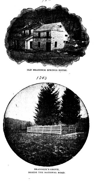
The Old National Road. 453
gate keepers. It may be seen that gate
keepers were in a position
to embezzle large sums of money if they
were so minded, and
it is undoubted that this was done in
more than one instance.
Indeed, with a score and a half of
gates, and a great many travel-
ing on computation rates, it would have
been remarkable if some
employed in all those years during which
the toll system was in
general operation did not steal. But
this is lifting the veil from
the good old days.
As will be seen later the amounts
handled by the gate keepers
were no small sums. In the best days of
the road the average
amount handled by toll gate keepers in
Pennsylvania
was about $1800.00 per annum. In Ohio,
with gates
every ten miles, the average (reported)
collection was about
$2,000.00 in the best years. It is difficult to reconcile the state-
ment made by Mr. Searight concerning the
comparative amount
of business done on various portions of
the National Road, with
the figures he himself quotes. He says:
"It is estimated that
two-fifths of the trade and travel of
the road were diverted at
Brownsville, and fell into the channel
furnished at that point
by the slack water navigation of the
Monongahela river, and a
like proportion descended the Ohio from
Wheeling, and the
remaining fifth continued on the road to
Columbus, Ohio, and
points further west. The travel west of
Wheeling was chiefly
local, and the road presented scarcely a
tithe of the thrift, push,
whirl and excitement which characterized
it east of that point."73
on another page Mr. Searight gives the
account of the old time
superintendents of the road in
Pennsylvania in its most pros-
perous era, one dating from November 10, 1840, to November
1O,
1841,74 the other from May 1, 1843, to December 31,
1844.75
In the first of these the amount of
tolls received from the eastern
division of the road (east of the
Monongahela) is two thousand
dollars less than the amount received
from the western division!
Even after the amounts paid by the two
great stage companies
are deducted, a balance of over a
thousand dollars is left in favor
of the division west of the Monongahela
river. In the second
73 The Old Pike, p. 298.
74 Idem, p. 362-6.
75 Idem, p. 367-70.
454 Ohio
Arch. and His. Society Publications.
report, $4,242.37 more was received on
the western division of
the road than on the eastern, and even
after the amounts received
from the stage companies are deducted,
the receipts from the
eastern division barely exceed those of
the western. How can
it be that "two-fifths of the trade
and travel of the road were
diverted at Brownsville"? And the
further west Mr. Searight
goes, the more does he seem to err, for
the road west of the Ohio
river, instead of showing "scarcely
a tithe of the thrift, push,
whirl and excitement which characterized
it east of that point"
seems to have done a greater business
than the portion east of
the Ohio river. For instance, when the
road was completed as
many miles in Ohio as were built in
Pennsylvania, the returns
from the portion in Ohio (1833) was
$12,259.42-4 (in the very
first year that the road was completed),
while in Pennsylvania
the receipts in 1840 were only
$18,429.25, after the road had
been used for twenty-two years. In the
same year (1840) Ohio
collected $51,364.67 from her National
Road toll gates-about
three times the amount collected in
Pennsylvania. Again Mr.
Searight gives a Pennsylvania
commissioner's receipts for the
twenty months beginning May 1, 1843, as
$37,109.11,
while the
receipts from the road in Ohio in only
the twelve months of
1843 was $32,157.02! At the same time
the tolls charged in
Ohio were a trifle in excess of those
imposed in Pennsylvania,
therefore, Ohio's advantage must be
curtailed slightly. On the
other hand it should be taken into
consideration that the National
Road in Pennsylvania was almost the only
road across the portion
of the state through which it ran, while
in Ohio other roads were
used, especially clay roads running
parallel with the National
Road, by drivers of sheep and pigs, as
an aged informant testifies.
As Mr. Searight has said, the travel of
the road west of the Ohio
may have been chiefly of a local nature,
yet his seeming error
concerning the relative amount of travel
on the two divisions
in his own state, makes his statements
less trustworthy in the
matter. Still it can be readily believed
that a great deal of con-
tinental trade did pass down the
Monongahela after traversing
the eastern division of the road and
that increased local trade
on the western division rendered the
toll receipts of both divisions
quite equal. Local travel on the eastern
division may have been
The Old
National Road.
455
light, comparatively speaking. Mr. Searight undoubtedly
meant
that two-fifths of the through trade stopped at
Brownsville and
Wheeling and one-fifth only went on into Ohio. The
total amount
of tolls received by Pennsylvania from all roads,
canals, etc., in
1836 was about $50,000, while Ohio received a greater
sum than
that in 1838 from tolls on the National Road alone, and
the road
was not completed further west than Springfield.
A study of the amounts of tolls taken in from the National
Road by the various states will show at once the volume
of
the business done. Ohio received from the National Road
in
forty-seven years nearly a million and a quarter
dollars. An
itemized list of this great revenue is interesting,
showing, as
it does, the varying fortunes of the great road:
YEAR TOLLS YEAR TOLLS
1831
............. $2,777
16 1856 ............. 6,105
00
1832 .
............ 9,067 99 1857 ............. 6,105 00
1833
............ 12,259
42-4 1858 . ............ 6,105
00
1834 .
............ 12,693
65 1859 ............. 5,551
36
1835 ......... 16,442 26 1860 . ............ 11,221 74 .
1836 ......... 27,455 13 1861 ............. 21,492 41
1837 .
............ 39,843
35 1862 ............. 19,000
00
1838 ......... 50,413 17 1863 ............. 20,000 00
1839 ......... 62,496 10 1864 . ............ 20,000
00
1840 ......... 51,364 67 1865 ............. 20,000 00
1841 ......... 36,951 33 1866 ......... 19,000 00
1842 ......... 44,656 18 1867 ............. 20,631 34
1843 ......... 32,157 02 1868 ............. 18,934 49
1844 .
........ 30,801
13 1869 ............. 20,577
04
1845 ......... 31,439 38 1870 ............. 19,635 75
1846 .
........ 28,946
21 1871 ............. 19,244 00
1847 ............. 42,614 59 1872 ........... 18,002 09
1848 ........... 49,025 66 1873 ............. 17,940 37
1849 ............. 46,253 38 1874 ............. 17,971 21
1850 ............. 37,060 11 1875 ............. 17,265 12
1851 ............. 44,063 65 1876 ............. 9,601 68
1852 ............. 36,727
26 1877 ............. 288
91
1853
............. 35,354 40
1854 . ............ 18,154 59 Total ...... $1,139,795 30-4
1855 ............. 6,105 00
About 1850 Ohio began leasing portions of the National
Road to private companies. In 1854 the entire distance from
456 Ohio Arch. and His. Society Publications.
Springfield to the Ohio river was leased
for a term of ten years
for $6,105 a year. Commissioners were
appointed to view the
road continually and make the lessees
keep it in good condition
as when it came into their hands.76
Before the contract had half
expired, the Board of Public Works was
ordered (April, 1859)
to take the road to relieve the lessees.77 In 1870 the proper
limits of the road were designated to be
"a space of eighty feet
in width, and where the road passed over
a street in any city
of the second class, the width should
conform to the width of
that street" and such cities should
own it so long as it was
kept in repair.78
Finally, in 1876, the state of Ohio
authorized commissioners
of the several counties to take so much
of the road as lay in
each county under their control. It was
stipulated that toll
gates should not average more than one
in ten miles, and that
no toll be collected between Columbus
and the Ohio Central
Lunatic Asylum. The county commissioners
were to complete
any unfinished portions of the road.79
Later (1877) the rates of toll were left
to the discretion of
the county commissioners, with this
provision:
"That when the consent of the
Congress of the
United States shall have been obtained
thereto, that the
county commissioners of any county
having a popula-
tion under the last Federal census of
more than fifteen
thousand six hundred and less than
fifteen thousand
six hundred and fifty shall have the
power when they
deem it for the best interest of the
road, or when the
people whom the road accommodates wish
to submit
to the legal voters of the county, at
any regular or
special election, the question, Shall
the National Road
be a free turnpike road? And when the
question is so
submitted, and a majority of all those
voting on said
question, shall vote yes, it shall be
the duty of said
76 Laws of Ohio LII, p. 126.
77 Idem LVI, p. 159.
78 Idem LXX, p. 194.
79 Idem LXXIII, p. 105.
The Old National Road. 457
commissioners
to sell gates, toll-houses and any other
property
belonging to the road to the highest bidder,
the
proceeds of the sale to be applied to the repair of
the
road, and declare so much of the road as lies within
their
county a free turnpike road to be kept in repair
in
the way and manner provided by law for the repair of
free
turnpikes."80
The
receipts from the Franklin county, Ohio, toll gate, now
in
operation, for the year 1899 was as follows:
January ......................................... $36 00
February ............' ................... ........ 32 80
M
arch ........................................... 39 90
April
............................................ 80
75
May ............................................ 67 25
June ............................................ 54 85
July ............................................. 47 15
August ........................................
. 35 75
September ....................................... 29 27
October
......................................... 29
26
November ....................................... 35 05
December
....................................... 34
05
Total ..................................... $522 08
It
will be noted that April was the heaviest month of the
year.
The gate keeper receives a salary of $30.00 per month.
It
is hardly necessary to say that the great American high-
way
was never a self-supporting institution. The fact that it
was
estimated that the yearly expense of repairing the Ohio
division
of the road was $100,000.00 while the greatest amount
of
tolls collected in its most prosperous year (1839) was hardly
half
that amount ($62,496. 10) proves this conclusively. Inves-
tigation
into the records of other states shows the same condition.
In
the most prosperous days of the road the tolls in Maryland
(1837)
amounted to $9,953.00 and the expenditures $9,660.5181
In
1839 a "balance" was recorded of $1,509.08, but a like
amount
was
charged up on the debtor side of the account. The receipts
reported
each year in the Auditor's reports of the state of Ohio
80 Laws of Ohio LXXIV, p. 62.
81"Report of the Superintendent of the National Road, with Ab-
stract of Tolls for the fiscal year" (1837).
458 Ohio Arch. and His. Society Publications.
show that equal amounts were expended
yearly upon the road.
As early as 1832 the Governor of Ohio
was authorized to borrow
money to repair the road in that state.82
VII.
STAGE COACHES, AND FREIGHTERS.
The great work of building and keeping
in repair the Na-
tional Road, and of operating it,
developed a race of men as
unknown before its era as afterward. For
the real life of the
road, however, one will look
to the days of its prime-to those
who passed over its stately stretches
and dusty coils as stage and
mail coach drivers, express carriers and
"wagoners," and the
tens of thousands of passengers and
immigrants who composed
the public which patronized the great
highway. This was the
real life of the road-coaches numbering
as many as twenty
traveling in a single line; wagon-house
yards where a hundred
tired horses rest over night besides
their great loads; hotels
where seventy transient guests have been
served breakfast in a
single morning; a life made cheery by
the echoing horns of hurry-
ing stages; blinded by the dust of
droves of cattle numbering into
the thousands; a life noisy with the
satisfactory creak and crunch
of the wheels of great wagons carrying
six and eight thousand
pounds of freight east or west.
The revolution of society since those
days could not have
been more surprising. The change has
been so great it is a won-
der that men deign to count their gain
by the same numerical
system. As Macauley has said, we do not
travel to-day, we
merely "arrive." You are
hardly a traveler now unless you cross
a continent. Travel was once an
education. This is growing
less and less true, perhaps, with the
passing years. Fancy a jour-
ney from St. Louis to New York in the
old coaching days, over the
National Road and the old York roads.
How many persons the
traveler met! How many interesting and
instructive conversa-
tions were held with fellow travelers
through the long hours;
What customs, characters, foibles,
amusing incidents would be
noticed and remembered, ever afterward
furnishing the informa-
82 Laws of Ohio XXX,
p. 8.
The Old National Road. 459
tion necessary to help one talk well and
the sympathy necessary to
render one capable of listening to
others. The traveler often sat
at the table with statesmen whom the
nation honored, as well
as with stage coach drivers whom a
nation knew for their skill and
prowess over six galloping horses. Henry
Clays and "Red" Bun-
tings dined together, and each made the
other wiser, if not better.
The greater the gulf grows between the
rich and poor, the more
ignorant do both become, particularly
the rich. There was un-
doubtedly a monotony in stage coach
journeying, but the con-
tinual views of the landscape, the
ever-fresh air, the constantly
passing throngs of countless
description, made such traveling an
experience unknown to us
"arrivers" of to-day. How fast it has
been forgotten that travel means seeing
people rather than things.
The age of sight seeing has superseded
that of traveling. How
few of us can say with the New Hampshire
sage, "We have trav-
eled a great deal 'in Concord.'"
Splendidly are the old coaching
days described by Thackeray who caught
their spirit:
"The Island rang, as yet, with the
tooting horns
and rattling teams of mail coaches; a
gay sight was the
road in merry England in those days,
before steam en-
gines arose and flung its hostelry and
chivalry over.
To travel in coaches, to drive coaches,
to know coachmen
and guards, to be familiar with inns
along the road, to
laugh with jolly hostess in the bar, to
chuck the pretty
chambermaid under the chin, was the
delight of men
who were young not very long ago. The
road was an
institution, the ring was an
institution. Men rallied
around then; and, not without a kind of
conservatism,
expatiated upon the benefits with which
they endowed
the country, and the evils which would
occur when they
should be no more:-decay of English
spirit, decay of
manly pluck, ruin of the breed of
horses, and so forth.
To give or take a black eye was not
unusual or deroga-
tory in a gentleman; to drive a stage
coach the enjoy-
ment, the emulation of generous youth.
Is there any
young fellow of the present time who
aspires to take the
place of a stoker? You see occasionally
in Hyde Park
one dismal old drag with a lonely
driver. Where are you,
460 Ohio Arch. and His. Society Publications.
charioteers ? Where are you, 0 rattling
Quicksilver, O
swift Defiance? You are passed by racers
stronger and
swifter than you. Your lamps are out,
and the music
of your horns has died away."83
In the old coaching days the passenger
and mail coaches
were operated very much like the
railways of to-day. A vast
network of lines covered the land. Great
companies owned hun-
dreds of stages operating on innumerable
routes, competing with
other companies. These rival stage
companies fought each other
at times with great bitterness, and
competed, as railways do
to-day, in lowering tariff and in
out-doing each other in points
of speed and accommodation.84 New
inventions and appliances
were eagerly sought in the hope of
securing a larger share of
public patronage. This competition
extended into every phase
of the business-fast horses, comfortable
coaches, well known
and companionable drivers, favorable
connections.
However, competition, as is always the
case, sifted the compe-
titors down to a small number. Companies
which operated upon
the National Road between Indianapolis
and Cumberland became
distinct in character and catered to a
steady patronage which
had its distinctive characteristics and
social tone. This was in
part determined by the taverns which the
various lines patronized.
Each line ordinarily stopped at separate
taverns in every town, as
our railways formerly entered individual
depots. There were
also found Grand Union taverns on the
Old National Road. Had
this system of communication not been
abandoned, coach lines
would have gone through the same
experience that the railways
have, and for very similar reasons.
The largest coach line on the National Road was the National
Road Stage Company, whose most prominent
member was Lucius
W. Stockton. The headquarters of
this line was at the National
House on Morgantown street, Uniontown,
Pennsylvania. The
principal rival of the National Road
Stage Company was the
"Good Intent" line, owned by Shriver, Steele and
Company, with
83 "The Newcomes," pp. 132-133.
84 In one instance a struggle between
two stage coach lines in In-
diana resulted in carrying passengers
from Richmond to Cincinnati for
fifty cents. The regular price was five
dollars.
The Old National Road. 461
headquarters at the McClelland House,
Uniontown. The Ohio
National Stage Company, with
headquarters at Columbus, Ohio,
operated on the western division of the
road. There were many
smaller lines, as the
"Landlords," "Pilot," "Pioneer,"
"Defiance,"
"June Bug," etc.
Some of the first lines of stages were
operated in sections,
each section having different
proprietors who could sell out at
any time. The greater lines were
constantly absorbing smaller
lines and extending their ramifications
in all directions. It will
be seen there were trusts in the
"good old days" of stage coaches,
when smaller firms were "gobbled
up" and "driven out" as hap-
pens to-day, and will ever happen in
mundane history, despite the
nonsense of political garblers. One of
the largest stage com-
panies on the old road was that of Neil,
Moore and Company of
Columbus, which operated hundreds of
stages throughout Ohio,
It was unable to compete with the Ohio
National Stage Com-
pany to which it finally sold out, Mr.
Neil becoming one of the
magnates of the latter company, which
was, in its day, a greater
trust than anything known in Ohio
to-day.85
To know what the old coaches really
were, one should see
and ride in one. It is doubtful if a
single one now remains intact.
Here and there inquiry will raise the
rumor of an old coach still
standing on wheels, but if the rumor is
traced to its source, it
will be found that the chariot was sold
to a circus or wild west
show or has been utterly destroyed. The
demand for the old
stages has been quite lively on the part
of the wild west shows.
These old coaches were handsome affairs
in their day-
painted and decorated profusely without,
and lined within with
soft silk plush.86 There were ordinarily
three seats inside, each
capable of holding three passengers.
Upon the driver's high
outer seat was room for one more
passenger, a fortunate posi-
85 An old Ohio National Stage driver,
Mr. Samuel B. Baker of
Kirkersville, Ohio, is authority for the
statement that the Ohio National
Stage Company put a line of stages on
the Wooster-Wheeling mail and
freight route and "ran out"
the line which had been doing all the business
previously, after an eight months'
hitter contest.
86 The following appears in the Ohio
State Journal of August 12,
1837:-A SPLENDID COACH -We have looked at a Coach now
finishing
off in the shop of Messrs. Evans &
Pinney of this city, for the Ohio Stage
|
462 Ohio Arch. and His. Society Publications. |
|
|
The Old National Road. 463
tion in good weather. The best coaches like their
counterparts
on the railways of to-day, were named;
the names of states,
warriors, statesmen, generals, nations
and cities, besides fanciful
names, such as "Jewess,"
"Ivanhoe," "Sultana," "Loch Lomond,"
were called into requisition.
The first coaches to run on the old
National Road were long,
awkward affairs, without braces or
springs, and with seats placed
crosswise. The door was in front, and
passengers, on entering,
had to climb over the seats. These first
coaches were made at Lit-
tle Crossings, Pennsylvania.
The body of succeeding coaches was
placed upon thick, wide
leathern straps which served as springs
and which were called
"through braces." At either end of the body was the driver's
boot and the baggage boot. The first
"Troy" coach put on the
road came in 1829. It was a great
novelty, but some hundreds
of them were soon throwing the dust of
Maryland and Pennsyl-
vania into the air. Their cost then was
between four and six
hundred dollars. The harness used on the
road was of giant pro-
portions. The backbands were often
fifteen inches wide, and the
hip bands, ten. The traces were chains
with short thick links
and very heavy.
But the passenger traffic of the Old
National Road played
the same relation to the freight traffic
as passenger traffic does to
freight on the modern railway-a small
item, financially con-
sidered. It was for the great wagons and
their wagoners to haul
over the mountains and distribute
throughout the west the pro-
ducts of mill and factory and the rich
harvests of the fields.
And this great freight traffic created a
race of men of its own,
strong and daring, as they well had need
to be. The fact that
teamsters of these "mountain
ships" had taverns or "wagon
Company, and intended we believe for the
inspection of the Post-Master
General, who sometime since offered
premiums for models of the most
approved construction, which is
certainly one of the most perfect and
splendid specimens of workmanship in
this line that we have ever beheld,
and would be a credit to any Coach
Manufactory in the United States.
It is aimed, in its construction, to secure
the mail in the safest manner
possible, under lock and key, and to
accommodate three outside pas-
sengers under a comfortable and complete
protection from the weather.
It is worth going to see."
464 Ohio Arch. and His. Society Publications.
houses" of their own, where they
stopped, tended to separate them
into a class by themselves. These wagon
houses were far more
numerous than the taverns along the
road, being found as often
as one in every mile or two. Here, in
the commodious yards,
the weary horses and their swarthy Jehus
slept in the open air.
In winter weather the men slept on the
floors of the wagon
houses. In summer many wagoners carried
their own cooking
utensils. In the suburbs of the towns
along the road they would
pull their teams out into the roadside
and pitch camp, sending into
the village to replenish their stores.
The bed of the old road freighter was
long and deep, bending
upward at the bottom at either end. The
lower broad side was
painted blue, with a movable board
inserted above, painted red.
The top covering was white canvas drawn
over broad wooden
bows. Many of the wagoners hung bells of
a shape much similar
to dinner bells, on a thin iron arch
over the hames of the harness.
Often the number of bells indicated the
prowess of a teamster's
horses, as the custom prevailed, in
certain parts, that when a
team became fast, or was unable to make
the grade, the wagon,
rendering the necessary assistance,
appropriated all the bells of
the luckless team.
The wheels of the freighters were of a
size proportionate
to the rest of the wagon. The first
wagons used on the old roads
had narrow rims, but it was not long
before the broad rims,
or "broad tread wagons," came
into general use by those who
made a business of freighting. The
narrow rims were always
used by farmers, who, during the busiest
season on the road,
deserted their farms for the high wages
temporarily to be made,
and who in consequence were dubbed
"sharp shooters" by the
regulars. The width of the broad tread
wheels was four inches.
As will be noted, tolls for broad wheels
was less than for the
narrow ones which tended to cut the
roadbed more deeply. One
ingenious inventor planned to build a
wheel with a rim wide
enough to pass the toll gates free. The
model was a wagon
which had the rear axle four inches
shorter than the front, making
a track eight inches in width. Nine
horses were hitched to this
wagon, three abreast. The team caused
much comment, but
was not voted practicable.
The Old National Road. 465
The loads carried on the mountain ships
were very large.
An Ohio man, McBride by name, in the
winter of 1848 went
over the mountains with seven horses,
taking a load of nine
hogsheads weighing an average of one
thousand pounds each.
The following description is from the St.
Clairsville (Ohio)
Gazette of 1835:
"It was a familiar saying with Sam
Patch that
some things can be done easier than
others, and this fact
was forcibly brought to our mind by
seeing a six-horse
team pass our office on Wednesday last,
laden with
eleven hogsheads of tobacco, destined for Wheeling.
Some speculation having gone forth as to
its weight, the
driver was induced to test it on the
hayscales in this
place, and it amounted to 13,280 lbs. gross weight-
net weight 10,375. This
team (owned by General C.
Hoover of this county) took the load
into Wheeling
with ease, having a hill to ascend from
the river to the
level of the town, of eight degrees. The
Buckeyes of
Belmont may challenge competition in
this line."
Teamsters received good wages,
especially when trade was
brisk. From Brownsville to Cumberland
they often received
$1.25 a hundred; $2.25 per hundred has been paid for a load
hauled from Wheeling to Cumberland.87
The stage drivers
87 Before the era of the National Road
the price for hauling the
goods emigrants over Braddock's Road was
very high. One emigrant
paid $5.33 per hundred for hauling
"women and goods" from Alex-
andria, Virginia, to the Monongahela.
Six dollars per hundred weight
was charged one emigrant from
Hagarstown, Md., to Terre Haute,
Indiana. An elaborate description of the
freighters of our 'Middle Age'
is given by Mr. Thomas Wilson of the
United States National Museum
in a delightful article entitled
"The Arkansas Traveller", Ohio Archaeo-
logical and Historical Society
Publications Vol. VIII, pp. 296-300.
Among other things the following is of
special interest, written of a road
parallel to the National road in Ohio:
"The wagons were immense lum-
bering machines with broad tires three
to five inches in width and an inch
in thickness. The boxes or bodies were
like unto the latter "Prairie
Schooners;" the keel was not
straight as is usual at the present day, but
highly curved, being low in the center
or middle of the wagon and high
in the air at the front and back. The
body was of framework mortised
together, the slats, both horizontal and
perpendicular, conformed in curve
466 Ohio Arch. and His. Society Publications.
received twelve dollars a month with
board and lodging. Usually
the stage drivers had one particular
route between two towns
about twelve miles apart on which they
drove year after year,
and learned as well as trainmen, know
their "run" to-day. The
life was hard, but the dash and spirit
rendered it as fascinating
as railway life is now.
to their respective body-pieces and
standards in that they increased and
made the top end of the body to be
higher and longer than was the bot-
tom of the foundation. (See cut.) They
were provided with bows and
covered with sail-cloth, an efficient
protection against rain. The wagon
had what was then called a "patent
Lock," now so common as to have
lost the terms "patent" and
"lock" both, and become a "brake." The
handle of the brake was managed by the
driver from the ground. Occa-
sionally it swung back and forth over
the hind wheel and was pulled down
by the weight of the driver and fastened
with a chain to a spike or hook;
occasionally it was at the rear of the
wagon and was pushed from side to
side and kept in place by a ratchet. The
pole of these wagons was known
as "stiff," that it is it was
fastened solid into the front hounds and did
not fall to the ground, nor was it
supported by the horses' necks. It
was only used to steer and hold back,
for which purpose long chains were
fastened to its ends and attached by
breast-chains to the hames.
The bodies of these wagons were set on
bolsters and, of course,
without springs. This, with their curve,
brought them low in the center
and gave the front wheels but little
play in turning. The great length
and weight of the wagon, with its six
horses, made it a machine as
unwieldy to turn or steer as a
steamboat. The six horses were hitched
to the wagon thus: the wheel horses with
double and single trees
fastened to the tongue and hounds by
means of hammer and hammer-
strap, the former serving as a bolt or
pin; the middle leaders were hitched
to double and single trees which hung by
the middle hook in the iron
loop at the end of the pole. From the
same loop the lead-chain was
hooked which, stretched between the
middle leaders, received the hook
of the double trees of the leaders. The
drivers used but a single line
fastened to the bridle-rein of the near
lead horse. The lefthand side was
the "near" side, the other the
"off" side. The middle span of horses
were the "middle leaders," the
rear ones the "wheel horses." The near
wheel horse carried the saddle for the
driver, on which he could mount
as occasion demanded, but he rarely did.
In driving, he walked by the
side of the near wheel horse, carrying
in his hand his Loudoun County
black-snake whip, the single line
attached to the lead horse being con-
tinually within reach. The rear end of
the line was buckled to the hame
of the wheel horse, high up, and was
about long enough to clear the
ground as it swung; when it was not in
use its slack was hung over the
The Old National Road. 467
Far better time was made by these old
conveyances than
many realize. Ten miles an hour was an
ordinary rate of speed.
A stage driver was dismissed more
quickly for making slow time,
than for being guilty of intoxication,
though either offense was
considered worthy of dismissal. The way
bills handed to the
drivers with the reins often bore the
words "Make this time
or we'll find some one who will."
Competition in the matter
of speed was as intense as it is now in
the days of steam. A
thousand legends of these rivalries
still linger in story and tra-
dition.
Defeated competitors were held accountable by their
companies and the loads or condition of
their horses were seldom
accepted as excuses. Couplets were often
conjured up containing
some brief story of defeat with a
cutting sting for the vanquished
driver:
"If you take a seat in Stockton's
line
You are sure to be passed by Pete
Burdine."
or
"Said Billy Willis to Peter Burdine
You had better wait for the oyster
line."
In September, 1837, Van Buren's
presidential message was
carried from Baltimore (Canton Depot) to
Philadelphia, a dis-
tance of one hundred and forty miles, in
four hours and forty-
three minutes. Seventy miles of the
journey was done by rail,
three by boat, and eighty-seven by
horse. The seventy-three by
rail and boat occupied one hundred and
seventeen minutes and
the eighty-seven by horse occupied the
remaining two hundred
and twenty-six minutes, or each mile in
about two minutes and
a half. This time was considered
remarkable and shows how
little time was lost, even in the relay
system. And that message
was not light, as any one may see by
perusing its contents.
The news of the death of William the
Fourth of England,
which occurred June 20, 1837, was
printed in Columbus, Ohio,
hame. The line was used to guide the
horses, more as a signal than by
actual force. To pull it steadily
without jerk means for the lead horse
to come to "haw" (to the
left); two or three short jerks meant for him
to go "gee' (to the right). By
these signals, with the aid of his voice,
the driver had perfect command of his
team."
468 Ohio Arch. and His. Society Publications.
papers July 28. It was not until 1847
that the capital of Ohio was
connected with the world by telegraph
wires.
Time tables of passenger coaches were
published as railway
time tables are to-day. The following is
a National Road time
table printed at Columbus for the winter
of 1835-1836:
COACH LINES.
WINTER ARRANGEMENT.
THE OLD STAGE LINES with all their
different connections throughout
the state, continue as heretofore.
THE MAIL PILOT LINE, leaves Columbus for
Wheeling daily, at 6
A. M., reaching Zanesville at 1 P. M.
and Wheeling at 6 A. M. next day,
through in 24 hours, allowing five hours
repose at St. Clairsville.
THE GOOD INTENT LINE, leaves
Columbus for Wheeling, daily at 1
P. M., through in 20 hours, reaching
Wheeling in time to connect with
the stages for Baltimore and
Philadelphia.
THE MAIL PILOT LINE, leaves Columbus
daily, for Cincinnati at 8
A. M., through in 36 hours, allowing six
hours repose at Springfield.
Extras furnished on the above routes at
any hour when required.
THE EAGLE LINE, leaves Columbus every
other day, for Cleveland,
through in 40 hours, via. Mt. Vernon and
Wooster.
THE
TELEGRAPH LINE leaves Columbus for Sandusky
City, every
other day at 5 A. M., through in two
days, allowing rest at Marion, and
connecting there with the line to
Detroit, via. Lower Sandusky.
THE PHOENIX LINE, leaves Columbus every
other day, for Huron,
via Mt. Vernon and Norwalk, through in
48 hours.
THE DAILY LINE OF MAIL COACHES, leaves
Columbus, for Chilli-
cothe at 5 A. M., connecting there with
the line to Maysville, Ky., and
Portsmouth.
For seats apply at the General Stage
Office, next door to Col.
Noble's National Hotel.
T. C. ACHESON, for the proprietor.
The following advertisement of an
opposition line, running
in 1837, is interesting:
OPPOSITION!
DEFIANCE FAST LINE COACHES.
DAILY
FROM WHEELING, VA. to Cincinnati, O. via
Zanesville, Columbus,
Springfield and intermediate points.
Through in less time than any other
line.
"By opposition the people are
well served."
The Defiance Fast Line connects at
Wheeling, Va. with Reside &
Co.'s Two Superior daily lines to
Baltimore, McNair and Co.'s Mail Coach
The Old National Road. 469
line, via Bedford, Chambersburg and the
Columbia and Harrisburg Rail
Roads to Philadelphia, being the only
direct line from Wheeling-: also
with the only coach line from Wheeling
to Pittsburg, via Washington,
Pa., and with numerous cross lines in
Ohio.
The proprietors having been released on
the 1st inst. from burthen
of carrying the great mail, (which will
retard any line) are now enabled
to run through in a shorter time than
any other line on the road. They
will use every exertion to accommodate
the traveling public. With stock
infinitely superior to any on the road,
they flatter themselves they will
be able to give general satisfaction;
and believe the public are aware, from
past experience, that a liberal patronage
to the above line will prevent
impositions in high rates of fare by any
stage monopoly.
The proprietors of the Defiance Fast
Line are making the necessary
arrangements to stock the Sandusky and
Cleveland Routes also from
Springfield to Dayton-which will be done
during the month of July.
All baggage and parcels only received at
the risk of the owners
thereof.
JNO. W. WEAVER & Co.,
GEO. W. MANYPENNY,
JNO. YONTZ,
From
Wheeling to Columbus, Ohio.
JAMES H. BACON,
WILLIAM RIANHARD,
F. M. WRIGHT,
WILLLIAM H. FIFE,
From Columbus to Cincinnati.
There was always danger in riding at
night, especially over
the mountains, where sometimes a
mis-step would cost a life.
The following item from
a letter to a newspaper in 1837 tells
of such an accident:
"One of the Reliance line of
stages, from Frederick to the
West, passed through here on its way to
Cumberland. About
ten o'clock the ill-fated coach reached
a small spur of the moun-
tain, running to the Potomac, and
between this place and Han-
cock, termed Millstone Point, where the
driver mistaking the
track reined his horses too near the
edge of the precipice, and in
the twinkling of an eye, coach, horses,
driver and passengers
were precipitated upward of thirty-five
feet onto a bed of rock
below - the coach was dashed to pieces,
and two of the horses
killed - literally smashed.
"A respectable elderly lady of the
name of Clarke, of Louis-
470 Ohio Arch. and His. Society Publications.
ville, Kentucky, and a negro child were
crushed to death - and
a man so dreadfully mangled that his
life is flickering on his lips
only. His face was beaten to a mummy.
The other passengers
and the driver were woefully bruised,
but it is supposed they
are out of danger. There were seven in
number.
"I cannot gather that any blame was
attached to the driver.
It is said that he was perfectly sober;
but he and his horses
were new to this road, and the night was
foggy and very dark."
An act of the legislature of Ohio
required that every stage
coach used for the conveyance of
passengers in the night should
have two good lamps affixed in the usual
manner, and subjected
the owner to a fine of from $10.00 to $30.00 for every forty-
eight hours the coach was not so
provided. Drivers of coaches
who should drive in the night when the
track could not be
distinctly seen without having the lamps
lighted were subject
to a forfeiture of from $5.00 to $10.00
for each offense. The
same act provided that drivers guilty of
intoxication, so as to
endanger the safety of passengers, on
written notice of a pas-
senger on oath, to the owner or agent,
should be forthwith dis-
charged, and subjected the owner
continuing to employ that
driver more than three days after such
notice to a forfeiture
of $50.00 a day.
Stage proprietors were required to keep
a printed copy of
the act posted up in their offices,
under a penalty of $5.00.
Another act of the Ohio Legislature
subjected drivers who
should leave their horses without being
fastened to a fine of
not over $20.00.
As has been intimated, passengers
purchased their tickets
of the stage company in whose stage they
embarked, and the
tolls were included in the price of the
ticket. A paper resembling
a way bill was made out by the agent of
the line at the starting
point. This paper was given to the
driver and delivered by
him to the landlord at each station upon
the arrival of the
coach. This paper contained the names
and destinations of the
passengers carried, the sums paid as
fare and the time of depar-
ture, and contained blank squares for
registering time of arrival
and departure from each station. The
fares on the National
The Old National
Road. 471
Road varied slightly
but remained nearly as follows, when the
great monopolies were
in control:
Baltimore to Frederic
................................ $2 00
Frederic to
Hagarstown .............................. 2 00
Hagarstown to
Cumberland ........................... 5 00
Cumberland to
Uniontown............................ 4 00
Uniontown to
Washington ............................ 225
Washington to
Wheeling ............................. 2 00
Wheeling to
Zanesville
.............................. 3 00
Zanesville to
Columbus ............................... 200
Columbus to
Springfield .............................. 2 00
Springfield to
Cincinnati ............................. 300
Springfield to
Indianapolis ............................ 3 00
Intermediate points 5
cents per mile.
VIII.
MAILS AND MAIL
COACHES.
The most important
official function of the National Road
was to furnish means
of transporting the United States mails.
The strongest
constitutional argument of its advocates was the
need of facilities
for transporting troops and mails. The clause
in the constitution
authorizing the establishment of post roads
was interpreted by
them to include any measure providing quick
and safe transmission
of the mails. As has been seen, it was
finally considered by
many to include building and operating rail-
ways with funds
appropriated for the National Road.
The great mails of
seventy-five years ago were operated
on very much the same
principle on which mails are operated
to-day. The postoffice department at Washington
contracted
with the great stage
lines for the transmission of the mails by
yearly contracts, a
given number of stages with a given number
of horses to be run
at given intervals, to stop at certain points,
at a fixed yearly
compensation, usually determined by the custom
of advertising for
bids and accepting the lowest offered.
When the system of
mail coach lines reached its highest
perfection the mails
were handled as they are to-day. The great
mails that passed
over the National Road were the Great Eastern
and Great Western
mails out of Washington and St. Louis. A
thousand lesser mail
lines connected with the National Road
|
|

|
(472) |
The Old
National Road. 473
at every step, principally those from Cincinnati in
Ohio, and
from Pittsburg in Pennsylvania. There were through and
way
mails, also mails which carried letters only,
newspapers going
by separate stage. There was also an "Express
Mail" corre-
sponding to the present "fast mail."
It is probably not realized what rapid time was made by
the old-time stage and express mails over the National
Road
to the central west. Even compared with the fast trains of
to-day, the express mails of sixty years ago, when
conditions
were favorable, made marvelous time. In 1837 the Post
Office
department required, in their contract for carrying the
Great
Western Express Mail from Washington over the National
Road
to Columbus and St. Louis, that the following time be
made:
Wheeling, Virginia .............................. 30 hours.
Columbus, Ohio ................................. 45� "
Indianapolis, Indiana ............................ 65�
"
Vandalia, Illinois ................................ 851/2 "
St. Louis, Missouri............................... 94 "
At the same time the ordinary mail coaches, which also
served as passenger coaches, made very much slower
time:
Wheeling, Virginia ...................... 2 days 11
hours.
Columbus, Ohio
.......................... 3 " 16 "
Indianapolis, Indiana ..................... 6 " 20 "
Vandalia, Illinois ........................ 9 " 10 "
St. Louis, Missouri
...................... 10 " 4 "
Cities off the road were reached in the following time
from
Washington:
Cincinnati,
Ohio
...............................
60 hours.
Frankfort, Kentucky ............................ 72 "
Louisville,
Kentucky
............................ 78 "
Nashville, Tennessee ............................ 100 "
Huntsville, Alabama ............................ 1151/2 "
The ordinary mail to these points made the following
time:
Cincinnati, Ohio ......................... 4 days 18
hours.
Frankfort, Kentucky .................... 6 " 18 "
Louisville, Kentucky .................... 6 " 23 "
Nashville, Tennessee .................... 8 " 16 "
Huntsville, Alabama ..................... 10 " 21 "
474 Ohio Arch. and His. Society Publications.
The postoffice department had given its
mail contracts to
the steamship lines in the east, when
possible at from Boston to
Portland and New York to Albany. One
mail route to the
southern states, however, passed over
the National Road and
down to Cincinnati, where it went on to
Louisville and the Mis-
sissippi ports by packet. The following
time was made by this
Great Southern Mail from Louisville:
Nashville, Tennessee ...........................
21 hours.
Mobile, Alabama
............................... 80
New Orleans, Louisiana ..............
..... 105 "
The service rendered to the south and
southwest by the
National Road, was not rendered to the
northwest, as might have
been expected. Chicago and Detroit were
difficult to bring into
easy communication with the east. Until
the railway was com-
pleted from Albany to Buffalo, the mails
went very slowly to
the northwest from New York. The stage
line from Buffalo
to Cleveland and on west over the
terrible Black Swamp road
to Detroit was one of the worst in the
United States. When
lake navigation became closed,
communication with northwestern
Ohio, Michigan, Wisconsin and northern
Indiana and Illinois
was almost cut off. Had the stage route
followed that of the
buffalo and Indian on the high ground
occupied by the Mahoning
Indian trail from Pittsburg to Detroit,
a far more excellent
service might have been at the disposal
of the postoffice depart-
ment! As it was, stage horses floundered
in the Black Swamp
with"mud up to the
horses'bridles," where a half dozen mails were
often congested, and "six horses
were barely sufficient to draw a
two-wheeled vehicle fifteen miles in
three days." In fact the road
was at times impassable: "The road
through the Black Swamp
has been much of the season impassable.
A couple of horses
were lost in a mud hole last week. The
bottom had fallen out
The driver was unaware of the fact. His
horses plunged in and
ere they could be extricated were
drowned."88
The old time-tables of the National Road
made an interest-
88Ohio State Journal, February 9, 1838. "The land mail between
this and Detroit crawls with snails pace"-Cleveland
Gazette, August
31, 1837.
The Old National Road. 475
ing study. One of the first of these
published after the great
stage lines were in operation over the
entire road and the southern
branch to Cincinnati, appeared early in
the year 1833. By this
schedule the Great Eastern Mail left
Washington daily at 7 P.
M. and Baltimore at 9 P. M. and arrived
in Wheeling, on the
Ohio river, in fifty-five hours. Leaving
Wheeling at 4.30 A. M.,
it arrived in Columbus at five the
morning following, and in
Cincinnati at the same hour the next
morning, making forty-
eight hours from one point on the river
to the other, much better
time than any packet could make. The
Great Western Mail left
Cincinnati daily at 2 P. M. and
reached Columbus at 1 P. M.
on the day following. It left Columbus
at 1.30 P. M. and reached
Wheeling at 2.30 the day
following, thence on to Washington
in fifty-five hours.89
At times the mails on the National Road
were greatly
delayed, taxing the patience of the
public beyond endurance.
The road itself was so well built that
rain had little effect upon
it as a rule. In fact, delay of the
mails was more often due
to inefficiency of the postoffice
department, inefficiency of the
stage line service, or failure of
contractors, than poor roads. Until
a bridge was built across the Ohio river
at Wheeling, in 1836,
mails often became congested, especially
when ice was running out.
There were frequent derangements of
cross and way mails which
affected seriously the efficiency of the
service. The vast number
of connecting mails on the National Road
made regularity in
89 The northern and southern Ohio mails
connected with the Great
Eastern and Great Western mails at
Columbus. They were operated as
follows:
NORTHERN MAIL: Left Sandusky City 4 A.
M., reached Delaware
8 P. M. Left Delaware next day 3 A. M.,
reached Columbus 8 A. M.
Left Columbus 8:30 A. M., reached
Chillicothe 4 P. M. Left Chillicothe
next day 4 A. M., reached Portsmouth 3
P. M.
SOUTHERN MAIL: Left Portsmouth 9 A. M.,
Chillicothe 5 P. M.,
Columbus 1 P. M., day following.
Delaware 7 P. M., Sandusky City 7
P. M. day following. A Cleveland mail
left Cleveland daily for Columbus
via Wooster and Mt. Vernon at 3 A. M.,
and reached Columbus on the
day following at 5 P. M., returning the
mail left Columbus at 4 A. M.
and reached Cleveland at 5 P. M.
on the ensuing day.
476
Ohio Arch. and His. Society Publications.
transmission of cross mails confusing,
especially if the through
mails were at all irregular.
To us living in the present age of
telegraphic communication
and the ubiquitous daily paper, it may
not occur that the mail
stages of the old days were the newsboys
of the age, and that
thousands looked to their coming for the
first word of news from
distant portions of the land. In times
of war or political excite-
ment the express mail stage and its
precious load of papers from
Baltimore, Philadelphia and New York,
was hailed as the latest
editions of our newspapers are to-day.
Thus it must have been
that a greater proportion of the
population along the Old National
Road awaited with eager interest the
coming of the stage in
the old days, than to-day await the
arrival of the long mail trains
from the east.
Late in the 30's and in the 40's, when
the mail stage system
reached its highest perfection, the mail
and passenger service
had been entirely separated, special
stages being constructed for
hauling the former. As early as 1837 the
postoffice department
decreed that the mails, which heretofore
had always been held
as of secondary consideration compared
with passengers, should
be carried in specially arranged
vehicles, into which the post-
master should put them under lock and
key not to be opened
until the next postoffice was reached.
These stages were of two
kinds, designed to be operated upon
routes where the mails
ordinarily comprised, respectively, a
half and nearly a whole load.
In the former, room was left for six
passengers, in the latter,
for three. Including newspapers with the
regular mail, the
later stages which ran westward over the
National Road rarely
carried passengers. Indeed there was
little room for the guards
who traveled with the driver to protect
the government property.
Many old drivers of the "Boston
Night Mail," or the "New York
Night Mail," or "Baltimore
Mail," may yet be found along the
old road, who describe the immense loads
which they carried
westward behind flying steeds. Such a
factor in the mail stage
business did the newspapers become, that
many contractors
refused to carry them by express mail,
consigning them to the
The Old National Road. 477
ordinary mails, thereby bringing down
upon themselves the fre-
quent savage maledictions of a host of
local editors.90
Newspapers were, nevertheless, carried
by express mail
stages as far west as Ohio in 1837, as
is proven by a newspaper
account of a robbery committed on the
National Road, the
robbers holding up an express-mail stage
and finding nothing
in it but newspapers.91
The mails on the National Road were
always in danger of
being assailed by robbers, especially on
the mountainous portions
of the road at night. Though by dint of
lash and ready revolver,
the doughty drivers usually came off
safely with their charge.
IX.
TAVERNS OF THE NATIONAL ROAD.
So distinctive was the character of the
National Road that
all which pertained to it was highly
characteristic. Next to the
race of men which grew up beside its
swinging stretches, noth-
ing had a more distinctive tone than the
taverns which offered
cheer and hospitality to its surging
population.
The origin of taverns in the east and
west was very dis-
similar. The first taverns in the west
were those which did service
on the old Braddock's Road. Unlike the
taverns of New Eng-
land, which were primarily drinking
places, sometimes closing
at nine in the evening and not
professing, originally, to afford
90 "The extreme irregularity which
has attended the transmission of
newspapers from one place to another,
for several months past has been a
subject of general complaint with the
editors of all parties. It was to
have been expected that, after the
adjournment of Congress, the evil
would have ceased to exist. Such,
however, is not the case. Although
the roads are now pretty good, and the
mails arrive in due season, our
eastern exchange papers seem to reach us
only by chance. On Tuesday
last, for instance, we received, among
others, the following, viz., The
New York Courier and Enquirer of March 1, 5 and 19; the Philadelphia
Times and Saturday Evening Post of March 2; the United
States Gazette
of March 6; and the New Jersey
Journal of March 5 and 19. The cause
of this irregularity, we have reason to
believe, does not originate in this
state." Ohio State Journal, March
30, 1833.
91 Ohio State Journal, August 9, 1837.
478 Ohio Arch. and His. Society Publications.
lodging, the tavern in the west arose
amid the forest to answer
the needs of travelers. It may be said
that every cabin in all
the western wilderness was a tavern,
where, if there was a lack
of "bear and cyder" there was
an abundance of dried deer meat
and Indian meal and a warm fire-place
before which to spread
one's blankets.92
The first cabins on the old route from
the Potomac to the
Ohio were at the Wills Creek settlement
(Cumberland) and
Gists clearing where Washington stopped
on his La Bouef trip
on the buffalo trace not far from the
summit of Laurel Hill.
After Braddock's Road was built, and the
first roads were opened
between Uniontown and Brownsville,
Washington and Wheeling,
during the Revolutionary period, a score
of taverns sprang up-
the first of the kind west of the
Alleghany mountains.
The oldest tavern on Braddock's Road was
Tomlinson's
Tavern near "Little Meadows,"
eight miles west of the present
village of Frostburg, Maryland.
At this point the lines of Braddock's
Road and the National
Road coincide. On land owned by him
along the old miliary
road Jesse Tomlinson erected a
tavern. When the National
Road was built, his first tavern was
deserted and a new one built
near the old site. Another tavern,
erected by one Fenniken,
stood on both the line of the military
road and the National
Road, two miles west of Smithfield
("Big Crossings") where
the two courses were identical.
The first taverns erected upon the road
which followed the
portage path from Uniontown to
Brownsville were Collin's Log
Tavern and Rollin's Tavern, erected in
Uniontown in 1781 and
1783, respectively. These taverns
offered primitive forms of hos-
pitality to the growing stream of
sojourners over the rough moun-
tain path to the Youghiogeny at
Brownsville, where boats could
be taken for the growing metropolis of
Pittsburg. Another
tavern in the west was carried on this
road ten mile west of
Uniontown. As the old century neared its
close a score of
taverns sprang up on the road from
Uniontown to Brownsville
92 It will be found upon investigation,
that the portions of our country
most noted for hospitality are those
where taverns gained the least hold as
a social institution.
The Old National
Road. 479
and on the road opened
from Brownsville to Wheeling. At
least three old
taverns are remembered at West Brownsville.
Hill's stone tavern
was erected at Hillsboro in 1794. "Catfish
Camp," the name
of James Wilson's tavern at Washington, the
first tavern in that
historic town, was built in 1781 and operated
eleven years for the
benefit of the growing tide of pioneers who
chose to embark on the
Ohio at Wheeling rather than on the
Monongahela at
Brownsville. Other taverns at Washington be-
fore 1800 were
McCormack's (1788), Sign of the White Goose
(1791), Buck Tavern (1796, Sign of the Spread Eagle, and
Globe Inn (1797). The
Gregg Tavern and the famous old
Workman House at
Uniontown were both erected in the last
years of the old
century, 1797-1799. Two miles west of Ran-
kintown, Smith's Stone
tavern stood on the road to Wheeling
and the Sign of the
American Eagle (1796), offered lodging
at West Alexander, several
years before the old century closed.
West of the Ohio
river, on Zane's rough blazed track through
the scattered Ohio
settlements toward Kentucky, travelers found,
as has been elsewhere
noted, entertainment at Zane's clearings
at the fords of the
Muskingum and Scioto, and at the little
settlement at
Cincinnati. Before the quarter of a century elapsed,
ere the National Road
crossed the Ohio river, a number of
taverns were erected
on the line of the road which was built
over the course of
Zane's trace. On this first wagon road west
of the Ohio river the
earliest taverns were at St. Clairsville and
Zanesville. At this
latter point the road turned southwest, fol-
lowing Zane's trace to
Lancaster, Chillicothe and Maysville,
Kentucky. The first
tavern on this road was opened at Zanes-
ville during the last
year of the old century, McIntire's Hotel.
In the winter of the
same year, 1799, Green's Tavern was built,
in which, it is
recorded, the Fourth of July celebration in the
following year was
held. Cordery's Tavern followed, and David
Harvey built a tavern
in 1800. The first license for a tavern in
St. Clairsville was
issued to Jacob Haltz, February 23, 1802.
Two other licenses
were issued that year to John Thompson
and Bazil Israel.
Barnes' Tavern was opened in 1803. William
Gibson, Michael
Groves, Sterling Johnson, Andrew Moore and
Andrew Marshall, kept
tavern in the first half decade of this
|
480 Ohio Arch. and His. Society Publications. |
|
|
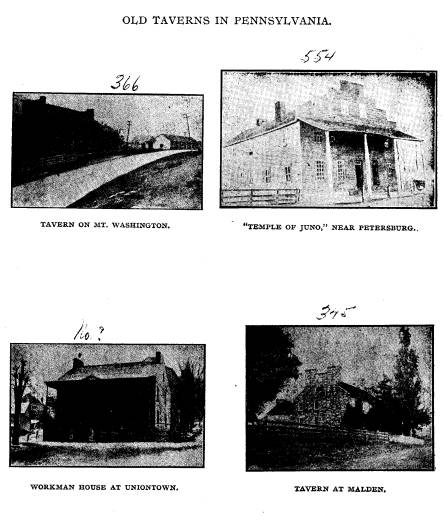
The Old National Road. 481
century. As elsewhere noted, there was
no earlier road between
Zanesville and Columbus which the
National Road followed.
West of Zanesville but one tavern was
opened in the first decade
of this century. Griffith Foos' tavern
at Springfield, which was
doing business in 1801, prospered until
1814. The other taverns
of the west, at Zanesville, Columbus,
Springfield, Richmond,
Indiana and Indianapolis, are of another
era and will be men-
tioned later.
The first taverns of the west were built
mostly of log,
though a few, as noted, were of stone.
They were ordinary wil-
derness cabins, rendered professionally
hospitable by stress of
circumstance. They were more often of
but one or two rooms,
where, before the fireplace, guests were
glad to sleep together
upon the puncheon floor. The fare
afforded was such as hunters
had-game from the surrounding forest and
neighboring streams
and the product of the little clearing,
potatoes and the common
cereals.
At the beginning of the new century a
large number of sub-
stantial taverns arose beside the first
western roads-even before
the National Road was under way. The
best known of these
were built at Washington, The Sign of
the Cross Keys, (1801);
The McClellan, (1802); National and
Walker Houses at Union-
town. At Washington arose The Sign of
the Golden Swan,
(1806); Sign of the Green Tree, (1808);
Gen. Andrew Jackson,
(1813); and Sign of the Indian Queen,
(1815). These were
built in the age of saw-mills and some
of them came well down
through the century.
It is remarkable how many buildings are
to be seen on the
National Road which tell by their
architectural form the story of
their fortunes. Many a tavern,
outgrowing the day of small
things, was found to be wholly
inadequate to the greater business
of the new era. Additions were made as
circumstances de-
manded, and in some cases the result is
very interesting.
The Seaton House in Uniontown was built
in sections, as was the
old Fulton House, (now Moran House) also
of Uniontown. A
fine old stone tavern at Malden,
Pennsylvania; was erected in
1822 and an addition made in 1830. A
stone slab in the second
section bears the date "1830",
also the word "Liberty", and a
482 Ohio Arch. and His.
Society Publications.
rude drawing of a plow and sheaf of
wheat. Though of more
recent date, the well known "Four
Mile House" west of Colum-
bus, Ohio, displays, by a series of
additions, the record of its
prosperous days, when the neighboring
"Camp Chase" held its
population of Confederate prisoners.
Among the more important taverns which
became the notable
hostelries of the National Road should
be mentioned the Black,
American, Mountain Spring and Pennsylvania
houses at Cumber-
land; Plumer tavern and Six Mile House
west of Cumberland;
Franklin and Highland Hall houses of
Frostburg; Lehman and
Shulty houses at Grantsville; Thistle
tavern at the eastern foot of
Negro mountain, and Hablitzell's stone
tavern at the Summit;
The Stoddard House on the summit of
Keyser's Ridge; the stone
tavern near the summit of Winding Ridge,
and the Wable stand
on the western slope; the Wentling and
Hunter houses at Peters-
burg; the "Temple of Juno" two
miles westward; the Endsley
House and Camel tavern at Smithfield
("Big Crossing") ; a tavern
on Mt. Augusta; the Rush, Inks and John
Rush houses, Sampey's
tavern at "Great Meadows"; the
Braddock Run House; Downer
tavern; Snyder's tavern at eastern foot
of Laurel Hill, and the
Summit House at the top; Shipley and
Monroe houses and Nor-
ris tavern east of Uniontown, and
Searight's tavern six miles
west; Johnson-Hatfield house; the
Brashear, Marshall, Clark and
Monongahela houses at Brownsville;
Adam's tavern; Key's and
Greenfield's tavern at Beallsville;
"Gall's House"; Hastings and
the Upland House at the foot of Egg Nogg
Hill; Ringland's
tavern at Pancake; the Fulton House,
Philadelphia and Kentucky
Inn and Travellers Inn at Washington;
Rankin and Smith tav-
erns; Caldwell's tavern; Brown's and Watkin's taverns at
Clays-
ville; Beck's tavern at West Alexander;
the Stone tavern at
Roney's Point and the United States
Hotel and Monroe House at
Wheeling.
West of the Ohio was Rhode's and
McMahon's taverns at
Bridgeport; Hoover's tavern near St.
Clairsville; Chamber-
lain's tavern; Christopher Hoover's
tavern, one mile west of
Morristown; Taylor's tavern; Gleave's
tavern and Stage office;
Bradshaw's Hotel at Fairview; Drake's
tavern at Middleton; Sign
of the Black Bear at Washington; Carran's, McDonald's, Mc-
The Old National Road. 483
Kinney's and Wilson's taverns in
Guernsey county and the "Ten
Mile House" at Norwich, ten miles
east of Zanesville. In Zanes-
ville, Robert Taylor opened a tavern in
1805, and in 1807 moved
to the present site of the Clarendon
Hotel, situated on the National
Road and hung out the Sign of the Orange
Tree. Perhaps no
tavern in the land can claim the honor
of holding a state legisla-
ture within its doors, except the Sign
of the Orange Tree, where,
in 1810-12, when Zanesville was the
temporary capital of Ohio,
the legislature made its headquarters.93
The Sign of the Rising
Sun was another Zanesville tavern,
opened in 1806, the name being
changed by a later proprietor, without
damage to its brilliancy,
perhaps, to the Sign of the Red Lion.
The National Hotel was
opened in 1818 and became a famous
hostelry. Roger's hotel is
mentioned in many old advertisements for
bids for making and
repairing the National Road. In 1811
William Burnham opened
the Sign of the Merino Lamb in a frame
building owned by Gen-
eral Isaac Van Home. The Sign of the
Green Tree was opened
by John S. Dugan in 1817, this being
remembered for entertaining
President Monroe, and General Lewis Cass
at a later date.
West of Zanesville, on the new route
opened straight westward
to Columbus, the famous monumental pile
of stone, the "Five Mile
House" long served its useful
purpose beside the road and is one
of the most impressive of its monuments,
to-day. Edward Smith
and Usal Headley were early tavern
keepers at this point. Henry
Winegamer built a tavern three miles
west of the Five Mile
House. Henry Hursey built and opened the
first tavern at Gra-
tiot. These public houses west of
Zanesville were erected in
the year preceding the opening of the
National Road, which was
built through the forest in the year
1831.94 The stages which
were soon running from Zanesville to
Columbus, left the uncom-
pleted line of the National Road at
Jacksontown and struck
across to Newark and followed the old
road thence to Columbus.
The first tavern built in Columbus was
opened in 1813, which,
93 The Virginian House of Burgesses met
in the old Raleigh Tavern
at Williamsburg, in 1773.--Woodrow
Wilson's George Washington, p
146.
94 For advertisement of sale of a
National Road tavern see Appendix
No. 4, p. 147.
484 Ohio Arch. and His. Society Publications.
in 1816, bore the sign "The Lion
and the Eagle." After 1817 it
was known as "The Globe." The
Columbus Inn and White
Horse Tavern were early Columbus hotels;
Pike's tavern was
opened in 1822, and a tavern
bearing the sign of the Golden Lamb
was opened in 1825. The Neil
House was opened in the 20's, a
transfer of it to new owners appearing
in local papers in 1832.
It was the headquarters of the Neil,
Moore and Company line
of stages, and the best known early
tavern in the old coaching
days in Ohio. Many forgotten taverns in
Columbus can be found
mentioned in old documents and papers
including the famous
American House, Buckeye Hotel, on the
present site of the Board
of Trade building, etc. West of Columbus
the celebrated "Four
Mile House", which has been
referred to previously, was erected
in the latter half of the century. In
the days of the great mail
and stage lines "Billy
Werden's" tavern in Springfield was the
leading hostelry in western Ohio. At
this point the stages run-
ning to Cincinnati, with mail for the
Mississippi Valley, left the
National Road. Across the state line,
Neal's and Clawson's tav-
erns offered hospitality in the extreme
eastern border of Indiana.
At Richmond, Starr Tavern (Tremont
Hotel), Nixon's Tavern,
Gilbert's two-story, pebble-coated
tavern and Bayle's Sign of
the Green Tree, offered entertainment
worthy of the road and its
great business, while Sloan's brick
stage house accommodated the
passenger traffic of the stage lines. At
Indianapolis, the Palmer
House, built in 1837, and
"Washington Hall," welcomed the pub-
lic of the two great political faiths,
Democrat and Whig, re-
spectively.
Almost every mile of the road's long
length wagon houses
offered hospitality to the hundreds
engaged in the great freight
traffic, in which a large room with its
fireplace could be found be-
fore which to lay blankets on a winter's
night. The most success-
ful wagon houses were situated at the
outskirts of the largertowns,
where, at more reasonable prices, and in
more congenial sur-
roundings than in a crowded city inn,
the rough sturdy men,
upon whom the whole west depended for
over a generation for its
merchandize, found hospitable
entertainment for themselves and
their rugged horses. These houses were
usually unpretentious
frame buildings surrounded by a
commodious yard, and gener-
The Old National Road. 485
ous watering troughs and barns. A
hundred tired horses have
been heard munching their corn in a
single wagon-house yard at
the end of a long day's work.
In both tavern and wagon house the fire
place and the bar
were omnipresent, whatever else might be
missing. The fire-
places in the first western taverns were
notably generous, as the
rigorous winters of the Alleghanies
required. Many of these
fire places were seven feet in length
and nearly as high, capable
of holding, had it been necessary, a
wagon load of wood. With
a great fire place at the end of the
room, lighting up its darkest
corners as no candle could, the taverns
along the National Road
where the stages stopped for the night,
saw merrier scenes than
any of their modern counterparts
witness. And over all their
merry gatherings the flames from the
great fires threw a soft-
ened light, in which those who remember
them best seem to bask
as they tell of them to us. The taverns
near some of the larger
villages, Wheeling, Washington or
Uniontown, often entertained
for a winter's evening, a sleighing
party from town, to whom the
great room and its fireplace was
surrendered for the nonce,
where soon lisping footsteps and the
soft swirl of old fashioned
skirts told that the dance was on.
Beside the old fire place hung two
important articles, the
flip-iron and the poker. The poker used
in the old road taverns
was of a size commensurate with the fire
place, often being seven
or eight feet long. Each landlord was
Keeper-of-the-Poker in
his own tavern, and many were particular
that none but them-
selves should touch the great fire,
which was one of the main fea-
tures of their hospitality, after the
quality of the food and drink.
Eccentric old "Boss" Rush in his
famous tavern near Smith-
field (Great Crossings) even kept his
poker under lock and key.
The tavern signs so common in New
England were known
only in the earlier days of the National
Road as many of the
tavern names show. The majority of the
great taverns bore
on their signs only the name of their
proprietor, the earliest
landlord's name often being used for
several generations. The
advancing of the century can be noticed
in the origin of such
names as the "National House,"
the "United States Hotel," the
"American House,"etc. The
evolution in nomenclature is, plainly,
486 Ohio Arch. and His. Society Publications.
from the sign or symbol to the
landlord's name, then to a fanciful
name. Another sign of later days was the
building of verandas.
The oldest taverns now standing are
plain ones or the two story
buildings rising abruptly from the
pavement and opening directly
upon it. Of this type is the Brownfield
House at Uniontown
and numerous half-forgotten houses which
were early taverns
in Pennsylvania and Ohio.
The kitchen of the old inn was an
important feature, espe-
cially as many of the taverns were
little more than restaurants
where stage passengers hastily dined.
The food provided was
of a plain and nourishing character,
including the famous home-
cured hams, which Andrew Jackson
preferred, and the buck-
wheat cakes, which Henry Clay highly
extolled. In this
connection it should be said that the
women of the old west
were most successful in operating the
old time taverns, and
many of the best "stands" were
conducted by them. The pro-
vision made in a license to a woman in
early New England, that
"she provide a fit man that is
godly to manage the business,"
was never suggested in the west, where
hundreds of brave
women carried on the business of their
husbands after their
decease. And their heroism was
appreciated and remembered
by the gallant aristocracy of the road.
The old Revolutionary soldiers who,
quite generally, became
the landlords of New England, did not
keep tavern in the west.
But one Revolutionary veteran was
landlord on the National
Road. The road bred and brought up its
own landlords to a large
extent. The early landlords were fit men
to rule in the early tav-
erns, and provided from forest and
stream the larger portion of
food for the sojourners over the first
rough roads. It is said that
these objected to the building of the
National Road, through
fear that more accelerated means of
locomotion would eventually
cheat them out of the business which
then fell to their share.
But, like the New England landlord, the
western tavern-
keeper was a many-sided man. Had the
National Road taverns
been located always within villages,
their proprietors might have
become what New England landlords are
reputed to have been,
town representatives, councilmen,
selectmen, tapsters and heads
of the"Train Band"-in
fact,next to the town clerk in importance.
The Old National Road. 487
As it was, the western landlord often
filled as important a posi-
tion on the frontier as his eastern
counterpart did in New Eng-
land. This was due, in part, to the
place which the western
tavern occupied in society. Taverns
were, both in the east and
in the west, places of meeting for
almost any business. This was
particularly true in the west, where the
public house was almost
the only available place for any
gathering whatever between the
scattered villages. But while in the
east the landlord was most
frequently busy with official duties,
the western landlord was
mostly engaged in collateral
professions, which rendered him of
no less value to his community. The
jovial host at the National
Road tavern often worked a large farm,
upon which his tavern
stood. Some of the more prosperous on
the eastern half of the
road, owned slaves which carried on the
work of the farm and
hotel. He sometimes ran a store in
connection with his tavern,
and almost without exception, officiated
at his bar, where he
"sold strong waters to relieve the
inhabitants." Whiskey, two
drinks for a "fippeny bit,"
called "fip" for short (value 61/4 cents)
was the principal "strong
water" in demand. It was the pure
article, neither diluted nor
adulterated. In the larger towns of
course any beverage of the day was kept
at the taverns - sherry
toddy, mulled wine, madeira and cider.
As has been said, the road bred its own
landlords. Youths,
whose lives began simultaneously with
that of the great road,
worked upon its curved bed in their
teens, became teamsters and
contractors in middle life, and spent
the autumn of their lives as
landlords of its taverns, purchased with
the money earned in
working upon it. Several well-known
landlords were prominent
contractors, many of whom owned their
share of the great six
and eight-horse teams which hauled
freight to the western rivers.
The old taverns were the hearts of the
National Road, and
the tavern life was the best gauge to
measure the current of
business that ebbed and flowed. As the
great road became super-
ceded by the railways, the taverns were
the first to succumb
to the shock. In a very interesting
article, a recent writer on
"The Rise of the Tide of Life to
New England Hilltops,"95
95 Mr. Edward P. Pressey in New
England Magazine, Vol. XXII,
No. 6 (August 1900).
|
488 Ohio Arch. and His. Society Publications. |
|
|
The Old National Road. 489
speaks of the early hill life of New
England, and the memorials
there left "of the deep and
sweeping streams of human history."
The author would have found the National
Road and its pre-
decessors an interesting western example
of the social phenom-
ena with which he dealt. In New England,
as in the central
west, the first travelled courses were
on the summits of the water-
sheds. These routes of the brute were
the first ways of men.
The tide of life has ebbed from
New England hilltops since the.
beginning. Sufficient is it for the present subject that the
National Road was the most important
"stream of human history"
from Atlantic tide-water to the
headwaters of the streams of
the Mississippi. Its old taverns are,
after the remnants of the
historic road-bed and ponderous bridges,
the most interesting
"shells and fossils" cast up
by this stream. This old route, chosen
first by the buffalo and followed by red
and white men, will ever
be the course of travel across the
mountains. From this rugged
path made by the once famous National
Road, the tide of life
can not ebb. Here, a thousand years
hence, may course a mag-
nificent boulevard, the American Appian
way, to the commercial,
as well as military, key of the eastern
slopes of the Mississippi
basin at the junction of the Alleghany
and Monongahela rivers.
It is important that each fact of
history concerning this ancient
highway be put on lasting record.
x.
CONCLUSION.
It is impossible to leave the study of
the National Road
without gathering up into a single
chapter a number of threads
which have not been woven into the
preceding record. And
first, the very appearance of the old
road as seen by travellers
who pass over it to-day. One can not go
a single mile over it
without becoming deeply impressed with
the evidence of the age
and its individuality of the old
National Road. There is nothing
nothing like it in the United States.
Leaping the Ohio at Wheel-
ing, the National Road throws itself
across Ohio and Indiana,
straight as an arrow, like an ancient
elevated pathway of the gods,
chopping hills in twain at a blow,
traversing the lowlands on
490 Ohio Arch. and His. Society Publications.
high grades like a railroad bed,
vaulting river and stream on
massive bridges of unparalled size. The
farther one travels upon
it, the more impressed one must become,
for there is, in the long
grades stretches and ponderous bridges,
that "masterful sug-
gestion of a serious purpose, speeding
you along with a strange
uplifting of the heart," of which
Kenneth Grahame speaks; "and
even in its shedding off of bank and
hedgerow as it marched
straight and full for the open downs, it
seems to declare it con-
tempt for adventitious trappings to
catch the shallow-pated."96
For long distances, this road "of
the sterner sort" will be, so far
as its immediate surface is concerned,
what the tender mercies
of the counties through which it passes
will allow, but at certain
points, the traveler comes out
unexpectedly upon the ancient road
bed, for in many places the old
macadamized bed is still doing
noble duty.
Nothing is more striking than the
ponderous stone bridges
which carry the road bed over the water
ways. It is doubtful
if there are on this continent such
monumental relics of the
old stone bridge builders' art. Not only
such massive bridges
as those at Big Crossings - Smithfield,
Pennsylvania - and the
artistic "S" bridge near
Claysville, Pennsylvania, will attract the
traveler's attention, but many of the
less pretentious bridges over
brooks and rivulets will, upon
examination, be found to be pon-
derous pieces of workmanship. A pregnant
suggestion of the
change which has come over the land can
be read in certain of
these smaller bridges and culverts. When
the great road was
built the land was covered with forests
and many drains were
necessary. With the passing of the
forests many large bridges,
formerly of much importance, are now of
a size out of all pro-
portion to the demand for them, and
hundreds of little bridges
have fallen into disuse, some of them
being quite above the general
level of the surrounding fields. The
ponderous bridge at Big
Crossings was finished and dedicated
with great eclat July 4,
1818. Near the eastern end of the three
fine arches is the fol-
lowing inscription: "Kinkead, Beck
& Evans, builders, July 4,
1818."
96 "The Golden Age," p. 155.
The Old National Road. 491
The traveler will notice, still, the
mile posts which mark
the great road's successive steps. Those
on the eastern portion
of the road are of iron and were made at
the founderies at Con-
nelsville and Brownsville. Major James
Francis had the contract
for making and delivering those between
Cumberland and
Brownsville. John Snowdan had the
contract for those between
Brownsville and Wheeling. They were
hauled in six horse teams
to their sites. Those between
Brownsville and Cumberland have
recently been reset and repainted. The
mile stones west of the
Ohio river are mostly of sand stone, and
are fast disappearing
under the action of the weather. Some
are quite illegible. In
central Ohio, through the Darby woods,
or "Darby Cuttings," the
mile posts have been greatly mutilated
by vandal wood-choppers,
who knocked off large chips with which
to sharpen their axes.
The bed of the National Road was
originally eighty feet in
width. In Ohio, at least, property
owners have encroached upon
the road, until in some places, ten feet
of ground has been in-
cluded within the fences. This matter
has been brought into
notice where franchises for electric
railway lines have been
granted. In Franklin county, west of
Columbus, Ohio, there is
hardly room for a standard gauge track
outside the road-bed,
where once the road occupied forty feet
each side of its axis.
When the property owners were addressed
with respect to the
removal of their fences, they demanded
to be shown quit claim
deeds for the land, which, it is
necessary to say, were not forth-
coming from the state. Hundreds of
contracts, calling for a
width of eighty feet, can be given as
evidence of the original width
of the road.97 In days when
it was considered the most extrav-
agant good fortune to have the National
Road pass through one's
farm, it was not considered necessary to
obtain quit claim deeds of
the land!
It is difficult to sufficiently
emphasize the aristocracy which
existed among the old "pike
boys," as those most intimately con-
nected with the road were called. This
was particularly true of
97 "The proper limits of the road
are hereby defined to be a space
of eighty feet in width - forty feet on
each side of the center of the graded
road-bed." - Law passed April 18,
1870, Laws of Ohio, Vol. LVIII,
p. 140.
492 Ohio Arch. and His. Society
Publications.
the drivers of the mail and passenger
stages, men who were as
often noted for their quick wit and
large acquaintance with men,
as for their dextrous handling of two
hands full of reins. Their
social and business position was the
envy of the youth of a nation,
whose ambition to emulate them was
begotten of the best sort
of hero worship. Stage drivers' foibles
were their pet themes,
such as the use of peculiar kinds of
whips and various modes of
driving. Of the latter there were three
styles common to the
National Road. (1) The flat rein
(English style), (2) Top and
bottom (Pennsylvania adaptation), (3)
Side rein (Eastern style).
The last mode was in commonest use. Of
drivers there were,
of course, all kinds, slovenly, cruel,
careful. Of the best class,
John Bunting, Jim Reynolds and Billy
Armor were best known,
after "Red" Bunting, in the
east, and David Gordon and James
Burr, on the western division. No one
was more proud of the
fine horses which did the work of the
great road than the better
class of drivers. As Thackeray said was
true in England, the
passing of the era of good roads and the
mail stage has sounded
the knell of the rugged race of horses
which once did service in the
central west.
As one scans the old files of
newspapers, or reads old time
letters and memoirs of the age of the
National Road, he is im-
pressed with the interest taken in the
coming and going of the
more renowned guests of the old road.
The passage of a Presi-
dent-elect over the National Road was a
triumphant procession.
The stage companies made special stages,
or selected the best of
their stock, in which to bear him. The
best horses were fed and
groomed for the proud task. The most
noted drivers were ap-
pointed to the honorable station as
Charioteer-to-the-President.
The thousands of homes along his route
were decked in his honor,
and welcoming heralds rode out from the
larger towns to escort
their noted guests to celebrations for
which preparations had been
making for days in advance. The slow
moving presidential page-
ant through Ohio and Pennsylvania was an
educational and pa-
triotic ceremony, of not infrequent
occurrence in the old coach-
ing days-a worthy exhibition which
hardly has its counterpart
in these days of steam. Jackson, Van
Buren, Monroe, Harrison,
Polk and Tyler passed in triumph over
portions of the great road.
The Old National Road. 493
The taverns at which they were feted are
remembered by the fact.
Drivers who were chosen for the task of
driving their coach were
ever after noted men. But there were
other guests than presi-
dents-elect, though none received with
more acclaim. Henry
Clay, the champion of the road, was a
great favorite throughout
its towns and hamlets, one of which,
Claysville, proudly per-
petuates his name. Benton and Cass, Gen.
Lafayette, Gen. Santa
Anna, Black Hawk, Jenny Lind, P. T.
Barnum and J. Q. Adams,
are all mentioned in the records of the
stirring days of the old
road. As has been suggested elsewhere,
politics entered largely
into the consideration of the building
and maintenance of the road.
Enemies of internal improvement were not
forgotten as they
passed along the great road which they
voted to neglect, as even
Martin Van Buren once realized when the
axle of his coach was
sawed in two, breaking down where the
mud was deepest!
Many episodes are remembered, indicating
that all the political
prejudice and rancor known elsewhere was
especially in evidence
on this highway, which owed its
existence and future to the
machinations of politicians.
But the greatest blessing of the National
Road was the splen-
did era of national growth which it did
its share toward hastening.
Its best friends could see in its
decline and decay only evidences
of unhappiest fortune, while in reality
the great road had done its
noble work and was to be superseded by
better things which owed
to it their coming. Historic roads there
had been, before the
great highway of America was built, but
none in all the past had
been the means of supplanting themselves
by greater and more
efficient means of communication. The
far-famed Appian Way
witnessed many triumphal processions of
consuls and pro-consuls,
but it never was the means of bringing
into existence something
to take its place in a new and more
progressive era. It helped
to create no free empire at its
extremity, and they who tra-
versed it in so much pride and power
would find it to-day nothing
but a ponderous memorial of their
vanity. The National Road
was built by the people and for the
people, and served well its
high purpose. It became a highway for
the products of the fac-
tories, the fisheries and the commerce
of the eastern states. It
made possible that interchange of the
courtesies of social life
|
494 Ohio Arch. and His. Society Publications. |
|
|
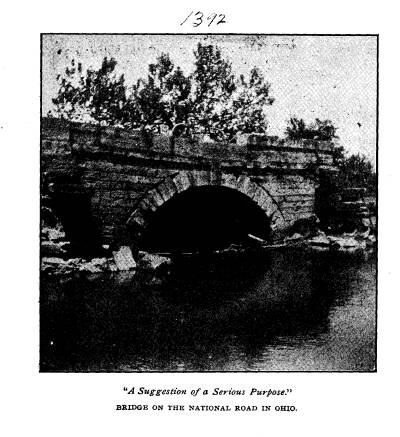
The Old National Road. 495
necessary in a republic of united
states. It was one of the great
strands which bound the nation together
in early days when there
was much to excite animosity and provoke
disunion. It became
the pride of New England as well as of
the west which it more
immediately benefited; "The state
of which I am a citizen," said
Edward Everett of Lexington, Kentucky,
in 1829,
"has already
paid between one and two thousand
dollars toward the construc-
tion and repair of that road; and I
doubt not she is prepared
to contribute her proportion toward its
extension to the place
of its destination."98
Hundreds of ancient but unpretentious
monuments of the old
National Road-the hoary mile stones
which line it-stand to
perpetuate its name in future days. But
were they all gathered
together-from Indiana and Ohio and
Pennsylvania and Virginia
and Maryland-and cemented into a
monstrous pyramid, the pile
would not be appropriate to preserve the
name and fame of a high-
way which "carried thousands of
population and millions of
wealth into the West, and, more than any
other material structure
in the land, served to harmonize and
strengthen, if not save, the
Union !"
What of the future? The dawning of the
era of country
living is in sight. It is being hastened
by the revolution in
methods of locomotion. The bicycle and
automobile presage
an era of good roads, and of an
unparalleled countryward move-
ment of society. With this era is coming
the revival of inn and
tavern life, the rejuvenation of a
thousand ancient highways and
all the happy life that was ever known
along their dusty coils and
stretches. By its position with
reference to the national capital,
and the military and commercial key of
the central west, Pitts-
burg, and both of the great cities of
Ohio, the old National Road
will become, perhaps, the foremost of
the great roadways of
America. The bed is capable of being
made substantial at a com-
paratively small cost, as the grading is
quiet perfect. Its course
measures the shortest possible route
practicable for a roadway
from tide water to the Mississippi
river. As a trunk line its
location cannot be surpassed. Its
historic associations will render
98Everett's Speeches and Orations, Vol. 1, p. 202.
496 Ohio Arch. and His. Society Publications.
the route of increasing interest to the
thousands who, in other
days, will travel, in the genuine sense
of the word, over those
portions of its length which long ago
became hallowed ground.
The "Shades of Death" will
again be filled with the echoing horn
which heralded the arrival of the old
time coaches, and Winding
Ridge again be crowded with the traffic
of a nation. A hundred
National Road taverns will be opened,
and bustling landlords wel-
come, as of yore, the travel-stained
visitor. Merry parties will
again fill those tavern halls, now long
silent, with their laughter.
And all this will but mark a new and
better era than its pre-
decessor, an era of outdoor living,
which must come, and come
quickly, if as a nation we are to retain
our present hold on the
world's great affairs.
APPENDIX No. 1.
THE FIRST REFORT OF THE NATIONAL ROAD
COMMISSIONERS-1806.
"The commissioners, acting by
appointment under the law of
Congress, entitled, 'An act to regulate
the laying out and mak-
ing a road from Cumberland, in the State
of Maryland, to the
State of Ohio, beg leave to report to
the President of the United
States, and to premise that the duties
imposed by the law became
a work of greater magnitude, and a task
much more arduous, than
was conceived before entering upon it;
from which circumstance
the commissioners did not allow
themselves sufficient time for the
performance of it before the severity of
the weather obliged them
to retire from it, which was the case in
the first week of the pre-
sent month (December). That, not having
fully accomplished
their work, they are unable fully to
report a discharge of all the
duties enjoined by the law; but as the
most material and principal
part has been performed, and as a
communication of the progress
already made may be useful and proper,
during the present ses-
sion of Congress, and of the
Legislatures of those States through
which the route passes, the
commissioners respectfully state that
at a very early period it was conceived
that the maps of the country
were not sufficiently accurate to afford
a minute knowledge of the
true courses between the extreme points
on the rivers, by which
the researches of the commissioners were
to be governed; a survey
The Old National Road. 497
for that purpose became indispensable,
and considerations of pub-
lic economy suggested the propriety of
making this survey
precede the personal attendance of the
commissioners.
Josias Thompson, a surveyor of
professional merit, was taken
into service and authorized to employ
two chain carriers and a
marker, as well as one vaneman, and a
packhorse man and horse,
on public account; the latter being
indispensable and really benefi-
cial in accelerating the work. The
surveyor's instructions are con-
tained in document No. 1, accompanying
this report.
Calculating on a reasonable time for the
performance of the
instructions to the surveyor, the
commissioners, by correspond-
ence, fixed on the first day of
September last, for their meet-
ing at Cumberland to proceed in the
work; neither of them,
however, reached that place until the
third of that month, on
which day they all met.
The surveyor having, under his
instructions, laid down a plat
of his work, showing the meanders of the
Potomac and Ohio riv-
ers, within the limits prescribed for
the commissioners, as also
the road between those rivers, which is
commonly traveled from
Cumberland to Charleston, in part called
Braddock's road; and
the same being produced to the
commissioners, whereby straight
lines and their true courses were shown
between the extreme
points on each river, and the boundaries
which limit the powers
of the commissioners being thereby
ascertained, serving as a basis
whereon to proceed in the examination of
the grounds and face of
the country; the commissioners thus
prepared commenced the
business of exploring; and in this it
was considered that a faith-
ful discharge of the discretionary
powers vested by the law made
it necessary to view the whole to be
able to judge of a preference
due to any part of the grounds, which
imposed a task of examin-
ing a space comprehending upwards of two
thousand square
miles; a task rendered still more
incumbent by the solicitude and
importunities of the inhabitants of
every part of the district, who
severally conceived their grounds
entitled to a preference. It
becoming necessary, in the interim, to
run various lines of ex-
periment for ascertaining the
geographical position of several
points entitled to attention, and the
service suffering great delay
for want of another surveyor, it was
thought consistent with the
498 Ohio Arch. and His. Society Publications.
public interest to employ, in that
capacity, Arthur Rider, the
vaneman, who had been chosen with
qualification to meet such an
emergency; and whose services as vaneman
could then be dis-
pensed with. He commenced, as surveyor,
on the 22nd day of
September, and continued so at field
work until the first day of
December, when he was retained as a
necessary assistant to the
principal surveyor, in copying field
notes and hastening the
draught of the work to be reported.
The proceedings of the commissioners are
especially detailed
in their general journal, compiled from
the daily journal of each
commissioner, to which they beg leave to
refer, under mark No. 2.
After a careful and critical examination
of all the grounds
within the limits prescribed, as well as
the grounds and ways out
from the Ohio westwardly, at several
points, and examining the
shoal parts of the Ohio river as
detailed in the table of soundings,
stated in their journal, and after
gaining all the information, geo-
graphical, general and special, possible
and necessary, toward a
judicial discharge of the duties
assigned them, the commissioners
repaired to Cumberland to examine and
compare their notes and
journals, and determine upon the
direction and location of their
route.
In this consultation the governing
objects were:
1. Shortness of distance between navigable points on the
eastern and western waters.
2. A point on the Monongahela best
calculated to equalize
the advantages of this portage in the
country within reach of it.
3. A point on the Ohio river most
capable of combining
certainty of navigation with road
accommodation; embracing,
in this estimate, remote points
westwardly, as well as present and
probable population on the north and
south.
4. Best mode of diffusing benefits with
least distance of road.
In contemplating these objects, due
attention was paid as
well to the comparative merits of towns,
establishments and
settlements already made, as to the
capacity of the country with
the present and probable population.
In the course of arrangement, and in its
order, the first
point located for the route was
determined and fixed at Cumber-
land, a decision founded on propriety,
and in some measure on
The Old National Road. 499
-necessity, from the circumstance of a
high and difficult mountain,
called Nobley, laying and confining the
east margin of the Poto-
mac, so as to render it impossible of
access on that side without
immense expense, at any point between
Cumberland and where
the road from Winchester to Gwynn's
crosses, and even there
the Nobley mountain is crossed with much
difficulty and hazard.
And this upper point was taxed with
another formidable objec-
tion; it was found that a high range of
mountains, called Dan's,
stretching across from Gwynn's to the
Potomac, above this point,
precluded the opportunity of extending a
route from this point
in a proper direction, and left no
alternative but passing by
Gwynn's; the distance from Cumberland to Gwynn's being
upward of a mile less than from the
upper point, which lies ten
miles by water above Cumberland, the
commissioners were not
permitted to hesitate in preferring a
point which shortens the
portage, as well as the Potomac
navigation.
The point of the Potomac being viewed as
a great repository
of produce, which a good road will bring
from the west of Laurel
Hill, and the advantages which
Cumberland, as a town, has in
that respect over an unimproved place,
are additional considera-
tions operating forcibly in favor of the
place preferred.
In extending the route from Cumberland,
a triple range of
mountains, stretching across from
Jening's run in measure with
Gwynn's, left only the alternative of laying
the road up Will's
creek for three miles, nearly at right
angles with the true course,
and then by way of Jening's run, or
extending it over a break
in the smallest mountain, on a better
course by Gwynn's, to
the top of Savage mountain; the latter
was adopted, being the
shortest, and will be less expensive in
hill-side digging over a
sloped route than the former, requiring
one bridge over Will's
creek and several over Jening's run,
both very wide and consid-
erable streams in high water; and a more
weighty reason for
preferring the route by Gwynn's is the
great accommodation
it will afford travelers from Winchester
by the upper point;
who could not reach the route by
Jening's run short of the top
of Savage, which would withhold from
them the benefit of an
easy way up the mountain.
It is, however, supposed that those who
travel from Win-
|
500 Ohio Arch. and His. Society Publications. |
|
|
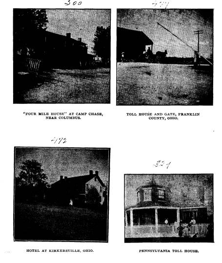
The Old National Road. 501
chester by way of the upper point to
Gwynn's, are in that respect
more the dupes of common prejudice than
judges of their own
ease, as it is believed the way will be
as short, and on much
better ground, to cross the Potomac
below the confluence of the
north and south branches (thereby
crossing these two, as well
as Patterson's creek, in one stream,
equally fordable in the same
season), than to pass through Cumberland
to Gwynn's. Of
these grounds, however, the
commissioners do not speak from
actual view, but consider it a subject
well worthy of future
investigation. Having gained the top of
Alleghany mountain,
or rather the top of that part called
Savage, by way of Gwynn's,
the general route, as it respects the
most important points, was
determined as follows, viz:
From a stone at the corner of lot No. 1,
in Cumberland,
near the confluence of Will's creek and
the north branch of the
Potomac river; thence extending along
the street westwardly,
to cross the hill lying between
Cumberland and Gwynn's, at the
gap where Braddock's road passes it;
thence near Gwynn's and
Jesse Tomlinson's, to cross the big
Youghiogheny near the mouth
of Roger's run, between the crossing of
Braddock's road and the
confluence of the streams which form the
Turkey foot; thence
to cross Laurel Hill near the forks of
Dunbar's run, to the west
foot of that hill, at a point near where
Braddock's old road
reached it, near Gist's old place, now
Colonel Isaac Meason's,
thence through Brownsville and
Bridgeport, to cross the Monon-
gahela river below Josias Crawford's
ferry; and thence on as
straight a course as the country will
admit to the Ohio, at a
point between the mouth of Wheeling
creek and the lower point
of Wheeling island.
In this direction of the route it will
lay about twenty-four
and a half miles in Maryland,
seventy-five miles and a half in
Pennsylvania, and twelve miles in
Virginia; distances which will
be in a small degree increased by
meanders, which the bed of
the road must necessarily make between
the points mentioned in
the location; and this route, it is
believed, comprehends more
important advantages than could be
afforded in any other, inas-
much as it has a capacity at least equal
to any other in extending
advantages of a highway; and at the same
time establishes the
502 Ohio Arch. and
His. Society Publications.
shortest portage between the points
already navigated, and on
the way accommodates other and nearer
points to which navi-
gation may be extended, and still
shorten the portage.
It intersects Big Youghiogheny at the
nearest point from
Cumberland, then lies nearly parallel
with that river from the
distance of twenty miles, and at the
west foot of Laurel Hill
lies within five miles of Connellsville,
from which the Yough-
iogheny is navigated; and in the same
direction the route inter-
sects at Brownsville, the nearest point
on the Monongahela river
within the district.
The improvement of the Youghiogheny
navigation, is a
subject of too much importance to remain
long neglected; and
the capacity of that river, as high up
as the falls (twelve miles
above Connellsville), is said to be
equal, at a small expense,
with the parts already navigated below.
The obstructions at
the falls, and a rocky rapid near Turkey
Foot, constitute the
principal impediments in that river to
the intersection of the
route, and as much higher as the stream
has a capacity for navi-
gation; and these difficulties will
doubtles be removed when the
intercourse shall warrant the measure.
Under these circumstances the portage
may be thus stated:
From Cumberland to Monongahela,
sixty-six and one-half
miles. From Cumberland to a point in
measure with Connels-
ville ,on the Youghiogeny river,
fifty-one and one-half miles.
From Cumberland to a point in measure
with the lower end of
the falls of Youghiogeny, which will lie
two miles north of the
public road, forty-three miles. From
Cumberland to the inter-
section of the route with the
Youghiogheny river, thirty-four
miles.
Nothing is here said of the Little
Youghiogheny, which lies
nearer Cumberland; the stream being
unusually crooked, its
navigation can only become the work of a
redundant population.
The point which this route locates, at
the west foot of
Laurel Hill, having cleared the whole of
the Alleghany moun-
tain, is so situated as to extend the
advantages of an easy way
through the great barrier, with more
equal justice to the best
parts of the country between Laurel Hill
and the Ohio. Lines
from this point to Pittsburg and
Morgantown, diverging nearly
The Old National Road. 503
at the same angle, open upon equal terms
to all parts of the
western country that can make use of
this portage; and which
may include the settlements from
Pittsburg, up Big Beaver to
the Connecticut reserve, on Lake Erie,
as well as those on the
southern borders of the Ohio and all the
intermediate country.
Brownsville is nearly equi-distant from
Big Beaver and
Fishing creek, and equally convenient to
all the crossing places
on the Ohio, between these extremes. As
a port, it is at least
equal to any on the Monongahela within
the limits, and holds
superior advantages in furnishing
supplies to emigrants, traders,
and other travelers by land or water.
Not unmindful of the claims of towns and
their capacity of
reciprocating advantages on public
roads, the commissioners were
not insensible of the disadvantage which
Uniontown must feel
from the want of that accommodation
which a more southwardly
direction of the route would have
afforded; but as that could
not take place without a relinquishment
of the shortest passage,
considerations of public benefit could
not yield to feelings of
minor import. Uniontown being the seat
of justice for Fayette
county, Pennsylvania, is not without a
share of public benefits,
and may partake of the advantages of
this portage upon equal
terms with Connellsville, a growing
town, with the advantage
of respectable water-works adjoining, in
the manufactury of flour
and iron.
After reaching the nearest navigation on
the western waters,
at a point best calculated to diffuse
the benefits of a great high-
way, in the greatest possible latitude
east of the Ohio, it was
considered that, to fulfill the objects
of the law, it remained
for the commissioners to give such a
direction to the road as
would best secure a certainty of
navigation on the Ohio at all
seasons, combining, as far as possible,
the inland accommodation
of remote points westwardly. It was
found that the obstruc-
tions in the Ohio, within the limits
between Steubenville and
Grave creek, lay principally above the
town and mouth of Wheel-
ing; a circumstance ascertained by the
commissioners in their
examination of the channel, as well as
by common usage, which
has long given a decided preference to
Wheeling as a place of
embarcation and port of departure in dry
seasons. It was also
504 Ohio Arch. and His. Society Publications.
seen that Wheeling lay in a line from
Brownsville to the centre
of the state of Ohio and Post Vincennes.
These circumstances
favoring and corresponding with the
chief objects in view in
this last direction of the route, and
the ground from Wheeling
westwardly being known of equal fitness
with any other way
out from the river, it was thought most
proper, under these
several considerations, to locate the
point mentioned below the
mouth of Wheeling. In taking this point
in preference to one
higher up and in the town of Wheeling,
the public benefit and
convenience were consulted, inasmuch as
the present crossing
place over the Ohio from the town is so
contrived and confined
as to subject passengers to
extraordinary ferriage and delay,
by entering and clearing a ferry-boat on
each side of Wheeling
island, which lies before the town and
precludes the opportunity
of fording when the river is crossed in
that way, above and below
the island. From the point located, a
safe crossing is afforded
at the lower point of the island by a
ferry in high, and a good
ford at low water.
The face of the country within the
limits prescribed is gen-
erally very uneven, and in many places
broken by a succession
of high mountains and deep hollows, too
formidable to be reduced
within five degrees of the horizon, but
by crossing them obliquely,
a mode which, although it imposes a
heavy task of hill-side dig-
ging, obviates generally the necessity
of reducing hills and filling
hollows, which, on these grounds, would
be an attempt truly
Quixotic. This inequality of the surface
is not confined to the
Alleghany mountain; the country between
the Monongahela
and Ohio rivers, although less elevated,
is not better adapted
for the bed of a road, being filled with
impediments of hills and
hollows, which present considerable
difficulties, and wants that
super-abundance and convenience of stone
which is found in
the mountain.
The indirect course of the road now
traveled, and the fre-
quent elevations and depressions which
occur, that exceed the
limits of the law, preclude the
possibility of occupying it in any
extent without great sacrifice of
distance, and forbid the use of
it, in any one part for more than half a
mile, or more than two
or three miles in the whole.
The Old National Road. 505
The expense of rendering the road now in
contemplation
passable, may, therefore, amount to a
larger sum than may have
been supposed necessary, under an idea
of embracing in it a
considerable part of the old road; but
it is believed that the
contrary will be found most correct, and
that a sum sufficient
to open the new could not be expended on
the same distance of
the old road with equal benefit.
The sum required for the road in contemplation
will depend
on the style and manner of making it; as
a common road cannot
remove the difficulties which always
exist on deep grounds, and
particularly in wet seasons, and as
nothing short of a firm, sub-
stantial, well-formed, stone-capped road
can remove the causes
which led to the measure of improvement,
or render the insti-
tution as commodious as a great and
growing intercourse appears
to require, the expense of such a road
next becomes the subject
of inquiry.
In this inquiry the commissioners can
only form an estimate
by recurring to the experience of
Pennsylvania and Maryland
in the business of artificial roads.
Upon this data, and a com-
parison of the grounds and proximity of
the materials for cov-
ering, there are reasons for belief
that, on the route reported, a
complete road may be made at an expense
not exceeding six
thousand dollars per mile, exclusive of
bridges over the principal
streams on the way. The average expense
of the Lancaster, as
well as Baltimore and Frederick
turnpike, is considerably higher;
but it is believed that the convenient
supply of stone which the
mountain affords will, on those grounds,
reduce the expense to
the rate here stated.
As to the policy of incurring this
expense, it is not the
province of the commissioners to
declare; but they cannot, how-
ever, withhold assurances of a firm
belief that the purse of the
nation cannot be more seasonably opened,
or more happily applied,
than in promoting the speedy and
effectual establishment of a
great and easy road on the way
contemplated.
In the discharge of all these duties,
the commissioners have
been actuated by an ardent desire to
render the institution as
useful and commodious as possible; and,
impressed with a strong
sense of the necessity which urges the
speedy establishment of
506 Ohio Arch. and His. Society Publications.
the road, they have to regret the
circumstances which delay the
completion of the part assigned them.
They, however, in some
measure, content themselves with the
reflection that it will not
retard the progress of the work, as the
opening of the road
cannot commence before spring, and may
then begin with making
the way.
The extra expense incident to the
service from the necessity
(and propriety, as it relates to public
economy,) of employing
men not provided for by law will, it is
hoped, be recognized
and provision made for the payment of
that and similar expenses,
when in future it may be indispensably
incurred.
The commissioners having engaged in a
service in which
their zeal did not permit them to
calculate the difference between
their pay and the expense to which the
service subjected them,
cannot suppose it the wish or intention
of the government to
accept of their services for a mere
indemnification of their expense
of subsistence, which will be very much
the case under the
present allowance; they, therefore,
allow themselves to hope and
expect that measures will be taken to
provide such further com-
pensation as may, under all
circumstances, be thought neither
profuse nor parsimonious.
The painful anxiety manifested by the
inhabitants of the
district explored, and their general
desire to know the route
determined on, suggested the measure of
promulgation, which,
after some deliberation, was agreed on
by way of circular letter,
which has been forwarded to those
persons to whom precaution
was useful, and afterward sent to one of
the presses in that
quarter for publication, in the form of
the document No. 3,
which accompanies this report.
All which is, with due deference,
submitted.
ELI WILLIAMS,
THOMAS MOORE,
JOSEPH KERR.
December 30, 1806.
The Old National Road. 507
APPENDIX No. 2.
SECOND REPORT OF THE
NATIONAL ROAD COMMISSIONERS - 1808.
"The undersigned,
commissioners appointed under the law
of the United States,
entitled 'An act to regulate the laying out
and making a road from
Cumberland, in the State of Maryland,
to the State of Ohio,'
in addition to the communications hereto-
fore made, beg leave
further to report to the President of the
United States, that,
by the delay of the answer of the Legislature
of Pennsylvania to the
application for permission to pass the road
through that state,
the commissioners could not proceed to the bus-
iness of the road in
the spring before vegetation had so far ad-
vanced as to render
the work of exploring and surveying difficult
and tedious, from
which circumstance it was postponed till the
last autumn, when the
business was again resumed. That, in
obedience to the
special instructions given them, the route hereto-
fore reported has been
so changed as to pass through Uniontown,
and that they have
completed the location, gradation and marking
of the route from
Cumberland to Brownsville, Bridgeport, and the
Monongahela river,
agreeably to a plat of the courses, distances
and grades in which is
described the marks and monuments by
which the route is
designated, and which is herewith exhibited;
that by this plat and
measurement it will appear (when compared
with the road now
traveled) there is a saving of four miles of dis-
tance between
Cumberland and Brownsville on the new route.
In the gradation of
the surface of the route (which became
necessary) is
ascertained the comparative elevation and depres-
sion of different
points on the route, and taking a point ten feet
above the surface of
low water in the Potomac river at Cumber-
land, as the horizon,
the most prominent points are found to be
elevated as follows,
viz.:
FEET
Summit of Wills
mountain .................................. . 581.3
Western foot of same
........................................ 304.4
Summit of Savage
mountain .................................. 2,022.24
Savage river
................................................ 1,741.6
Summit Little Savage
mountain ............................... 1,900.4
Branch Pine Run, first
Western water ........................ 1,699.9
|
508 Ohio Arch. and His. Society Publications. |
|
|

The Old
National Road. 509
FEET
Summit of Red
Hill (afterwards called shades of death)....... 1,914.3
Summit Little
Meadow mountain ............................. 2,026.16,
Little
Youghiogheny river .................................. 1,322.6
East Fork of
Shade run ..................................... 1,558.92
Summit of
Negro mountain, highest point99 .................... 2,328.12
Middle branch
of White's creek, at the west foot of Negro
mountain ............................................... 1,360.5
White's creek .............................................. 1,195.5
Big
Youghiogheny river ...................................... 645.5
Summit of a
ridge between Youghiogheny river and Beaver
waters .................................................. 1,514.5
Beaver Run ................................................ 1,123.8
Summit of
Laurel Hill ....................................... 1,550.16
Court House in
Uniontown ................................... 274.65
A point ten
feet above the surface of low water in the Monon-
gahela river,
at the mouth of Dunlap's creek ..............
119.26
The law
requiring the commissioners to report those parts
of the route
as are laid on the old road, as well as those on new
grounds, and
to state those parts which require the most imme-
diate
attention and amelioration, the probable expense of making
the same
passable in the most difficult parts, and through the whole
distance, they
have to state that, from the crooked and hilly course
of the road
now traveled, the new route could not be made to
occupy any
part of it (except an intersection on Wills mountain,
another at
Jesse Tomlinson's, and a third near Big Youghiogheny,
embracing not
a mile of distance in the whole) without unneces-
sary
sacrifices of distances and expense.
That,
therefore, an estimate must be made on the route as
passing wholly
through new grounds. In doing this the com-
missioners
feel great difficulty, as they cannot, with any degree
of precision,
estimate the expense of making it merely passable;
nor can they
allow themselves to suppose that a less breadth than
that mentioned
in the law was to be taken into the calculation.
The rugged
deformity of the grounds rendered it impossible to
lay a route
within the grade limited by law otherwise than by
ascending and
descending the hills obliquely, by which circum-
stance a great
proportion of the route occupies the sides of the
hills, which
cannot be safely passed on a road of common breadth,
99 Keyser's Ridge.
510 Ohio Arch. and His.
Society Publications.
and where it will, in the opinion of the
commissioners, be neces-
sary, by digging, to give the proper
form of thirty feet, at least in
the breadth of the road, to afford
suitable security in passing on
a way to be frequently crowded with
wagons moving in opposite
directions, with transports of emigrant
families, and droves of
cattle, hogs, etc., on the way to
market. Considering, therefore,
that a road on those grounds must have
sufficient breadth to
afford ways and water courses, and
satisfied that nothing short
of well constructed and completely
finished conduits can insure
it against injuries, which must
otherwise render it impassable at
every change of the seasons, by heavy
falls of rain or melting of
the beds of snow, with which the country
is frequently covered;
the commissioners beg leave to say,
that, in a former report, they
estimated the expense of a road on these
grounds, when properly
shaped, made and finished in the style
of a stone-covered turn-
pike, at $6,000 per mile, exclusive of
bridges over the principal
streams on the way; and that with all
the information they have
since been able to collect, they have no
reason to make any
alteration in that estimate.
The contracts authorized by, and which
have been taken
under the superintendence of the
commissioner, Thomas Moore
(duplicates of which accompany this
report), will show what has
been undertaken relative to clearing the
timber and brush from
part of the breadth of the road. The
performance of these con-
tracts was in such forwardness on the
1st instant as leaves no
doubt of their being completely
fulfilled by the first of March.
The commissioners further state, that,
to aid them in the
extension of their route, they ran and
marked a straight line from
the crossing place on the Monongahela,
to Wheeling, and had
progressed twenty miles, with their
usual and necessary lines of
experiment, in ascertaining the shortest
and best connection of
practical grounds, when the approach of
winter and the short-
ness of the days afforded no expectation
that they could com-
plete the location without a needless
expense in the most inclement
season of the year. And, presuming that
the postponement of the
remaining part till the ensuing spring
would produce no delay
in the business of making the road, they
were induced to retire
from it for the present.
The Old National Road. 511
The great length of time already
employed in this business
makes it proper for the commissioners to
observe that, in order
to connect the best grounds with that
circumspection which the
importance of the duties confided to
them demanded, it became
indispensably necessary to run lines of
experiment and reference
in various directions, which exceed an
average of four times the
distance located for the route, and
that, through a country so
irregularly broken, and crowded with
very thick underwood in
many places, the work has been found so
incalculably tedious
that, without an adequate idea of the
difficulty, it is not easy to
reconcile the delay.
It is proper to mention that an
imperious call from the private
concerns of Commissioner Joseph Kerr,
compelled him to re-
turn home on the 29th of November, which
will account for the
want of his signature to this report.
All of which is, with due reference,
submitted, this 15th day
of January, 1808.
ELI WILLIAMS,
THOMAS MOORE.
APPENDIX No. 3.
APPROPRIATIONS BY CONGRESS AT VARIOUS
TIMES FOR MAKING, REPAIRING,
AND CONTINUING THE ROAD -AGGREGATE
OF APPROPRIATIONS, $6,824,-
919.33.100
1. Act of March 29, 1806, authorizes the
President to
appoint a commission of three citizens
to lay out a
road four rods in width "from
Cumberland or a point
on the northern bank of the river
Potomac in the
State of Maryland, between Cumberland
and the
place where the main road leading from
Gwynn's to
Winchester, in Virginia, crosses the
river, * * *
to strike the river Ohio at the most
convenient place
between a point on its eastern bank,
opposite the
northern boundary of Steubenville and
the mouth of
Grave creek, which empties into the said
river a little
below Wheeling, in Virginia."
Provides for obtain-
ing the consent of the States through
which the road
passes, and appropriates for the
expense, to be paid
lOOThe Old Pike, pp. 100-106.
512 Ohio Arch. and
His. Society Publications.
from the reserve fund
under the act of April 30,
1802
.............................................. $30,000 00
2. Act of February 14,
1810, appropriates to be expended
under the direction of
the President in making the
road between
Cumberland and Brownsville, to be
paid from fund act of
April 30, 1802 ................ 60,000
00
3. Act of March 3,
1811, appropriates to be expended
under the direction of
the President, in making the
road between
Cumberland and Brownsville, and au-
thorizes the President
to permit deviation from a
line established by
the Commissioners under the orig-
inal act as may be
expedient; Provided, that no devi-
ation shall be made
from the principal points estab-
lished on said road
between Cumberland and
Brownsville, to be
paid from fund act of April 30,
1802
.............................................. 50,000 00
4. Act of February 26,
1812, appropriates balance of a
former appropriation
not used, but carried to surplus
fund
.............................................. 3,786 60
5. Act of May 6, 1812,
appropriates to be expended under
direction of the
President, for making the road
from Cumberland to Brownsville,
to be paid from
fund act
of April 30, 1802 ......................... 30,000
00
6. Act of March 3,
1813 (General Appropriation Bill),
appropriates for
making the road from Cumberland
to the State of Ohio,
to be paid from fund act of
April 30,
1802 ..................................... 140,000 00
7. Act of February 14,
1815, appropriates to be expended
under the direction of
the President, for making the
road between
Cumberland and Brownsville, to be
paid from fund act of
April 30, 1802 ............... 100,000
00
8. Act of April 16,
1816 (General Appropriation Bill),
appropriates for
making the road from Cumberland
to the State of Ohio,
to be paid from the fund act
April 30, 1802
.....................................
300,000 00
9. Act of April 14,
1818, appropriates to meet claims due
and unpaid
....................................... 52,984
60
Demands under existing
contracts ................... 260,000
00
from money in the
treasury not otherwise appropriated.
10. Act of March 3,
1819, appropriates for existing claims
and contracts
..................................... 250,000
00
Completing road
.................................... 285,000
00
To be paid from
reserved funds, acts admitting Ohio,
Indiana and Illinois.
11. Act of May 15,
1820, appropriates for laying out the
road between Wheeling,
Va., and a point on the left
The Old National Road. 513
bank of the Mississippi river, between
St. Louis and
the mouth of the Illinois river, road to
be eighty feet
wide and on a straight line, and
authorizes the Presi-
dent to appoint Commmissioners. To be
paid out
of any money in the treasury not
otherwise appro-
priated
...........................................
10,000 00
12. Act of April 11, 1820, appropriates
for completing
contract for road from Washington, Pa.,
to Wheel-
ing, out of any money in the treasury not
otherwise
appropriated
......................................
141,000 00
13. Act of February 28, 1823,
appropriates for repairs be-
tween Cumberland and Wheeling, and
authorizes the
President to appoint a superintendent at
a compensa-
tion of $3.00 per day. To be paid out of
any money
not otherwise appropriated ......................... 25,000 00
14. Act of March 3, 1825, appropriates for opening and
making a road from the town of Canton,
in the State
of Ohio, opposite Wheeling, to Zanesville,
and for
the completion of the surveys of the
road, directed
to be made by the act of May 15, 1820,
and orders its
extension to the permanent seat of
government of
Missouri, and to pass by the seats of
government of
Ohio, Indiana and Illinois, said road to
commence
at Zanesville, Ohio; also authorizes the
appointment
of a superintendent by the President, at
a salary of
$1,500 per annum, who shall make all
contracts, re-
ceive and disburse all moneys, &c.;
also authorizes
the appointment of one commissioner, who
shall have
power according to provisions of the act
of May 15,
1820; $10,000 of the money appropriated
by this act
is to be expended in completing the
survey mentioned.
The whole sum appropriated to be
advanced from
moneys not otherwise appropriated, and
replaced
from reserve fund, acts admitting Ohio,
Indiana,
Illinois and Missouri
............................. 150,000
00
15. Act of March 14, 1826 (General
Appropriation Bill),
appropriates for balance due superintendent,
$3,000;
assistant superintendent, $158.90;
contractor, $252.13. 3,411 03
16. Act of March 25, 1826 (Military
Service), appropri-
ates for continuation of the Cumberland
road during
the
year 1825
......................................
110,749 00
17. Act of March 2, 1827 (Military
Service), appropri-
ates for construction of road from
Canton to Zanes-
ville, and continuing and completing the
survey from
Zanesville to the seat of government of
Missouri, to
514 Ohio Arch. and His. Society
Publications.
be paid from reserve fund, acts
admitting Ohio, In-
diana, Illinois and Missouri ......................... 170,000
00
For balance due superintendent, from
moneys not oth-
erwise
appropriated
...............................
510 00
18. Act of March 2, 1827, appropriates for repairs between
Cumberland and Wheeling, and authorizes
the ap-
pointment of a superintendent of
repairs, at a com-
pensation to be fixed by the President.
To be paid
from moneys not otherwise appropriated.
The lan-
guage of this act is, "For
repairing the public road
from
Cumberland to Wheeling" .................. 30,000 00
19. Act of May 19, 1828, appropriates for the completion
of the road to Zanesville, Ohio, to be
paid from
fund, acts admitting Ohio, Indiana,
Illinois and
Missouri
........................................
175,000 00
20. Act of March 2, 1829, appropriates for opening road
westwardly, from Zanesville, Ohio, to be
paid from
fund, acts admitting Ohio, Illinois
Indiana, and
Missouri
..........................................
100,000 00
21. Act of March 2, 1829, appropriates for opening road
eighty feet wide in Indiana, east and
west from In-
dianapolis, and to appoint two
superintendents, at
$800 each per annum, to be paid from
funds, acts ad-
mitting Ohio, Indiana, Illinois and
Missouri...... 51,600 00
22. Act of March 3, 1829, appropriates for repairing
bridges &c., on road east of
Wheeling ........... 100,000 00
23. Act of May 31, 1830 (Internal Improvements), appro-
priates for opening and grading road
west of Zanes-
ville, Ohio, $100,000; for opening and
grading road
in Indiana, $60,000; commencing at
Indianapolis,
and progressing with the work to the
eastern and
western boundaries of said State; for
opening, grad-
ing, &c., in Illinois, $40,000, to
be paid from reserve
fund, acts admitting Ohio, Indiana,
Illinois and
Missouri; for claims due and remaining
unpaid on
account of road east of Wheeling,
$15,000; to be
paid from moneys in the treasury not
otherwise ap-
propriated ........................................ 215,000
00
24. Act of March 2, 1831, appropriates
$100,000 for open-
ing, grading, &c., west of
Zanesville, Ohio; $950 for
repairs during the year 1830; $2,700 for
work here-
tofore done east of Zanesville; $265.85
for arrear-
ages for the survey from Zanesville to
the capital of
Missouri; and $75,000 for opening,
grading, &c.,
in the State of Indiana, including
bridge over White
river, near Indianapolis, and
progressing to eastern
The Old National Road. 515
and western boundaries; $66,000 for
opening, grad-
ing and bridging in Illinois; to be paid
from the
fund, acts admitting Ohio, Indiana,
Illinois and
Missouri
..........................................
244,915 85
25. Act of July 3, 1832, appropriates $150,000 for repairs
east of the Ohio river; $100,000 for
continuing the
road west of Zanesville; $100,000 for
continuing the
road in Indiana, including bridge over
east and
west branch of White river; $70,000 for
continuing
road in Illinois; to be paid from the
fund, acts ad-
mitting Ohio, Indiana and Illinois
................. 420,000 00
26. Act of March 2, 1833, appropriates
to carry on certain
improvements east of the Ohio river,
$125,000; in
Ohio, west of Zanesville, $130,000; in
Indiana,
$100,000; in Illinois, $70,000; in
Virginia, $34,440. 459,440 00
27. Act of June 24, 1834, appropriates $200,000 for con-
tinuing the road in Ohio; $150,000 for
continuing
the road in Indiana; $100,000 for
continuing the road
in Illinois, and $300,000 for the entire
completion of
repairs east of Ohio, to meet provisions
of the acts
of Pennsylvania (April 4, 1831),
Maryland (Jan.
23, 1832) and Virginia (Feb. 7, 1832),
accepting the
road surrendered to the States, the
United States not
thereafter to be subject for any expense
for repairs.
Places engineer officer of army in
control of road
through Indiana and Illinois, and in
charge of all
appropriations. $300,000 to be paid out
of any money
in the Treasury not otherwise
appropriated, balance
from acts admitting Ohio, Indiana and
Illinois..... 750,000 00
28. Act of June 27, 1837 (General
Appropriation), for
arrearages due contractors .......................... 1,609
36
29. Act of March 3, 1835, appropriates $200,000 for con-
tinuing the road in the State of Ohio;
$100,000 for
continuing road in the State of Indiana;
to be out
of fund acts admitting Ohio, Indiana and
Illinois,
and $346,186.58 for the entire
completion of repairs
in Maryland, Pennsylvania and Virginia;
but be-
fore any part of this sum can be
expended east of
of the Ohio river, the road shall be
surrendered to
and accepted by the States through which
it passes,
and the United States shall not
thereafter be subject
to any expense in relation to said road.
Out of any
money in the Treasury not otherwise
appropriated.. 646,186 58
30. Act of March 3, 1835 (Repair of Roads), appropri-
ates to pay for work heretofore done by
Isaiah Frost
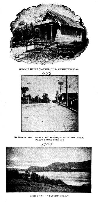
The Old
National Road. 517
on the
Cumberland Road, $320; to pay late Super-
intendent of
road a salary, $862.87 ................
1,182 87
31. Act of
July 2, 1836, appropriates for continuing the
road in Ohio,
$200,000; for continuing road in In-
diana,
$250,000, including materials for a bridge
over the
Wabash river; $150,000 for continuing the
road in
Illinois, provided that the appropriation for
Illinois shall
be limited to grading and bridging, and
shall not be
construed as pledging Congress to future
appropriations
for the purpose of macadamizing the
road, and the
moneys herein appropriated for said
road in Ohio
and Indiana must be expended in com-
pleting the
greatest possible continuous portion of said
road in said
States so that said finished part thereof
may be
surrendered to the States respectively; to be
paid from acts
admitting Ohio, Indiana, Illinois and
Missouri
..........................................
600,000 00
32. Act of March 3, 1837, appropriates $190,000 for con-
tinuing the
road in Ohio;, $100,000 for continuing
the road in
Indiana; $100,000 for continuing road in
Illinois,
provided the road in Illinois shall not be
stoned or
graveled, unless it can be done at a cost
not greater
than the average cost of stoning and
graveling the
road in Ohio and Indiana, and provided
that in all
cases where it can be done the work to be
laid off in
sections and let to the lowest substantial
bidder. Sec. 2
of the act provides that Sec. 2 of act
of July 2,
1836, shall not be applicable to expendi-
tures
hereafter made on the road, and $7,183.63 is
appropriated
by this act for repairs east of the Ohio
river; to be
paid from the acts admitting Ohio, In-
diana and
Illinois ................................. 397,183 63
33. Act of May 25, 1838, appropriates for continuing the
road in Ohio,
$150,000; for continuing it in Indiana,
including
bridges, $150,000; for continuing it in Illi-
nois, $9,000;
for the completion of a bridge over
Dunlap's creek
at Brownsville; to be paid from
moneys in the
Treasury not otherwise appropriated
and subject to
provisions and conditions of act of
March 3, 1837
.....................................
459,000 00
34. Act of June 17, 1844 (Civil and Diplomatic), appro-
priates for
arrearages on account of survey to Jeffer-
son, Mo .......................................... 1,359 81
Total .......................................... $6,824,919 33
518 Ohio Arch.
and His. Society Publications.
APPENDIX No. 4.
SPECIMEN ADVERTISEMENT FOR BIDS FOR
REPAIRING NATIONAL ROAD IN
OHIO -1838.
Sealed proposals will be received at
Toll-gate No. 4, until the 6th
day of March next, for repairing that
part of the road lying between the
beginning of the 23rd and end of the
42nd mile, and if suitable bids are
obtained, and not otherwise, contracts
will be made at Bradshaw's hotel
in Fairview, on the 8th. Those who
desire contracts are expected to
attend in person, in order to sign their
bonds.
On this part of the Road three hundred
rods or upwards (82� cubic
feet each) will be required on each
mile, of the best quality of lime-
stone, broken evenly into blocks not
exceeding four ounces in weight,
each; and specimens of the material
proposed, must be furnished, in
quantity not less than six cubic inches,
broken and neatly put up in a
box, and accompanying each bid; which
will be returned and taken as
the standard, both as it regards the
quality of the material and the
preparation of it at the time of
measurement and inspection.
The following conditions will be
mutually understood as entering
into, and forming a part of the contract,
namely: The 23, 24 and 25
miles to be ready for measurement and
inspection on the 25th of July;
the 26, 27 and 28 miles on the 1st of
August; the 29, 30 and 31 miles
on the 15th of August; the 32, 33 and 34
miles on the 1st of September;
the 35, 36, 37 miles on the 15th of
September; the 38, 39 and 40 miles
on the 1st of October; and the 41 and 42
miles, if let, will be examined
at the same time.
Any failure to be ready for inspection
at the time above specified,
will incur a penalty of five per cent.
for every two days' delay, until the
whole penalty shall amount to 25 per
cent. on the contract paid. All the
piles must be neatly put up for
measurement and no pile will be measured
on this part of the work containing less
than five rods. Whenever a pile
is placed upon deceptive ground, whether
discovered at the time of
measurement or afterward, half its
contents shall in every case be for-
feited for the use of the road.
Proposals will also be received at the
American Hotel in Columbus,
on the 15th of March for hauling broken
materials from the penitentiary
east of Columbus. Bids are solicited on
the 1, 2 and 3 miles counting
from a point near the Toll-gate towards
the city. Bids will also be
received at the same time and place, for
collecting and breaking all the
old stone that lies along the roadside,
between Columbus and Kirkersville,
neatly put in piles of not less than two
rods, and placed on the outside
of the ditches.
The Old National Road. 519
APPENDIX No. 5.
ADVERTISEMENT FOR PROPOSALS FOR BUILDING
A NATIONAL ROAD BRIDGE
AND FOR TOLL HOUSES IN OHIO - 1837.
Proposals will also be received in
Zanesville on Monday the 1st day
of May next, at Roger's Tavern, for
rebuilding the Bridge over Salt
Creek, nine miles east of Zanesville.
The structure will be of wood,
except some stone work to repair the
abutments. A plan of the Bridge,
together with a bill for the timber,
&c., can be seen at the place of letting
after the 24th inst. Conditions with
regard to proposals the same as
above.
At the same time and place, proposals
will likewise be received, for
building three or four Toll gates and
Gate Houses between Hebron, east
of Columbus, and Jefferson, west of it.
The house of frame with stone
foundations, and about 13 by 24 feet,
one story high, and completely
finished. Bills of timber, stone,
&c., will be furnished, and particulars
made known, by calling on the
undersigned, at Rodger's Tavern, in
Zanesville after the 24th inst. In
making bids conditions the same as above.
All letters must be post-paid, or no
attention shall be given to them.
THOMAS M. DRAKE, Superintendent.
P. S.- Proposals will also be received
at Columbus, on Monday, the
17th of April, for repairing the
National Road between Kirkersville and
Columbus--by William B. Vanhook,
Superintendent.
April 12.
WILLIAM WALL, A. C. B. P. W.
APPENDIX No. 6.
ADVERTISEMENT OF NATIONAL ROAD TAVERN IN
OHIO -1837.
Tavern Stand for Sale or Rent. - A
valuable Tavern Stand Sign
of the Harp, consisting of 25� acres of
choice land partly improved, and
a dwelling house, together with three
front lots. This eligible and healthy
situation lies 8 miles east of Columbus
City, the capital of Ohio, on the
National Road leading to Zanesville, at
Big Walnut Bridge. The stand
is well supplied with several elegant
springs.
It is unnecessary to comment on the
numerous advantages of this
interesting site. The thoroughfare is
great, and the growing prospects
beyond calculation. For particulars
inquire of
Dec. 4-14. T. ARMSTRONG, Hibernia.