Ohio History Journal
- 1
- 2
- 3
- 4
- 5
- 6
- 7
- 8
- 9
- 10
- 11
- 12
- 13
- 14
- 15
- 16
- 17
- 18
- 19
- 20
- 21
- 22
- 23
- 24
- 25
- 26
- 27
- 28
- 29
- 30
- 31
- 32
- 33
- 34
- 35
- 36
- 37
- 38
- 39
- 40
- 41
- 42
- 43
- 44
- 45
- 46
- 47
- 48
- 49
- 50
- 51
- 52
- 53
- 54
- 55
- 56
- 57
- 58
- 59
- 60
- 61
- 62
- 63
- 64
- 65
- 66
- 67
- 68
- 69
- 70
- 71
- 72
- 73
- 74
- 75
- 76
- 77
- 78
- 79
- 80
- 81
- 82
- 83
- 84
- 85
- 86
- 87
- 88
- 89
- 90
- 91
- 92
- 93
- 94
110
Ohio Arch. and His. Society Publications.
REPORT OF FIELD WORK IN VARIOUS PORTIONS
OF OHIO.
BY WARREN KING MOOREHEAD, CURATOR AND IN
CHARGE OF EXPLORATIONS.
PREFACE.
April 4, 1897, I left Columbus for
Farmington, New Mex-
ico. Mr. Clarence Loveberry, who had
been associated with
me for nearly three years in the museum
as well as in the field,
was appointed to act as Assistant
Curator in my absence. Dur-
ing my stay in the West he carried on
field work and attended
to the museum routine duties. August 27,
when I resigned the
Curatorship, Mr. Loveberry was appointed
in my stead.
The field work had been projected and
routes laid out for
Mr. Loveberry before I left for New
Mexico. These he fol-
lowed. I am greatly indebted to him for
his faithfulness in observ-
ing the lines of investigation
indicated.
In mapping out certain localities for
explorations I had in
mind not so much the securing of mound
specimens for the
museum as the investigation of certain
peculiar mounds. These
struck me (especially those in Pickaway
county) as being dif-
ferent from the average lowland or
"high culture groups" of
the Scioto Valley. Explorations tended
to confirm my opinion.
In addition, it was thought best to
follow the Scioto to its
source and from thence down the Sandusky
to the Lake. By
such means we could ascertain if mounds
or other works followed
the streams from the Ohio to the Lake.
Trips through sections
of the state heretofore not well
represented upon the archaeologic
map were also made.
There is not sufficient space to present
the names of several
hundred persons who kindly aided the
survey in many ways,
who donated specimens, assisted in
placing monuments upon
the map. Suffice it to say that the
Society is under great obliga-
tions to each and every one of them.
Report of Field Work. 111
I am particularly indebted to Miss Lucy
Allen for her
cooperation in the preparation of the
state map for publication
in this report and for her constant
assistance in the museum.
Mr. J. S. Roof, of Asheville, and Mr. F.
E. Bingham, of
Jackson, were especially interested in
the survey and rendered
very considerable service.
Concerning the importance of work
accomplished, the
exploration of the Snake Den group and
the Baum village site
probably rank first. Our trip up the
Scioto to Lake Erie was
quite necessary. The results of this
expedition indicate that travel
by that route from the Ohio river to the
Lake was not as exten-
sive in pre-Columbian times as during
the historic period.
I am under obligations to the Trustees
of the Society for
cooperation in the execution of the
plans for field work.
REPORT OF FIELD WORK IN VARIOUS PORTIONS
OF OHIO.*
"I got together my field outfit,
and armed with a letter from
the governor requesting that land owners
grant me permission
to excavate, I went to Asheville on
April 14. Pending negotia-
tions I journeyed to Chillicothe and
endeavored to secure per-
mission to explore several mounds, but
was unsuccessful.
Returning to Asheville I saw Mr. J. S.
Roof and in company with
him went to the famous Snake Den Group.
On the way there
we purchased a number of old historical
objects at a country
sale." Thus begin the field notes.
The Snake Den Group is well named. In
early times hun-
dreds-and, if we are to believe the
older farmers living near
there-thousands of reptiles dwelt
beneath the large rocks
forming the mounds. In the spring of
1817 the neighboring
farmers organized to abate the nuisance
and, repairing to the
place, they built a high board fence
entirely around the two stone
mounds. When warm weather set in and the
snakes came out
of their winter quarters they tried in
vain to penetrate into the
surrounding country. Great numbers of
them were stoned, shot
* The report contained in the following
pages is made up from
Mr. Loveberry's field notes. These have
been changed somewhat. All
conclusions and explanations and
foot-notes not in quotation marks (and
in parentheses) are my own. W. K. M.
112
Ohio Arch. and His. Society Publications.
or clubbed. When the survey arrived and
heard the tradition
it seemed to the men a gross
exaggeration. But as work con-
tinued and the survey removed hundreds
of vertebrae another
"verification of a
tradition"-as Professor Hodge said of the
Enchanted Mesa of the Southwest-was
established.
"Often we threw them out by the
shovel full," says the report.
About a peck were saved and mounted in
the museum as a curios-
ity of historic interest. People carried
away quantities strung
upon slender twigs.
The Snake Den Group lies upon the point
of a high plateau
and is surrounded by low, level bottoms
save towards the
south and east. The land below must have
originally been
prairie, judging from its appearance and
character. There being
few hills in this portion of Pickaway
county, the elevation of
between one hundred and fifty and two
hundred feet is quite
a prominent landmark. The group lies in
Walnut township,
seven miles north of Circleville and
one-half mile north of East
Ringgold.
Mr. D. Snyder, the owner, gave
permission for exploration,
but imposed peculiar conditions, and
these finally compelled the
survey to end its labors before the
exploration of the group was
complete. The field notes on this point
state: "He gave per-
mission to dig the mounds on condition
we would stop work
when he requested us. All gold and
silver were to be turned
over to him. I readily agreed to this,
as I had never heard of
gold or silver being found in the
mounds, save some modern
silver bands that were of French or
English origin, being traded
to the Indians by the early
explorers."
Upon Friday, April 16, the party located
upon Mr. Snyder's
farm. From this high table land, upon
which the group is located,
one obtains a commanding view of the
surrounding country.
Approaching enemies could be easily
detected. To the west-
ward, perhaps six or seven miles, heavy
timber bordering upon
the Scioto can be seen. Towards the
southeast the plateau widens
out, but there appear to be no monuments
in that direction, at
least none within a mile or more of the
group. Evidences of
occupation as a village site are scant,
being confined to a piece
|
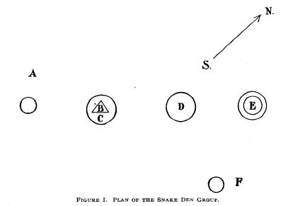
Report of Field Work. 113 of pottery here and there, or arrow heads or flint chips in no more profusion than are found upon hunting sites. Beginning at the western point of the hill, or, at least, but a few yards from the slope, we find a large stone mound. It can be said to form the northwest extension of the group and is marked A upon the ground plan, Figure 1. The boulders and spalls of which it is composed are about as large as a can could conveniently handle. It is twelve feet high and one hundred and |
|
|
|
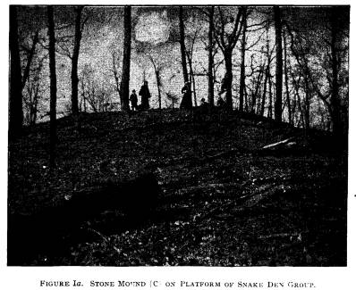
twenty-five feet in diameter, and is covered with numerous large trees. Just east of the stone mound A is a long, wide platform some three feet in height and one hundred and ten feet east and west, and ninety feet north and south. Upon this platform (or mound site) stands a stone mound one hundred and fifty feet in diameter. The stone of which it is composed is much burnt, and on that account Mr. Loveberry called it a "crematory." He observes that the east side of this "crematory" is composed of clay and the west side of stone. In Figure I the platform will Vol. VII-8. |
|
114 Ohio Arch. and His. Society Publications. be found to be marked C and the mound B. This mound is shown in Figure 1a. Continuing east, the hill still narrow, but curving slightly, perhaps not more than two hundred feet wide, we find a clay mound. It is one hundred and four feet in diameter east and west and ninety-one feet north and south and is eleven feet high. (See D on map of the Snake Den Group.) On top of it is the |
|
|
|
stump of an oak tree, perhaps two hundred years old. Contin- uing to the east twenty feet we find a circle of clay one hundred and fifty feet in diameter, ten feet wide and two feet high. The moat within the circle is two feet deep. Letter E. on the map shows this circle. Passing to Mr. Henry May's farm, the adjoining property, we find another circle, two hundred feet distant from the last men- tioned. It is one hundred and fifty feet in diameter, twelve feet across and two and one-half feet high. There is a slight moat within. Letter F upon the map indicates its position. Five hun- |
Report of Field Work. 115
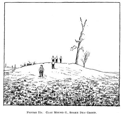
dred feet directly south of this circle
stands a clay mound twelve
feet high and one hundred and thirty
feet across the base, and
is marked G upon the map. There is a
fair-sized tree growing
near its summit. Immediately beyond the
mound and circle the
plateau widens (towards the southeast).
A deep hole, dug by
farmers while burying stock, revealed
nothing of interest. As
the excavation was large, the survey did
not attempt further
exploration.
Work was begun upon the earth mound (D).
A trench ten
feet wide was run from the west side.
Various small patches
of colored earth were noticed which
showed plainly the "dumps"
or loads carried up by the builders.
Most of the material was
yellowish sandy clay. Continuing, a few feet from
the outer edge
several large rocks were found, also
ashes and charcoal. These
latter seem scattered through a majority
of the ancient remains
in America and have been noticed by all
archaeologists. No
importance is to be attached to them
unless found in beds or
deposits. Numerous black spots were
found and these may, or
may not, have resulted from the decay of
certain perishable
materials. Three feet from the surface
the ground was very dry.
Scattered along the bottom, some
distance from the starting point,
were found fifteen or twenty masses of
ashes or mouldy sub-
stance, and in two of these the survey
discovered skeletons. The
field notes state: "The first one
was about ten feet deep and
ten feet west of the center of the
mound. It lay ten inches above
the bottom and was covered with the
ashes or mouldy substance.
All that remained were a few ribs, a bit
of humerus, pieces of
other long bones and fragments of skull.
Two feet northeast
of this was another skeleton a few
inches above the bottom. It
headed north. Excepting the pelvis and
the skull, it was well
preserved. The teeth indicated a person
some thirty years old.
No relics were with the remains. We
found flint chips and blocks
of flint scattered through the dirt.
They appear to be Flint
Ridge material."
The last burial is interesting because
it presents a rare form
of burial - face downward. The discovery
of Flint Ridge material
is also of importance. In many of
the sites indicating higher
culture in the lower Scioto Valley no
Flint Ridge material is
|
116 Ohio Arch. and His. Society Publications. found. This brings up interesting questions: Are the quarries representative of an old culture? Are those sites where no Flint Ridge material is found later or earlier? Possibly a careful tabu- lation of all localities in the state where implements of this par- ticular stone are found will aid in the solution of the problem. As excavation in the trench proceeded it was found neces- sary to work the mound in two benches. It is extremely difficult |
|
|
|
to pitch dirt out of a pit eleven or twelve feet deep. By throw- ing the top section out on either side and the lower one imme- diately to the rear, time and labor were both saved. "Saturday, April 17th, we worked out the lower bench in our trench. Skeleton No. 3 was found lying a little beyond No. 2 and parallel to it, headed north. Neither was it well preserved nor were there objects with it. No. 4 and No. 5 were found upon the base line; No. 4 being much decayed and No. 5 somewhat better preserved. The latter may have been a person thirty-five years of age and was headed southeast. No. 8 was found eight |
Report of Field Work. 117
feet southwest of the center nearly on
the bottom. It was
bunched and did not cover a space to
exceed two feet each way.
The bones appeared to have been placed
in a neat pile. Nothing
was with either of these bodies."
Bones placed in heaps are rarely found
in prehistoric burial
mounds, graves and glacial kame deposits
in central or southern
Ohio. They are more common in the
Iroquois country, Canada
and the Northwest, and also in the South.
Sometimes the bones
are painted or decorated. Dr. A.
Herdlicka, of the American
Museum of Natural History, New York, has
made a study of
these conditions and his forthcoming
report will be welcomed
by all archaeologists. It seems that the
long bones are usually
placed by themselves, the small ones
piled in a neat heap. Such
a burial denotes the removal of the
bones from field of battle, or
that they were carried from a
considerable distance. It would
be impossible to transport the body.
Some villages did not bury
the entire body but placed the deceased
upon the ground in an
open graveyard, or on a scaffold, or in
a charnel house. When
the flesh had decayed, the bones were
collected, arranged and
buried. An instance of this occurred in
1676, when the Kiska-
lon Ottawas removed the pious Marquette
from his grave, washed
and dried his bones, placed them in a
birch box, and, "in a pro-
cession of thirty canoes, they bore it,
singing their funeral songs,
to St. Ignace of Michillimackinac."*
On Mr. Barger's farm, three miles above
Waverly, a dis-
covery of a painted skeleton was made in
1886, and it is referred
to and described in the "Report of
Field Work" for last year
(page 219). Dr. Herdlicka will speak of
this find and also of
similar ones made in Ross County, in the
northern part of the
state, in the Southwest and other
portions of America. It is,
therefore, not necessary to go into
further details here.
"Skeleton No .7 was fairly well
preserved, headed west and
near the center. Some one had dug a hole
in the center and
we found traces of the old excavation
down to within two feet
of the bottom. No. 7 was just below this
old hole. No. 8 was
a child and lay just north of the feet
of No. 7. It must have been
* La Salle and the Discovery of the
Great West, Parkman, p. 71.
Boston, 1889.
|
118 Ohio Arch. and His. Society Publications. five or seven years old. It lay with head to the east. By it we found the first relics. Near the sternum was a bone awl six inches long, highly polished and well made, also a piece of graphite the size of a hickory nut. "I concluded that the white, mouldy substance in which the |
|
|
|
skeletons were buried resulted from a decay of wood, weeds, brush, etc., placed over the bodies. I think that the burials were all made at the same time. We found three large beds of ashes at various depths as if there had been some kind of ceremonies or feasts as the work progressed. At one place, seven feet from the top, we found a bed of clay burned red, two feet in diameter and three to four inches thick, also another bed of yellow clay. Two flint knives and some pottery fragments were found scat- tered in the dirt." |
Report of Field Work. 119
Most bodies found in a layer of black
soil, or in mouldy,
whitish substance are thought by
archaeologists to have been
covered by skins or layers of bark.
These decaying form the
soft layer so often observed. It is
probable that such is the case
rather than that the bodies were covered
by brush, etc.
After working a day or so longer the
survey moved to the
platform (C) and mound (B). This was at
first thought by Mr.
Loveberry to be a circle surrounding a
stone mound. I visited
the place in November and observed that
the platform towards
the south is a little higher at the
edges, but towards the north
and northwest it is nearly flat. The
depression to the south may
have been caused by one or two large
trees falling and uprooting
earth and stones. It may have resulted
from an excavation at
an early period. It is not regular nor
is the raised edge suffi-
ciently extended to indicate a circle.
"The force was divided part being
put upon the west side
and others upon the south side. I must
confess that I had no
idea of finding anything here, but
wished more to learn of the
nature of the platform. It was a hard
place to work, being cov-
ered with pawpaw bushes and showing on
top a yellow clay-
shale. On the south side the work began
about twelve feet from
the top of the platform of earth and
stone, on the outer edge of
the south side. It is here three feet
high. The second blow of
the pick struck something round about
six inches from the sur-
face and one foot from the edge of the
incline of the platform.
The next stroke brought out a concretion
six inches in diameter.
This at once attracted my attention. We
worked off a foot or
two of soil and uncovered several. I
then called the men from
the west side and set all hands at work
with our small hand
trowels and knives. We uncovered
fifty-five concretions.
These ranged in size from a marble to
ones a foot in diameter
and weighing seventy-five pounds. There
was no regularity ex-
cept that the largest ones were on the
north side and they seemed
to alternate, a large one and then a
small one. They were all
included in a space three by four feet.
Some were on top of
each other and all touched. They ran in
under the platform and,
in fact, the greater part were covered
by dirt washing down from
the elevation above. Scattered among
them were forty-seven
|
120 Ohio Arch. and His. Society Publications. fossils (cornae), two septaria, one block of granite, one specimen of quartz crystal and fifty odd shaped stones. Dr. Edward Or- ton, the State Geologist, said: 'There were at least twelve spe- cies of coral in the collection and fifty peculiar formations.' There were some relics among them, namely: six hammer stones, five pestles, one broken and one unfinished tube (pipe ?), one |
|
|
|
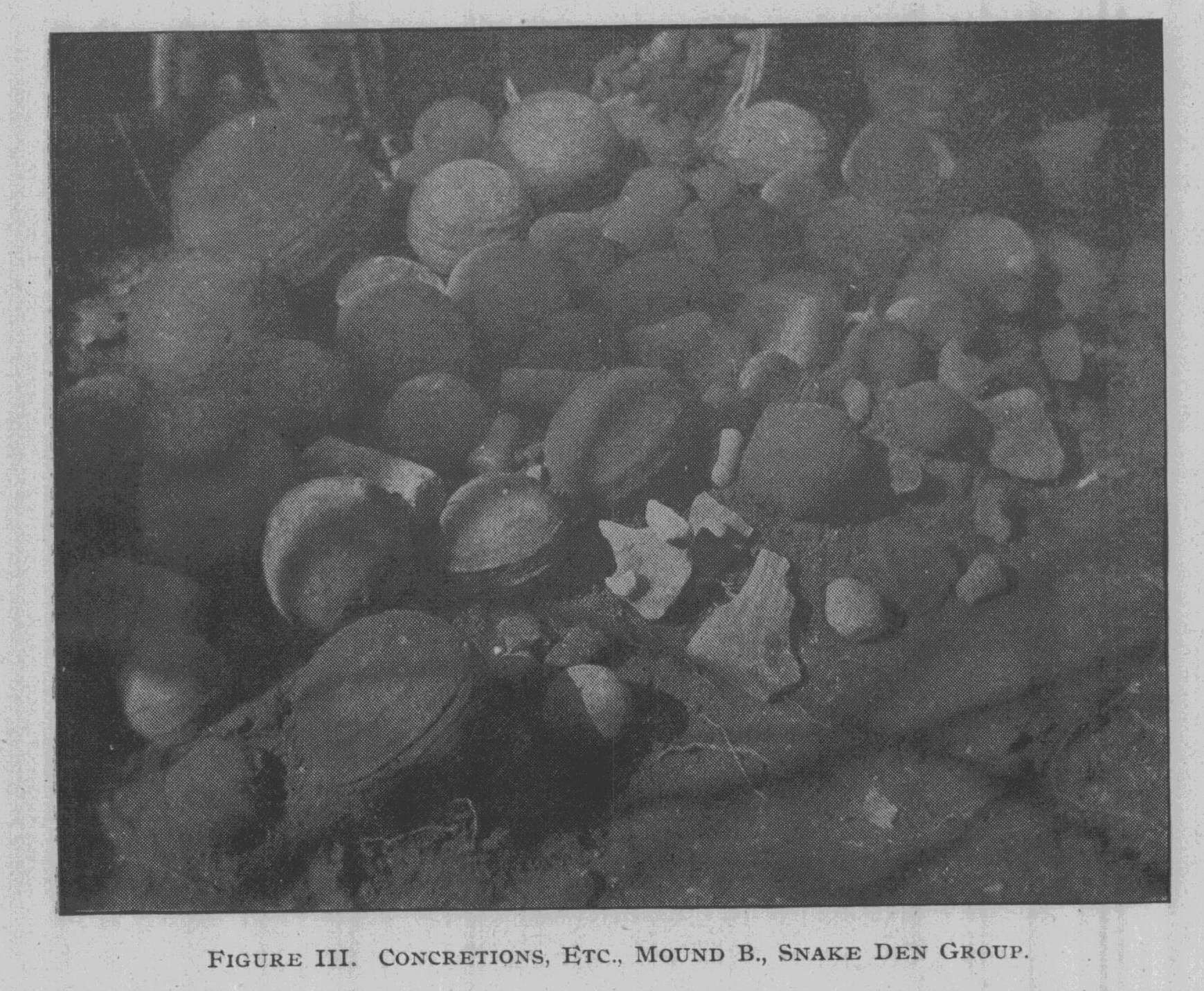
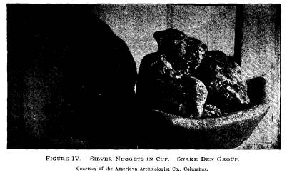
large stone head, three paint grinders, ten small round and ob- long stones (hammers ?), one stone celt, one unfinished effigy and dozens of peculiar bright colored pebbles. "To the south side, among the objects, we made a most re- markable find. It was a small stone box three and one-half inches long, three inches deep. It was made up of halves of two concretion shells fitted together. Inside I found five silver nuggets about the size of small walnuts. Three were coated with black paint and two with pink ochre. The weights were: six |
Report of Field Work. 121
and one-half ounces. The largest nugget
two ounces. The box
weighed fifteen and three-fourths
ounces."
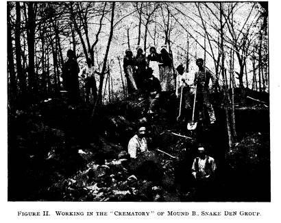
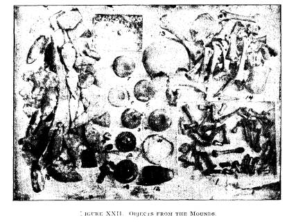
Figure II shows the stone mound or
crematory just north
of where the silver was found. Figure
III, the heap of con-
cretions after being removed. Figure IV,
the nuggets and the
box.
"Just under the collection were
found some large, flat stones
covering a grave two feet long and
eighteen inches wide and
eight inches deep. In the center of this
stone vault we found
about a cigar box full of cremated
bones. There was no evi-
dence that this skeleton had been burned
in the mound, but it
was cremated elsewhere and the fragments
brought here for
burial. Continued excavation at the spot
resulted in nothing
more of interest. We cut through the
platform at this point
finding, towards the stone heap or
mound, quite a quantity of
sandstone spalls mixed with black earth
near the bottom. On
top, the coil continued a yellow
clay-shale. The soil below the
collection and silver was black and
sandy.
"I divided the force, putting some
on the west side of the
platform and others elsewhere. I
journeyed to Columbus and
showed the silver to the Trustees and
had it tested by a jeweler.
Dr. Orton said that they were native
silver nuggets from the
lakes or the lead region. I returned to
the Snake Den Group.
"I immediately called upon Mr.
Snyder and found that a
young man from Circleville, had, in my
absence, influenced him
to such an extent that he wished work to
cease and the silver to be
turned over to him. He was told that his
mounds were of value,
and our survey was spoken of in a
slighting way. I endeavored
to get him to give up the silver
enlarging upon its importance to
science; but was only able to do so upon
the payment of twenty-
five dollars, seven times the commercial
value of the nuggets.
He consented to give me one more day and
then I must end
my labors. This I reluctantly agreed to,
for the exploration of
the group was not complete and should
have been carried on for
some weeks.
"Friday, April 23rd, I started an
increased force, putting
part of the men on a test trench on the
east side. It was ten
feet long, two and one-half feet wide
and three feet deep. The
|
122 Ohio Arch. and His. Society Publications. earth was of a sandy nature mixed with large sandstone boulders or spalls. Nothing was found. On the northeast side we dug another trench finding earth of the same nature. The south trench had reached the heap of stones, mound or crematory (whatever it may be). Here we found large sandstone spalls and black sandy soil and numberless snake bones, but no relics or human bones. "Beginning on the center of the mound (D) we trenched for twenty-five feet, ten feet wide and twelve feet deep. At the west end of our trench it was six feet deep. We found about four wagon loads of burnt stone, crumbled and reduced. The bed was nine feet in diameter. We found beds of charcoal and ashes at various depths. There was a bed of red clay burned hard. Fragments of human bones were scattered through the stones. "Saturday, the 24th, we did some more work upon the cre- matory. I tested the sides of the stone mound (A on plan) and concluded that it would not justify exploration. I tested the east circle, but found nothing. The circle and mound to the ex- treme east (Mr. May's farm) would not seem to yield much, and so I brought the work at the Snake Den Group to a close." This is a very important and interesting group, and Mr. Loveberry is to be congratulated upon his success. Reference to the plan will show a peculiar arrangement. |
|
|
Report of Field Work. 123
The works to the west are stone (or
mostly so) and those to the
east are clay. The circles may represent
sun symbols, or they
may have been used for defence. The
strongest point in favor
of the latter theory is that the group
lies upon a high hill and
not in the valley. Yet we have other
works upon elevations, and
manifestly of defensive character, which
are accompanied by
circles and crescents. The question,
therefore, must be left open.
But as to the character of the tumuli we
can positively assert that
they were all erected to cover
interments.
The enclosed space within the east
circle is lower than the
surrounding surface outside. This would
indicate rather of a
defensive character. The circle to the
west (E) may be a sun
symbol. Its moat is still plain and I
infer, from looking over the
spot, that the moat originally may have
been four or five feet in
depth. The central portion of the area
inclosed is on a level with
the surrounding land and may have been
used for dances and cere-
monies. We cannot say positively as to
this, however. I give
it merely as an opinion that the circle
is of religious significance
and is a sun symbol.
Great labor was necessary to construct these
mounds, even if
the stones were not quarried but
collected in gullies to the south-
east. It would seem that the builders
ran short of material, or
lacked sufficient laborers, else they
would have continued the
construction of the platform with stone and
not have employed
earth. As to the cremated skeleton and
the objects just above it,
I would venture the opinion that these
singular concretions, fos-
sils, etc., were placed as an offering.
Why such objects, instead
of the usual run of artifacts, covered
his remains cannot be ex-
plained. Without doubt many bodies were
cremated in the cen-
tral part of the platform and these as
well as the fire, were cov-
ered while burning.
None of the crania were secured whole
and it is therefore
impossible to determine whether we have
here the brachycephali
or the dolichocephali.
The survey moved, shortly afterward, to
the northwest cor-
ner of Washington township and located
upon Mr. Wagerly's
farm. It was known in the neighborhood
as the "haunted
mound", because lights were seen at
night (?) and a man com-
124
Ohio Arch. and His. Society Publications.
mitted suicide near it. Superstitions
regarding mounds are not
uncommon in Ohio. I have frequently been
warned "that no
good could come of explorations
here", or "that you will be
haunted by the dead you disturb."
Our folk lore brethren -
not an inconsiderable part of
anthropologists - should investi-
gate these beliefs. Briefly they are
usually as follows:
That lights are seen at night; that so
and so dug there years
ago and heard strange noises; that an
Indian was seen by so and
so a moonlight night standing upon the
mound; that an Indian
came here and dug at night carrying away
a treasure; that so
and so digging and finding bones heard
them rattle. These su-
perstitions are very common in the hilly
sections of southern and
eastern Ohio, where many ignorant
persons reside.
Mr. Wagerly's mound stands upon a bank
of gravel some
twenty-five feet above the plain, the
structure itself standing nine
feet high, with a diameter of one
hundred feet. On the west side
is a basin which was formerly a swamp.
In the field notes the
comment is made that work began by means
of a trench running
from the east towards the west, but that
"the neighbors told us
that every man who had tried to dig this
mound would get scared
and run away and leave it. Nevertheless
we began work under
these trying circumstances." The
trench was twenty feet long
and nine feet deep. The first few feet
were made up of fine red
clay in which were fragments of flint,
chips and charcoal. Be-
low, was a gravelly, yellow clay
containing no flint or charcoal.
This had been carried up from the
immediate vicinity and was
very hard, showing "that there was
little vegetable matter in it
at the time of making the mound."
The survey, having in its
experience found little in a hard or
compact mound, and realiz-
ing that it would be next to impossible
to secure the bones or
objects in a good state of preservation,
filled the excavation.
One-half mile east is a kame in which
farmers have found
ten or twelve skeletons when getting
gravel for the roads. It
was visited, but the burial portion had
been entirely removed.
The twenty-ninth Mr. Roof, of Asheville,
and the survey
went to the southwest part of Madison
township (Pickaway
county) visiting Messrs. Bauer and
Morrison, both of whom owned
mounds. Mr. Roof had permission to dig
them, but waived in
Report of Field Work. 125
favor of the survey. The Bauer mound is
located upon the first
terrace of Walnut creek, being one
hundred and thirty feet in
diameter and eight feet high. On top a
flint arrow head and some
chips were picked up. Back of it, two
hundred yeards east, is
a very perfect "bottom" mound,
near the creek. It was a curious
structure in that very black soil,
occupied a circle of twenty-five
feet in diameter in the center, while
surrounding that was a lighter
brown clay. The black earth extended
eight feet deep.
Upon sinking a circular pit twenty feet
in diameter to the
bottom it was concluded that the surface
soil of the valley had
washed away in times of flood and left
the mound upon its foun-
dations somewhat higher than the
surrounding land. It could
not be ascertained why the mound was
built in such form -the
black soil solid to the bottom and being
surrounded by the
brown clay.
"Skeleon No. 1 was found two feet
deep just north of the
center. The head lay towards the south.
The body was extended
and the bones badly decayed. Skeletons
Nos. 2, 3, 4 and 5
were three feet deep and seven feet west
of the center of the
mound in the black soil. They were
adults and placed so closely
together that some of the bones crossed.
No common direction
was observed in the interments and there
were no objects.
"Skeleton No. 7; near the
north-center, three feet deep,
head to the west, extended, badly
decayed, nothing with it. Nos.
8 and 9, just south of the center, their
heads being close together.
Adults, no objects, badly decayed. No.
10 was in the center,
two feet below the bottom of the mound,
in a depression which
seemed to have been made especially for
it. The grave or excava-
tion was coffin shaped. Buried extended,
head to the north.
At the knee of the right leg lay a
beautiful double perforated
slate ornament of the squared or tablet
pattern. Remains of
decayed wood or hides were noticed about
this skeleton. (See
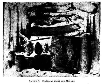
Figure X. No. 8 in figure and on
specimen-museum No. 14,940.)
"Skeleton No. II, found
north of the center. Headed south,
was under three feet of black earth,
adult, decayed, no objects.
Two feet from the surface above and near
the center of the mound
was found a war point of good
workmanship. A little below
it was a peculiar notched stone having
two grooves upon one
126
Ohio Arch. and His. Society Publications.
side and notches upon the edge. (See
figure X, No. 9, museum
number on specimen 14,941.) The black
soil at the bottom was
sticky and therefore caused the decay of
the skeletons. Of some
only the teeth remained. Our trench upon
the east side showed
the mound to be quite old, much of the
earth worked down,
leaving the mound only eight feet high
at that point. We filled
up the hole and drove to Mr. Henry
Morrison's farm three miles
south."
The mound is upon the east side of
Harrison township (all
this work being in Pickaway county) and
upon the low land in
Walnut Creek Valley. It is three feet
high and sixty feet base.
A small elevation was selected as its
site. The material is yellow
clay, much of which had been burned. In
an excavation sixteen
feet square and four feet deep several
large beds of burned clay
were observed. Being burned very hard it
could be taken out
in large lumps and several of these went
to the museum. Paint,
in the form of bits of soft hematite,
was found in it. There
were also fragments of cremated hones.
Near the center on the
east side were two celts, the one
perfect and the other broken.
(See Figure X, Nos. 10 and 11.)
Pottery fragments and flint
chips were also numerous. Ashes and
charcoal were under the
clay.
May eighth the survey located at
Chillicothe and set
about securing permission for
explorations. Just northwest
of Chillicothe are nine large mounds.
They lie to the west
and northwest of the fair grounds,
distant from a few hundred
yards up to a mile. A group of three had
been opened under
my direction in 1889. Squier and Davis
had opened another
in 1845 or 1846. Within the fair-grounds
enclosure is a large
mound owned by Mr. Story. North of it,
some few hundred
yards, is a very large one owned by Mr.
Miller, another to the
northwest is owned by the Carriage
Factory Company. All of
these owners kindly permitted
explorations.
From the larger mound (Miller's) people
had been hauling
away much of the rich, black soil for
lawns and gardens. A
considerable excavation had therefore
been made in the side, and
this greatly facilitated explorations,
as will be seen. The Carriage
Company was represented by Colonel Entrekin,
and he also gave
|
Report of Field Work. 127 |
|
|
|
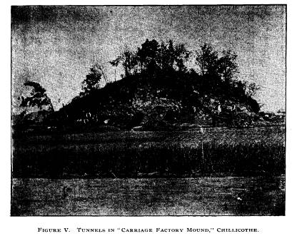
consent for explorations. The Worthington mounds are within one-fourth of a mile of this tumulus. The Miller or Carriage Factory mound stands thirty-five feet high and has a diameter at the base of two hundred and twenty-five feet. It has retained its form exceedingly well until within the last five years, during which people have hauled away earth. The west side, at the point of removal, stands about fifteen feet in perpendicular height, and from the edge of the mound to this wall or face it must be nearly fifty-five feet. Work began the tenth of May with six men. The face was squared up at the base and three tunnels started. These and the mound are shown in Figure V. As the survey had had con- siderable experience in tunneling large mounds (one at Coshoc- ton, one at Harnesses', nine miles south of Chillicothe, one at McConnellsville) it was thought that this structure - soft though the earth might be - could be examined with safety. All such |
128
Ohio Arch. and His. Society Publications.
work is, however, attended with more or
less danger, as I can
testify, having ribs broken and my spine
permanently injured
in 1888 at Austin, Ross county. We had
undermined and tun-
neled in a weak bank, and it fell.
The central tunnel was flanked by one on
either side. Each
was fourteen feet from the main shaft.
This left sufficient earth
between to prevent a cave-in. These
tunnels were three feet six
inches wide and four feet six inches
high. Their bottoms or floors
were kept well beneath the base line.
Progress was slow at first
for the earth was very hard and solid.
As long as sunlight could
penetrate one could notice many and
diversified colors. The
dumps or masses of earth (about the size
of a peck-just what
one man could easily carry) seemed to
have been brought from
places where soils and clays of red,
black, yellow, grey and brown
colors abounded. The same peculiarity
was noticed in the large
mound of the group of three called Mound
No. 43 and opened
in 1889. The construction is very
minutely described in a pub-
lished report upon the exploration.* It
is, therefore, reasonable
to conclude that all of these tumili,
grouped as they are, show
a similarity of construction, were built
by the same people, and
if not at the same time, at least within
a few generations of each
other. The explorations of Mr. Loveberry
tend to confirm this
opinion advanced when the group of which
No. 43 is a part was
examined. The dumps were oval or diamond
shaped. That
peculiarity is noticed not only in most
large mounds of the Scioto,
but at Fort Ancient, in the Muskingum
region and along the
Great Miami.
"On the base line was a streak of
decayed wood several
inches thick and showing high colors.
This seemed to have been
pretty generally placed over the base of
the mound. Between
the center and south tunnel (these were
started on the west side
and therefore headed east, but we speak
of the tunnel to the left
of the main one as north, and the other
as south tunnels) I found
casts of poles two to three inches in
diameter in the form of a
pen or hut. These casts plainly retained
the stamp of the bark
and showed the knot holes of the
saplings. The soil of the base
line was now very black, and immediately
above it was the heavy
*"Primitive Man in Ohio,"
Moorehead, p. 168. New York, '92.
Report of Field Work. 129
line of decayed wood and then the
streaked or diamond shaped
deposits or dumps of earth. I counted
about 20 shades of these.
There were a few spots of gravel among
them. The darkest
spots were near the bottom and the
lighter ones toward the top.
On the whole the mound was of sandy soil
and very hard, making
digging slow. After working in our
tunnels about seven feet,
we started to cut side tunnels, so as to
give a mode of escape
in case of a cave-in, and also to
furnish more air. In the side
tunnels we met with nothing
extraordinary. Soft spots seen now
and then I thought resulted from the
decay of a log.
"When we had dug the tunnels in
fifteen feet from the en-
trance we began to side tunnel and ran
branches south and east,
but leaving large pillars to hold the
mound up, as in a coal mine.
We found in the south tunnel, fifteen
feet in, a rough sandstone
disc. It lay in the decayed wood line.
All the way this peculiar
line ran nearly level. Even by candle
light we could make out
the different colors.
"Wednesday, May 12. We pushed the
tunnels very rapidly
today. Side tunnels were dug. The decay
line is very heavy
and we can take out large pieces showing
eight to ten streaks
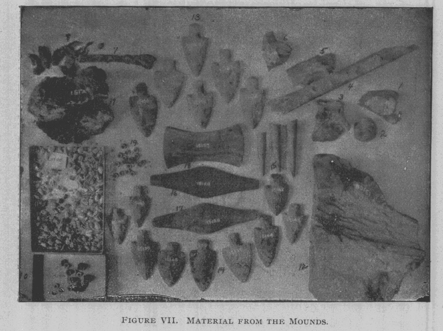
or different colors. (Figure VII, No.
11, shows the base line
and streaks in same.) At noon today we
struck a place wherein
was soft, black earth. After digging
into it about a foot we
struck the skull of a skeleton,
twenty-five feet from the mouth
of the north tunnel. Its skull was badly
decayed, but upon close
examination the pieces of skull were
found to be covered with
a thin bark like fibre. (Figure VII,
Nos. 1, 2, 3, 4, 5, 6, 7, are
fragments of bone with bark or fibre.)
Around the next were
bone beads and from the shoulder of the
left arm to the hand
were three or four strings of shell
beads numbering over two
hundred and made from a kind of small
ocean shell. (Figure VII,
Nos. 9 and 10 show the beads from this
skeleton.) There were
bits of the string yet remaining in some
of them. Several pieces
of mica and several bits of limestone
also lay near the remains.
The skeleton was headed north, lying
upon its back. Around it
were evidences of thin wood or bark.
Most of the bark and
wood lay in a longitudinal direction
with the skeleton. This
Vol. VII-9.
130
Ohio Arch. and His. Society Publications.
body was wrapped or dressed in some
woven fabric of fibre-like
consistency next to the skin, for some
parts of the skeleton could
be lifted up and to them would yet
adhere the woven fabric.
"Then came a most peculiar thing.
There was bandaging
of some sort of bark like birch about
the body and legs. It
extended in many directions like mummy
wrapping. The beads
and body seemed to be coated with a
peculiar plaster cast, very
white and to the depth of one-half to
three-fourths of an inch.
Several of the long bones, humerus,
femur and clavicle were
taken out whole, while others were
fairly preserved. We found
some mica fragments around the skeleton.
This skeleton lay
upon the base line and there was no
evidence of fire about it.
No charcoal was discovered. There were
no other relics near it.
"The tunnels continued and more
branches were run in
various directions. The decay line
seemed to grow thicker.
"Friday, May 4. Our tunnels keep
getting deeper. We
still run onto some of the soft spots of
earth. I discovered that
they came from the decay of wood. The
earth fell down when
the wood decayed and thus left the soft
places. On the base
line we now found great quantities of
rotten wood. All of these
peculiraities were carefully
investigated. The center and north
tunnels (main ones) were now turned to
the south. The ground
kept getting harder and the colors
lighter. We were past the
center of the mound a considerable
distance. We were finding
nothing, and as none of these mounds of
the large group, of
which this is a part, had yielded much,
I concluded we would
close the tunnels and quit. There were
several hundred visitors
during the course of examination.
"Our south tunnel measured
thirty-three feet, north one
thirty-five feet, while the center one
was seventy feet, and side
tunnels one hundred and forty feet;
total, two hundred and
seventy-eight feet."
In the matter of "relics" this
mound yielded little, as did
others of the same group. But they
furnished information regard-
ing mound construction. The varied
earths, of all colors, have
a special significance. It is not to be
supposed that these varied
shades resulted from a hap-hazard
gathering of earth from about
the base of the mound. There are no
soils near its base pre-
|
Report of Field Work. 131 senting such diversity of colors. There can be but one expla- nation; that both in the case of Mound No. 43 (opened in 1889) and this one just described, the selection of these "dumps" was intentional. Sand painting is common in the southwest among the Pueblos, to some extent among the Navajos, also in portions of Asia. The brightest colors are used and the designs, executed upon a flat surface, are complicated and symbolic in character. These dumps may not be classed as "paintings," but that they have some peculiar relation to the mounds themselves, I am con- vinced. The grouping of various shades so that the contrasts are quite apparent--red next to black or yellow next to grey, or brown next to white - is evidence of the purpose. Instead of stratification, or of altars, or of treasured possessions exhibit- ing rare material from a distance, or high artistic aptitude in execution are all absent. At the Hopewell, Harness, Mound City and Hopetown groups--all within ten miles (or less) of this place -the tumuli revealed offerings of religious or ornamental character. The artifacts were beautifully wrought and frequently |
|
|
132 Ohio Arch.
and His. Society Publications.
of substances or materials which had
been transported from a
great distance. But this mound, and one
or two of its fellows,
evince more care and labor in the simple
fact of construction.
Whether these earths were artificially
colored, whether they were
brought from a distance of several miles
cannot be ascertained.
But that they were selected with special
reference to their shades
is indisputable. Time and pains were
both necessary to construct
this tumulus. Along with No. 43--some
few hundred yards
northwest- it stands as unique and
peculiar. It is a part of that
strange culture of the lower Scioto - a
culture which was higher
than elsewhere in the Ohio Valley -a
culture of great antiquity
and possibly one which was affected by
southern influences.
The fibre covered and wrapped skeleton
presents a condition
not observed elsewhere so far as I am
aware. Skeletons wrapped
in coarse cloth, copper wrapped in
cloth, have been frequently
described. Both the bark and the cloth
of fibre should be care-
fully studied. The weaving of the cloth
and the material of which
it is composed, the nature of the
bark--these are points to be
determined in the future.
Monday, May 17th, the survey
began work upon Mr. Story's
mound just within the fair ground
enclosure. It is twenty-five
feet high and two hundred feet base.
Several large trees grow
upon its summit. There is a slight ridge
or elevation of pure
white sand upon which the tumulus is
built. Excavations in the
sand to a depth of six feet revealed
nothing and it was therefore
concluded to be of natural origin.
The tunnel, six feet high and four feet
wide, was started from
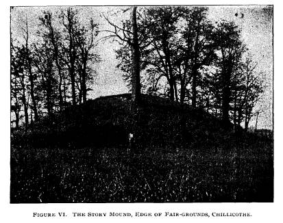
the north side. Figure VI shows the
mound. A man is stand-
ing where the tunnel started. The earth
was quite soft for a
distance of twenty-five feet. Towards
the center it was found to
be damp - an unusual condition in so
large a mound. A frag-
ment of chalcedony was found twenty feet
in the tunnel.
Until the excavation was well into the
structure, the base
line could not be distinctly traced.
Twenty-five feet were dug
the first day. Only twelve feet were dug
the second, for the
ground had become harder.
When in forty-seven feet the earth began
to get darker and
softer. Thursday, the 20th, after
working one foot two post
Report of Field Work. 133
holes were found some four inches apart.
They were six inches
in diameter and two feet in depth. The
post had been squared
at the bottom. The tunnel was
considerably below the base line,
and the posts, therefore, had been sunk
five feet below it. This
was an unusual depth. They were
perfectly true, being exactly
perpendicular. Every few inches more
post holes were discov-
ered running in diameter from four to
twelve inches. As a side
tunnel progressed it was seen that the
post holes gradually curved
and further examination revealed a
circle some twelve to fifteen
feet in diameter. Fragments of bark, in
places sticking to the
sides of the holes were all that
remained of the posts.
Near the center of the mound a heavy
"decay line" was
found. The soil changed to black. More
branch tunnels were
started to investigate the center
thoroughly. Three feet south
of the circle of posts and within it
were found finger bones of a
skeleton's right hand. Near the wrist
lay a fine coffin-shaped
ceremonial. It is shown in figure VII,
No. 16 (museum number,
15,126). It was highly polished, made of ribbon slate, and
per-
forated in two places.
"The skeleton was in a poor state
of preservation and I
did not try to take a photograph of it
in place. Around the feet
and head was more decayed wood, etc.
Where the wood lay the
earth was soft, but on other portions of
the body where there
was no wood, it was hard. On the left
wrist was another coffin-
shaped ceremonial. (See Figure VII, No.
17, museum number
15,128).
It was not perforated and had been burned. A bevel
ornament, highly polished lay near this.
(See Figure VII, No.
18, museum number, 15,127). It was
perforated, of ribbon slate
and the lower side had been coated with
red paint. It was one
of our finest finds. The edges are very
true. This skeleton
headed north, was extended. It was a
young man; the skull
was thick. From appearances it was laid
near the north wall
of the log house or pen.
"Another side tunnel was run from
the main tunnel east, and
also several others. We found five feet
from the skeleton in the
rotten wood on the base line in a little
pocket six chalcedony
spears of rare beauty. (Figure VII, No.
13). Near
them were
134
Ohio Arch. and His. Society
Publications.
three ends of deer antlers worked into
awls. (Figure VII,
No. 15).
"About two feet south of the
skeleton we found another
cache of nine shouldered spears like the
others. (Figure VII,
No. 14). These caches are valuable as
they undoubtedly show
one man's work. In the west tunnel I
found a large piece of
tibia." Figure VII, No. 19, beads found
with the skeleton.
DESCRIPTION OF ARTICLES OF FIGURE VII.
Specimens rom the Miller and Story tumuli,
Chillicothe.
Nos. 1, 2, 3, 4, 5, 6 and 7 are
fragments of bone from the
burial in the Miller mound. They are
covered with portions of
the bark wrappings. No. 7 has fragments
of dried skin and
tissue still clinging to it.
Fragments of skin are shown in No. 8.
They were taken
from the ulna and radius.
No. 9 are shell beads, No. 10 bone beads
from the arm of the
skeleton.
No. 11 is an imprint of the base line of
heavy "decay streak."
No. 12 is an imprint of a log.
THE STORY MOUND.
No. 13 is a cache of six chalcedony
spears found in the circle
of posts.
No. 14 is a cache of nine similar
implements found near the
above.
No. 15, three bone awls of deer antler,
found near the
caches.
No. 16, a beautiful "coffin
ceremonial" found at the right
wrist of the skeleton. Perforated,
polished and of ribbon slate.
No. 17, a "coffin ceremonial",
burned, not perforated. Lay
near the left wrist of the skeleton.
No. 18, a beveled ornament of ribbon
slate, highly polished.
Found near the left wrist. Its edges are
very sharp.
No. 19, bone beads found with the skeleton.
The tunnels continued, branches were run
and the whole
base of the mound covered as far as was
compatible with safety.
|
Report of Field Work. 135 |
|
|
|
In the west side were found animal bones. The diameter of the log pen was placed at fifteen feet. It was nearly a true circle. Professor Otis T. Mason of the United States National Mu- seum, and other ethnologists and archaeologists think that nearly all tribes living in wooded regions, whether in modern or pre- historic times constructed their dwellings of wood and that they were usually conical in form, although log huts may have been employed. The majority of the habitations were circular at the base. This would seem to be borne out by mound explorations, and the Story mound is but further proof of this supposition. It was, then, a circular structure built around the skeleton, larger than those small dome-shaped affairs found in the Effigy mound of the Hopewell group, but of the same general character. Some of the circular dwellings in which the mound tribes are supposed to have lived were undoubtedly clay covered. There are many reasons for this supposition, and as they have been published |
136 Ohio Arch. and His.
Society Publications.
several times, it is not necessary to
enter upon a discussion of
the testimony here.*
Two tumuli upon the farm of Mr. M. V.
Briggs, four miles
north of Chillicothe in the southeast
corner of Union township
were explored. They are ranged north and
south, about one
hundred feet apart, upon the second
terrace of the Scioto.
The south mound is seven feet high and
seventy-five feet
base; the north one ten feet high and
seventy feet base. Both
have a sandy clay top and black soil in
the lower sections. The
southern tumulus had been farmed over
for many years, the
other was more nearly in its original
condition.
"We trenched the south mound
thoroughly. Found the
skull of a skeleton north of the center
and within two feet of the
surface. Nothing else save a few worked
pieces of flint came
to light during our digging. The other
bones of the skeleton
could not be found.
"We dug a pit in the south mound
twenty feet long, fifteen
feet wide and eleven feet deep. Two feet
from the south edge
of the mound we found a skeleton headed
west and fairly well
preserved. One foot north of this lay
another headed west but
not very well preserved. Near it we
found a celt. Seven feet
deep and twenty-five feet north of the
south edge I found a large
burned red sandstone relic of unknown
use. (The celt and
ashes-covered bones are shown in Figure
X, Nos. 17 and 18).
"Near these was a third body headed
east. These three
were in a row although they headed
differently. Five feet deep,
in the central part of the structure we
found a fourth skeleton.
The bones were the largest I ever
removed from a mound. All
joints were exceedingly massive and the
muscular attachments
were wonderfully developed. Badly
decayed as it was, the longer
bones were sound enough for me to make
these observations.
Another body lay beyond this one, and
five feet below the central
skeleton we found another buried in a
large bed of ashes. They
were perfectly white and appeared very
pure. They were six to
seven inches thick and covered the
entire body, preserving it in
good shape, save that the skull was
fractured.
*See the American Archaeologist,
May-Jany., 1897-98, for a discussion
of these matters.
|
Report of Field Work. 137 "The Austin Brown mound is one of the largest in the state. It stands thirty-eight feet high having a base of one hundred and sixty-five feet and is located near Brown Chapel in Scioto town- ship (Ross county). It lies upon the second terrace of the Scioto and is made up of a rich, brown clay containing not a pebble or stone. "We went up the side trirty-four feet from the edge and sunk a shaft on the east side. It was ten feet down to the base line at this point. We then started a large tunnel and worked in under from this point. We soon struck quantities of rotten timbers or logs and a heavy decay line. We found a fine rotary arrowhead. (See Figure X, No, 14.) There were many soft spots of black earth. Twenty feet from the mouth of the tunnel we struck a log ten inches in diameter running north and south. "From indications I think that at the time of building this mound they felled the trees and covered them up without clearing. "We sent several side tunnels. When the main tunnel |
|
|
138
Ohio Arch. and His. Society Publications.
passed the center we found difficulty in
keeping our lights lit as
we had no draught from the outside. We
put in about one hun-
dred feet of tunnel and then quit."
It is possible that if tunnels had been
run in from opposite
sides of the mound a current of air
would have enabled the men
to continue. As the Brown mound is not
far from that of Chas.
Metzer, where a log pen and also a cedar
log (well preserved)
were found, and as it is of nearly the
same size, one might be
justified in concluding that there
existed a log structure some-
where within it. The cedar log - over
fifteen feet in length -
was removed from Metzger's mound in good
condition. The
pen was not circular but seemed to have
been nearly square.
While the logs were decayed, the great
mass of earth above had
partially preserved some of them. The
Brown mound may not
have contained such a structure, but the
finding of logs would
indicate it. Let us hope that some
institution, in the future will
complete the exploration. I am convinced
that the results would
justify the expense and trouble. The log
and pen in the Metzger
mound were not in the center but to the
west of it.
"These three mounds which we
tunneled in Ross county
were so large that it would have taken
all summer to dig them
out by the wide trench method. Moreover,
the owners did not
want them destroyed.
"In such cases it is either a
question of 'tunnel' or not ex-
plore."
A hill top mound upon the farm of Mr.
Frank Gilmore,
two miles south of Chillicothe, was
opened but nothing found.
It was made up of yellow clay.
"June 3 we located in Perry county.
I had previously
secured permission to dig twelve
mounds."
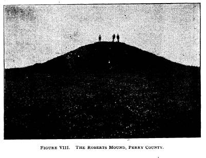
The Roberts mound is one of the largest
tumuli east of the
Scioto. It is shown in Figure VIII.
Standing upon a very high
hill, it is indeed a beautiful as well
as an imposing monument
of the past. It is in a famous
neighborhood. Flint Ridge is
within sight (upon a clear day) and the
stone fortification at Glen-
ford--the largest of its kind in the
state--can also be seen.
This mound lies in the northwestern part
of Hopewell township
in Perry county. The Glenford
fortification is only two miles
|
Report of Field Work. 139 |
|
|
|
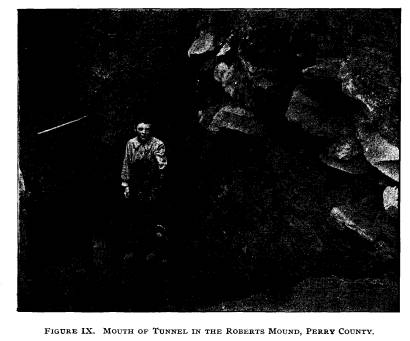
distant. The large earthwork upon Mr. Yost's farm and described in the report of last year (page 174) is but five miles away. The structure is one hundred and twenty feet in diameter and twenty-seven feet high. Not a tree nor a bush is upon it. Sixty years ago very large trees grew upon it and a white oak in particular was noted for its size and height. "Our trench started from the west side and ran in until the bank in front was thirteen feet in height. In making the cut we came upon a large number of very large, flat stones weighing from ten to seventy pounds. (These, as well as the tunnel, are shown in Figure IX.) They ran from two to ten feet deep. They were only near the edges and extended up the mound for about ten feet. I suppose that they were used to keep the struc- ture from washing down. It being built upon a high hill would be subjected to more or less wash." This point is well taken and true. At Fort Ancient the same |
140
Ohio Arch. and His. Society Publications.
precaution is observed and in some parts
of the structure a rude
wall of the flat limestone slabs has
been carried around the edges
of the embankments.
"Near the base of the mound the
earth was thicker over
these stones, showing that the soil
above had washed down in
quantities. We struck an immense
quantity of ashes and burnt
clay and charcoal, etc., on the base
line. The mound is made
up of many colors of soil and is soft
and dark. The colors are
not so bright as those noted in the
Chillicothe group.
"After starting the tunnel and
observing how soft and wet
the mound was, my hopes fell as to
making a big find, for if there
was any perishable material in the mound
it would certainly be
gone by this time. The drift was a few
inches below the base
line, four feet high and three and
one-half feet wide.
"When in eight feet (or
thirty-eight feet from edge of mound)
we came upon a small hole in the base
line filled with ashes,
charcoal and burnt bones of the deer,
etc., also mussell shells,
snail shells and the like. I presume
they had a feast there. The
bottom of the mound was now found not to
be perfectly flat,
but wavy or irregular. Some fragments of
flint and a flint knife
were found. The base line was two or
three inches thick some
distance beyond the burnt bones. Thirty
feet from the tunnel
mouth much decayed wood was uncovered.
As we drew near
the center the ground became sticky and
wet and both hard and
dangerous to work. It made shoveling
slow.
"Near the center of the mound and
forty feet from the mouth
of the tunnel we found a skeleton, badly
decayed. It was par-
tially cremated. All the relics with it
were burned except some
bone beads found around the neck. We
found a fragment of
burned coffin-shaped ceremonial (Figure
X, No. 6). We could
find traces of many relics which had
been burned up. The skel-
eton was large, headed north, and
extended. The mound was
now dangerous and our lights were kept
lit with difficulty. So
we concluded to quit.
"Directly southeast of the large
mound is a small one which
was originally eight or nine feet high,
but it had partly been
dug away to make brick for a
school-house. The workmen
found eight skeletons during this
digging and they all lay with
|
Report of Field Work. 141 feet towards the center, so I was informed by persons who saw them. Nearly half of it had been removed. We sank a pit eight by eight feet and five feet deep. We uncovered five whole and five fragmentary skeletons. These skeletons were placed with- out any regard to direction and were at all depths. They lay across each other, the bones being in confusion. Some were in cramped positions and all of them seemed to have been hastily thrown in. On the breast of one of them we found a handsome needle of bone six inches long, having a notch where the eye should be. (See Figure X, No. 5.) With another skeleton was a fine leaf-shaped spear. We also found flint knives and worked bits of flint. There were traces of fire and many small shells. The skeletons were on the side of the mound nearest the large one. "We began work upon Mr. Helsir's mound in the central part of Hopewell township. It is upon a hill, seventy-five feet in diameter and eight feet high. Flint arrow-heads, knives, chips |
|
|
|
142 Ohio Arch. and His. Society Publications. |
|
|
|
and discs were found. There were considerable traces of fire. There were no burials. Material, yellow clay. There is an extensive workshop near it and black flint from Flint Ridge abounds. "We next dug upon Mr. R. Vanixle's farm in central Hope- well township. It is also a hill mound, sixty feet base and six feet high. Burned clay, charcoal and ashes in the bottom. A small stone mound near this yielded us nothing. "Mr. Alvues' mound was next explored. It is not far distant and in the same township. It is seventy-five feet base and eleven feet high. Traces of fire were abundant. "The Wilson mound is controlled by Mr. C. Rhodes, who gave us permission to explore. It covers nearly an acre of ground, is flat on top and averages eighteen feet high. The farmers con- sider it turtle shape. There are two indentations to the north, but none to the south. I think it more likely a platform mound. "We started a shaft in this, back of what might be the head, at the lowest point in the mound. When five feet deep we began |
Report of Field Work. 143
to strike large sandstones, about forty
to seventy-five pounds
weight. For eight feet the mound was
mostly stone. Then we
found a layer of ashes on the bottom.
Some of the stones were
burned. At this point the mound was
thirteen feet high. Under
the ashes was a thin layer of red clay
two or three inches thick.
The shaft was lengthened. Continuing,
the red clay was found
to be three feet in thickness. It was
the largest mass of burned
clay we had encountered, and for what
purpose such an immense
quantity was placed there I do not know.
Just above the clay
was a layer of white substance
resembling asbestos. It was evi-
dently a mineral. We gradually uncovered
a mass of this red
clay, twenty-four feet long and fourteen
feet wide. The clay
continued on all sides. Under the
stones, as far as we could
undermine, it was still a foot thick. I
should judge that the
mound was one-half stone. A little plumb
was found lying upon
one of the stones. (Figure X, No. 7.) In
the red clay bone
fragments and mica were found. About
fifty feet south of the
shaft we sunk another.
"The mound was so large that we did
not have time nor
appropriations to dig it properly, so we
filled the holes."
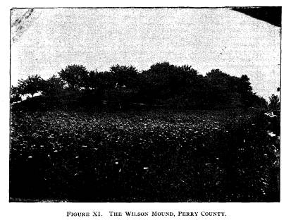
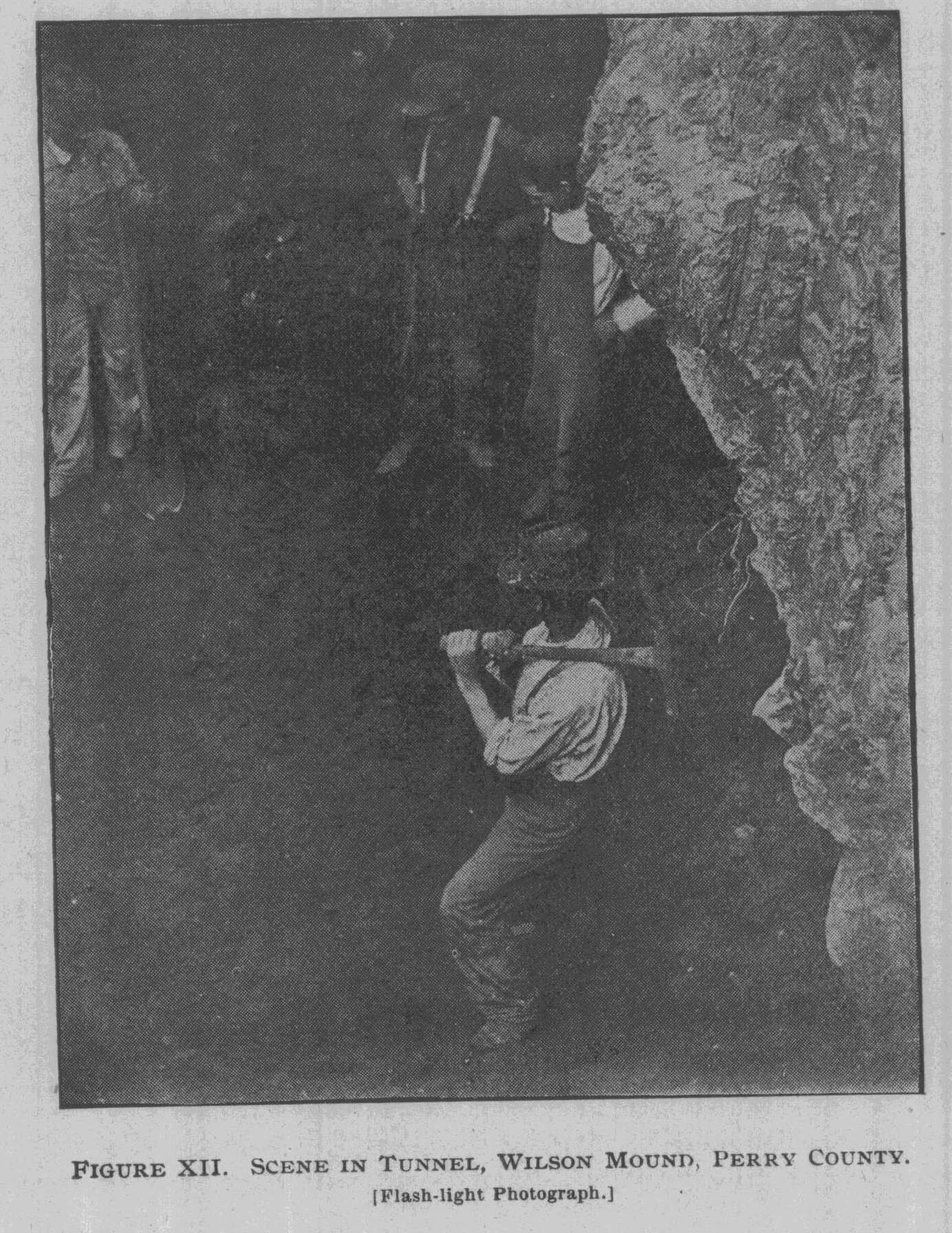
Figure XI shows the mound and Figure XII
the tunnel.
The field notes add that the mound
should be investigated
thoroughly. This proposition is entirely
true. Just work enough
has been done to show its important
character. From the limited
excavations we cannot determine the true
character of the struc-
ture. Complete explorations are
necessary.
The survey now took a long trip through
various southern
counties, visiting sections which had
been indicated as worthy
of exploration.
Saturday, July 3, with a camp outfit,
the survey left Somer-
set and drove to Lancaster. From thence
it moved to Tarleton
and from there to Bourneville by the way
of Chillicothe. It
camped upon Mr. Jones' farm near the
Baum village site. There
is an extensive earthwork at this place
and its most prominent
mound was examined years ago by Mr.
Reynolds of the Smith-
sonian Institution. The enclosure has
been frequently described
and several times surveyed. The village
site lies along the second
terrace, some five hundred yards south
of Paint creek in Paxton
|
144 Ohio Arch. and His. Society Publications. township, Ross county. The whole site covers some thirty acres, but the debris is thickest on an area of some two or three acres. Upon the surface can be seen numerous fragments of pottery and chips of flint, bones, hammer stones, etc. While not the largest village site in the state, it exceeds the average in extent. Fire places can be found in many places. "Our trench showed refuse to a depth of two and one-half feet. At this depth we came upon a yellow clay in which was noth- ing of artificial origin. During the course of exploration many trenches were dug in various portions of the field. We soon located where the relics were most numerous. Buffalo, bear, |
|
|
|
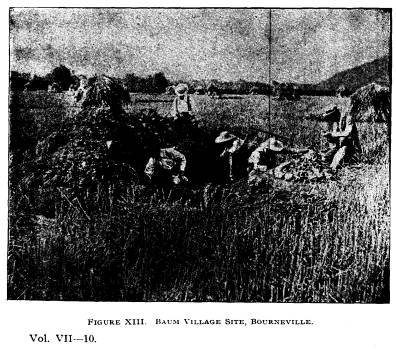
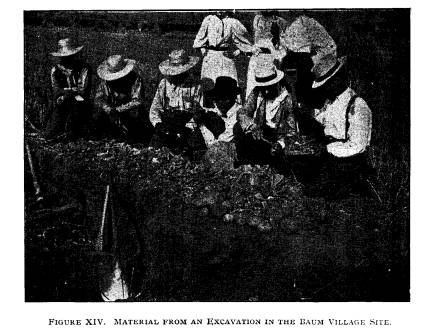
Report of Field Work. 145 deer, elk, coon, and small animals; turkey, turtle, fish and snake bones were found. Some were split, others burned and others smooth from boiling. Mussells and snails were common. Among the pottery ashes and broken stones were awls, needles and scrapers made from the tibiae of the deer. Decorated shells, worked and cut bones, perforated teeth (as ornaments), shell ornaments, etc., were found. Hoes were made by perforating the larger mussel shells in the center and then inserting a handle." (Just as the survey of 1889 and 1891 found in the Fort Ancient village sites.) Figure XIII gives a general view of the site. The pit in the foreground was opened by Messrs. Coover and Bean of Roxabell, and we are indebted to them for the view. Figure XIV shows the richest part uncovered by the survey together with a mass of material. Near the spot shown in Figure XIV were found several in- |
|
|
|
146 Ohio Arch. and His. Society Publications. |
|
|
|
teresting objects; a pipe with a rude human face (more like that of a monkey), an awl having a fox head carved at its top, a cre- mated skeleton in an ash pit. This cremation was about a foot from the surface and the pipe accompanied it. Al1 around the skeleton were many worked bones, perforated shells, cup stones, hammer stones, etc. Excavations for a space of 30 x 40 feet were made all around the spot. "In cataloguing our specimens we find nearly 5,000 frag- ments, etc. The most important are: 12 or 15 bear jaws. 35 bear tusks. 6 panther teeth. 9 perforated or grooved panther teeth. 15 deer tibiae scrapers, some of them eight or nine inches long. 2 deer antlers nearly whole. |
Report of Field Work. 147
56 worked deer antlers, perforated
needles, awls.
5 turkey bone awls made from tibiae.
3 turkey bone spurs.
250 bone beads.
3 pieces of worked bone.
3 effigies in bone.
1 monkey-faced effigy pipe.
6 fragments of pipes.
3 pieces of decorated mussell shell.
17 mussell shell hoes.
1 flint disc.
1 core.
2 scrapers.
1 arrow head.
1 knife.
30 war points.
8 drills.
I axe.
1 celt.
12 mortars.
6 cup stones.
12 hammer
stones."
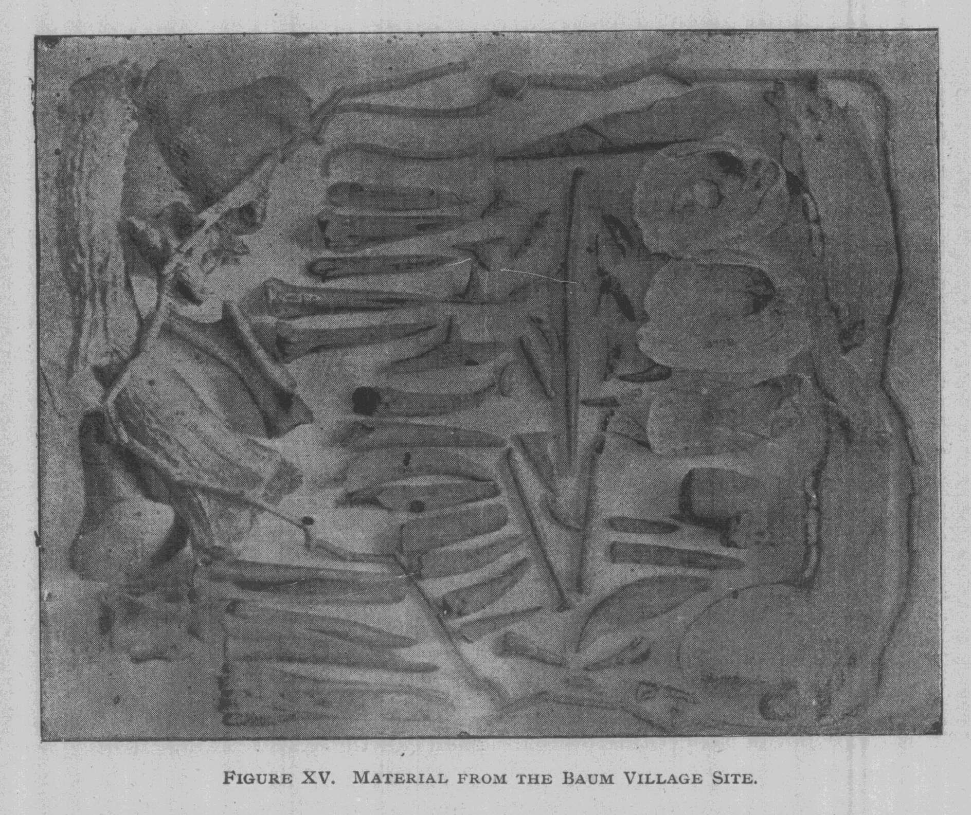
Figure XV is an exhibition of some of
the more important
finds from the village site.
Bear jaws are shown to the right. Next
to them (18,778-9)
are two of the perforated mussel shell
hoes. Below is the pipe.
A string of cylindrical bone beads
encircles the objects on
the left of the plate. Bone awls are to
the left of the shells.
18,776 is a decorated shell. Many of
these were taken from
the pits.
Lying between awls 18,771 and 18,473 is
the fox head
(broken) perforator. It is not
sufficiently large to be clearly
seen.
Perforated teeth (beads or earrings),
and the peculiar tri-
angular awls (some of them of turkey
spurs) are shown in the
center.
|
148 Ohio Arch. and His. Society Publications. Antlers and larger bones are to the extreme left. The grooved tibiae scrapers lie in the lower left hand corner. The American Archaeologist kindly permitted me to repro- duce Messrs. Coover and Bean's article together with the illus- tration. Their exploration was productive of some interesting additional discoveries: |
|
|
Report of Field Work. 149
"A RARE ARCHAEOLOGICAL FIND
MADE BY A. B. COOVER AND
L. M. BEAN, OF ROXABELL, OHIO.*
"Near Bourneville, a small village
situated on Paint Creek,
twelve miles southwest of Chillicothe,
Ohio, there are to be found
numerous earth-works, the work of
prehistoric man.
"The valley abounds in mounds,
forts (in circles and squares)
and numerous village sites. On the farm
of Mr. Ed. Baum and
Mr. Pollard Hill, lies a village site of
about thirty acres in extent,
which is rich in instruments of bone,
made by an ancient race of
people of whom we have no definite
history, except as we unearth
specimens of their work.
"Prof. Moorehead and Dr. Loveberry,
of the Ohio State
Archaeological and Historical Society,
were at work on this site
some three or four months ago, and made
a number of finds of
bone instruments and broken pottery, all
of which were shipped
to Columbus by Prof. Moorehead for the
Society.
"A. B. Coover and L. M. Bean, of
Roxabell, Ohio, assisted
by William Kerran, of Bourneville (each
of whom have a private
collection of ancient Indian and Mound
Builders' relics) having
obtained permission from Mr. Baum to
make a number of exca-
vations on his farm, camped on the farm
of Mr. Hill near by,
prepared to stay a week or more, and to
give the ground a
search.
"The first pit dug extended over a
space of 8 x 18 feet and
two feet deep, the work being done with
trowels. It took two
days to examine that amount of ground.
"From this excavation were taken
several awls made of
bone, arrow points of bone and stone,
bone beads, scrapers made
from the leg bone of deer, a bone
ornament about three inches
long, a part of which is missing, and
hundreds of pieces of pot-
tery and animal bones.
"Bones and pottery getting scarce
in pit No. 1, another pit
was started about one hundred and twenty
feet to the north, and
at the depth of eighteen inches from the
surface a number of
creek boulders were struck, and upon
closer examination were
found to have been arranged in a
systematic order, in the shape
* From the American Archaeologist,
October, '97.
|
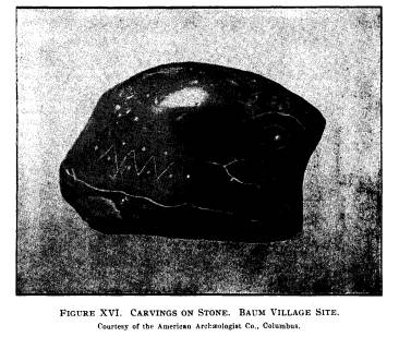
150 Ohio Arch. and His. Society Publications. of a small oblong mound eighteen inches wide and 30 inches long. The dirt was carefully removed from the stones, and a photograph of the pile taken. In removing the stones a count was kept and there were found to be sixty-six boulders the size of a man's fist. The stones had been arched over a bed of ashes about twelve inches thick, and contained a number of animal bones, and near the center of the ashes lay a polished stone four |
|
|
|
and one-fourth inches long, three and one-half inches wide and one and one-half inches thick. On one side was carved a human eye, below the eye an excellent image of a turtle; at the lower right hand corner a fox or wolf; to the left, zigzag marks with dots; under all runs a line the full extent of the stone. The re- verse side is plain and the stone shows the marks of having been exposed to intense heat. The mound or arch lay the longest way, due north and south. "About five feet to the south were unearthed the skulls of two deers, a bear, and what was taken to be a buffalo and moose. The five skulls lay in a quarter circle, and each facing the mound |
Report of Field Work. 151
of stones, as if for some special
purpose. Near the mound and
the skulls were found perforated mussell
shells, bone awls, one
bone celt, one perfect bone fishhook,
one piece of stone pipe.
bone beads and countless pieces of
pottery and animal bones.
which were broken. Sixty feet to the
south of the arch of
boulders were unearthed two skeletons of
men of average height.
Both skeletons lay on their backs with
their heads to the north.
One lay at the depth of only ten inches
from the surface, the
other being at the depth of two feet,
and appeared to have been
encased in black walnut, large pieces of
which were taken from
around it in a charred state, having,
like most everything else
found at this place, been subjected to
the action of fire. Near
the skeletons were found a number of
bone beads, shell hoes.
bone awls, several flint points and
scrapers, large polished teeth
and quite a lot of broken ornamented
pottery. It was estimated
that about ten thousand pieces of
animal, bird and fish bones,
and three thousand pieces of broken
pottery were unearthed in
the five days' work."
A communication from Mr. Coover gives
additional details.
Several days more were spent at the site
and excavations were
made in various parts of the field. The
boulder arch was found
one hundred and twenty feet north of our
pits, the first skeleton
sixty feet north.
Of one of the later pits Mr. Coover
says:
"The sides of the pit were found to
be burned to a red color
in places. In an excavation fourteen
feet long were found four
bone awls, arrow points of stone,
several tips of deer horns
which had been dressed to a point and a
hole drilled in the base,
as if to receive the shaft."
It is to be regretted that the
appropriation was insufficient,
for the entire field should have been
examined as was the famous
village and cemetery at Madisonville.
With other village sites of the Scioto
this has much in com-
mon. While larger than the average, yet
it can be said that it
presents somewhat of a lower culture
than others connected with
great earthworks. It will be observed*
that there are no great
number of burial mounds within or
without the enclosure.
* See Ancient Monuments of the Mississippi
Valley.
|
152 Ohio Arch. and His. Society Publications. |
|
|
|
Those two to four miles west, along Paint creek, may have been used by the occupants of the enclosure for their interments, but one cannot say positively. The character of the relics and the lack of evidence of high aboriginal art at this place are taken as evidence of the primitive character of the villagers. I do not think that they were the same people who erected the earth- work, or of the same tribe. At Hopewell's, Hopetown, Har- nesse's and Mound City fragments of elaborately carved shells, rings, polished pipes, both effigy and platform, etc., have been found. None of these truly polished, ceremonial, or artistic objects were found in the ash pits or on the habitation sites of the Baum village site. The place is interesting in that it shows a lower degree of culture than that evinced on the sites above men- tioned. This naturally brings forward the question-Is this a later occupation? Is it an earlies one? I am convinced that it antedates the construction of the works. I do not think it is of the historic period and if Indian, of some tribe which knew little |
Report of Field Work. 153
or naught of agriculture. No pestles
were found. The bones of
animals and the unios from the creek
found in such profusion
would indicate the presence of a hunting
tribe. No foreign sub-
stances were present. Flint Ridge
material was absent. Neither
the effigy of the fox, nor the rude
sculpture upon the pipe can be
classed with the beautiful carvings of
other Scioto valley culture-
sites.
It is interesting to find a site which
cannot be classed with
those referred to above. It shows more
than one occupation of
the valley and it will aid in settling a
few of the remaining prob-
lems connected with pre-Columbian life
in this famous region.
There are several small mounds connected
with the great
"Bourneville enclosure." Most
of them occupy gateways and
were probably erected for protection.
Three of these were ex-
plored and aside from traces of fire
upon the base lines nothing
was found. There were neither bones nor
objects.
"We secured permission to work a
mound on Mr. Medcalf's
farm. This lies just east of the Baum
village upon the same
terrace and in the same township. It
stood six feet high and had
a diameter of seventy-five feet. We dug
a fair-sized trench in it.
At the depth of four feet we found
charcoal and ashes in several
beds. These were rather small. In one of
the beds of ashes
were fifty spear heads which had
suffered from heat, being
broken and burned. They were in a little
heap near the center
of the mound. (See Figure X, No. 15).
There were two frag-
mentary skeletons here and the skulls of
each could not be saved.
The soil was brown clay.
"We then moved to a gravel pit on
his farm where several
skeletons had been found, but we were
not able to find bones.
We opened three stone graves upon Spruce
hill but found noth-
ing. They seem to have been disturbed by
previous parties."
Spruce hill is well known. An extensive
stone fortification
crowns the summit. The walls are low,
but originally must have
been of a considerable height. It is
described in Ancient Monu-
ments of the Mississippi Valley, Squier
and Davis. Also in Fort
Ancient, page 103.
"Mr. Dill of Bainbridge permitted
us to work a mound of
his three miles west of the village
site. (See Figure XVII. It
|
154 Ohio Arch. and His. Society Publications. lies upon the second terrace, is one hundred feet in diameter and four feet high. Our trench was ten feet long, eight feet wide and four feet deep. It was constructed of red sandy soil and very soft. The usual evidences of fire were there. One large white spear head, three inches in length, was our only find. (See Figure X, No. 13). "Mr. Dill permitted the exploration of a second mound some few hundred yards west of this one. It had been partly removed and now stands seven feet high. Material, red clay. Our trench was 16 feet long, nine feet wide and seven feet deep. Fire traces were abundant upon the bottom. Near the center was a child's skeleton some two or three years of age. Bone beads lay about the neck; there was also a decayed mussell shell. "East of this mound and not far distant is a mound belong- ing to the Dill estate. Miss Emma Dill kindly permitted us to examine it. Dimensions, one hundred feet diameter, five feet high. Our trench was 20 x 15 x 5 feet. Near the surface in the |
|
|
|
Report of Field Work. 155 |
|
|
|
center was a decayed skeleton of an intrusive burial. The base of the skull of another skeleton near it exhibited the Inca bone. It was also decayed. On the bottom was a fine black flint knife, leaf shaped. (See Figure X, No. 12). As the mounds had all been located upon the map along this valley the party moved to Waverly. Mr. McKenzie, who owns a group of three mounds just south of the town, gave per- mission for explorations. The large mound of the group, lying near the Norfolk and Western railroad tracks, is shown in Fig- ure XX. Pike county contains many mounds. The group near Pike- ton, several miles south of Waverly, is probably better known than other mound centers in this county. The famous graded way, the tumuli upon Judge Van Meter's estate are also frequently visited by archaeologists. About Waverly, at the time of set- tlement, there were numbers of tumuli in the rich bottoms of the Scioto, which have since disappeared under cultivation. |
|
156 Ohio Arch. and His. Society Publications. "The mounds owned by Mr. McKenzie are upon the second terrace of the Scioto. Two of them are small. The three form a triangle thus: |
|
|
|
"July 16. We located upon the group mentioned. While the men prepared for work I located ten or twelve stone graves upon Mr. A. Lee's farm south of the town. "The small mound is forty feet in diameter and three feet high. We dug out its center, sixteen by ten by eight feet. (See A in plan above.) It was built of rich, dark earth. In the center was a skeleton on the bottom, headed northwest and extended. It was finely preserved. Bone beads were about the neck. (See Figure XXII. This plate, devoted entirely to finds in and around |
|
|
Report of Field Work. 157
Waverly, need not be described in the
text. The explanation
in detail, opposite the figure, will
give the locality of each object.)
There were two copper buttons clasped in
each hand, the arms
being extended along the sides. There
was nothing else in this
structure.
"The mound (B) was fifty feet in
diameter and four feet
high. It was of the same material. The
entire central portion
was opened. A skeleton lay upon the
bottom in the center,
headed north and extended. There were
two fragmentary skel-
etons near the surface and these were
intrusive, I think.
"In each hand was a copper button.
Under the skull was
a small wooden button about the size of
a five cent piece, which
was copper covered.
"The large mound (C, shown in
Figure XX), which has
been somewhat reduced by cultivation,
now stands six feet high
and one hundred and twenty-five feet
across the base. The soil
in it is similar to that noticed in the
others. Our trench started
from the west side and was thirty feet
wide. We found one
skeleton ten feet southwest of the
center, headed north. Like
nearly all burials, it lay on the back,
extended, and was five feet
eight inches in length. The earth was
all of a dark color about
it. None of the bones could be saved.
Just north of this one,
upon a well marked base line, was
another body. It lay a little
to the east. It was of medium size,
decayed and the soil about
it was very dark. About five feet from
the center of the mound
was a third skeleton, headed south and
partly buried in sand.
Around it was a dark outline. The teeth
showed medium age.
Its height, five feet nine inches. We
could not preserve it. Nearer
the center was the fourth burial. It lay
upon a raised platform
of earth, one foot high, and all around
the skeleton was pure,
white sand. It was five feet and nine
inches long and from the
teeth I should judge it was of middle
age. The muscular attach-
ments of the bones were well developed.
Bones were large but
not massive. (Figure XXI shows the
skeleton after having been
carefully "brought out" by the
hand trowels and whisk brooms,
so that the bones could be well shown in
a photograph. Because
of the lack of contrast between bones
and earth it is extremely
difficult to procure a clear view of a
skeleton.) This was one
|
158 Ohio Arch. and His. Society Publications. |
|
|
|
of the best mound skeletons I ever uncovered. Three arrow heads lay along the right arm and between the knees was a piece of worked antler. "South of this was the skeleton of a child of but a few months of age. Beneath the child's skeleton, but a few inches, was the skeleton of a doe. Among the bones was the calcis of an adult. It was unusually large. Four feet north and four feet deep was the tibiae of a skeleton surrounded by spear heads. They were twenty in number, twelve being broken. No other bones or traces were found. "Four feet east of this cache of spears on the base line lay another extended skeleton. On the left wrist was a copper bracelet. The bones could not be taken out entire. About three feet east of the center, lying on the base line and in a small bed of ashes about twelve inches in diameter, was a cremated skel- eton. With the bones were an arrow-head and a polished celt. Southeast was the skeleton of a child near the surface. From |
Report of Field Work. 159
indications I think it to have been a
recent interment-probably
of the whites. This concluded the
exploration of this mound."
About one and one-half miles north of
Waverly, upon a hill
some one hundred and fifty feet high,
stand three large glacial
kames. The people of the neighborhood
consider them mounds
and their rounded appearance would lead
one to suppose them
to be artificial. But upon investigation
they were found to be
of unmistakable glacial origin, being
composed entirely of gravel.
They extend in an even line. The smaller
ones to the north
contained nothing. Several holes were
sunk at various points
upon their summits, but nothing of
importance was found.
To the south, and upon a point of the
hill, is a kame full
thirty feet high. Its summit is somewhat
elongated, extending,
perhaps, one hundred feet north and
south. The plow has turned
up many bits of bone. A careful
investigation of the kame revealed
fourteen burials. Most of these were
extended, say twenty inches
from the surface and for the most part
well preserved, save the
crania. Of the latter two were secured
whole. They are exceed-
ingly thick and rather incline towards
the brachycephalic type.
No boulders or flat stones surrounded
them. The burials were
simply made in the gravel. There is no
indication that the sum-
mit of the kame had been artificially
rounded. Numerous
humeri, tibiae and other bones which
might exhibit anatomical
peculiarities were removed entire. The
vertebrae were uniformly
decayed. Some of the other small bones
were also not sufficiently
preserved to admit of their being
removed.
With the fourteen skeletons were
numerous portions of others
which lay a little above them. These had
doubtless been dis-
turbed by the plow. It might not be an
exaggeration to state
that some twenty-five interments had
originally been made.
No common direction could be observed,
as they headed
towards all points of the compass. The
fine yellow sand
and gravel of the top of the kame
afforded soil easy of excava-
tion, and the rapid penetration of the
water (when it rained)
through the gravel left the bones dry
and thus assured their
preservation. There were sixty bone
beads with two of the skel-
etons. A child seemed to have been the
object of affection on
the part of its parents, for it had with
it three bone chisels, a
|
160 Ohio Arch. and His. Society Publications. |
|
|
|
flint knife and a shell ornament. There were two spear-heads with another interment. These were exceedingly heavy and ill- made, being five inches long and very narrow. All these burials did not cover a space to exceed fifty feet square. DESCRIPTION OF FIGURE XXII. All from McKenzie mounds, Waverly group. No. 1, phalanges of skeletons which held copper buttons in their hands. These are colored by verdegris, but the figure does not show this clearly. Nos. 2, 3, 4, 5, 6, 7 and 8 are copper buttons. Nos. 9 and 10, wooden button surrounded by copper. No. 11, a bracelet found upon the wrist of a skeleton in the large mound. No. 12, a celt found with the cremated skeleton. No. 13, child's skeleton buried just above the doe. |
Report of Field Work. 161
No. 14, the calcis of an adult; museum
number, 15,618.
No. 15, tibiae surrounded by spears
(large mound).
"We secured permission from Mr.
James Corwin to work
two small mounds which lie one and
one-half miles north of
Waverly. The largest one is five feet
high and fifty-five feet
base. It is made of yellow clay. After
digging a large hole,
nothing was found save the usual traces
of fire.
"One hundred yards northwest is a
small mound three feet
high and thirty feet base. There was not
a trace of skeletons
in it, but on the bottom was a very
heavy black streak, and in
it were several objects the like of
which we had not found prev-
iously. It must have resulted from the
decay of skins or hides.
There were no ashes. In a swamp near the
foot of the hill is
similar soil. It may have come from
there. In the center were
whole and broken bar-amulets, galena
ceremonials and a fine
bird ceremonial. (See Figure X. No. 19
is the bird ceremonial.
Nos. 20 and 21 are the
bar-amulets. No. 22, museum number
15,830, is the galena object.) Flint
arrow-heads, a plumb bob
and some galena ore were found.
"In the bottoms along the Scioto,
two and one-half miles
north of Waverly, is a large village
site upon Mr. Corwin's land.
We dug a number of trenches and pits. We
found quantities
of the usual village debris: pottery,
shells, broken relics, etc.
There were many dark colored spots and
numerous beds of
ashes. About a half bushel of material
was secured at this place.
"The bottom mound lay back from the
river two hundred
yards. It was three feet high and one
hundred and twenty-five
feet base, made up of hard black, mucky
soil. Our trench only
revealed cremated bones and charcoal,
ashes, etc.
"Mr. Charles Foster, two miles
north of town, permitted
us to dig a hill top mound upon his
farm. It is ten feet high
and one hundred and sixty feet base. It
is composed of red clay,
and at the bottom is a black streak two
feet thick. I think that
it came from the swamp referred to
above. There was a skele-
ton on the bottom, headed north and
decayed. There were
quantities of decayed wood about it. One
arrow head was in
Vol. VII-11.
|
162 Ohio Arch. and His. Society Publications. such a position among the bones as to lead me to believe that it killed the individual. "Mr. Corwin had secured permission for us to dig several mounds upon his father-in-law's farm near Omega on the east side of the Scioto. On July 28th we went thither. There are two mounds near his barn, one being four feet high and one hun- dred and fifty feet base, and the other about the same size. They are not far from the Scioto. The first was composed of black soil and there were traces of fire. Nothing of importance found. The second (one hundred yards east) contained a decayed skele- ton and some fragments. The base line was distinct. Another mound in the bottom some two hundred yards distant was not investigated. "Three-fourths of a mile east, on the high hills overlook- ing the river is a mound eight feet high and one hundred and fifty feet base. Material, red clay and sandstone spalls. Pieces of worked flint and two arrow heads constituted the finds. That was all. A second hill mound lies one hundred yards to the |
|
|
Report of Field Work. 163
west. It is four and one-half feet high
and one hundred and
twenty-five feet base. We uncovered a
skeleton in the center,
two feet from the surface. Three arrow
heads lay by it.
"Col. Jas. Moore of Chillicothe,
living two miles north of
Waverly, owns a field in which beds of
mica have been revealed
by the plow. We were unable to locate
the spot.
"July 29th. We started for Jackson,
driving to Beavertown
we located some earthworks and mounds
near there and brought
a small collection. (See Figure X, No.
16. A fine chisel which
was in the collection purchased).
Driving into Jackson the next
day we were greatly assisted by Mr. F.
E. Bingham, who drove
out with me and secured permissions for
explorations. We be-
gan work upon Mr. Burn's mound, three
miles southeast of
Jackson. It is made up of red clay and
is five feet high, one
hundred feet base. We trenched in
thoroughly, finding some
arrow heads and a very fine slate
ornament. We found no traces
of any skeletons or of fire.
"A third of a mile southwest on the
same terrace of the run
on which the above mound was located is
another. It is five
feet high and fifty feet base. There were traces of fire. I
found one fine leaf shaped arrow head.
"We drove six miles southeast to
Mr. Harshberger's farm.
In the bottom appeared to be a large
mound, but upon examina-
tion we found it to be composed of solid
rock covered by soil.
It is the nearest approach of a natural
formation to a mound that
I ever saw.
"Returning to Jackson we went up
Salt creek to Richmond,
locating mounds along the route.
"After reporting at Columbus, the
survey was ordered by
my chief, Prof. Moorehead, to proceed up
the Scioto to its head-
waters and obtain a general idea of the
character of ancient
remains along the river. Mounds were not
supposed to exist in
numbers, but there might be evidence of
other works, such as
graves, kame burials, etc. And these
might indicate the pres-
ence of another tribe, and one different
from that occupying the
southern portion of Ohio.
"From Columbus we drove up the
Olentangy to Delaware.
Mr. R. E. Hills of the city, one of the
trustees of the Society, ren-
164 Ohio Arch. and His. Society Publications.
dered us much assistance. Mr. Taggert
and others also told us
of mounds. We drove to Galena on the Big
Walnut (creek).
Near there, on Big Walnut creek, is a
circle which surrounds a
mound. There was a village site and a
workshop near by and
we looked over the surface carefully and
found quite a number
of specimens. The site did not seem to
have been occupied for
a very long time. We trenched the mound,
but found little of
interest. It is seven feet high and one
hundred feet diameter.
The circle is about two hundred feet
diameter with the moat on
the inside. There is an enclosure or
fortification here but it has
been so nearly obliterated that I can
barely make out its contour.
"From here we returned to Delaware
and drove to the
Scioto on the west. I took a side trip
to Magnetic Springs, lo-
cating mounds, village sites and gravel
burials. We followed the
Scioto to Mr. Dill's farm near Prospect
in the northwest part of
Delaware county, where there is a group
of mounds along the
banks of the Scioto. One of these is one
hundred and twenty-
five feet base and six feet high. The
other one is larger. Hav-
ing secured permission we began
operations upon the small one,
fifty yards east of the large one. Three
pits were dug, each six
feet long, five feet wide and five feet
deep. It was composed of
a gravelly soil. One skeleton found was
badly decayed. Headed
northwest, decayed. Three arrow heads
were near the head.
The hardness of the ground prevented its
removal. The largest
mound had been explored.
"We drove to Prospect, and from
thence to Green Camp,
locating remains along the way. At Green
Camp, upon Mr. S.
Porter's farm, there was a stone grave.
The foot bones of the
skeleton were painted with red ochre.
Large quantities of the
paint were found at the feet. Fragments
of a large jar and some
beads also lay near the feet. A bow and
quiver, a pick shaped
ceremonial, several double-pointed
chisels, mica in large quan-
tities, arrows, scrapers, spear heads,
celts, etc., were found with
the skeleton by Mr. Porter. We simply
reopened the grave in
order to ascertain if he had overlooked
anything. An old Indian
trail passes near this grave along the
top of a small hill. There
Report of Field Work. 165
is a spring near by and the Scioto river
is not far distant. The
bones were six feet below the surface
and covered by many
stones. There is little soil above the
stones and the locality of
the grave was ascertained by the plow
striking them."
Some of these objects are shown in
Figure X:
No. 1, a piece of mica; No. 2, a
double-pointed chisel; No.
3, a flat stone, polished or unfinished
ornament; No. 4, a notched
bone fish spear or harpoon. These latter
are exceedingly rare,
only a few having been found in Ohio.
Several were dug up in
the famous cemetery at Madisonville, and
two found near Cin-
cinnati were described in the Quarterly
of the Cincinnati Histor-
ical Society for 1896, by Professor
Smith, curator at that time.
It is unfortunate that the entire
collection from this interest-
ing grave could not have been secured by
our Society for preser-
vation.
"From here we went to Marion, and
from thence northeast
until the Sandusky river was reached.
Following the river we
soon reached Bucyrus and called upon
General Finley, who is
much interested in archaeology. General
Finley is confident
that the Indian village of Secium was
located near Bucyrus and
that it was a most important place in
primitive times, marking
the being near the portage from the
Sandusky to the lake, from
the Scioto to the Sandusky, and that all
canoes or traveling par-
ties ascending the river stopped at this
point.
"We dug twenty-five or thirty pits
and field hunted over fifty
acres, but could not find the least
trace of Secium.
"We continued on to Upper Sandusky.
Nearly all of the
way the river was followed. Some
information was obtained
from resident collectors.
"Six miles north, on Mr. J.
Hayman's farm, is a modern In-
dian (probably Wyandotte) burial ground.
There were at least
fifty graves here, but all had been
opened by curiosity seekers
and the bones strewn about the surface.
We did some work,
but were not able to locate any
interments.
"At McCullomville we heard of some
mounds near Sycam-
more and drove east to that place. But
all the mounds were
glacial kames and contained few burials.
At Tiffin and Fort
166
Ohio Arch. and His. Society Publications.
Seneca we secured some additions to the
map. From Fremont,
where we found little in the way of
prehistoric remains, we pro-
ceeded to Port Clinton and found a few
small mounds, all of
which had been explored. From here we
drove to Lakeside and
located some stone graves and small
mounds. We dug in a
stone mound at Lakeside sixty feet in
diameter and three feet
high. There was nothing in it but
fragments of bones. We
took the boat to Sandusky and from
thence drove east along the
lake shore, making observations.
"Turning southeast we ascended the
Huron river and se-
cured some locations for the map. A few
relics were bought at
these various northern places. From here
we traveled to Belle-
ville by the way of Mansfield. At
Fredericktown we dug in
some graves but made no discoveries.
There were six mounds
and four earthworks near Fredericktown.
By the way of Mount
Vernon we drove to Newark and then on to
Glenford. Near
the latter place, on Isaac Zartman's
farm, is a mound by the
banks of a small creek. It was
fifty-seven feet wide and five feet
high. Material, yellow clay. Pieces of
flint and some knives
were scattered through it. The base line
was fairly distinct.
Some one had partly explored it, but we
could not learn if dis-
coveries had been made. We found
charcoal and ashes in abund-
ance. A stone mound not far from this
one was opened. Di-
mensions, seventy-five feet base and
three feet high. The trench
run through it took out most of the
structure. We found
arrow heads, knives and some ornaments
in it, also evidences of
great heat. At Somerset the survey
disbanded and the field
work came to an end August 28th,
1897."
THE STATE ARCHAEOLOGIC MAP.
The additions during the past year to
the map have been
considerable, but they have not reached
my expectations. To
complete this important work there
should be an appropriation
of at least $2000 per year. At present
there is no provision for
the work and the records are obtained
through correspondence
or by the Curator during his travels.
This latter method is entirely
satisfactory so far as it goes, but the
survey cannot cover more
than a small portion of six or eight
counties in a season, as its
Report of Field Work. 167
time is spent in excavating and there is only opportunity
to record
such monuments as are heard of in the
region wherein it is at
work. Two or three employees of the
Society should visit various
portions of the state; especially such
as are not represented on
the map. They should travel through all
the townships in each
county. At this rate it would take few
summers to record all
monuments of which there remain a trace.
It seems unfortunate
that the map-- begun with such zeal and
assisted throughout
by private contribution- should not be
pushed to completion.
It is the most important work ever
undertaken by the Society
and has been recognized generally among
scientific institutions
of the East.
In the enumeration it will be seen that
a number of changes
have been made. These are due in part to
errors of correspond-
ents, to the study of our map up to
date, to separation into proper
classes, etc. Some marks were removed,
and with all additions
the present number stands 3,292, a gain
of only 449 over last
year. We can not be too careful in the
tabulation of data for the
map and I am pleased that now, so far as
it has progressed,
there are but few errors.
One of the changes - and an important
one - came about
as a study of the map itself rather than
the field.
Squares and circles are often in
combination with valley
enclosures. Last year the student who
called off the various
works to me made the natural mistake of
counting all the squares
or circles whether by themselves or
connected with other embank-
ments. He reported seventy-four. There
are that number in
the state, but only thirty-seven stand
by themselves. The others
enter into the "enclosure
division.' He also included mound-
groups with enclosures, thus making the
total of enclosures
greater than the actual number shown
this year. By enclosure
is meant a group of embankments, mounds,
sites, etc., and the
one mark for that class may stand for as
many as thirty mon-
uments.
A careful estimate of the total
monuments recorded so far
for results is an estimate of 8,230; assuming that
each mark
averages two and one-half works.
I only fear for errors in one or two
classes. The distinction
168 Ohio
Arch. and His. Society Publications.
between works upon
hills and those in the valleys seems to puzzle
both correspondents
and the surveys. The differences between
various works are
invariably correctly given, but the "on hill
or in valley"
sign is often left off the county tracings. I think
this is especially
true of the stone graves. Most of them occur
upon high hills and I
cannot agree that so few (as indicated
by the map) are found
there. The co-laborers on the map have
inadvertently omitted
the hill-top sign.
But be these small
omissions as they may, the map as a
whole has
sufficiently progressed for us to obtain a pretty clear
idea of monument
distribution.
Certain inferences
were published in last year's report. These
have been
strengthened and some of them can now be classed
as facts.
The southern part of
the state (omitting the Scioto Valley
and the lower
Muskingum) abounds in stone graves and stone
mounds; the upper
Scioto in gravel or kame burials, graves and
small village sites.
The tumili and works found in the hills back
from the Scioto,
Muskingum or Miamis may be classed as not
belonging to the
higher culture of the people of the combination-
works or enclosures.
Glacial kame burials are found to be exceed-
ingly numerous, and,
as stated last year, furnish a fruitful field
for study, being of
an earlier or more primitive type than the
mounds and enclosures
or village sites.
The map also
emphasizes this fact: that culture was local
and no "high
civilization of the Mound Builders," can be as-
signed. We must
account for the presence of many tribes of
varying degrees of
intelligence, none of them above middle or
upper barbarism and
many of them being in upper savagery.
It indicates a long
mound-building period by a fairly limited
population rather
than an occupation of the entire area by large
numbers of people for
a short time.
SUMMARY OF
PREHISTORIC EARTH AND STONE REMAINS IN
THE STATE OF OHIO ACCORDING TO KIND.
Mounds of earth not
located upon high hills............... 1,899
Mounds of earth
located upon high hills ......................... 376
Mounds of stone not
located upon high hills..................... 43
Mounds of stone
located upon high hills......................... 13
Report of Field Work. 169
Village
sites
.................................................... 253
Enclosures: This includes all "combination"
or "religious" works,
irregular in form, or of geometric designs found in the
val-
leys
.........................
..............................
133
Enclosures upon high hills. These may be considered as
fortifi-
cations
....................
................................ 7
Circles of
earth not on high hills................................. 19
Squares of
earth not on high hills.............................. 37
Crescents of earth not on high hills
............................. 17
Groups of stone graves not on high hills
......................... 135
Groups of stone graves on high
hills............................ 8
Stone fortifications or enclosures upon high hills
................ 4
Glacial kame burials (skeletons found in gravel knolls
and sup-
posed to represent interments by a different tribe from
that
burying in the
mounds)..................................... 225
Flint quarries ................................................... 4
Effigies
............................ ............................ 4
Groups of earth mounds not on high hills
........................ 14
Groups of earth mounds on high hills. (These groups may
con-
tain from three to twenty-five mounds
each).................. 93
Parallel Walls .................................................. 8
Total .................................................. 3,292
SUMMARY ACCORDING TO COUNTY.
Ross ...................... 298 Greene .................... 41
Licking ................... 228 Clarke .................... 41
Pickaway .................. 222 Wyandotte ................ 40
Butler ..................... 162 Marion .................... 39
Jackson ................... 150 Brown ..................... 37
Fairfield ................... 141 Fulton .................... 36
Franklin .................. 137 Hamilton .................. 36
Perry ..................... 102 Highland .................. 35
W ashington
............... 92 Ashland .................. 35
Clinton .................... 84 M
organ ................... 34
Delaware .................. 74 W
ayne .................... 33
Adams .................... 71 Clermont .................. 33
Muskingum
............... 70 Montgomery ............... 32
Athens .................... 62 Fayette .................... 28
Pike ...................... 60 Erie ....................... 27
K nox ..................... 59 Vinton .................... 27
W arren ................... 56 Union ..................... 26
Scioto ...................... 54 Lawrence .................. 23
Coshocton
................. 52 Madison
................... 22
Hardin .................... 46 Miami
..................... 21
170 Ohio Arch. and His. Society
Publications.
Summit
................... 21 Islands in Lake Erie ...... 8
Hocking
................... 20 Sandusky .................. 7
Loraine
................... 19 Auglaize ................... 7
Morrow ................... 19 Allen ...................... 7
Holmes
................... 18 Noble ..................... 6
Williams
.................. 18 Portage ................... 6
Tuscarawas
................ 16 Harrison .................. 6
Darke
..................... 16 Wood .................... 6
Gallia
..................... 15 Medina .................... 6
Lucas
..................... 15 Hancock .................. 4
Belmont
................... 15 Paulding .................. 3
Huron
..................... 14 Monroe ................... 3
Crawford
.................. 13 Mahoning ................. 3
Cuyahoga
................. 13 Seneca .................... 2
Ashtabula
................. 13 Henry ..................... 2
Richland .................. 13 Geauga .................... 2
Lake
...................... 11 Putnam ................... 1
Ottawa
.................... 10 Logan ..................... 1
Stark
...................... 10 Shelby ...................... 1
Jefferson .................. 10 Carroll .................... 1
Champaign
................ 9 Columbiana ............... 1
Mercer
.................... 9 Van Wert ................. 1
Trumbull
.................. 8 Guernsey .................. 1
Preble
..................... 8
Defiance
................... 8 Total ................. 3,292
|
Report of Field Work. 171 |
|
|
|
172 Ohio Arch. and His. Society Publications. |
|
|
|
Report of Field Work. 173 |
|
|
|
174 Ohio Arch. and His. Society Publications. |
|
|
|
Report of Field Work. 175 |
|
|
|
176 Ohio Arch. and His. Society Publications. |
|
|
|
Report of Field Work. 177 |
|
|
|
178 Ohio Arch. and His. Society Publications. |
|
|
|
Report of Field Work. 179 |
|
|
|
180 Ohio Arch. and His. Society Publications. |
|
|
|
Report of Field Work. 181 |
|
|
|
182 Ohio Arch. and His. Society Publications. |
|
|
|
Report of Field Work. 183 |
|
|
|
184 Ohio Arch. and His. Society Publications. |
|
|
|
Report of Field Work. 185 |
|
|
|
186 Ohio Arch. and His. Society Publications. |
|
|
|
Report of Field Work 187 |
|
|
|
188 Ohio Arch. and His. Society Publications. |
|
|
|
Report of Field Work. 189 |
|
|
|
190 Ohio Arch. and His. Society Publications. |
|
|
|
Report of Field Work. 191 |
|
|
|
192 Ohio Arch. and His. Society Publications. |
|
|
|
Report of Field Work. 193 |
|
|
|
194 Ohio Arch. and His. Society Publications. |
|
|
|
Report of Field Work. 195 |
|
|
|
196 Ohio Arch. and His. Society Publications. |
|
|
|
Report of Field Work. 197 |
|
|
|
198 Ohio Arch. and His. Society Publications. |
|
|
|
Report of Field Work, 199 |
|
|
|
200 Ohio Arch. and His. Soeiety Publications. |
|
|
|
Report of Field Work. 201 |
|
|
|
202 Ohio Arch. and His. Society Publications. |
|
|
|
Report of Field Work. 203 |
|
|
|
On the banks of the Ohio, in Kentucky and West Virginia, are. forty-eight tumuli and works just opposite similar ones on the Ohio side. These are not included in the totals, although they are shown upon the borders of our map. |
110
Ohio Arch. and His. Society Publications.
REPORT OF FIELD WORK IN VARIOUS PORTIONS
OF OHIO.
BY WARREN KING MOOREHEAD, CURATOR AND IN
CHARGE OF EXPLORATIONS.
PREFACE.
April 4, 1897, I left Columbus for
Farmington, New Mex-
ico. Mr. Clarence Loveberry, who had
been associated with
me for nearly three years in the museum
as well as in the field,
was appointed to act as Assistant
Curator in my absence. Dur-
ing my stay in the West he carried on
field work and attended
to the museum routine duties. August 27,
when I resigned the
Curatorship, Mr. Loveberry was appointed
in my stead.
The field work had been projected and
routes laid out for
Mr. Loveberry before I left for New
Mexico. These he fol-
lowed. I am greatly indebted to him for
his faithfulness in observ-
ing the lines of investigation
indicated.
In mapping out certain localities for
explorations I had in
mind not so much the securing of mound
specimens for the
museum as the investigation of certain
peculiar mounds. These
struck me (especially those in Pickaway
county) as being dif-
ferent from the average lowland or
"high culture groups" of
the Scioto Valley. Explorations tended
to confirm my opinion.
In addition, it was thought best to
follow the Scioto to its
source and from thence down the Sandusky
to the Lake. By
such means we could ascertain if mounds
or other works followed
the streams from the Ohio to the Lake.
Trips through sections
of the state heretofore not well
represented upon the archaeologic
map were also made.
There is not sufficient space to present
the names of several
hundred persons who kindly aided the
survey in many ways,
who donated specimens, assisted in
placing monuments upon
the map. Suffice it to say that the
Society is under great obliga-
tions to each and every one of them.
(614) 297-2300
