Ohio History Journal
| Summer-Autumn
2003 pp. 87-92 |
||
|
Copyright
© 2003 by the Ohio Historical Society. All rights reserved.
|
||
|
The
State of Ohio
|
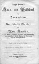 The title page of Bromme's publication (click to view larger image). |
|
|
During the early part of the 1800s, Europeans came to the United States in large numbers. One such person was Traugott Bromme. Bromme, born near Leipzig in 1802, came to the United States in 1821 where he studied medicine, subsequent to becoming a doctor in the “Columbian service.” Before returning to Germany, he served aboard a Columbian vessel in the West Indies and spent time in Haiti.1 During his travels he surely faced many of the problems encountered by immigrants in a new land. Many immigrants to America arrived with no prospect of a job and unable to speak English, the dominant language. Many of these people, looking for a new start in life, were Germans.2 In order to supply the information that would aid these people to know what to expect, Bromme wrote a travel guide for German emigrants. This book was popular, going through at least five editions by the year 1848, and it was entitled Hand- und Reisebuch für Auswanderer nach den Vereinigten Staaten von Nord-Amerika, Texas, Ober- und Unter-Canada, Neu-Braunschweig, Neu-Schottland, Santo Thomas in Guatemala und den Mosquitoküsten [Hand- and Travel-Book for Emigrants to the United States of North America, Texas, Upper and Lower Canada, New Brunswick, Nova Scotia, Saint Thomas in Guatemala, and the Mosquito Coast].3 Bromme’s travel guide indicates that he did substantial research on the various states within the United States, using the maps of Henry Schenck Tanner.4 The book has over 550 pages divided into two main parts. In the first part, Bromme gives a general overview of the United States, including a thumbnail sketch of most of the states, territories, or countries an emigrant was likely to enter in North America. He devotes more attention to those places most likely to benefit an immigrant—for example, Ohio, just over four pages—than those places he felt would be of less benefit—less than half a page to “The Territory of Missouri and the Oregon Territory,” where for “settlement, this recommendation comes still too early . . . in the two here-named Indian territories with the wild inhabitants of the same.”5 In the second part of his book, Bromme advises those who should and those who should not emigrate, during which he discusses some one hundred professions. Bromme cites his book “as the most crucial and accurate purveyor of information on the conditions of the western world, in so far as emigrants might be interested.”6 Bromme did not intend that all his books be used solely as guides. For example, in 1842 he published the second volume of his two-volume set, ůemälde von Nord-Amerika in allen Beziehungen von der Entdeckung an bis auf die neueste Zeit—Eine pittoreske Geographie für Alle, welche unterhaltende Belehrung suchen und ein Umfassendes Reise-Handbuch für Jene, welche in diesem Lande wander wollen úPortrait of North America in All Connections from the Discovery to the Most Recent Time—A Picturesque Geography for Everyone Who Seeks Entertaining Instruction and a Comprehensive Traveler’s Handbook for Anyone Who Wants to Travel in this Land]. As xs apparent in the title, these volumes were intended not only as travel guides, but as entertaining instruction as well. According to Joseph Sabin in his Bibliotheca Americana, Bromme produced at least twenty-three titles, some multiple volumes, and some as supplements to the works of others, such as those of Alexander von Humboldt.7 But whatever his intent, his works concerned geography. Bromme’s spellings, errors, and omissions are left as they are in the original, so as not to intrude upon the original copy. However, at times punctuation and word organization have been changed in order to bring the text somewhat more in line with modern idiomatic English, as well as breaking the text into more paragraphs (only two in the original). Richard L. Bland |
||
|
Bromme's 1848 Guide to Ohio The flourishing state of Ohio lies between 38° 20' and 41° 58' north latitude and between 3° 32' and 7° 44' west longitude.8 It is bounded on the north by Michigan and Lake Erie, in the east by Pennsylvania, in the southeast by Virginia, in the south by Kentucky, and in the west by Indiana. From north to south it extends 204 miles, from east to west 210 miles, and embraces a area of 39,750 [square] miles or 25,440,000 acres. The form of the land is extremely varied. In the north it is nearly level, in the middle part are pleasant hills with many plains, and in the south and southeast is a highland, and in some places hills. The ground is generally excellent, and superior in the southwestern parts of the state. Stratified hills and depositional soil are prevalent. Large sandstone masses of the most recent formation stretch from Steubenville to the Scioto, and behind this river are large deposits of limestone. Toward the north the land is flat, swampy, and covered in part with fertile soil. The western grass plains (prairies)9 have their beginning in this state, and the fertile parts of the land are the river valleys (flat lands or bottom lands), where the westerly waters, stretching through a land of stratified hills, have deposited excellent soil. The climate is exceptionally varied, but in all temperate and healthy. The summer heat is moderate, and oppressive and unhealthy only in the river valleys and lowlands. The winter is mild. Spring and fall are very pleasant. The Ohio Valley is warmer than the remaining part of the land, and between the mouth of the Sandusky in Lake Erie and the confluence of the Scioto and Ohio there is a difference in climate of three weeks. The important rivers of the state are the Ohio, which forms the southeastern and southern border of the state, the Muskingum, Hockhocking, Scioto, Big and Little Miami, Maumee, St. Mary, Au Glaize, Sandusky, Huron, Vermillion, Black, Cuyohoga, Chagrine, Grand, Ashtabula, Conneaught, and Beaver. Fifty years ago a complete wilderness, Ohio is now one of the most cultivated states, and if great stretches of land still lie as wasteland or forest, few have indeed made such advancements in agriculture as this one. The chief cereals are wheat and corn. Rye, barley, oats, flax, and hemp are also cultivated in quantity, and in the Ohio Valley tobacco and even indigo and cotton. Vegetables and pot-herbs are grown everywhere. Fruit thrives well. Wild vines crown the hills and deliver sweet grapes, and in various places attempts at wine making have been made. The forests are colossal. In the damp river valleys, exposed to flooding, walnut trees, honey locust, elm, maple, and plane tree form the predominant types of trees. On the shores of the Ohio the white maple with magnificent foliage and the black willow alternate with one another and grant a splendid view. In the higher parts of the state tulip trees, white oak, and sugar maples are especially to be found. The forests are still very rich in game, particularly deer and all kinds of fur-bearing animals. The gray squirrels are truly a scourge in many years and do extraordinary damage to corn crops. Game birds are to be found in exceptional quantity, and the wild turkey is truly at home here. The rivers are everywhere full of fish, and the Ohio River especially with sturgeon, catfish, buffalo fish, pike, and trout. One can find turtles in quantity. The luxurious meadows and pastures of the land are excellent and support livestock breeding here exceptionally well, and cattle and hogs are led yearly to the public market in great herds. Mining is not yet pursued, and minerals, of which the land possesses a great variety, only bog iron, which is found on the Hockhocking, at Bush Creek, and in Adams, Columbiana, and some other counties, is worked in 72 furnaces and 19 forges. The value of land has risen remarkably in the cultivated regions. In the interior 2 to 6 dollars per acre is still sufficient for land. For agricultural land 10 to 30 dollars is paid. And on the Ohio and in the vicinity of larger cities the price has climbed to 80 and 120 dollars and more. Land here in trade is divided into 4 classes: flooding shore lands; highlands with walnut, hickory, ash, and maple; beech lands; and oak lands; the first is the most expensive, the last is let go the cheapest. Industry and trade have already made important strides: one counts 8 cotton manufacturers with 13,754 spindles, 130 wool manufacturers, 206 fulling mills, 9 weaving factories, 536 flour mills, 1,325 corn mills, 2,883 sawmills, 112 oil mills,10 2 gun powder mills, 14 paper mills, 812 tanneries, 99 potters, 390 distilleries, 59 breweries, 21 rope makers, and 159 book presses. Ship construction and the building of steam- and other boats employ many hands on the Ohio. The export trade is increasing, estimated at 1,500,000 dollars in 1845, and the chief products are: flour, pork, beef cattle, whiskey, peach brandy, beer, porter, potash, pearl ash, soap, candles, butter, cheese, hemp- and flax-yarn, walnut lumber, and hide works. Import consists of colonial products through New Orleans and manufactured wares through Baltimore and Philadelphia. The residents, whose number at present amounts to 2,610,560, among which are no slaves, but about 19,750 free coloreds, come from the eastern provinces, are for the most part immigrants from Scotland, Ireland, Germany, and Switzerland (Germans and Swiss alone number 587,000). They are an industrious, frugal, calm, religious race of people, live in groups or mixed, in the greatest compatibility, and still preserve with great preference the language and customs of their old fatherland, and are each and every one devoted and attached to their new one. The Germans enjoy here a good reputation, are considered honorable, industrious, and punctual citizens, have done much for the flourishing condition of the state, and are generally the richest and most respected farmers. There are about 4,000 Indians in the land. Each person who prays to a God has complete freedom of thought in this state and the undisturbed practice of his religion: Presbyterians, Methodists, and Baptists are incidentally the most numerous sects. For schools, the government has provided through relinquishment a 36th part of all land, but many places still lack an elementary school. There are already several establishments of higher learning in the state: Ohio University at Athens, Miami University at Oxford, Franklin College at New Athens, Western Reserve College at Hudson, Kenyon College at Gambier, Granville College at Granville, and colleges at Marietta, Oberlin, Cincinnati, and Woodward. Willoughby University at Willoughby is a medical institute. A Lutheran theological institution is in Columbus and two medical and one juridical school are in Cincinnati. One can count 73 academies, 5,186 elementary schools, and 218,609 students. The state has a large number of public works: the Ohio Canal, which stretches 307 miles from Cleveland on Lake Erie to Portsmouth on the Ohio, and has a navigable feeder of 14 miles to Zanesville, one of 10 miles to Columbus, one of 9 miles to Lancaster, and one of 50 miles to Athens. The Wahlholding branch is 23 miles long, the Eastport branch 4 miles long, and the Dresdner 2 miles long. The production costs of these great works, which will be completed in 8 years, ran to 5 million dollars. The Miami Canal, of 178 miles, stretches from Cincinnati to Defiance where it joins the Wabash and Erie Canals. The entire length from Cincinnati to Lake Erie amounts to 265 miles. The Warren Canal, a branch of the previous, stretches from Middletown 20 miles to Lebanon. The Sandy and Beaver Canal, which will stretch 76 miles from Bolivar, on the Ohio Canal, to the Ohio at the mouth of Little Beaver Creek, is still under construction. The Mahoning Canal, from Akron, on the Ohio Canal, to the Beaver River, stretches 88 miles, of which 8 miles are in Pennsylvania. There are the Milan Canal from Huron to Milan, of 3 miles, which steamboats can reach; the Mad River and Sandusky Railroad of 36 miles from Tiffin to Sandusky City; and the Ohio Railroad, which stretches 40 miles from Manhattan to Sandusky City. The law-giving power here rests on a general assembly, which has the power to appoint judicial and military authorities and consists of a senate, which is elected for two years, and the house of representatives, which is renewed yearly by the people. The executive power is in the hands of a governor, who fills his office for 2 years, and who has his seat in Columbus. Ohio is presently broken up into 79 counties, which are divided into townships and wards, and has important cities: Columbus, at 39° 57' north latitude, is the capitol of the state. It is on the east bank of the Scioto in a pleasant region, with 1 state house, 1 state prison, 5 churches, 1 academy, 2 banks, 1 institution for the deaf and mute, 1 for the blind, and 1 for the insane, 1 German Lutheran seminary, and 654 houses. The number of inhabitants is 8,408, who employ themselves with trade and industry. Cincinnati is the largest trade city in the state, is on the Ohio in a low, sometimes flooded, exposed region. It is already built, regularly laid out, has a spacious and business-like market place, and nice public buildings, among which it distinguishes itself advantageously with a courthouse, 43 churches, 4 market houses, 1 bazar, 1 theater, 2 colleges, 1 insane asylum, 2 museums, 7 banks, and 1 prison. It counts 4,694 houses and 58,236 inhabitants who maintain numerous manufactures and industries and a substantial trade between Pittsburg and New Orleans. The surroundings are extremely charming, food is inexpensive, and the land is rather high in price. Steubenville, on the Ohio, has 500 houses, 1 courthouse, 6 churches, 2 banks, and 5,953 inhabitants, several factories and manufacturies, and substantial trade by boat. Zanesville, on the Muskingum, over which two bridges cross here, has 483 houses and 4,766 inhabitants. Marietta, on the Ohio, is the first place in the state where Europeans settled. The city lies low at the mouth of the Muskingum and in part exposed to flooding. It counts 400 houses, 4 churches, 1 land office, 1 courthouse, 1 prison, 1 bank, 1 college, but now only 2,324 inhabitants, who employ themselves primarily with boat building, industry, and trade. There are also Galliopolis, on the Ohio, with 1,800 inhabitants; Portsmouth, at the mouth of the Big Scioto, with 4,500 inhabitants; Circleville, on the east bank of the Scioto, with 3,309 inhabitants; Dayton, at the mouth of the Mad in the Big Miami, with 6,947 inhabitants; Sandusky, on the bay by the same name in Lake Erie, with 4 churches, 1 academy, 310 houses, and 2,140 inhabitants; Cleveland, at the mouth of the Cuyahoga and the Ohio Canal in Lake Erie, with 1 courthouse, 8 churches, 2 banks, and with opposite-lying Ohio City, 10,650 inhabitants. It is a quickly blossoming city conducting trade and industry.
1 2 3 4 5 6 7 8 9 10 |
||