Ohio History Journal
THE INDIAN THOROUGHFARES OF OHIO.*
BY ARCHER BUTLER HULBERT.
History tells of two Ohios—the old
and the new. The old
Ohio was that portion of the American Hinterland drained by
the Ohio and Allegheny rivers which, together, formed la Belle
Riviere of New France. It included the territory between the
Alleghenies, the Mississippi and the great lakes, save as we ex-
cept the country of Illinois, which early in history became a ter-
ritory distinct by itself, as the meadow lands of Kan-ta-kee be-
came distinct later. As late as the Revolutionary war an English
map printed "Ohio" south, as well as north, of the Ohio river.'
Of this old Ohio (including the Illinois
country) only that
part which lay north of the Ohio river
contained a resident In-
dian population. That portion south of the river was the Korea
of the central west–the "dark and bloody" battle ground of
surrounding nations half a century before the white man gave
it that name.
North of the Ohio river, in the valleys
of the Alleghany,
Beaver, Muskingum, Scioto, Sandusky, Miami,
Maumee, Wa-
bash and Illinois, more white men knew the redman intimately
than perhaps anywhere in the United States in the eighteenth
century. This knowledge of the Indian in his own home-land
resulted in giving to the world a mass of material respecting
his country, customs and character. Among other things this
knowledge of the northern division of the old Ohio during the
Indian regime made it possible to map it, and some of these
maps are essentially correct.
The dismemberment of the great old
Ohio was rapid, and
in some instances spectacular. The extension
of Virginian do-
minion by George Rogers Clark and the evolution 'of the state
of Kentucky, and especially the passage of the great Ordinance
*Copyrighted 1900, by Archer Butler Hulbert.
1 Map with Pownall's "Middle British Colonies in North America 1776,"
(London, 1776).
(264)
Scroll
down to view The Muskingum Trail and proceed
to next page.
The Indian Thoroughfares of
Ohio. 265
which once and forever divided the
territory by the Ohio river
-all combined to narrow down
"Ohio," until now the present
imperial commonwealth is but the core of
the great empire once
embraced under its name.
This new Ohio, or the portion of the
northern division of
the old Ohio contained between the
Beaver and Miami rivers,
offers special inducements to prosecute
the study of the branch
of Indian archaeology herewith
presented, that of Indian thor-
oughfares. Perhaps the more important
conditions are not an-
swered better in any portion of the
continent than in what is
now the state of Ohio: it contained a
resident Indian popula-
tion; it was extensively visited during
Indian occupation by ex-
plorers, traders, spies, armies,
missionaries, surveyors and
geographers, who studied and knew the
land as it then was;
and, finally, a last and imperative
condition is answered, it is in
part a hilly country.
It is possible to believe that in the
earliest times the In-
dians travelled only on rivers and
lakes. When they turned in-
land we can be practically sure that
they found, ready-made and
deeply-worn, the very routes of travel
which have since borne
their name. For the beginning of the
history of roadmaking
in this central west, we must go back
two centuries, when the
buffalo, urged by his need of change of
climate, newer feeding
grounds and fresher salt licks, first
found his way through the
forests. Even if the first thoroughfares
were made by the mas-
todon and the moundbuilder, they first
came to white man's
knowledge as buffalo "traces,"
and later became Indian trails.1
1 A vivid description of the trails of
Darkest Africa as seen by Du
Chaillu and Stanley has come recently
from the pen of Julian Hawthorne
and may be interesting in this
connection:
"These trails, but two or three
feet in width, traverse the vast ex-
panse from one side to another; you walk
in them single-file; if you
step aside for a few rods, you may spend
the rest of your life trying to
find the route again. Around you on
every side are the gigantic columns
of the forest-trees; overhead, two
hundred feet aloft, their boughs and
dense foliage make a roof through which
no sunshine ever falls; all is
as nature made it, except that single
narrow thread of thoroughfare,
created by human footsteps, none can
tell how many thousand years ago.
For days, weeks, months, you follow such
trails, over thousands of miles;
266 Ohio Arch. and His. Society Publications.
In Kentucky, which we have already noted
as unoccupied by
resident Indians, the word
"trace" has come down from last
century rather than "trail,"
which is the word generally used by
the oldest inhabitants of Ohio.l
The routes of the plunging buffalo,
weighing a thousand
pounds and capable of covering two
hundred miles a day,
were well suited to the needs of the
Indian. One who
has any conception of the west as it was
a century and a half
ago, who can see the river valleys
filled with the immemorial
plunder of the river floods, can realize
that there was but one
practicable passage-way across the land
for either beast or man,
and that, on the summits of the hills.
Here on the hilltops,
mounting on the longest ascending
ridges, lay the tawny paths
of the buffalo and Indian. They were not
only highways, they
were the highest ways, and chosen
for the best of reasons:2
1. The hilltops offered the driest courses; from them
water was shed most quickly and least
damage was caused
by erosion.
2. The hilltops were windswept; the snow
of winter
and the leaves of summer were alike
driven away, leaving
little or nothing to block or obscure
the pathway.
3. The hilltops were coigns of vantage
for outlook
and signalling.
they were laid out without a compass, by
the unaided instinct of the savage;
but they bring you by the shortest route
from distant sea to sea." - Cos-
mopolitan, November 1899, p. 127.
1 The two great thoroughfares in
Kentucky were on buffalo traces.
Boone's road led to the Blue Grass
country where Lexington was built.
Logan's road left Boone's at Rockcastle
Creek and led to Crab Orchard,
Bardstown, Bullittt's Lick and
Louisville. - Speed's "Wilderness Road,"
p. 27.
2 In such a study as the present nothing
could be of more value than
the testimony offered by the Catholic
missionaries to New France during
the seventeenth and eighteenth
centuries. Citations will constantly be
made to this great volume of testimony,
sometimes as proof, sometimes
in contrast, but always to depict the
Indian custom and practice in refer-
ence to our subject. Our quotations will
be from "Jesuit Relations and
Allied Documents" edited by Mr. Reuben Gold Thwaites.
The great snow falls of Canada were not
experienced south of Lake
Erie. It is interesting to note the
effect of much snow on the use of
MAP
OF
INDIAN TRAILS ON WATERSHEDS.
[The evolution of our American highways
is described elsewhere.
And while noticing the fact that our
roads have been coming down hill
for a century, it is interesting to
recall that this is true of our civilization.
Our first towns were on the hilltops, as
well as our first roads, and like
the roads have come down into the
valleys. The need of the motive
power furnished by the streams led to
the building of mills in the val-
leys. About the mills sprang up small
settlements. The coming of the
railway era was the doom of thousands of
proud towns and villages, and
and the shrill scream of the locomotive
sounded the passing of the old
thoroughfares on the hills.
Another interesting matter comes up in
this conneection. After a
lecture by the author at Adebert
College, Cleveland, a well known Ohio
legislator and champion of good roads,
took exception to a state-
ment made that the first clearings and
farms were along the old high-
ways on the hilltops. There is much
evidence that the statement as made
was true, and it is an interesting
question for discussion. The question
refers to the first clearings and farms,
not the location of the first set-
tlements and towns. Several writers
speak of the early clearing of
the hilltops, De Hass, for instance, and
the burden of testimony of
the pioneers with whom I have talked is
that the first farms were on
the hills. In such a question there can
be no rule to hold true in all
cases, but there is a middle ground to
take, which, we believe, will in-
cline toward our original view of the matter.]
(267 )
268 Ohio Arch. and His. Society Publications.
The following chart gives the names, destinations
and routes
of the main Indian thoroughfares of
Ohio. Of a great number
of trails only a few became prominent. The establishment of
forts, as at Detroit and Pittsburg, and of trading stations,
ren-
dered certain trails especially
important.1 Of these the follow-
ing were well known:
Indian trails: "There was
everywhere 3 feet of snow; and no paths
had yet been made" (Jes. Rel.
and Doc. Vol. XII, p. 261). "We departed
therefore, on the 13th and reached home
very late at night, after con-
siderable trouble - for the paths were
only. about half a foot wide where
the snow would sustain one, and if you
turned ever so little to the right
or left you were in it half way up to
your thighs" (do. Vol. XV, p. 267).
It is quite evident from the records of
the Jesuit missionaries that
the trails of Canada were not of such
importance as routes of travel as
were those south of the lakes. The long
winters and deep snows rendered
them, for the greater part of the year
seemingly, well nigh impassible.
The rivers were the main routes of
travel and the missionaries call both
water and land routes "roads"
indiscriminately: "the whole length of
the road (from the Huron country to
Quebec) is full of rapids and
precipices." (Do. Vol. XXII, p.
307).
1 But the Indian trails had much to do
with the location of the forts
and trading stations. Detroit, Sandusky,
Pittsburg, Marietta and Cin-
cinnati were the earliest stragetic
points for the whites, for both trade
and war, and these were located in
naturally stragetic positions. But
for the location of the scores of inland
forts and trading houses the In-
dian thoroughfares must have been
responsible to a large degree; as we
shall see later they were responsible in
a measure for the distribution of
the early population.
|
The Indian Thoroughfares of Ohio. 269 |
|
|

|
270 Ohio Arch. and His. Society Publications. |
|
|

|
The Indian Thoroughfares of Ohio. 271 |
|
|

|
272 Ohio Arch. and His. Society Publications. |
|
|

|
The Indian Thoroughfares of Ohio. 273 |
|
|

274 Ohio Arch.
and His. Society Publications.
Advancing civilization has made the
valley and hillside blos-
som as the rose; the rivers are dredged until they look little
as they did in the old days; great
chasms have been hewn
through hill and mountain by the
railways--but the rough
summits of the hills are left much as
they were. And here on
the highlands, which were to the trade
and travel of the olden
time what our through trunk railways are
to us, one may still
follow the serpentine highways of the
buffalo and Indian with
as perfect assurance, in many cases, as
he may follow the rail-
way, turnpike or tow-path in the valley
below. The writer's
sources of information have been, then;
1: a bibliography cov-
ering the many narratives, diaries and
memoirs, and the works
written upon them, which have come down
to us from last cen-
tury; 2: Personal exploration and
interviews with many of that
race of pioneers who knew this west when
the Indian thorough-
fares were its main routes of travel.1
Compare any good geological or
topographical map of Ohio
with one of the old maps of last
century, Hutchin's, Heckewel-
der's or Evan's, and it will not be
difficult to determine, theo-
retically, the courses of the old
highways.2 Among the several
guiding principles one is of very great
help, and that, the general
rule that the trails kept faithfully on
the summit of the water-
sheds - for even what may be termed
valley trails, as distinct
from cross-country trails, kept well
away from the river courses,
often a mile or more back on the
highlands.3 Having once
de-
1 Among many the author owes a special
debt of thanks, greater or
less as the case may be, to the
following gentlemen: Rev. David Yant
of Bolivar; Mr. J. C. Zutavern of Zoar;
Mr. Obadiah Brokaw of Stock-
port; Bishop Van Vleck of Gnadenhutten;
Mr. F. C. Kinsey, Tus-
carawas Co.; Mr. John Hovey of Akron;
also J. Hope Sutor, Esq. of
Zanesville; and the Hon. R. M. Stimson
of Marietta.
2For early maps see Baldwin's "Early Maps of
Ohio and the West,"
tract twenty-five, Vol. 1. "Western
Reserve and Northern Ohio His-
torical Society Publications" (April, 1875). Also appended list of maps in
possession of same society.
3 Le Jeune wrote "The road to the
Savages' cabins was very bad; it
was necessary to ascend a very steep
mountain." (Jes. Rel. and Doc. Vol.
XI, p. 91). "Steep rugged hills
were to be clomb," wrote one who fol-
lowed Braddock's army through the
Alleghanies on the Indian road;
"headlong declivities to be
descended, down which the cannon and wagons
The Indian Thoroughfares of Ohio. 275
termined the course of a given trail it
is ordinarily an easy
task, by inquiring in the region through
which it passed, to
prove by living witnesses its actual
course. There is not an
Indian thoroughfare in Ohio which it is
not possible to identify,
in portions at least, by means of the
testimony of living men.
Trails (7), (2) and (4) are especially
interesting to locate, be-
cause they are cross-country trails and
follow so faithfully the
highland ranges. The author has never
attempted to follow
trail (6), but has as little doubt of
its being capable of easy
identification as of its former
existence.
It may be valuable to give a detailed
description of some
of the important trails, if only to show
what information it is
yet possible to obtain of them:
MONONGAHELA TRAIL (7).
(VIRGINIAN DIVISION.)
Left Old Chillicothe - met Muskingum
trail north of Stock-
port, Morgan Co., O.- left Muskingum
valley at Big Rock -
crossed Ohio river at Belpre, Washington
Co., O.- passed
Neal's Station (now Baltimore and Ohio
station Ewing's) to
Turtle Run - went north of Kanawha
Station - over Eaton's
Tunnel, B. & 0. R'y.- on Dry Ridge
northeast into Dodridge
Co., W. Va. - through Martin's woods -
north of Greenwood
to Center Station - east to West Union
tunnel ("No. 6" or
Gorham's) - thence to headwaters of
Middle Island creek - up
Middle Island creek to Tom's Fork--on
into Harrison county
to headwaters of Ten Mile creek - down
creek to Mononga-
hela river. The course of this trail was
described to the writer
by an old Virginian mountaineer who
lived near it and who
hunted upon it when it was what the
Baltimore and Ohio rail-
way is in this day to that rugged
country. The testimony of
Dr. Hildreth in his chapter on
"Carpenter's Bar" in "Pioneer
Sketches" proves the correctness of the description, so far as it
goes. The trail may be identified above
the tunnels mentioned,
or by striking south to Dry Ridge from
the station Petroleum
on the Baltimore and Ohio railway.
were lowered with blocks and
tackle." (Journal in "History of Brad-
dock's Expedition," p. 203).
276 Ohio Arch. and His.
Society Publications.
THE GREAT TRAIL (2).
The great trail from Fort Pitt to Detroit descended the Ohio
river from Fort Pitt to the mouth of the
Big Beaver - struck
northwest to headwaters of Yellow Creek
- passed north of New
Lisbon on highlands between headwaters
of Big Beaver streams
and Yellow Creek - came down into Big
Sandy valley- passed
near Bayard, Columbiana Co., Pekin (now
Minerva), Stark Co.,
Waynesburg and Sandyville, crossing
Nimishillen creek half mile
above Sandyville--crossed Muskingum (now
Tuscarawas) at
the "Crossing Place of the
Muskingum" at the new mouth of
Big Sandy - struck northwest, passing
through old Baptist bury-
ing ground one-half mile south of
Wooster-crossed the Killbuck
north of the bridge on the Ashland road
- westward near pre-
sent site of Reedsburg to the Indian
town, Mohican John's town
-thence northwest near the present
Castalia, Erie Co., to
Fort Sandusky on Sandusky Bay--thence by
River Raisin
and Detroit river to Fort Detroit. Two
living men, Mr. J. C.
Zutavern, of Zoar, and the venerable
Rev. David Yant, of Bol-
ivar, described the course of the Great
Trail from Fort Pitt to
the Muskingum to the writer without
contradictions. Mr. Zu-
tavern came to Ohio from Fort Pitt in
1819, but crossed the Ohio
river at Wellsville, Columbiana Co., met
the Great Trail near
Bayard and followed it thence to the
"Crossing Place of the
Muskingum" (Bolivar).
MUSKINGUM TRAIL (9).
[IN TUSCARAWAS COUNTY.]
Take for instance this, the Muskingum
trail, in Tuscarawas
county, to show how fully men yet living
may be able to de-
scribe the course of the old time
highway. The writer learns
that descending the Muskingum (now
Tuscarawas) on the west-
ern bank, it crossed Sugar Creek near
the present site of Canal
Dover - crossed Stone creek at its mouth
- crossed Old Town
creek at its mouth--thence on the
highland farms of A. W.
Patrick, A. Rupert, David Anderson, Elia
Mathias, Chas. Kin-
sey (who was the writer's guide), P. F.
Kinsey, Sweitzer heirs
- crossed Frye's creek - farms of B.
Gross and Wyant - fol-
MAP
OF
TUSCARAWAS COUNTY.
[The map of Tuscarawas County will show
that it may be possible
to map the whole State of Ohio if all
the ground were covered care-
fully. On the northern line is the
famous "Crossing Place of the
Muskingum," on the Great Trail from
Fort Pitt to Fort Detroit. This
ford is one of the most famous in the
west. Its exact site has been
pointed out to the writer by the
venerable David Yant. It was exactly
at the spot where the Big Sandy now
enters the Tuscarawas, having
broken from its ancient course and
reaching the river some distance
from the old time estuary. Half a mile
south of the site of the old
ford may be seen the site of Fort
Laurens, the first fort built in Ohio.
Colonel Boquet followed the Great Trail
from Fort Pitt, but turned
south after crossing the river,
following the route indicated toward the
Delaware capitol at Gosh-gos-hing
(Coshocton). The river trail (Mus-
kingum) came down the river and
illustrates what has been said con-
cerning river trails keeping away from
the river itself in order to follow
the most practicable course. The author
has also mapped this trail by
townships, showing its course through
each farm. Every inch of this
county is worthy of the most searching
investigation. Near the old-
time highway lies the dust of the heroic
Zeisberger. From it are seen the
quiet hamlets of Gnadenhutten and
Shoenbrunn, and the rise of ground
which marks the site of Fort Laurens. It
is the most historic of all our
interior counties, indeed, with the
exception of Washington, the most
historic county in the State.]
(277)
278
Ohio Arch. and His. Society Publications.
lowed Tuscarawas to site of Moravian
town, Salem (now Port
Washington) - thence turned westward
onto hills toward Chili,
Coshocton county.
MONONGAHELA TRAIL (7).
(OHIO DIVISION.)
Crossed Fairfield and Perry counties
coming from the Scioto
valley - descended Wolf creek in Morgan
county to Mills Hall
farm--thence over the highland and down
ridge thirty rods
east of Eve's schoolhouse - Little Wolf
creek on farm formerly
owned by Jeremiah Stevens on old Harmar
and Lancaster
road -
thence over ridge to William Pickett farm
on branch of
Bald Eagle creek--down creek to hills
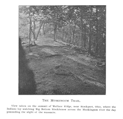
behind Stockport--
thence onto Wallace Ridge between
Stockport and Roxbury
stations of the Zanesville and Ohio
River R'y. (where picture
was taken as shown in frontispiece,
opposite site of Big Bottom
Blockhouse) - left Muskingum at Big
Rock, one-half mile above
railway station Luke Chute - crossed
over the ridge and crossed
the west branch of Wolf Creek at the
mouth of Turkey Run -
through farm of George Conner--through
Quigley flats--
crossed south branch of Wolf creek about
two miles above its
junction with the west branch-thence due
southeast on high-
lands to a point opposite the mouth of
the Little Kanawha--
thence to Monongahela as described under
Virginian division
The historical side of our subject is
capable of indefinite
expansion. The Indian trails of the old
Ohio were the keys
to the central west. They opened a way
for men to come
to know and exploit it. The story of the
first adventurers who
followed these trails beyond "the
Great Mountains" is of in-
tense interest. To Walker and Boone and
Gist and Washing-
ton, men who lived on and beside the
winding trails of the
west, we owe our first knowledge of the
land and the first en-
deavors to awaken a desire to reclaim it
from savage hands.1
1 In "Extracts from 'An Analysis of a General Map of the Middle
British Colonies'" in Darlington's "Journals of Cristopher
Gist" (p.
271), we find this tribute to the trader
in informing the world of the
West: "The Map of Ohio, and its
Branches, as well as the Passes through
HECKEWELDER'S MANUSCRIPT MAP.

|
It is unnecessary to state who John Heckewelder was or why the map from his pen is of great value and interest. Several trails are here given. which are not to be found on any other maps; the branching trail from the Mahoning to Great Trail, and the Lake Shore Trail; also the trail from the Crossing Place of the Muskingum to the Portage Path in Sum- mit County. No map gives the trail up the Walhounding and Vernon rivers, which was travelled by a portion of the Moravian pilgrims when driven from the Muskingum. It would be expected that Heckewelder would give it, but he does not.] (279) |
280 Ohio Arch. and His. Society Publications.
Christopher Gist employed trails 2,1 12,
11, 1, and 14, while
exploring the west for the first Ohio
Company. George Wash-
ington knew every mile of Nemacolin's
Path from Fort Cum-
berland, Md., to the "Forks of the
Ohio." In his mission to
Fort la Boeuf he traversed No. 13 from
the present site of Pitts-
burg.
In addition to the explorers and spies,
the brave mission-
aries came westward on the Indian
trails. In some instances
they were the first white
men to travel certain trails.
"Why does the pale-face travel so
unknown a road," called an
old Seneca chieftain from the door of
his lodge to the heroic
Zeisberger, pushing westward, "this
is no road for white people
and no white man has come this trail
before." One of the
most interesting maps made of early Ohio
is in the handwriting
of John Heckewelder, so long a faithful
Moravian missionary
in the Muskingum valley. This gives
several trails not given
on other maps. The knowledge gained by
the first mission-
aries to the central west of the Indian
nations and the geog-
raphy of the land, was often of greatest
value to the United
States in peace and in war. The men who
came into the cen-
tral west in the hope of Christianizing
the redman were fit suc-
cessors to the brave "black
robes" of the St. Lawrence and
Huron country, whose heroism stands
unparalleled in the an-
nals of missionary endeavor.
If the Indian trails were useful to
explorers in the west,
they were indispensable to the first
armies. Single men could,
in time, push their way through pathless
forests. For bodies
of men hastening to a certain goal,
carrying on their backs a
limited supply of food, this was out of
the question. Conse-
quently, when the Indian thoroughfares
of the west are once
the Mountains Westward, is laid down by
the Information of Traders
and others, who have resided there, and
travelled them for many years
together."
1 Monday (Nov.) 26 (1750); "From
this Place (Logg's Town) We
left the River Ohio to the S E &
travelled across the Country." (Gist's
Journals, p. 35). Mr. Gist on this trail- 2 - gave his courses "N 45
W 10 M, & N 45 W 8 M,"
which Mr. Darlington corrected to "W 8 M and
N 45 W 6 M. Do., p. 36.)
The Indian Thoroughfares of Ohio. 281
outlined, an interesting introduction to
the "winning of the
west" is gained. These routes show
at once the availability
of certain rivers as highways for the
transportation of troops and
supplies; they show at a glance the
strategic military points,
where, in many cases, fort or stockade
arose; and they indi-
cate the distribution and the centers of
Indian population. The
rivers, save the Ohio, ran north and
south. The Indian trails
ran, largely, east and west. The
conquest was westward; and
it is to be noted that it was made river
valley by river valley
until at last the conquest, begun on the
Monongahela and little
Bushy Run, was ended in triumph at
Tippecanoe on the Wa-
bash. First the Alleghany and
Monongahela rivers were re-
claimed and held by Boquet, who avenged
Braddock's Ford at
Bushy Run (1762). In the year following
Boquet advanced to
the Muskingum, where he firmly brought
the Delaware and
Shawanese contingent of Pontiac's host
to terms. A decade later
Lewis won the decisive battle of Point
Pleasant at the mouth
of the Great Kanawha and secured all the
benefits for Ken-
tucky settlers formerly granted by the
Stanwix treaty, but
which had been repudiated by the
arrogant Shanwanese of the
Scioto Valley. Half a decade later
General McIntosh pushed
through to the Muskingum and built Fort
Laurens "to serve
as a bridle upon the savages in the
heart of their own coun-
try" (1778). At this time we may
consider the Muskingum
valley to have been reclaimed, for the
next step westward was
Crawford's campaign directed toward the
Sandusky valley. It
resulted in failure, but the conquest of
the Scioto and San-
dusky valleys was achieved by the
Kentuckians in the border
wars waged from 1780 to 1785. Another
determined step was
made in 1790 and was toward the Maumee and Wabash, which
were finally reclaimed by the treaty of
Greenville, wrung by
Wayne from the disconcerted allied
nations under Little Tur-
tle in 1795. Thus the conquest of the
central west was by
river valleys, on Indian trails. For, to
restate the story of this
conquest in the terms suggested by our
present study, we should
say: The first military movement in the
central west was the
building of the French military road
from Presqu'ile to Fort
La Boeuf, on French Creek, in 1753. This
road was twenty
282 Ohio
Arch. and His. Society Publications.
miles in length and followed the
alignment of the Venango
trail, or 13. This road was used in
bringing forward the for-
tification for the line of French forts between
Lake Erie and
the Ohio river.1
Two years later Braddock was sent
westward to capture
Fort Duquesne.
His advance corps of six hundred choppers
cleared the way for the army following Nemacolin's Path, at
least as far as the present site of Upiontown, Pa.,
whence
the road swung northward to the memorable ford.2 In 1762
Boquet was sent westward from
Philadelphia to annihilate Pon-
tiac's allies who were doggedly beleaguring
Fort Pitt. At
Bushy Run, in a terrible three days'
battle, he confirmed the dying
Braddock's words, "We shall do
better next time," and soon after
raised the siege of Fort Pitt. In the
year following, consequent
upon orders, Boquet began a further
westward conquest, across
the Ohio river. His was the first military expedition into the
present state of Ohio, and it followed
the course of the Great Trail
from
Fort Pitt to the "Crossing Place of the Muskingum."3
In Dunmore's war Lewis was sent over the
Sandusky-Rich-
mond trail from Virginia to compel the
Shawnese to acknow-
ledge the Fort Stanwix treaty. In 1778 General McIntosh was
sent with an expedition toward Detroit.
He built a road straight
1 Hist. Erie Co. Penn.
2 "The
truth is, that Sir John (St. Clair) implicitly followed the
path that Nemacolin, a Delaware Indian,
had marked out or blazed for
the Ohio Company some years before, and
which, a very little widened,
had served the transient purposes of
that association and of Washing-
ton's party in 1754." Journals in "History
of Braddock's Expedition," p.
200. Of Braddock's battlefield we read
in the same volume (p. 355), "The
place of action was covered with large
trees, and much underbrush upon
the left, without any opening but the
road, which was about twelve foot
wide." Warfare along the trails of
Canada is often noted by the Jesuit
missionaries: "These murders are
imputed to the enemies who throughout
the summer and autumn are in ambushes
along the roads." (Jes. Rel. and
Doc. Vol. XX. p. 75); "As for the war their (Huron)
losses have been
greater than their enemies; for the
whole matter consisting of a few
broken heads along the highways"
(do. XIX, p. 81). Also see "Sketches
*of Pioneer History, pp. 205, 206.
3 See map accompanying "Boquets
Expedition Against the Ohio In-
dians," pp. 149-152.
MAP
OF
WAYNE'S ROUTE ALONG THE MAUMEE.
[This map is a copy from the original by
Dr. Belknap, now in the
library at Harvard, and the only map of
Wayne's campaign. It is to be
regretted that it does not comprehend
the army's entire route from Fort
Washington (Cincinnati). It will be
noticed that the Miami Trail de-
scending the Auglaize is given, also
diverging paths from Fort Wayne,
by which General Wayne came from the
south. From Fort Wayne
a dotted line is given as the route of
the portage path, between the
Maumee and Wabash. This portage path was
one of the most import-
ant in the northern half of the old
Ohio, being one of the original
French routes from the lakes to the
Mississippi. The course of the
path is today practically the route of
the Wabash Railway. In many
instances the old routes of travel,
which followed the path of least re-
sistance, have become the route of
railway beds today.1 This is true
here; it is also true of the Chesapeake
& Ohio Railway, through the
passes in the Allegheny Mountains, which
followed the portage path.
between the New and Great Kanawha
rivers.]
1 Ohio in 1788 p. 75; Howe
II, 831.
(283)
284 Ohio Arch. and His. Society
Publications.
west from
Fort Pitt to the Ohio, built Fort McIntosh at the
mouth of
Beaver river, and then marched over the Great Trail
to the
"Crossing Place of the Muskingum" where Fort Laurens
was erected,
"in the heart of the enemies' country." Although
he intended
to avoid all Indian trails,l Colonel Crawford's ill-
starred
expedition did follow an Indian trail even before reach-
ing the
Muskingum;2 and, later, the battle was fought in the
forks of the
two trails and the retreat was conducted along a
trail3 to
the Muskingum and "Williamson's trace"4 from the Mus-
kingum to the
Ohio.
In 1790
Harmar was sent northward, building his road
from Fort
Washington (Cincinnati) to Fort Jefferson on
the general alignment, probably, of a northward
trail.
St. Clair was
annihilated in attempting to retrieve Har-
mar's
mistakes, but the wily Wayne pushed on, now by
Indian trail,
now through pathless swamps (meriting the name
given him by
the savages, "Black Snake"5) and settled forever
the question
of white man's conquest at Fallen Timbers. Dr.
Belknap's
map, appended, is not only valuable in giving Wayne's
route, but
also for giving the general course of the diverging
trails from
Maumee southward. A chart giving Indian trails
with their
use to the armies which completed the conquest of
Ohio from the
savages may be in place:
1Letter of
Rose to Irving 13th June, 1782 (In State Department,
Washington).
Cf. Crawford's Campaign against Sandusky, p. 138.
2 Do., p. 202.
3 Do., p.
221.
4A blazed
trace from Ohio river, Mingo Bottom, straight west to
Muskingum
river. Followed by Williamson's band of murderers who
committed the
Gnadenhutten outrage.
5 Wayne built
Fort Recovery on St. Clair's battlefield, June 1794. To
deceive
Little Turtle he then turned west to St. Mary's River and built
Fort Adams.
In July, he doubled his track and built Fort Defiance at the
confluence of
the Auglaize and Maumee.
The Indian
Thoroughfares of Ohio. 285
Trails Military Roads Remarks
Venango
(13) French road Ft. Presq'- Furnished
armament and sup-
isle-Ft.
LeBoeuf (1753) plies for French forts
in Ohio.
Nemacolin's Braddock's Road (1755) Departed from path
near pres-
Path (See 2) ent
Uniontown, Pa.
Great Trail
(2) Boquet's Road (1763) Expedition ended
Pontiac's
war in Ohio.
Sandusky- Lewis' route to Point
Expedition secured freedom
Richmond (10) Pleasant for Kentucky settlers.
Great Trail
(2) Mclntosh's route to
Expedition erected Forts Lau-
Muskingum rens
and McIntosh.
Miami (5)
(?) Harmar's Road N. from Opened
way for Wayne.
Ft.
Washington
Ft. Miami
(1) Wayne's route to Fallen Resulted in
Treaty of Green-
Timbers ville and peace.
Mingo
(6) "Federal Trail" 1
After spies,
explorers, missionaries and armies came
the deluge -
of pioneers. History furnishes no parallel to this
instantaneous
filling of an imperial domain with a free popula-
tion,
achieving almost on the instant of occupation a large mea-
sure of the
blessings of liberty. The population of Kentucky
increased 300
per cent. in a decade and Ohio and Indiana al-
most equalled
this. Thousands of immigrants to Kentucky
and Ohio came
by the Ohio river, after compassing the diffi-
cult journey
over Braddock's Road. But more came by land
1 History of Morgan County, p. 126.
286 Ohio Arch. and His. Society Publications.
over Warrior's Path through Cumberland
Gap.1 This was the
second most famous continental
thoroughfare, being somewhat
lessened in importance by the building
of the National Road
over Braddock's Road and through Ohio to
Kentucky. But
the Cumberland Gap route never lost its
importance and offers
to-day, perhaps more than any road in
the central west,
a journey of surpassing interest to the
tourist who dares under-
take it. The route early became known as
the "Wilderness Road."
It was marked out by the sturdy hand of
Daniel Boone. In
1775 the Transylvania Company, with
Colonel Richard Hen-
derson as head, engaged Boone to mark
out a road from Fort
Wataga, on a branch of the Holston, to
the Kentucky river,
where the company's newly-purchased
lands lay. "This I ac-
cepted," wrote Boone, "and
undertook to mark out a road in
the best passage through the wilderness
to Kentucky with such
assistance as I thought necessary to
employ for such an im-
portant undertaking."2 Boone's road
went through Cumber-
land Gap over the course of the
"Warrior's Path," but at some
distance from the gap left the Indian
trail and followed a buffalo
trace toward the desired destination,
the mouth of Otter creek
on the Kentucky river. Here Fort
Boonesborough was erected.
As clearly shown by Mr. Speed in his
most valuable mono-
1 Two publications, one a monograph and
the other a magazine article,
comprise all the previous work in the
study of old highways so far
as the author knows. The monogram,
Speed's "Wilderness Road" is
one, and R. G. Thwaite's article in the New
England Magazine (Novem-
ber 1896) on Braddock's Road is the
other. To the Wilderness Road
the author owes a great debt for
information and inspiration. On Mr.
Speed's authority we make the startling
assertion above; "Wilderness
Road," pp. 11, 22, 23 and 42.
Among the many references in many books
to Indian trails the
author cannot refrain from quoting one
which is out of the ordinary.
It is from Douglass' History of Wayne
Co. O., p. 166: "These brigands
and vagrants, no doubt like other birds
of passage, had their chosen
and well understood courses of travel,
but to assume to trace or define
them would be playing spendthrift with
time and a culpable distortion
of the legitimate bent of investigation.
Nor is it important to indulge
what must be bald fancy and gratuitous
speculation on a matter so sterile
of historical uses and so profitless to
the public."
2 Boone's
Autobiography; also Wilderness Road, pp. 25, 26.
The Indian Thoroughfares of Ohio. 287
graph, Boone's route became a momentous
factor in the early
history of Kentucky. To be sure the Ohio
river was the great
highway thither, but it was not until
near the beginning of this
century that that river became the
customary route, for pre-
vious to that time river traveling was
exceedingly dangerous
and boat building and the hazardous
risks to be encountered
in sailing decided many thousands to
undertake the longer but
surer land route over the
"Wilderness Road." When, however,
the National Road was built from
Cumberland to the Ohio river,
1823,
and shipping facilities were available,
the Wilderness Road
became, comparatively, forgotten. Yet it
had been used long
enough to influence decidedly the
distribution of population in
the southern half of the old Ohio,
tomahawk claims along its
course becoming thriving villages,
villages becoming cities and
the meadow lands at its destination
becoming the home of the har-
diest race of men, according to the most
ingenious of our scholars,
in all our republic.
But not only did the great continental
routes, Braddock's
Road and the Wilderness Road, serve the
pioneer; the maze
of minor trails leading into every
portion of the land invited
him onward into the perennial twilight
of the woods. It is a
fair question, and introduces an
interesting theme, to ask, "What
proportion of Ohio's early interior
population made its way by
water and what proportion by land routes
?"
The testimony of all with whom the
writer has conversed and
who knew whereof they spoke, renders it
possible to believe that
the more careful the investigation the
clearlier it will be proved
that the Indian trails and not the
rivers were the routes of
the early settlers into the
interior. The following sentence
from one of the histories of an interior
(but on a navigable
river) county is pertinent: "James Oglesby was a very
early settler in the township, some say
the earliest. He also
came from Virginia and is said to have
travelled up the
Muskingum and Walhounding rivers, in
true Indian style,
in a canoe."1 This
occurs in a twenty-five page account of
the early settlements in the county, and
of few settlers is it
1 Hunt's
Historical Collections of Coshocton County, p. 37.
288 Ohio Arch. and
His. Society Publications.
suggested that they came by a water
route. In this connec-
tion, however, it is well to remember
that the very vanguard of
the pioneer host did not usually settle
anywhere permanently.
There was a familiar expression,
"following the emigration,"
which reveals the adventurous spirit of
the times. Pioneers came
and settled in what was an unbroken
wilderness. In a few years
the district began to fill and the first
comers would pull up stakes
and advance westward another stage. Thus
the first settlers in
any given district of Ohio and Indiana
often hailed from only a
short distance away, and it is not
possible to believe that they came
by a long, difficult water-route. This was usually the case,
with notable exceptions of course, and
quite precludes the argu-
ment that water routes were chosen by
the first of the emigrant
army. And those who came in the wake of
others who had "fol-
lowed the emigration," came by the
same routes.
An interesting proof of the use made of
Indian trails by the
white man is found in the blazed trees
which line them. There is
not an important trail in Ohio which is
not blazed, and it is
wellknown that the redmen were not in
the habit of blazing
their trails.1 The writer has been over Indian trails
in other
parts of the country (Northern Michigan
and Canada) where
the trees were not blazed. Why the white
man found it neces-
sary to blaze the well worn paths along
their whole extent, and
in spots where there was not the
remotest possibility of one's
losing his way, does not appear to the
writer. But such is the
case, and upon the high summit of the
long ranges of hills one
may to-day see upon the aged tree trunks
savage gashes made
The author has been surprised to find
that it is the popular opinion
that Indians blazed their paths. To
those interested a study of the fol-
lowing references will prove that no
such custom existed among the
Indians: Jes. Rel. and Doc. Vol.
VII: 109; Vol. XIX: 45, 129. The
Wilderness Road, p. 15. The borderers of Kentucky were drawn into
the fatal battle of Blue Licks because
they followed headlong the route
of the wily Indians, who by blazing the
trees and leaving garments on
the ground made it seem that they were
in full retreat. These un-Indian
signs rendered Daniel Boone suspicious,
but his advice was unheeded
and a massacre was the result. For
similar incident see History of
the Maumee Valley, pp. 86 and 107; cf. History of Hamilton County, p.
221; History of Muskingum County, p.
67.
The Indian Thoroughfares of
Ohio. 289
not less than a century ago, as the
writer has ascertained by
a study of the blazes made in Washington
county on roads laid
out by the surveyors of the Ohio
Company, 1279-1800.
In one instance, on the Monongahela
trail on Wallace Ridge,
Morgan county, as one passes northward
along the ridge, a line of
blazed trees is found running from the
trail at right angles, to a
mass of rocks, distant about a hundred
yards, wherein a cave of-
fered a night's protection, or a spring,
no sign of which exists to-
day, may have refreshed the wayfarer.
Everyone from whom
information has been acquired testifies
that the Indian trails
were common blazed routes of travel for
the pioneers. The
Muskingum trail in Tuscarawas county has
every appearance
of having been carefully built. At one
place on a hillside the
embankment on the lower side is three
feet high and seem-
ingly as strong as ever. An old man
living on the line of this
trail affirmed that he could recall
early in the century, when
the trail was commonly used, and he
remembered with the vivid
recollections of youth the coming of the
travelling Punch and
Judy shows that way. Yet a study of the
records in the Re-
corder's office at the county seat, New
Philadelphia, fail to throw
any light on the subject, although the
record of road building
goes back to 1797. Mr. Zutavern, already
quoted, traversed the
old highway from Pittsburg to
Laurenceville, as the "Crossing
Place of the Muskingum" was known
early in the century, in
1819. He came over the roadway built
from Fort Pitt straight
west to the Ohio river by General
McIntosh, crossing the
Ohio at Wellsville and striking
northwest until the Great Trail
was met near Bayard. This was perhaps
the general route of
pioneer travel from Pittsburg to central
Ohio. It was then. in
1819, a rough, wide Indian
trail and unimproved. The trail from
Ft. Presqu 'ile to French Creek, the
line of Marin's military road
of 1753, became a notable thoroughfare
early in the century.
This "Watertown turnpike" was
really a portage path between
Lake Erie and the Alleghany. Over it
great quantities of salt
were forwarded by water to Pittsburg and
Louisville, and, in
return, glass and flour came up from the
Monongahela country
and bacon from Kentucky en route to the
east.1 Travellers
1 Egle's
History of Pennsylvania, p. 271.
Vol. VIII-19
290 Ohio Arch. and His. Society Publications.

|
leave record of the strange appearance of this old roadway. In the expectation of making it a military road in the European sense, the course had been grubbed by hauling out the stumps of the felled trees. Great cavities were left and never filled.1 However it served for hauling cannon toward Forts La Boeuf, Venango and Duquesne. Not only were the Indian trails used largely by the pio- neers, opening the way to a distribution of population over the face of the land, but they became the course of our first roads. The day of the ridge road is not long passed and in most in- stances the ridge road was only the trail of the buffalo, Indian and pioneer, widened and improved. The first road upon which Kentucky spent money was the old trail, blazed by Boone, through Cumberland Gap. The National Road from Cumber- land, Md., to Wheeling, W. Va., Zanesville, Ohio, Maysville, Ky., and Lexington, Ky., followed the famous Braddock Road, as already stated, at least as far as Uniontown, Pa. From Wheeling to Zanesville and on to the Ohio river again it fol- lowed Zane's trace, which did not, probably, follow an Indian trail2. The money behind this epoch-making enterprise made it possible to push this road straight through. While climbing a country road in West Virginia the writer noted the trees which were blazed by the first surveyors, the gashes of which are still yawning. As the road reached the summit it met and crossed the Monongahela trail, not far from the spot where Tecumseh's murderous banditti opened fire upon Nicholas Car- penter, Jesse Hughes and party, just as Carpenter began his morning devotions and was singing the old West End Baptist hymn, "Awake our souls, away our fears." At the junction of the two thoroughfares stands an aged tree. On the side toward the country road was the fresh, ugly blaze of the road sur- veyors. On the side toward the trail was the deep, partly- healed blaze of the Long Knives - two trade marks of the two centuries. In one instance the writer, while following the Mus- 1 History Erie County (Penn.) 2 But vide History of Muskingum County, p. 67, which affirms that Zane's trace ran nearly with a trail; perhaps general alignment of Mingo trail for a distance. |
MAP

|
OF PORTAGE PATH.
[No oldtime highway in Ohio is of more historic interest than the Portage Path in Summit County, at least in proportion to its length. It is probably one of the oldest highways in the west, having been the route of the buffaloes across the summit of the State. In later years it became the portage for the Indians from the lake country to the streams flowing south to the country of their enemies, the Creeks and Cherokees and Mobilians. It may have been traversed by La Salle on his trip to the Ohio, but he probably followed the Lake Chau- tauqua-Allegheny route. Some hold that he came through Ohio, and he argument, at least, suggests the importance of this portage path. It is said in the text that it is possible to know the exact course of this path for the entire distance of eight miles. Maps of Summit County are still to be seen bearing a faint line which marks its course. The author, after several visits, has become acquainted with the ground. From two men, Mr. John Hovey, of Akron, and Rev. David Yant, of Bolivar, he has obtained descriptions of the path in early days of this century. Merchandise from Cleveland was brought up the Cuyahoga river, over the portage and down the Tuscarawas to the inland set- tlements. Mr. Hovey remembers, particularly, the bewildering circuit- ousness of the trail as it came from the hills and approached the Cuya- hoga. In the city of Akron the writer found the original survey of this path, made in 1797 by Moses Warren. It is an interesting and highly amusing document. The length of the path was found to be eight miles, four chains and 55 links.] (291) |
292
Ohio Arch. and His. Society Publications.
kingum trail in Tuscarawas county, was
informed by an old
resident that if he continued a certain
number of miles he would
find himself in a good travelled road.
This proved to be true
- the old highway has never been closed
up and one may drive,
if on horseback, freely from the best of
county roads into the
old-time Indian highway without
hindrance, as shown in the ac-
companying photograph. The old Portage
Path between the
Tuscarawas and Cuyahoga rivers in Summit
county, was one
of the most important trails for its
length (eight miles) in the
state. Having been defined as a portion
of the western boundary
of the United States in the treaties of
Fort McIntosh (1785)
and Fort Harmar (1789), this narrow
trail became a signifi-
cant landmark. In studying this subject
the writer found that
all the surveys made east of this trail
were of a different kind
from those made on the western side at a
later date, and that
the course of this trail was indicated
much of the way by a
line fence. The course of this trail has
always been marked by
a faint line on the maps of Summit
county. A new road has
been building between these self-same
streams, and in August,
'98, it had crossed the old path seven
times in seven miles and
for some distances the two courses are
identical. Thus the
tripod has been as successful in finding
the path of least re-
sistance as was the instinct of the
buffalo! Another chart may
be useful in bringing out distinctly the
further historical de-
velopment of certain trails:
The Indian
Thoroughfares of Ohio. 293
Trails Military
Roads Public Roads
Nemacolin's
Path Braddock's
Road National Road as far as Union-
town, Pa.
Warriors'
Path Blazed by
Boone from Ft. Wa-
taga, Tenn.,
to Boonesboro,
Ky. (200
miles). Great pion-
eer route
through Cumber-
land Gap.
Venango French military road, General course of
Watertown
Lake Erie to
Alleghe- (Pa.) Pike.
ny River.
Miami (?) Harmar's Road north Old
"Hamilton" and "Eaton"
from Fort Washing- Roads.
ton
(Cincinnati)
Muskingum Possibly route of Broad- Public Road in
Tuscarawas
head's army in
Co- County in
early years of the
shocton
campaign. century.
Mahoning Early
traders' route from Pitts-
burg to
Detroit (by water
from
Cleveland) described by
Col. James
Hilman.
Portage
Paths Tuscarawas- Cuyahoga, Practically
route of present
0. road.1
Maumee-Wabash,
Ind. General
course of Wabash
Railway.
New-Kanawha,
W. Va. General course of Chesapeake
& Ohio
Railway.
Ft. Miami Wayne's route Road from Napoleon, Henry
County, down
Maumee prac-
tically
identical with Wayne's
route.
1 See Note on
map of Portage Path.
294 Ohio Arch. and His. Society Publications.
To one to whom such things appeal,
nothing in cabinet
or museum will create a more living
interest in our past than
to find one of the old-time
thoroughfares and walk upon it-
to see the valley and meadow from the
Indian's points of van-
tage. To one who is imaginative, the old
century comes back,
and trail and forest are peopled. Border
armies will hurry by
carrying weapons strange to our eyes and
dressed in fashions
not in vogue to-day. The stream of
immigrants will pass, the
hard lines of rough faces speaking of
the toil and suffering which
made our present civilization possible.
The subject, again, is
the more interesting because of the
sources of information which
one must consult, the narratives and
journals written in the
olden time and living witnesses, too
many of whom by far are
carrying to the grave each day precious
facts which can never
afterward be revealed. The field work
required, demanding no
great expense, is not without pleasure
and romance. It is safe
travelling the Indian trails to-day; the
poll tax once required on
the old highways by redskin highwaymen
is not collected in
these days. Not a lone Indian will be
found overlooking the
spot "where he used to be
born." Those who once pushed their
horses along historic Harmar Hill with
scalps dangling from
the manes, or went whooping down the
Mahoning and Scioto
or toyed with the gate of Wolf Creek
mill are now hunting
the souls of the moose and beaver in the
Land of the Souls,
"walking on the souls of their
snowshoes on the soul of the
snow." But they have left their
trails behind them-and
nothing else, perhaps, so interesting,
so pregnant with varied
memories, so rich in historical
suggestion.
"The ports ye shall not enter
The roads ye shall not tread
Go, make them with your living
And mark them with your dead."
And yet this has been our mission for a
century. We have
waited in heavy harness on
"fluttered folk and wild." We have
made our roads with our living and
marked them all the way
from Plymouth Rock to the Golden Gate
with our dead. In
more than one Ohio valley may be found
an Indian trail on
The Indian Thoroughfares of
Ohio. 295
the hilltop, a pioneer road winding
along hillside and on sum-
mit, and a good pike in the valley, well
built, scientifically
drained. Each type of road speaks of the
civilization which built
it and between these three faint lines
one may read the story of
the hard-earned century now passing
away.