Ohio History Journal
|
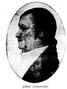
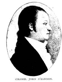
COLONEL JOHN O'BANNON. NELSON W. EVANS. It is and has been utterly impossible to fix, with absolute certainty the date, or place of the birth of Colonel John O'Bannon. It was not later than the year 1756, and may have been several |
|
|
years previous. The place, as near as can be determined, was called Neville, Virginia. John Presley and Morgan Neville, prominent officers in the Revolutionary War, were her kinsmen, and likely broth- ers. We are not certain as to her father's name. From the best information obtainable, we are led to the conclusion that the O'Bannon family was of prominence in Virginia, and that John O'Bannon had a fair education. Among his other acquirements, he learned the art of surveying. We find that on April 14th, 1784, Thomas Jefferson wrote him |
|
a letter on the subject of a military commission as Major. It was addressed to Captain John O'Bannon. It speaks of his men being in the field and of the expected resignation of Major Buckner. From the fact that Captain John O'Bannon is not found in Heit- man's Register, we infer that his service must have been in the state line. Mr. J. H. O'Bannon, public printer at Richmond, Va., is sure that the Captain addressed by Thomas Jefferson, April 14, 1781, is the same one we describe. We are unable to account for John O'Bannon between April 14, 1781, and April 1786. In that (319) |
320 Ohio Arch. and Hist.
Society Publications.
period he probably married. His wife was
a daughter of Minor
Wynne, of Loudon County, Virginia. In
April, 1786, he was in
Kentucky, and in an expedition against
Indians, composed of ten
persons. His party overtook the Indians
and fired upon them.
The Indians returned the fire and
wounded Col. W. Christain.
Alex Scott Bullitt and John O'Bannon
fired on the Indians, and
two of them fell. One Kelley, a member
of the party, approached
one of the fallen Indians, believing him
to be dead. The Indian
raised on his knees, fired on Kelley and
killed him. The Indian
then fell back and expired. Some time in
the summer of 1787,
John O'Bannon was appointed a Deputy
Surveyor of the Virginia
Military District of Ohio, by Col.
Richard C. Anderson, then at
Louisville, Kentucky. The Virginia
Military District of Ohio,
had been ceded by Virginia to the United
States, March 1, 1784,
but Congress did not open the District
to location until August
10, 1790. Notwithstanding this fact, John
O'Bannon began
making surveys in the District. The
first he made, or rather
which the record shows that he made was
No. 386, for Mace
Clements, which lies just east of
Ripley, on the Ohio River, and
was for 1,000 acres out of a 7,000 acre
warrant. The record
shows that on the same day he made a
survey for his relative,
John Neville, in Washington Township,
Clermont County, Ohio,
for 1,400 acres on Warrant 937 for
7,7772/3 acres. The record
shows that one John Williams was a chain
carrier on both sur-
veys, and that he chained around 2,400
acres in one day, and that
James Blair was a marker on both
surveys. When we reflect that
the locations were an absolute
wilderness at that time, and that
the parties might expect the crack of an
Indian rifle at any mo-
ment, we see the absolute impossibility
of these two surveys hav-
ing been made in one day. The records
show that John O'Ban-
non, Deputy Surveyor, continued to make
these surveys right
along until May 29, 1788, when he
stopped work.
In that time he had surveyed along the
Ohio River, between
the mouth of the Scioto and Little Miami
Rivers, 163,548 acres,
and that it was distributed among the
counties afterward formed,
as follows:
The Surveys from 1 to 386 had been made
in Indiana, op-
posite Louisville, Kentucky, and near
that vicinity. The record
Colonel John O'Bannon. 321
shows that on November 17, 1787,
John O'Bannon surveyed
5,000 acres of land; Survey 459, at the
mouth of Ohio Brush
Creek, on the right bank, for 1,000
acres; Survey 436 for 1,000
acres just above Vanceburg, Kentucky;
Survey 496 for 1,000
acres for Byrd Hendricks in Sprigg
Township, Adams County,
Ohio, and 1,000 acres for John McDowell,
in Liberty Township,
Adams County, Ohio; Survey 418 for 1,000
acres on Warrant
386, for James Page, embraces the site
of Ripley, Ohio.
Here were 5,000 acres purporting to be
surveyed in one
day and Sylvester Moroney was certified
as a chain carrier on
four of these surveys. When it is stated
the Survey 496 is just
above Maysville, Ky., and 386 opposite
Vanceburg, Ky., and
Survey 418 is at Ripley, Ohio, and when
we reflect that the en-
tire country north of the Ohio River was
then an unbroken wil-
derness, without a single settlement of
white men, we realize the
utter impracticability of 5,000 acres of
land between Vanceburg,
Kentucky, and Ripley, Ohio, being
surveyed in one day. 640
acres of land in one section is only one
mile square, but 1,000
acres on a warrant was a favorite number
to be entered by O'Ban-
non in the warrants he held. On November
19, 1787, he certi-
fies to have surveyed 3,600 acres, all
in Adams County, Ohio, in
three surveys, lying close together and
the same chain carriers
and markers are used to each of the
three surveys, which were
some seven miles back from the river. On
Christmas Day, 1787,
he surveyed 4,239 acres of land in seven
different surveys, in
Clermont County, Ohio.
Evan Shelby, father of Isaac Shelby,
afterwards Governor of
Kentucky, was put down as a marker in
four of the different
surveys. George Marshall was put down as
chain carrier in four
of these different surveys.
To think that anyone would survey on
Christmas Day is
bad enough, but to survey 4,239 acres of
land, over six square
miles in a wilderness in one day, is
more than human nature
could stand. But there is worse and more
to come. 839 acres
of these 4,239 acres were for the
immortal George Washington.
The latter had a warrant for 3,000 acres
of land, which could not
be located in the Virginia Military
District of Ohio, and yet
O'Bannon had it there and not only
located the 839 acres of it on
Vol. XIV.- 21.
322 Ohio Arch. and Hist.
Society Publications.
Christmas Day, but located the remainder
of it, 1,235 acres in
Miami Township, and 977 acres in Union
Township, Clermont
County. The one in Union Township lies
partly in Hamilton
County.
General Washington's Warrant was founded
on a certificate
issued to John Rootes, on December 7,
1763, by Lord Dunmore,
under proclamations in the name of King
George.
Washington, who was always around buying
claims, bought
this certificate, the basis of a land
warrant. On December 14,
1784, the House of Delegates of
Virginia, passed a resolution
that certificates of this class owned by
persons who purchased
them prior to May 1, 1779, and who
served in the Revolution
from May 1, 1779 to the close of the
war, could have them
changed into warrants, which could be
located on the lands re-
served by Virginia north of the Ohio
River. The Senate con-
curred in this resolution January 7,
1785, and on February 14,
1785,
Washington had his warrant issued to him
for 3,000 acres.
This he gave to Col. O'Bannon, who
located it in full and 51
more acres of another in the three
surveys, 1775, 1765, and 1650,
in Clermont and Hamilton Counties. This
warrant numbered
3,753, could not legally be located in
the Virginia Military Dis-
trict in the Northwest Territory.
The resolution of the Virginia
Legislature was passed after
the delivery of the deed of cession by
Virginia to the United
States, which was on March 1, 1784, and
the claim under this
warrant was not in the class of claims
for which the land was
reserved. The United States never
extended the class of bene-
ficiaries and hence this warrant could
not be legally located in the
Virginia Military District, which
afterwards became a part of
Ohio. Col. O'Bannon had located the Mayo
Carrington Survey
of 1,000 acres opposite Vanceburg,
Kentucky, on a state line war-
rant issued to one Edward Williams, and
which could not be lo-
cated in Virginia Military District of
Ohio. General Washing-
ton wrote in the year of his death as to
the ownership of these
3,000 acres. He said he had owned them
for 12 years,
and that
they were near Judge Symmes' grants, on
the opposite side of the
Miami River, in the neighborhood of
Cincinnati and Fort Wash-
|
Colonel John O'Bannon. 323 ington; that he had never seen them, but that the Surveyor had reported them valuable. By using the calendar, we find that some of these large sur- veys were made on Sunday. From January 7 to February 2, 1788, Col. O'Bannon did no surveying. From February 7 to April 1, 1788, he did no surveying, but on April 1, 1788, he began and continued busy till May 29, 1788, when he ceased operations. He made no more surveys in the Virginia Military District, in the |
|
|
Northwest Territory, till 1792, when he made one or more. Col. John O'Bannon had no right or authority whatever to make these 199 surveys. He was a trespasser in so do- ing. He never, in point of fact, made them himself, and it was physically impossible he should have done so. He, no doubt, had not less than six parties of surveyors, and they did the work. He certi- fied all the 199 surveys as Deputy Surveyor, and put down the names of the chain carriers and markers as oc- curred to him. O'Bannon claimed to have |
|
made these surveys under a law of Virginia, passed in October, 1783, which required the surveyor to actually run the lines and mark the corners. This law required chain carriers to be sworn. The Continental Congress, at its last session, became alarmed at this wholesale surveying of Col. O'Bannon, and, on July 17, 1788, passed a resolution declaring these surveys void, and this resolution remained in force until August 10, 1790, when the act, opening the district for location was passed, and the resolution repealed. The act of August 10, 1790 incidentally referred to these 199 locations as to be approved, but never directly confirmed them. However, most of them were afterwards patented. But |
324 Ohio Arch. and Hist.
Society Publications.
the business of locating in the Virginia
Military District of Ohio,
was stopped and not resumed again until
about December 1,
1792.
Some lawyers claim that the patents
issued on the 199 sur-
veys of O'Bannon are void because the
surveys were made with-
out authority of law and were expressly
declared void by the
resolution of Congress of July 17, 1788.
These lawyers claim the
Act of August 10, 1790, opening up the
district, did not confirm
these surveys, and that the latter being
void, the patents are void,
but if such were the case, the parties
could confirm their titles
by deeds from the Board of Trustees of
the Ohio State Univer-
sity, and in that case, the new title
would relate to March 14, 1868.
The Cincinnati Waterworks, east of the
Little Miami, is on one
of these O'Bannon surveys. In the
celebrated McArthur will
cases, which involved two or more of
these O'Bannon surveys,
the distinguished counsel on both sides
assumed that the patents
to these surveys were valid, and did not
raise any question as to
their validity.
As to the three Washington Surveys, they
were never sent to
the United States Land Office and never
patented. It seems they
were sent to the Virginia Land Office,
in Richmond, and grants
issued on them there. On May 20, 1806,
some one in the name
of Col. John Neville, who had died July
30, 1803,
made a survey
4,847, which completely covered the
Washington survey 1650,
in Pierce Township, Clermont County,
Ohio. On May 20, 1806,
some one in the name of the same John
Neville, covered Wash-
ington's Survey 1765, in Miami Township,
Clermont County, for
1,235 acres. On the same day, a survey
in the name of Major
Henry Massie, the founder of Portsmouth,
Ohio, was made,
overlying the whole of General
Washington's Survey 1775 for
977 acres in Union Township, Clermont
County, and Anderson
Township in Hamilton County. The Deputy
Surveyor who
made these three overlying surveys was
Joseph Kerr. Congress,
however, got alarmed at this kind of
business and on March 3,
1807, enacted the famous proviso, which
forbade the making of
any surveys over previous locations.
This famous proviso of
March 3, 1807, was construed in Jackson
vs. Clark, 1st Peters,
666, by the great Chief Justice
Marshall.
Colonel John O'Bannon. 325
No doubt Joseph Kerr, Deputy Surveyor,
knew that Wash-
ington's Warrant was not locatable in
the Virginia Military Dis-
trict of Ohio, and he took care to
locate them on Virginia Mili-
tary Continental Warrants, though two of
the surveys were made
in the name of a person who had been
dead over two years.
The value of a survey made in the name
of a dead man, I
leave to the lawyers. I have no
information as to whether the
overlying surveys 4847, 4848 and 4862
have ever been patented.
After the resolution of July 17, 1788,
Colonel John O'Bannon
returned to Woodford County, Kentucky,
where he became an
extensive land owner. The Virginia
Military District had rest
from any locations after his 199 surveys
till 1792.
In 1795, John
O'Bannon was trustee of the town of
Versailles, Kentucky. In
1808, he was sheriff of Woodford County,
Kentucky, and George
T. Cotton, his son-in-law, was his
deputy. He had two daugh-
ters, Elizabeth, who married George T.
Cotton, and Eliza, who
married a man named Bucham. In the
preparation of this ar-
ticle, I was unable to find any
descendants of the latter. George
T. Cotton, a son of Mrs. Elizabeth
Cotton, was a Lieutenant Col-
onel of the 6th Kentucky Regiment of
Infantry (Union), in the
Civil War, and was killed at the battle
of Shilo. The titles of John
O'Bannon, Major and Colonel, were
acquired after his location
in Kentucky. He made his will on January
7, 1810. He recites
that he is much afflicted with
rheumatism, but is of sound mind.
He was an extensive slave holder and
land holder. He devised
his wife seven slaves with his home
plantation, and his lot in
Versailles. He gave his daughter,
Elizabeth Cotton, a plantation
and five slaves by name. He gave his
daughter Eliza, 500 acres
of land in Hopkins County, and several
slaves. He devised lands
and slaves to his grandsons by the name
of Cotton. He gave his
brother, Presley O'Bannon, 1,000 acres
of land in Clermont
County, Ohio, a slave and a horse. He
gave a slave each to his
niece, Margaret O'Bannon and his nephew,
George O'Bannon.
He gave to his brother William, two
slaves and a plantation.
He was an extensive owner of horses,
cattle and live stock, and
disposed of them by will. He directed
certain of his slaves to
be hired out and the hire to be applied
in certain directions. His
residuary estate, after the death of his
wife, was to be sold and
326 Ohio Arch. and Hist.
Society Publications.
divided into eight parts, two parts to
his daughters and the other
parts to go to collateral relatives
named by him. He appointed
a committee of three friends, named in
his will, to decide all ques-
tions arising under that instrument,
without going to law. He
made Robert Alexander and his
son-in-law, George T. Cotton, his
executors. He departed this life
February 17, 1813, and his will
was probated at Woodford County Court,
in April, 1813.
Of his political or religious views, we
know nothing. He
evidently enjoyed the acquaintance and
respect of Jefferson and
Washington. He also had the complete
confidence of General
Richard Clough Anderson, who appointed
him a Deputy Sur-
veyor of the Virginia Military District,
in the North West Ter-
ritory. He was the only Deputy Surveyor
who made any sur-
veys in the District before it was
legally opened by Congress.
From the number of surveys made by him
in Hamilton and Cler-
mont Counties, it is apparent that he
operated with Fort Wash-
ington as a base, and none of his
surveys were made over five
miles back from the Ohio River, except
in Clermont or Hamilton
Counties. All were made in peril of
Indian attacks and no doubt
three or more parties of surveyors
traveled together. The lowest
number of surveys made by O'Bannon was
386, made at Ripley,
Ohio, and the highest number 1775, made
for General George
Washington. Of the 1190 numbers not
taken by O'Bannon, I
am unable to state where they were
located-a few of those num-
bers were taken in the district after
1792.
It seems a pity the way General
Washington's interests were
sacrificed after O'Bannon's surveys. His
own agents did not
know enough to return his surveys with
the Warrant to the Gen-
eral Land Office at Washington D. C. The
subsequent locators
appropriated his lands, and to add
insult to injury, Congress, on
March 3, 1899, outlawed his warrant, and
thus the Washington
estate lost that which at one time would
have realized $14,250.
The lands which were located under the
warrant were doubtless
worth at this time, with improvements,
not less than $300,000.
Washington's estate at the time of his
death was worth $500,000,
and had it been kept intact, its value
now would have been fabu-
lous.
|
Colonel John O'Bannon. 327 In ascertaining the facts set forth herein as to John O'Ban- non, I have pursued every lead to its source and have been baffled seemingly, at every point. The facts that I wished to know have receded into oblivion and cannot be brought to light. There was not a publication, in February, 1813, which had an obituary notice of John O'Bannon. There is no mention of him of any significance in any contemporary history. A man now in full life, has every opportunity to have his record preserved to posterity. If he is of the slightest importance, the Daily News- papers record his doing from day to day, but of John O'Bannon scarcely anything was preserved, except what the official records disclose. |
|
|