Ohio History Journal
|
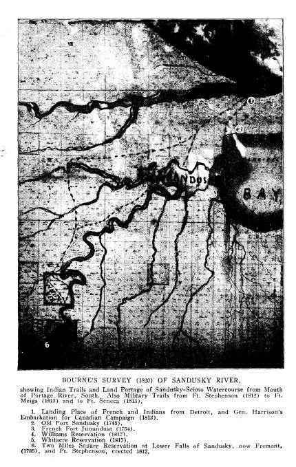
OLD FORT SANDOSKI OF 1745 AND THE "SANDUSKY COUNTRY."
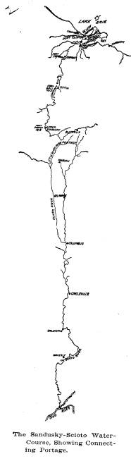
LUCY ELLIOT KEELER. My story will be confined to the sixteen miles which separate Fort Stephenson at the Lower Falls of the Sandusky river, (now Fremont), from the banks of Lake Erie, at the mouth of the Portage river, (Port Clinton), the point visited by all Indians and French in coming from or going to Detroit and the north- |
|
|
|
Ohio, in 1745; diagonally opposite to it the French Fort Junundat, built in 1754, where the first white child was born in Ohio, of French parentage; thence up the river twenty miles to the home of James Whitaker and Elizabeth Foulks Whitaker, his wife, the first permanent white settlers in Ohio, who were brought to the Sandusky country as prisoners by the Wyandots in 1774 and 1776 respectively, adopted as Indians and married at Detroit in (357) |
358 Ohio Arch. and Hist.
Society Publications.
1781, and immediately settled on what
has since been known as
the Whitaker Reservation; Fort
Stephenson, here in Fremont,
the place first brought into prominence
in American history by
the presence of the famous Revolutionary
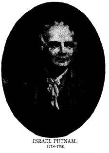
patriot, Israel Put-
nam, who commanded the Colonial troops
from Connecticut in
the Bradstreet expedition of 1764; the
place to which General
Washington sent Captain Brady to
ascertain the war-like inten-
tions of the Indians in 1780; where the
British established a tem-
porary fort in 1782 during the
Revolutionary war; where General
Wayne promised to build an American fort
in 1795 to protect
the friendly Indians against the
encroachments of the British
Indians; where finally the youthful
Major George Croghan on
the 2d of August, 1813, defeated the
combined forces of the
British under Proctor and the Indians
under Tecumseh in the
famous battle of Fort Stephenson; and to
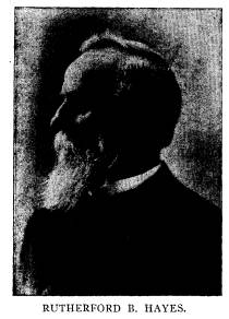
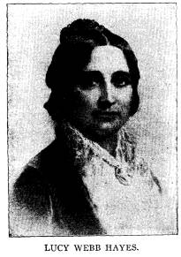
Spiegel Grove, the
home of Rutherford Birchard Hayes and
Lucy Webb Hayes, the
typical American home of the last half
of the 19th century. My
desire is to show how this Sandusky
country was one of the
great natural runways of the Indians in
their migrations between
the St. Lawrence and the Great Lakes, to
the Ohio and the
Mississippi Rivers; of the French, who
cannily imitated the In-
dian in his method of travel and
woodland life; of the English,
coming in from the east to possess the
land; and of the Ameri-
cans, in expelling the English from the
country.
The term Sandusky, in all military and
frontier history is
broadly used, having been applied by the
Indians not only to the
river but to the valley and the Indian
villages situated at the
upper and lower rapids (Upper and Lower
Sandusky), and the
bay, or "little lake." This
ubiquitous nomenclature has not
unnaturally led many persons of the
present day to suppose that
the flourishing neighboring city of
Sandusky was one of the vil-
lages bearing that name; whereas the
Sandusky city of today was
unknown until years after the War of
1812 and was called
Ogontz's Place, later Portland, and not
until a decade after
the glorious defence of Ft. Stephenson
(or "Sandusky" as the
name is inscribed on the gold medal
awarded to Croghan by
the Congress of the United States), was
the name "Sandusky
City" formally adopted by our
neighbor on the Lake.
|
Old Fort Sandoski of 1745. 359
The Sandusky country in Indian history possesses a peculiar charm and fascinating interest. During that period of years which fills western annals with the story of bloody conflict, the valley of the Sandusky river and the Indian village at the lower falls of the Sandusky, (now Fremont) were the home of the most powerful and war-like of the savage nations. Between the period of the old French war of 1755 and the war of 1812, this place presented the varied scenes of Indian life-primitive agri- culture, rude cabins, canoe building, amusements, the council |
|
|
|
federacy of four highly organized Huron tribes, doubtless the remnants, with additions, of Cartier's Indians who had been driven westward, dwelt in the vicinity of Lake Simcoe and Georg- ian Bay, and were known as Wendats. This term the English later corrupted to Wyandot, while the French continued to use the term Huron. In 1615 Champlain found all these northern tribes waging fierce war against the Iroquois tribes in New York. When the French established trading posts on the St. Law- rence the Hurons made annual trips to the posts, and in 1615 the Jesuits established a mission for them about fifty miles below |
|
360 Ohio Arch. and Hist. Society Publications.
Montreal. Father Sagard was the first historian of the mission, and is authority for the statement that the Hurons were in the habit of sending large war parties to ravage the country of the Iroquois. The hostility between them dated from prehistoric times, so that the invasion and destruction of the Huron country in 1648-50 by the Iroquois was but the final blow in a struggle of almost 100 years. The acquisition of firearms by the Iroquois from the Dutch while the Hurons had almost none, was an important factor in the success of the Iroquois. Hundreds of Hurons were carried captive to the Iroquois country; others escaped to their kindred the Neutrals and the Eries; and others |
|
|
|
Sandusky (Fremont) two fortified neutral towns, on opposite sides of the Sandusky river, which in the shape of earthworks were observed by the pioneer residents of Fremont. Major B. F. Stickney, for many years an Indian agent in this locality and familiar with its history and traditions, in a lecture in Toledo in 1845, speaking of these towns, said: "The Wyandots have given me this account of them. At a period of two and a half centuries ago all the Indians west of this point were at war with those east. Two walled towns were built near each other, inhabited by those of Wyandot origin. They assumed a neutral character. All of the west might enter the western city and all of the east the eastern. The inhabitants of one city might |
Old Fort Sandoski of 1745.
361
inform those of the other that war
parties were there; but who
they were or whence they came or
anything more must not be
mentioned."
Gen. Lewis Cass, in an address in 1829
before the Historical
society of Michigan, alluding to these
neutral towns, said: "During
the long and disastrous contest which
preceded and followed the
arrival of the Europeans, in which the
Iroquois contended for
victory, and their enemy for existence,
this little band preserved
the integrity of their tribe and the
sacred character of peace-
makers. All who met upon their threshold
met as friends. This
neutral nation was still in existence
when the French mission-
aries reached the upper lakes two
centuries ago. The details of
their history and of their character are
meagre and unsatisfactory,
and this is the more to be regretted as
such a sanctuary among
the barbarous tribes is not only a
singular institution but alto-
gether at variance with that reckless
spirit of cruelty with which
their wars are usually prosecuted."
Internal feuds arose, as the
tradition goes, and the villages were
destroyed.
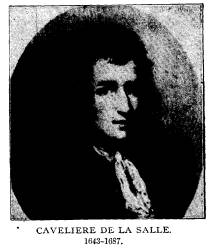
The first white explorer of all this
region was La Salle who
on Aug. 7, 1679, in his bark the
Griffin, sailed from Niagara out
on the surface of Lake Erie. With him
came Father Hennepin
who wrote that "the lake encloses
on its southern bank a tract
of land as large as the kingdom of
France." A map attached to
Hennepin's work, published in 1683,
shows Sandusky bay and
river drawn to an accurate angle with
the southern shore of Lake
Erie, from which it is evident that La
Salle entered Sandusky
bay and river.
Although Cadillac had founded Detroit
in 1701 it was not
until 1739 that we begin to gain a
little definite information about
events on the Sandusky. The war chief of
the Wyandot or Huron
tribe before mentioned, was one Orontony
or Nicolas, who
after being worsted in conflict with the
French near Detroit, had
removed his followers to the mouth of
Sandusky River. Nicolas
was a wily savage whose enmity was
greatly to be feared, and
he commanded men who formed an alert,
unscrupulous and pow-
erful body. The French having provoked
his bitter hatred, which
was fomented by English agents, he
conspired to destroy the
French not only at Detroit but at the
upper posts. In 1745
Old Fort Sandoski of 1745. 363
Nicolas had permitted the English to
erect a trading post or
blockhouse known as Ft. Sandoski at his
principal town on the
bay and to remain and dispose of their
stock. Notwithstanding
some discrepancy as to time, the
blockhouse which Nicolas per-
mitted the English traders to build was
probably the first of the
English forts, known as Fort Sandusky,
built on the portage
between the Sandusky river and Lake
Erie. By August, 1747,
the Iroquois of the west, the Hurons,
Ottawas, Miami, Sioux,
Shawnees and other tribes, to the number
of seventeen, had en-
tered into the conspiracy. Through the
treachery of a Huron
woman the plot was revealed to a Jesuit
priest who communi-
cated the information to Longueuil, the
French commandant at
Detroit, who in turn notified all the
other French posts, and
although a desultory warfare broke out
resulting in a number
of murders, there was no concerted
action. Nicolas finding that
he had been deserted by his allies, and
seeing the activity and
determination of the French not to
suffer English encroachments
on what they called French territory,
finally in April, 1748,
destroyed his villages and palisades at
(Fort) Sandusky and
removed with 119 warriors and their
families to White River
(Indiana). Not long after he withdrew to
the Illinois country
on the Ohio River, where he died in the
autumn of 1748. The
inflexible and determined conduct of Longueuil toward the
most of the conspiring tribes brought
the coalition to an end in
May, 1748.*
In 1739 Sieur de Noyelle wrote to the
Marquis de Beauharnais
that "the Hurons had all gathered
at Sandoske, although they had been
told that they have nothing to
fear."- Nevertheless "they were armed
like men who go to fight-bullets in
their mouths and in their guns-
and one Nicolas was their chief."
This is our first mention of the re-
doubtable warrior under whose protection
old Fort Sandusky was built.
These letters to and from Beauharnais
dwell upon Nicolas's zeal in pass-
ing about war belts among the various
tribes and his frequent treason
against the French. "As I fear lest
he may hatch something wrong,"
* Summarized from Handbook of the
Indians (Bureau Ethnology);
O'Callaghan's "Documents Relative
to the Colonial History of New
York," Vol. X, pp. 83-271; and
Winsor's "Narrative and Critical His-
tory of America." Vol. V. Knapp's
"History of the Maumee Valley"
and Sleeum's "History of the Maumee
River Basin" contain excellent
narratives of this conspiracy.
|
364 Ohio Arch. and Hist. Society Publications.
Beauharnais wrote, "I have sent out orders on all sides to inform me of what is going on." M. de Longueuil, commandant at Detroit noted in his daily reports, (Documents Relative to New France, vol. III), that on "on May 20 some Hurons from Detroit established now for some years at Sandoske, of the band of the war chief Nicolas, had killed five Frenchmen who were returning from White River, and had stolen their peltry; that the Indians thereabouts had formed a plan to destroy all the French at Detroit during the fete of Pentacost and then go to the fort and put all to fire and blood; that some Hurons had struck too soon, the plot has been disclosed by a Huron woman who came to warn M. de Longueuil. - Nicolas's band had continued to hold |
|
|
|
ceived. The scalps of the Frenchmen killed near the fort of the Miamis (now Ft. Wayne) have been carried there (Sandoske)." May 28, 1748. M. de Longueuil reports that a faithful Indian who had gone to gather up the Indians who had deserted from the village of Otsandoske (Nic- olas's village near the mouth of the river) reported that Nicolas with 119 warriors of his nation, women and children and baggage, after having burned the fort and the cabins of the village, had taken the route for White River.-Canadian Archives. Although Nicolas's career at Fort Sandusky was thus ended, the English traders did not give up the foothold they had gained. In 1749 La Jonquiere, governor of Canada, learned to his great indignation that several English traders had again reached the Sandusky and were "exerting a bad influence upon the Indians of |
|
Old Fort Sandoski of 1745. 365 that quarter." It was in 1749 also that Captain Pierre de Celoron* traversed Ohio with 300 men; buried leaden plates with the French arms thereon at the mouths of the rivers entering the Ohio from the north, claiming the whole country for France. He came north by the way of our sister river the Maumee. He told the Indians that the English traders would ruin them and drive them out of the country, and in this respect he told the truth. He was made |
|
|
|
side of the Sandusky bay or river. Gist, the land surveyor of the Ohio Company, under date of 1750 thus refers to Ft. San- dusky: "Two traders belonging to Mr. Croghan came into town and informed us that two of his people had been taken by 40, Frenchmen and 20 Indians, who carried them with 7 horse loads of skins to a new fort the French were building on one of the branches of Lake Erie." * Known also as Bienville de Celeron; but our spelling is copied from the "Jesuit Relations" (Burrows' Cleveland Edition) of Rev. Father Bonnecamps, who accompanied this Ohio expedition. |
366
Ohio Arch. and Hist. Society
Publications.
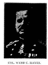
The location of Old Fort Sandoski, the
first fort built by
white men in Ohio, long a subject of
earnest research, was defi-
nitely settled by Col. Webb C. Haves, of
Fremont, and Mr.
Chas. W. Burrows, of Cleveland, by the
discovery, in 1906, of
the de Lery journals. Mr. Burrows' work
in publishing the "Jesuit
Relations" had familiarized him
with the richness of the Can-
adian archives, and at Colonel Hayes'
request he communicated
with the archivist of Laval University,
Quebec, and some clue
being found, Colonel Hayes and Mr.
Burrows at once visited
the Rev. Father A. F. Jones, S. J., of
St. Mary's College, Mon-
treal, and Abbe Gosselin, archivist of
Laval University at
Quebec, at which latter place the eight
de Lery Journals were
discovered. One of these journals, with
its numerous maps and
accompanying descriptions of the daily
journeyings and solar
observations, settles definitely the
exact location of old Fort San-
doski, the first fort built by white men
in Ohio, the location of
which has until now been in doubt even
among our foremost
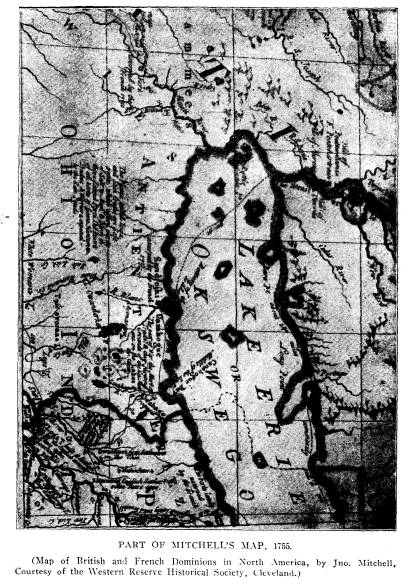
historians. The distinguished Col. Charles Whittlesey, long
president of the Western Reserve
Historical Society, in a Tract
published in 1873 on the forts at
Sandusky, had written:
"It is not easy to determine the
precise location of the early
French and English forts or trading
posts on Sandusky Bay.
The earliest map which has on it the
name of this bay is that of
Henry Popple, London, 1733, where it is
called 'Lake Sandoski.'
Indian traders from Pennsylvania were
there in 1748, but prob-
ably had not then a permanent post or
fort. On Mitchell's map,
London, 1755, and on that of Evans,
Philadelphia, same date, there
is a 'fort' laid down on the north side
of the bay near the mouth.
It is much more probable that this fort,
house or post was sit-
uated where the trail or portage path
came out on the bay, across
the neck from the Portage or Carrying
River, at Ottawa. The
English government had no fortifications
there at that time.
Mitchell states that the fort on the
north side, meaning post, was
'usurped by the French in 1751.' Fort
Junundat, on Evans' map,
is placed south of the bay and east of
Sandusky River, 'built in
1754.' This was a French establishment
for trade, perhaps with
|
Old Fort Sandoski of 1745 367 |
|
|
368 Ohio Arch. and Hist. Society
Publications.
a stockade for defence against the
English and their Indian
allies."*
*The late A. T. Goodman, for many years
secretary of the Western
Reserve Historical Society, in Tract No.
4. published Jan. 1871, has
the following references to Fort
Sandusky: "English traders first made
their appearance in the Ohio country in
1699-1700. From that time until
1745 we frequently hear of them at
various towns and stations. In 1745
they built a small fort or blockhouse
among the Hurons on the north
side of Sandusky Bay. In 1748 they were
driven off by a party of
French soldiers from Detroit. Prior to
1763 the English in Ohio were
very few in comparison to the
French."
In Tract No. 6, in "Papers Relating
to the First White Settlers
in Ohio," also by Mr. Goodman,
published in July 1871, occurs the fol-
lowing reference to Fort Sandusky.
"As early as the year 1745 English
traders penetrated as far as Sandusky,
or 'St. Dusky,' and established
a post on the north side of the bay near
the carrying place or portage
from the Portage river across the
peninsula. They were driven away
by the French probably in 1748
or 1749. During this period a celebrated
Indian trader from Pennsylvania, George
Croghan, had a station at or
near the mouth of the Cuyahoga, then
known as the Cayahaga, and
sometimes as Hioga."
Tract No. 25 is a 25-page description of
the early maps of America,
by Judge C. C. Baldwin for many years
Secretary of the Western Re-
serve Historical Society and later its
president. It was published in
April, 1875, and especially commands the
accuracy of the Evans' and
Mitchell's maps of 1755, and Pownall's
map of 1777. "Lewis Evans was
an American geographer and surveyor,
born about 1700 and died 1756.
He published a map of the Middle
Colonies in 1755 with an analysis.
The map itself is an epitome of history
and geography. It was engraved
by James Turner, and printed by B.
Franklin and D. Hall, in Philadel-
phia. It was dedicated to Gov. Pownall,
who in 1776 published a folio
with an enlarged analysis, but the same
map, in which the Governor
stood stoutly by his deceased friend
against other maps pirated. The
advance in local knowledge in this map
is large.--A map which was
repeatedly printed, much used and of
long authority was Mitchell's.
John Mitchell, M. D., F. R. S., came to
Virginia early in the 18th
century as a botanist. He lived long in
America and died in England
in 1768. His large and elaborate map has
a certificate from John Pownall,
secretary of the Board of Trade, and
brother of Governor Thomas
Pownall, that it was undertaken at his
request, composed from drafts,
charts, and actual surveys, transmitted
from the different Colonies by
the Governors thereof. This certificate
is dated July 1st, 1755. * **
This map was used by the commissioners
in making the treaty of peace in
1783, by which our country became a
nation."
Lewis Evans in the title page to his
"Geographical, Historical,
|
Old Fort Sandoski of 1745. 369 |
|
|
370 Ohio Arch. and Hist. Society Publications.
De Lery in his journal of 1754 refers to
Fort Junundat
when he mentions the fact of his having
discharged his rifle and
otherwise made futile attempts to
attract the attention of some
of the French traders on the opposite
side of the bay from the
ruins of Old Fort Sandusky; and later
speaks of Sieur Gouin,
a French trader who was settled opposite
in a blockhouse or
trading
post. Numerous authorities confirm
this, especially
Evans' map, published the next year,
1755, which locates "Fort
Junundat, built in 1754," as south
of the bay and east of the
river; and this fort Junundat must have
been the one near the
mouth of Pickerel Creek, now in Townsend
township, Sandusky
county; although the erosions of the
bank have caused it to
disappear. It was from this fort
Junundat that many of the
later Indian trails on the east side of
the Sandusky River started.
It is an interesting fact that the wife
of Sieur Gouin, re-
ferred to by de Lery, is mentioned nine
years later as having
early in May, 1763, seen the Ottawa
Indians filing off the ends
of their gun barrels evidently preparing
for the surprise and mas-
sacre of the Detroit garrison under
Gladwin by Pontiac.
In August, 1754, the Chevalier
Chaussegros de Lery, of
Quebec, a distinguished engineer of the
French army, was ordered
to accompany an expedition from Presq'isle (Erie) to Detroit
and Michillimacinac. The expedition started from Presqu'isle
(Erie) on the 30th of July, 1754,
and skirting along the southern
shore of Lake Erie, entered Sandusky
Bay, Sunday, August 4,
and made a portage across the peninsula
from the ruins of old
Fort "Sandoske on Lac
Sandoske," fifty-seven arpents or about
two miles across to the "great
lake," (Erie), to the present site
of Port Clinton.
Political, Philosophical and Mechanical
Essays, the first containing an
Analysis of a general Map of the Middle
British Colonies in America"
says: "Sandusky is a considerable
river abounding in level land, its
stream gentle all the way to its mouth
where it will receive considerable
slope. This river is an important pass
and the French have secured it
as such, the Northern Indians cross the
lake here from island to island,
land at Sandoski, and go by a quick path
to the lower Shawanese towns,
and thence to the gap of Onarioto in the
way to the Ottawa country.
This will no doubt be the way that the
French will take from Detroit
to Moville, unless the English will be
advised to secure it, now that it
is in their power."
|
Old Fort Sandoski of 1745. 371
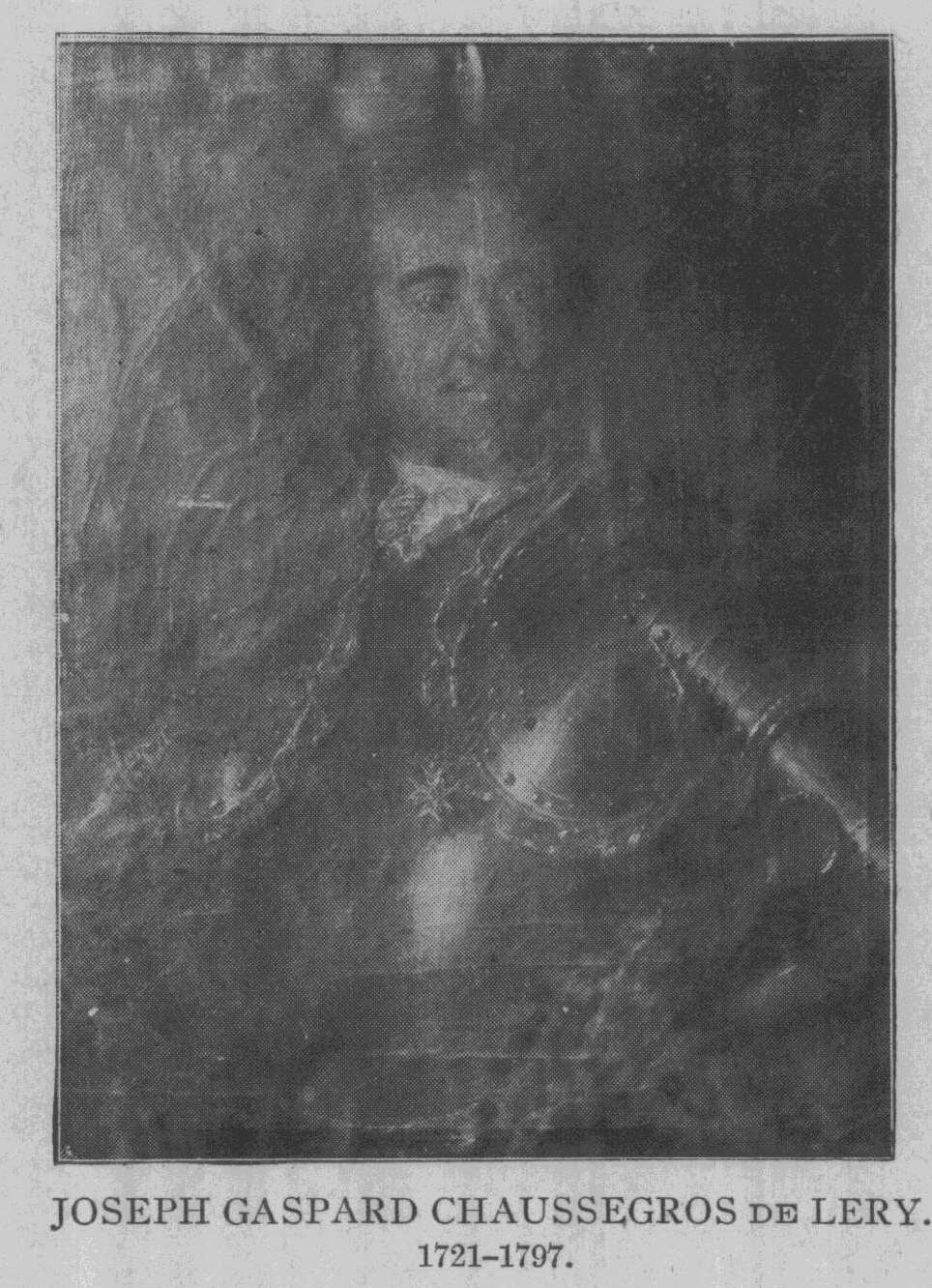
Colonel Crawford Lindsey of Quebec has prepared the following biographical sketch of DeLery. Abbe Daniel in his work entitled "Le Vicomte C. de Lery et sa famille" devotes over 40 pages to Joseph Gaspard de Lery. The author who had access to the family papers has succeeded in producing a fairly complete work in that comparatively short biography. From it we take the following notes: The de Lery family originally came from Toulon. Gaspard Chaus- segros de Lery, the grandfather of the one who forms the subject of this sketch, was the engineer of that city. His son Gaspard was also an engineer, and in 1716 the Council of the Marine sent him to Canada to direct the works on the Quebec fortifications. After a long and fine career, he died in 1756. On the 3d of October, 1717, he married Marie Renee le Gardeur |
|
|
|
who had himself written an excellent work on fortification. In any case the position of assistant engineer, which had been re- fused him in 1735, was given him on the 21st April, 1739, when he was only 18 years old. In the following year we find young de Lery in Louisiana. Charged by Broutin, the chief engineer, with the duty of reconnoitering the route leading to the Chicachos, he accomplished his mission to the sat- isfaction of his chiefs. In 1741 he was promised a commission of second ensign and he received it the following year. In 1743 he took a detachment to St. Frederick, put the fort in a state of defense and finished the prison. He was afterward engaged in repairing or constructing several forks in the Montreal district and was finally sent to that city whose fortifications were not in a proper condition. This was in 1744. The following years were devoted to repairing forts Chambly and St. Frederick. |
372 Ohio Arch and Hist.
Society Publications.
M. de Lery was not only an engineer, he
was also a soldier. The
authorities gave him frequent
opportunities of proving his valor His
expedition against the Loups and the
Aquires in 1747 was the first of
the kind; it was not to be the last.
de Lery who was only a second ensign was
promoted first ensign
or ensign on the establishment in 1748.
About the same time, M. De
Galissonniere, wishing to obtain in-
formation regarding the route from
Montreal to Detroit as well as the
necessity of building new forts or
repairing the old ones, ordered M.
de Lery to perform the journey and to
make a full report. To that
order we are indebted for the first of
M. de Lery's journals, and it will
be seen that he performed the duty
conscientiously.
Leaving Lachine on the 6th of June,
1749, he returned to Quebec
on the 25th September following. M. de
la Galissonniere was no longer
there to congratulate him, but M. de la
Jonquiere showed his satisfac-
tion by appointing him commandant of the
artillery, a position he held
till May, 1750.
The governor did better still On October 8th he submitted his
name to the King for a lieutenancy which
was granted him in April,
1751. M. de Lery was then in Acadia as
commandant of Fort Beause-
jour, which he built as well as thai of
Gaspareau. The reasons neces-
sitating the construction of those forts
are known to everybody.
Nevertheless the English were displeased
and accused the French
of having invaded a portion of Nova
Scotia, burned Beaubassin, fur-
nished arms to the inhabitants, etc.,
and would be satisfied with nothing
less than compelling M. de la Jonquiere
to disavow his conduct. There-
upon the Governor deemed it his duty to
send some one to France to
give information to the court and he
chose for the purpose M. de Lery
who had just arrived from Acadia. The
latter had no difficulty in justi-
fying M. de la Jonquiere.
After spending some time at La Rochelle
to acquire further knowl-
edge of military manoeuvres, M. de Lery
sailed for Quebec, where he
arrived on the 23d October, 1752.
On the 24th September, 1754, he was
married in Quebec to Louise
Martel de Brouague.
The years 1754 and 1755 were especially
busy ones for M. de Lery.
Ordered to Niagara, he spent the winter
there and went to Fort Du-
Quesne, where he had same repairs
executed. He was about to begin
work on Fort Mochault when he was
recalled to Fort Niagara by M.
de Villiers who was in command there.
The narrative of that campaign or rather
of those campaigns, con-
stitutes the second and probably the
most important of M. de Lery's
journals. In it will be found
interesting details which exist nowhere else.
From that date, M. de Lery's journals
enable us to follow him more
easily and we refer the reader to them,
merely calling attention to the
Old Fort Sandoski of 1745. 373
expedition of 1756 against Fort Bull,
that against Choueguen in the same
year and the work on the Quebec
fortifications in 1757.
Promoted Captain on the 1st of May,
1757, M. de Lery had not yet
been honored with the Cross of St.
Louis; it was granted him on the
20th January, 1759.
Finally on the 13th September of the
same year, he took part in
the battle of the Plains of Abraham and
was wounded.
After the capitulation of Montreal, M.
de Lery obtained permission
from M. de Vaudreuil, to remain in
Canada. In the following year he
went to France with his family. He
visited Paris and proceeded to
London where he was presented to the
King. It was on that occasion
that George III, addressing himself to M.
de Lery's young wife, said
to her: "Madame if all the Canadian
ladies are like you, I have truly
made a conquest."
M. de Lery returned to Canada in 1764.
In the following year the
Duc de Choiseul authorized him to live
there. He thought, however,
of returning to France, but the Court,
which had not looked with a fa-
vorable eye on his stay in England,
ignored his application.
In 1774, England granted Canada The
Quebec Act; a legislative
Council was formed and M. de Lery was
one of its first members. With
his colleagues, he took the oath on the
17th August, 1775. Seven years
afterward, September 7, 1782, the French
Court confirmed the pension
that had been granted him in 1762.
M. de Lery lived many years longer. He
died in Quebec, Dec. 11,
1797, at the age of 76, and was buried
three days afterward in the Ca-
thedral.
Madame de Lery had died in 1793. Of
their marriage 18 children
were born; 10 sons and 8 daughters. The
most celebrated of all was
Francois Joseph, who afterward became
Lieutenant-General, Chief En-
gineer and Baron of the French Empire.
This notice does not do justice to M. de
Lery's qualities.
By reading his journals one will know
him better and appreciate
the zeal, activity and intelligence of
that brave officer whom the
French governors honored with their
confidence while giving
him
unsparing proofs of their satisfaction.
Throughout his whole military career, de
Lery kept careful
journals. These have been translated
from the original French
by Col. Crawford Lindsey, the official
translator of the province
of Quebec, who had translated the
"Jesuit Relations" into Eng-
lish for the publishers, the Burrows
Bros., of Cleveland.
There are 8 of these journals of M. de
Lery's campaigns
whereof the following is a summary
description:
|
374 Ohio Arch. and Hist. Society Publications.
1. Journal of 1749. A memorandum book without a cover, contain- ing 42 pages, 2 of which are blank. This is the narrative of a voyage to Detroit undertaken by the order of M. de la Galissonniere. 2. Journal of 1754-1755. It consists of 8 small memorandum books whose sheets are held together by ribbons of different colors. There are 288 pages in all, including 14 blank ones. This journal is probably the most important of all those left by M. de Lery, owing to the numerous and interesting items of informa- tion it gives respecting the old French forts and the routes leading to them. It also contains a large number of figures, plans, etc. 3. Journal of 1756. Same size as the preceding one; 29 pages of text. Although the title of this journal would lead one to infer that it relates to expeditions at Ft. Bull, Choueguen and Carillon, this memor- |
|
|
|
andum book contains in reality only the narrative of the voyage to Carillon. The remainder is contained in two separate books. 4. Journal of the Campaign of 1756-April. Capture of Ft. Bull. A memorandum book with paste cover, containing 60 pages, three of which are blank. It contains two maps and a plat of Fort Bull. 5. Choueguen Campaign, 1756. Form and cover similar to the preceding one; this book contains 28 pages. In it the author gives a plan of Choueguen and vicinity. 6. Journal of 1757. A book of 32 pages. It gives interesting de- tails respecting thee Quebec fortifications at which M. de Lery worked all summer. 7. Journal of 1758. Consists of 27 pages, 10 of which are blank. It is the narrative of an expedition in July and August to the Iroquois country. |
Old Fort Sandoski of 1745. 375
8. Journal of 1758. Voyage in September
and October from Que-
bec to Carillon. A book of 12 pages.
The journals 1, 2, 3, 6, 7, 8, are
evidently a first draft, roughly
written; this can be seen by the writing
and spelling. The writing
without being bad is not always easy to
make out. With regard
to the spelling it may perhaps be
considered by some as queer.
But the reader must remember that M. de
Lery wrote currente
calamo, probably even during the course of his journeys, and
that,
apart from numbers 4 and 5, all the
other manuscripts are merely
a rough draft.
It is only fair to add this defect was
not peculiar to him.
Many men of his day, who had been
educated to some extent
were as deficient in their spelling. The
proof that M. de Lery
could do better will be found in the
journals of 1756, numbers
4 and 5, which are very well written
with correct spelling. The
latter two manuscripts, with their well
executed maps and plans,
may be classed among the finest of the
period.
M. de Lery's journals now belong to Laval University,
Quebec. They were bequeathed to it by
the late Abbe Verreau,
who had obtained them from the estate of
the late Jacques Viger,
well known throughout Canada for his
historical researches and
labors. We cannot tell how they came
into his possession.
The reader will judge for himself of the
history of the
country in general and of certain
sections of the United States in
particular. This induced Laval
University to allow their pub-
lication by the Burrows Bros. Co.,
Cleveland, Ohio, who will
follow the general style and arrangement
of their great work,
"The Jesuit Relations." Patriotic societies and all students of
history are greatly indebted to Chas. W.
Burrows, president of
the Burrows Bros. company, for his
historical researches and
publications.
The daily entries in de Lery's journal
from the time of leav-
ing Presqu'isle (Erie), July 30, 1754,
until the arrival at the
ruins of the old Fort Sandusky, August
4, give with great detail
the courses, distances and the character
of the country on the shore
of the lake. There are no less than
nineteen quite elaborate little
sketches of the entrances to the rivers,
etc., including five detailed
376 Ohio
Arch. and Hist. Society Publications.
sketches of the ruins of the old fort (Sandoski) and of
San-
dusky bay. We give this part of the journal:
Extract from Journal of Joseph Gaspard Chaussegros de
Lery,
Lieut. des Trouppes En route from Quebec to Fort
Duquesne
but Destination changed at Presque isle (Erie) to Fort
Detroit in
1754.
(Presque Isle (Erie) 30 July, 1754)
30th, Tuesday. Started from the presqu isle at half
past
4 in the morning. Monsieur Pean, captain, regimental
adjutant
of Quebec, commanding
................................. 1
Monsieur St Martin, acting
major............................
Monsieur
Lery
................................... Lieutenants 3
Monsieur St
Ours............................................
M onsieur Rigauville ..........................................
M onsieur Desmeloises ........................................
[127]
................................................. Ensigns 4
M onsieur Porneuf ............................................
M onsieur Cournoyer ..........................................
Father Bonnecamp jesuit
....................................... 1
Monsieur forget duverger, Priest of the missions
Etrangeres... 1
M onsieur M
auviles
...........................................
M onsieur Vig
e .....................................
Surgeons 3
M onsieur G
aron .............................................
M onsieur Laforce, store-keeper ................................ 1
Monsieur Constant, an old interpreter among the
outaouais,
Sauteux, etc. ............................................ 1
27 Canoes, each carrying 10
men.............................. 270
285 men
Each canoe was loaded with 25 Packages consisting
chiefly of pro-
visions. * * * * * *
(128 to 138 omitted).
4th Sunday. (Aug. 4, 1754). We started at 5 h. 22 m. N. W.
At 2/3 of a league, Monsieur de Rigauville landed with
Father Bonne-
camp, Jesuit, and another canoe. There he took the
altitude which was
41 Degrees, 24 Minutes, 54 Seconds. The wind was stormy
and a cloud
covered the whole sky to the North East. From the point
where the
altitude was taken to the Point seen in the East, the
bearing is E.N.W.;
from the same Point to the Point in the West, the
bearing is S.E. by
S. and N.W. by N. From the Riviere aux hurons, or
Riviere au
Pere, or Riviere au Vermilion, the shore runs S.E. and
N.W. for a
distance of About 134 Legue in which space is the
Entrance to lake
Old Fort Sandoski of 1745. 377
otsandoske. At 10 o'clock I found myself
opposite two entrances of a
Bay. As my canoe was the nearest to land
as well as the most in
advance and as I had no guide, I thought
this was the entrance of
lake otsandoske. The wind was astern and
as I steered for the entrance
the Rollers were very heavy while I was
in the pass on the left as one
enters (for the entrance of the lake is
divided by a small island) my
canoe shipped [139] a great deal of
Water. I discovered a great sheet
of Water which I took for lake
otsandoske. I displayed my flag as a
signal to all the canoes which steered
for me with the wind astern.
Many shipped a good Deal of Water and
suffered exceedingly from the
heavy wind. I saw them all enter the
lake and land at the other end
of the island to empty the water out of
the canoes. Monsieur Pean
had to change his clothes which were wet
through. I did not know
where the portage was. I imagined that
some vestiges still remained
of the fort the French had built in 1751
and which was afterwards
evacuated. To find it I followed the
shore on the north side of the
said lake which runs East and West.
After proceeding about 3 Leagues,
I found a clearing where I landed at
noon and discovered the Ruins of
the Old fort. I at once had the packages
in my canoe carried across
the portage. At two o'clock the whole [140] had been taken over.
Monsieur Pean arrived at 3 o'clock. The
Remainder of the day was
spent in portaging the effects and the canoes;
three of the latter, how-
ever, remained at the Little lake. The
portage is 57 arpents in length;
starting from the Little lake, it runs
N. by N.W. There are three small
prairies to be crossed which are at
about equal distance from one another;
after that is a small grove of trees and
then the bank of the River of
the Portage on the shore of the great
lake where our camp was.
I calculate that, from the River we call Riviere aux Hurons
to the Entrance of lake otsandoske, the
distance is two Leagues; for
the space of one league the shore is
bordered merely by a strip of woods,
after which is a great prairie which
ends at lake otsandoske.
To enable one to understand the Route of
this day and that of
Father Bonnecamp, jesuit, in passing out
of the little lake to [141] Pointe
aux cedres, I will indicate in the
figure below the route he took outside
and that which I followed inside. * * *
* * *
6th, Tuesday. At 1 h. 40 m. in the
afternoon the greater portion
of the detachment ordered to go to
Michilimaquinak arrived at detroit.
Monsieur Pean was in the van, and De
Lery formed the rear-guard,
Monsieur de St martin, the major, was in
the position suited to his
rank; Messieurs de St Ours, Neuvillette,
Desmeloises and de Cournoyer
commanded the divisions. The said
detachment saluted the flag of the
fort with three discharges of musketry.
We landed at the gardens, that
is to say above the fort which fired
nine Rockets, while the troops were
under arms and the drums beat the
general. Monsieur dumuy, the
|
378 Ohio Arch. and Hist. Society Publications.
commandant of the said fort, received Monsieur Pean, our commandant, thirty feet from the gate of the fort where the troops and militia were drawn up and they were dismissed only after Monsieur Pean had entered the fort, whence he sent orders to his canoe to proceed below it; there he pitched his camp adjoining the Enceinte of the fort on the Side facing the village of the Pouteouatamis. The officers en- camped in the front line along the hill facing the Water and the troops and militia-men placed their tents behind in four lines. The hurons went to salute the commandant of the detachment. The weather was Fine and the sun very hot; no wind. 7th, Wednesday. The Pouteouatamis saluted the Commandant of the detachment and all the officers, myself in particular because I was to remain at Detroit. Monsieur le mercier arrived at 9 o'clock in the evening and announced the approaching departure of Monsieur Pean's detachment. * * * Extract from Journal of Joseph Gaspard Chaussegros de Lery Lt. des Trouppes, return journey from Ft. Detroit to Ft. Du Quesne via Ft. Sandoske on Lac Dot Sandoske in March, 1755. March 15th, Saturday. As the wind blew from the water and it was impossible to Embark, I decided to leave behind the two Frenchmen who had brought me in the pirogue so that it might take it back to the fort, and to travel by land with the two iroquois. We started at 8 o'clock and at 4 we camped half a league beyond the Pointe aux feviers. We broke through in several places. The weather was cold. We passed two Rivers; 'one in the middle of the Bay and the other almost at the Pointe aux feviers. The savages were so loaded with our equipment that they were obliged to make traines with our apichimons or bear skins. I calculate that we traveled five and a half Leagues that day. 16th Sunday. The weather was Fine but cold but yet not sufficiently so [264] to allow of our crossing the Streams and Rivers on the ice |
|
|
|
We walked over difficult ground full of hot springs and when we had to leave it and go on the shore ice, we ran the risk of breaking our legs, as the ice was not sound and frequently there was No Water underneath. We saw great numbers of swans, bustards, ducks, cranes and other game but they were so wild we could not approach them. Two of us arrived at the Riviere du Portage. At 3 o'clock in the afternoon, Thomas, the iroquois from the lake of two mountains who was with me, went along the outer edge of the shore ice to go and |
Old Fort Sandoski of 1745.
379
get a pirogue on the other side of the
River and it was 5 o'clock
when I got across. I left him to await
the other savage who had re-
mained behind and I went on to lake
Sandoske to see whether we could
cross it either in a canoe or on the
ice. I arrived there at half past
six o'clock after walking continually in
the Water of which that portage
is full at that season. I found the lake
clear of ice and fired three
gun-shots, the signal I had arranged
with The iroquois who rejoined
me at half past seven o'clock. He had
not seen his comrade who did
not come to sleep with us. We fired
several gun-shots to make our-
selves heard by the French traders on
the South East shore of lake
dot Sandoske, but they did not answer.
We had nothing for supper
but a teal as The savage who had
remained behind carried the pro-
visions.
[266] I examined the River of the
portage and found its figure
different at this season from what it
was in the month of August last
year when I passed there; the grass was
then high and the Water lower.
[268] 17th, Monday. Very early in the
morning The iroquois from
the lake Started to go and meet the one
from the Belle Riviere who
had not joined us The previous evening.
I placed a flag on the Water's
edge and fired several gun-shots to make
the traders on the opposite
shore see and hear me, but they did not
hear any more than on the
previous day. At noon the two savages
arrived. We placed in the
water a large canoe of eight paddles that
we found and crossed 3/4 of a
league above the Riviere du Poisson
doree. [Pickerel Creek.]
I reached the house of Sieur gouin, a
trader, at 4 o'clock in the
afternoon. We were a long time crossing
because our canoe leaked a
good deal and I was kept busy bailing
while the two savages paddled.
* * * * *
[269] 18th, Tuesday. The wind was from
the south and cold;
the Sun came out. The savages prepared
and made a saddle for the
horse that was to carry our provisions.
I sent one of them with The
huron interpreter to the Little village
to get me a guide and I par-
ticularly charged the latter with that
mission; also to buy a horse for me.
At 4 o'clock in the afternoon The
interpreter and the savage Returned
without either guide or horse. Our two
savages decided to take the
route via the presqu isle by canoe.
This, added to what the hurons
told me about the Rivers having
overflowed their banks and the woods
being full of Water, led me to decide to
go in a Canoe.
[270] I had one of six paddles prepared
with all its fittings to be
ready to start very early the following
morning. I wrote to Monsieur
the Commandant of detroit and sent him
the Statement of the few
supplies advanced me by Sieur gouin for
those who owned the canoe
which I might Perhaps Leave at the
Riviere a seguin called gayahague.
19th. Wednesday. I was unable to start
before noon because the
canoe had to be gummed as it leaked a
great deal. I went to sleep at
|
380 Ohio Arich. and Hist. Society Publications.
the head of lake Sandoske in a place sheltered from the wind. The weather was Fine. We went to the Point on the lake to see whether there was Much ice. We found shore ice and, as the weather was setting in fine, this led us to Hope that we should reach whither we proposed going with fair ease. |
|
|
|
[271] I calculate that we traveled 4-1/2 Leagues. Figure of the entrance of lake dot Sandoske and view of the lands to the West with the Plan of the swamp as far as the portage of the village of ainoton. [272] 20th, Thursday, Heavy gale from the north east. We re- mained, being unable to put our canoe in the Water. |
|
Old Fort Sandoski of 1745. 381
21st, Friday. At 7 o'clock in the morning we embarked to go to the head of the swamp of lake dot Sandoske to the East. We went about a league and a half and portaged over to the great Lake which we found full of ice. This compelled us to retrace our steps and go to the Portage of the village of aniauton, which we did. At 5 o'clock we reached the said village whereof only three cabins and some palisades remain. We decided to take the conchake Route although it was long. |
|
|
|
We asked a huron to guide us. I offered him the value of a beaver skin to [273] take us to the Riviere a Seguin, but he refused, saying that his nation would think he was going on the war-path. This, in addition to the trouble the men of that nation had caused with the same object some days previously, led me to think that he would per- haps not submit without compulsion to all that might be favorable to us on The oyo. The Place where we were is that where the hurons took refuge |
|
382 Ohio Arch. and Hist. Society Publications.
after Leaving isle aux bois blanc and killed the Frenchmen. They had erected a fort there whereof the following is the figure. [274] 22d, Saturday. Very early in the morning one of my sav- ages started to go to the house of Sieur gouin, the Trader, at the |
|
|
|
to be full of Water. We had found a good deal on the previous day on our way to the village. At 5 o'clock the savage who had gone to get the horse, returned. The Frenchmen were to come the following day to take away their Canoe. I wrote to Monsieur du muy and to Madame de Lery and dated the letters the 23rd March. The weather was fine with a little rain in the morning. |
|
|
|
the morning we started on the Conchake road for Fort Duquesne. * * *
The importance of the "De Lery" portage and the loca- tion of old fort Sandusky at the entrance to the Sandusky coun- try is shown not only by the desire of the renegade Nicolas to occupy and hold this point of strategic importance almost midway between the French outpost at Detroit and the English outposts or settlements in Pennsylvania and Virginia on the headwaters of the Ohio. Fort Sandusky, the first fort in Ohio, originally built by the British in 1745 and destroyed by the French when they made Nicolas sue for peace in 1748, is located in the early map of Evans as "usurped by the French in 1751." The French built their post at Junundat at the point described by de Lery |
|
C.d Fort Sandoski of 1745. 383
as the location of the trading post of Sieur Gouin, and marked in the early maps Ft. Junundat, 1754. This in turn was de- stroyed by the British after the capture of Ft. du Quesne by the British in 1758, so that immediately after the surrender of all French territory in America, Sept. 8, 1760, when Major Robert Rogers was sent out to take possession of the western forts the importance of a new fort at Sandusky was realized and frequent references made in contemporary reports and letters. |
|
|
|
Little Lake Sandusky. The blockhouse and palisades were finished Nov. 29, 1761.
On the 8th of September, 1760, following Wolfe's Victory on the Plains of Abraham, Quebec, Canada with all its dependencies, was surrendered to the British crown. It still remained to carry into effect the full terms of the conquest by taking over the western forts, and this difficult and perilous task was assigned to |
384 Ohio Arch. and Hist. Society Publications.
Major Robert Rogers * of New Hampshire,
an old commander
of Putnam and Stark.
On Sept. 12, 1760, Rogers, at the height
of his reputation
received orders from General Amherst,
the British commander-
in-chief in America, to ascend the St.
Lawrence and take posses-
sion of the western forts; and he left
Montreal the next day,
with 200 Rangers, "half hunters,
half woodsmen, armed like
Indians with hatchet, gun and
knife;" artillery commanded by
Lieut. Davis; and Lieut. Brehm,
assistant engineer, who delivered
dispatches and summons to surrender to
Captain Beletre, the com-
mandant at Detroit. Beletre at first
refused to believe that Can-
ada had capitulated, but on receipt of
the letter from Vaudreuil,
the governor of Canada, he was forced to
yield and accom-
panied Rogers on his eastward trip to
Philadelphia+
Rogers' return was by land, via the
Sandusky and Tuscara-
was trail to Ft. Pitt. Jan. 2, 1761, says his
Journal: "We ar-
rived at Lake Sandusky." The
following month, namely Feb.
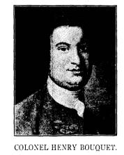
3, 1761, Bouquet wrote to Amherst:
"Lieutenant Meyer has left
Ensign Pauli and fifteen men at
Sandusky." This is the first
mention of H. C. Pauli, who was in
command of the garrison of
Ft. Sandusky. Several letters and reports
from him are among
the Bouquet collection, now in the
Canadian Archives, and he
uniformly used this spelling of his
name, although Parkman and
some other historians write it Paully.
Feb. 19, 1762, Pauli wrote
to Bouquet that the Indians were
discontented about the block-
house; and inquired how he should behave
if they became insolent.
*Rogers is described as "tall and
strong of person and rough of
feature; versed in all the arts of
woodcraft, sagacious, prompt and reso-
lute; his mind by no means uncultivated.
But his vain, restless and
grasping spirit and more than doubtful
honesty proved the ruin of an en-
viable reputation. Six years after his
western expedition he was tried
by court martial for a meditated act of
treason, the surrender of Ft.
Michillimackinac to the Spaniards at
that time masters of Upper Louis-
iana. Not long after he went to Africa
and fought two battles under
the Dey of Algiers. Returning to take
part in the American Revolution
he was suspected by Washington of
playing the part of a spy; openly
espoused the British cause; and in
1778 was banished from New Hamp-
shire. The time and place of his death
is unknown.-Condensed from
Parkman's "Conspiracy of
Pontiac."
+Mante's History of the Late War, 1772.
Old Fort Sandoski of 1745. 385
In May he reported that the chiefs had
given leave to Philip
Boyle to plant corn; that the Iroquois
were very quiet and the
department healthy. The batteaux left
for the winter thirty
miles off were found, when sent for, to
be nearly ruined by the
Indians probably for the nails; and the
men on their return lost in
the storm the only canoe he had. In July
he reported his men
had fever from the bad water and asked
for medicine. Provisions
were scarce. In August, provisions had
been delivered by Captain
Robertson, commanding a vessel on Lake
Erie, which could not
get into Lake Sandusky from shallowness
of the water. Men
of his old party were ill.
Rogers and his Rangers had been met
somewhere near the
mouth of Grand River, east of Cleveland,
by Pontiac, who
haughtily demanded their business. Later
he gave them his lofty
permission "to pass through the
country unmolested." The great
Ottawa leader here stands prominently
forward in history for the
first time. He believed that if all the
tribes could be made to
unite in a grand assault upon the
English, there might be a chance
of overthrowing them; and he had
succeeded in arousing to
bloodshed most of the tribes between the
Alleghenies and the
Mississippi. A detail of his plan of
procedure was to attack all
the English forts upon the same day; and
having destroyed the
garrisons to devastate the defenseless
frontier and concentrate
upon the more populous centers. Early in
May, 1763, the storm
burst. "Nine British forts yielded
instantly, Detroit and Ft. Pitt
alone escaping capture; and the savages
drank, scooped up in
hollow of joined hands the blood of many
a Briton;-Sandusky
was the first to fall." On the 16th
of May, Pauli, the command-
ing officer, was informed that some
Indians were waiting at the
gate to speak to him. As several of the
number were well known
to him he ordered them without
hesitation to be admitted. Arriv-
ing at his headquarters, two of the
treacherous visitors seated
themselves on either side of the
commandant, while the rest were
disposed in various parts of the room.
The pipes were lighted
and the conversation begun, when an
Indian who stood in the
doorway suddenly made a signal by
raising his head. Upon
this the astonished officer was
instantly pounced upon and dis-
armed; while at the same moment a
confused noise of shrieks
Vol. XVII - 25.
386
Ohio Arch. and Hist. Society Publications.
and yells, the firing of guns and the
hurried tramp of feet sounded
from the area of the fort without. It
soon ceased, however, and
Pauli, led by his captors from the room
saw the parade ground
strewn with the corpses of his murdered
garrison. At nightfall
he was conducted to the margin of the
lake, where several birch
canoes lay in readiness, and as amid the
thick darkness the party
pushed out from shore the captive saw
the fort lately under his
command bursting into sheets of flame.*
Pauli was carried to Detroit, bound hand
and foot and
solaced on the way with the expectation
of being burned alive.
However on landing at the camp of
Pontiac he was surrounded
by a crowd of Indians who pelted him with
stones, sticks and
gravel forcing him to sing and dance. An
old woman whose
husband had lately died chose to adopt
him in place of the de-
ceased warrior. He was plunged into the
river that the white
blood might be washed from his veins;
conducted to the lodge
of the widow and treated henceforth with
all the consideration
due to an Ottawa warrior. This forced
match took place about
the 20th of May, and in July following a
divorce occurred. One
evening a man was seen running toward
the fort at Detroit,
closely pursued by Indians. On his
arriving within gunshot they
gave over the chase and the fugitive
came panting beneath the
walls, where a wicket was flung open to
receive him. He proved
to be the commandant at Fort Sandusky
who had seized the first
opportunity to escape from the embraces
of the Ottawa widow.+
Meanwhile Pontiac himself was besieging
Detroit, which
garrison heard through one La Brosse, a
Canadian who came to
the gate, that Ft. Sandusky had been
taken and all its garrison
slain or captured. Pauli had sent
through one of the Canadian
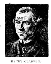
inhabitants a report to Major Gladwin,
commandant at Detroit,
giving a full account of the capture;
and on July 6, proceedings
of a court of inquiry were held by Major
Gladwin to ascertain
the manner of the taking of Fort
Sandusky.
*"Conspiracy of Pontiac;" and
MS official Documert Report of the
Loss of the Posts in the Indian country,
inclosed in a letter from Major
Gladwin to Sir Jeffrey Amherst, July 8,
1763.
+ Taylor's Ohio.
|
Old Fort Sandoski of 1745. 387
Lieutenant Cuyler with ninety-six men and twenty-three batteaux laden with stores was on the way to the relief of De- troit, along the northern shore of Lake Erie, when a band of Wyandots was sent to intercept him, which they did, May 28, at Point Pelee. Cuyler's boats had been beached and the party prepared to encamp. They were surprised by the Indians and a hot blaze of musketry took place from both sides. Then the Indians charged and the soldiers fled panic-stricken to their boats. Five were set afloat and pushed off. Cuyler seeing himself de- serted waded up to his neck in the water and climbed into a boat. |
|
|
|
burned fort and the decomposing bodies of the garrison, Dalyell decided to tarry a few days and inflict punishment of the per- petrators of the deed. He marched inland to the Wyandot village at the lower falls of the Sandusky (now Fremont), which he burned to the ground, at the same time destroying the adjacent fields of standing corn. This inadequate retribution voiced the soldiers' hatred of savage treachery-the turning of the hither- to friendly Wyandot against Pauli's little English force, just as sixteen years earlier Nicolas and his Hurons had, near the same place, turned against their whilom friends and associates, the French. Dalyell then continued his journey northward and under cover of night effected a junction with the Detroit garrison. Dalyell had been the companion of Israel Putnam in some of the |
|
388 Ohio Arch. and Hist. Society Publications.
most adventurous passages of that veteran's life, but more re- cently had acted as aide-de-camp to Sir Jeffrey Amherst. On the very day of his arrival he persuaded Gladwin to let him make a night attack on Pontiac's forces, which resulted in his own death and the loss of fifty-nine of his men at Bloody Run. Major Robert Rogers, trained in frontier warfare, who succeeded to the command, with his Rangers put the ambushed savages to flight; while two batteaux from the fort came to his own relief and an orderly retreat was made. This Indian victory restored the wan- ing fortune of Pontiac and brought daily accessions to his forces. In the spring of 1764 the frontiers were still alarmed by |
|
|
|
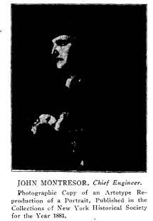
out from Albany with the following force: 243 men of the 17th Regiment; 98 of the 55th; 344 New York Battalion; 209 New Jersey Battalion; 73 boatmen; total 1183. The Connecticut bat- talion was under Israel Putnam, the future hero of Bunker Hill. The chief engineer of the exposition was Lieut. John Montresor, to whom we shall refer later. From Lake Ontario the army pro- ceeded westward in two vessels, 75 whaleboats and numberless canoes, stopping to found a fort at Erie and resting near the ruins of old Fort Sandusky. Bradstreet had been ordered by Gage to chastise the Indians whenever they appeared in arms, but all hostile indications ceased at his advance. On the 12th of August, near Presque isle (Erie) |
|
Old Fort Sandoski of 1745. 389
a delegation of Indians met him purporting to represent several tribes, promising that all prisoners should be delivered at Lower Sandusky within twenty-five days, that all claims to the posts of the English in the west were to be abandoned, and leave given to erect as many forts and trading posts as should be necessary for the security of the traders, with a grant of as much land around each post as a cannon could throw a shot over; that if any Indian killed an Englishman he should be delivered at Fort Pitt for |
|
|
|
same time they were sending others to stir up the tribes to war is shown from the journal of Capt. Thomas Morris, an English of- ficer of the 17th Regiment, who was sent to visit the Indians along the Maumee, Wabash and Indian Rivers, while Bradstreet was at Detroit and Sandusky. His journal is in the State Paper Office in London.+ For details of his thrilling trip -how he met an Indian riding a superb white horse which Braddock had ridden in his fatal expedition; and how an Indian chief traded *Taylor's Ohio. +Reprinted by Arthur Clark Co., Cleveland, 1904. |
|
390 Ohio Arch. and Hist. Society Publications. Morris a copy of Shakespeare for some gunpowder - see Park- man's Pontiac, vol. II. Morris wrote to Bradstreet, Sept. 18, 1764: "The villains have nipped our fairest hopes (of peace) in the bud. I tremble for you at Sandusky; though I was greatly pleased to find that you have one of the vessels with you and ar- tillery. I wish the chiefs were assembled on board the vessel and that she had a hole in her bottom." Camping near the ruins of old Fort Sandusky, Bradstreet spared the Wyandot villages, the Indians agreeing to make their |
|
|
|
submission at Detroit, which place was entered by his army Aug. 26th. After arranging matters there, Bradstreet left seven companies of the 7th Reg't., u n d e r Lieut.-Col. Campbell, and returned to Sandusky Lake, Sept. 18, 1764. We have already referred to Lieut. John Montresor, the engineer of Bradstreet's army, whose journals first printed in the New York Historical collection for 1881 cast a new light upon many of the most important occurrences of Bradstreet's expedition and the old French and In- dian wars. Montresor was, |
|
like de Lery, the son of a famous engineer, the elder Montresor having been ordered to America in 1757, where he planned and built several fortifications about New York. His eldest son John served as assistant engineer under his father at Gibraltar, and was gazetted chief engineer under General Braddock in that officer's American campaign. He was wounded in that dis- astrous engagement, July 9, 1755; was at the capitulation of Quebec in 1760, and to his talent as an artist we are indebted for an excellent likeness in profile of General Wolfe taken in camp |
Old Fort Sandoski of 1745. 391
near Quebec. In 1763 he assisted in the
relief of Major
Gladwin at Detroit when besieged by
Pontiac's army, and in
1764 was engineer of Bradstreet's
expedition. Later he was
principal engineer during the occupation
of Boston and New
York by the British troops, and in Dec.,
1775, was made by
George III. "chief engineer in
America." He was present as
one of the managers of the celebrated
ball "Mischianza" given
in Philadelphia by the British officers
to Sir William Howe on
the eve of his departure for
England. After the close of the
American Revolution Montresor returned
to England where he
obtained the rank of Colonel, traveled
extensively and died June
26, 1799. His portrait by Copley shows
what a fine specimen of
manhood he was. His valuable journals
contain many illuminat-
ing references to the period and the
locality with which we are
concerned. I insert a considerable
portion of this interesting
journal:
Sept. 7, 1764. Proposed by Col.
Bradstreet that the army set out
for Sandusky in three days. Up that
river (at the Lower Falls-Fre-
mont), was the rendezvous proposed where
Col. B. should entrench till
the arrival there of the troops under
command of Col. Bouquet.
Sept. 12. Received orders from Col.
Bradstreet to make out a
small proportion for building a fort at
Sandusky if the Indians on our
arrival there don't comply with the
articles agreed to on Aug. 12.
13th. Arrived advice from Sandusky that
the Indians to the num-
ber of 800 warriors had assembled there
to oppose our troops from dis-
embarkation instead of ratifying the
treaty.
14th. The whole embarked. Our present
number of boats, 60 of
the Long Boats and one Barge. Put on
board a proportion of intrench-
ing tools necessary for establishing a
post at Sandusky if necessary.
15th. This morning we were met in a
birch canoe by officers sent
to Sandusky who brought us account that
they were not well treated
by some of that village, that the reason
of their being so tardy in their
determination was owing to their having
been promised by the Upper
Nations to make some stroke, that by
what could be learned they pro-
pose assembling about 1,000 warriors to
surprise us when in council
at Sandusky and to murder the whole, but
they hoped forgiveness for
the ill advice of their sachems. -Two
Indians seen on horseback. The
savages in these parts possess,
including the Shawanese, about 6,000
horses.
17th. Accounts arrived that the
Delawares and Shawanese are as-
sembled at Sandusky where the old Fort
stood that the Indians burnt
392 Ohio Arch. and
Hist. Society Publications.
last year, a bad place for the boats.
The whole set sail and arrived at
Thistle Creek about one mile and
three-quarters to the eastward of it,
but the water failing returned and
encamped a half mile to the west-
ward of the old Fort. A good clay beach.
Found at the old Fort the
officer of the 80th sent with provisions
from Detroit.
19th. The channel of Sandusky was
sounded and found sufficient
water for the vessels now on Lake Erie
to enter. Arrived the sachem
Manitou and the great war chief of the
Ottawas with twelve more young
warriors to attend the general council
to be held there. Remark that
the water rises and falls upward of two
feet perpendicular, the difference
between the winds blowing in and out of
this lake.
20th. As the nations expected to ratify
the treaty propose taking
the route of the upper village of the
Hurons 60 miles from the first
rapids on the river of Sandusky, the
whole embarked and proceeded and
encamped one mile below the rapids in
order to meet them one day
sooner and also to be so much nearer to
attack their villages on the
Ohio should they not comply with every
article alluded to in the treaty
of peace. The country covered with Game.
The land extremely rich,
interspersed near the borders of the
Rivers and lake with large tracts
of meadow. This camp very advantageously situated on the rising
ground and open woods as per draught.
The most of this river from
the entrance to the rapids being about
18 miles is 5 fathoms water the
first six miles up meadow, the rest
woods, are part with another 80
yards Broad. The evening and morning gun
ordered to be fired, with
the camp duties as before. A
considerable difference observed in the
climate becoming more moderate.
21. The quarter guards of the several
battalions and detachments
defended by Fleches and Redoubts with 6
light field 6 pounders in the
intervals. The Indians from the
neighboring village at the Rapids (Lower
Sandusky), which for the most part is
abandoned this spring, brought
in the produce of their settlement
chiefly consisting of melons, squashes
and Indian corn to traffic with the troops
for salt, rum, etc. Arrived
an express from Miamis fort not being
permitted to proceed any further
by the Miamis. The warriors in that
river assembled 700 strong. When
he was at the fort, 15 Shawanese and
Delawares arrived there with 14
belts to the several nations to carry on
the war against the English as
well as themselves having vowed enmity
to us as long as the sun would
shine, as per journal from Capt. Morris
wherein is set forth the sev-
eral escapes he made of being scalped-A
Council was held this night
between Col. Bradstreet and the chiefs
of several nations now encamped
with us acquainting them with the above
accounts. Desiring to hear their
sentiments with regard to them tomorrow in Council. The Indians
counciled together the chief of the
night. The schooner with materials,
etc., discovered at anchor near the
entrance of Lake Sandusky. -Ar-
rived from the Upper Huron village of
Sandusky, 60 miles from hence,
Old Fort Sandoski of 1745. 393
accounts that the chiefs of that nation
were preparing to come down
and ratify the peace made with us.
22d. A Council held this afternoon
between Col. Bradstreet and
several friendly Indian chiefs. The
result that 3 Indians should be dis-
patched to see if the Delawares and
Shawanese were on their Rout, if
they were to hasten them. On examining
the provisions found sufficient
but for 20 days for the Troops. I went
to the Huron village (Lower
Sandusky), and took sketch and bearings
of that advantageous and
beautiful situation and the meanderings
of the river. Remarked that
the left of our encampment is
contiguous to the remains of an old Fort
where the Delawares and some of the
Western Indians took post to
shelter themselves against the Iroquois
near 100 years ago-this con-
structed in the form of a circle 300
yards in circumference, one-half
defended by the river and a remarkable
hollow or gully which covers
the left and part of the front of our
present encampment. The works
thrown up for the defence of the camp
completed by the respective corps
that were to occupy them.
23d. No accounts arrived as yet from the
chiefs of the Nations
expected. Orders for the Troops to
receive 2 days provisions and to
cook it. The Gun to fire at four o'clock
in the morning at which time
the tents are to be struck and the whole
to embark and proceed at the
Beating of the General, a very necessary
movement as affairs do not
wear the best appearance from the delay
of our enemies who were to
assemble to fulfill and ratify the
articles of the peace agreed on and for
near 12 miles of this river is one
entire Defile. Arrived accounts that
the Schooner was drove back to la Petite
Isle.
24th. The whole returned down the river.
Entered the lake, or
rather the Bay of Sandusky and continued
on it till we arrived three-
quarters of a mile above where the
French Fort stood on the carrying
place between the Lakes Sandusky and
Erie, where we encamped. A
working party set to work immediately in
clearing the ground to con-
struct a fort on. Made the Design,
marked out the work and began
on cutting the trenches and felling
timber for Stockades, etc. - Rowed
this day to the present encampment Seven
Leagues.
25th. This morning at daybreak a long
boat was dispatched to
the Schooner with letters for Detroit
where she is immediately to pro-
ceed after delivering into the boat the
materials, etc., belonging to the
Engineers for carrying on the Fort.
Arrived a canoe from up the
River of Sandusky with advices that some
of the Hurons of the Upper
Villages had arrived at the lower one
and that some of the Delawares
and Shawanese had been there on their
way to us, but that the courier
dispatched by the officer of the 80th
had sent them back for their pris-
oners. Two Ottawa chiefs arrived in our
camp on horseback from Les
Pariries des Mascoutins up the river
Miamis, confirming the accounts
transmitted by the officer of the 17th
to Col. Bradstreet, also that the
Miamis, Quicapous, Mascoutins, and
Powtowwattomies of St. Joseph
|
|
Old Fort Sandoski of 1745. 395
27th. Four long boats sent off for the
Hurons and prisoners to
the opposite side of the lake. Two long
boats one of which a Gun Boat
detached to the Point of the Lake with a
Captain of the 80th, two subal-
terns and 20 men to fire a gun in case
any vessel arrives either from
Detroit or Fort Erie and to be answered
from our encampment. The
two long boats sent up the Sandusky
river to hasten the return of the
Indians arrived this morning and brought
several in them. A Grand
Council held with the Indians at
Headquarters. Returned the four boats
and brought 102 Wiandots and one
prisoner (boy) who came all on
horses.
7th. By the behavior of the 6 Nations in
general now with us I
sincerely apprehend them to be the greatest
enemies to his Britain Ma-
jesty in North America.
Oct. 12. An armed long boat despatched
for to receive the party
where the Old Fort stood expected in
this day. Strength of our troops
present 1,400, beside 200 Indians.
14th. An Indian confirmed this day that
what I before remarked
in this Journal with regard to the
designs of the enemy who was present
when the plot was laid which was as
follows: That on our arrival at
Sandusky, that 300 picked men should
promiscuously join us in order
to treat with us at Sandusky, each armed
with either tomahawk or
scalping knife, that they should encamp
on our right and left according
to our usual custom of encamping Indians
when with us--that they
were to dance every night, that 400 others
armed with spears were to
be near at hand and when they should
find us least on our guard they
were to tomahawk us, seconded by those
without. Completed my plans
of the south side of Lake Erie as far as
the mouth of the Lake of San-
dusky.
Oct. 18. Whole decamped and embarked for
Niagara.
Montresor mentions the orders received from Col. Brad-
street to take the necessary supplies to
build a fort at the ruins
where old fort Sandoski stood and
mentions the good clay beach
a half mile to the westward of the old
fort where the Bradstreet
expedition encamped. On Sept. 20
he relates "that as the na-
tions expected to ratify the treaty,
proposed taking the route of
the upper village of the Hurons, 60
miles from the first rapids
on the river of Sandusky, the whole
(expedition in order to meet
them one day sooner at the Lower Falls
of the Sandusky and also
to be so much nearer to attack their
villages on the Ohio should
they fail to comply with every article
alluded to in the treaty of
peace. This day's route 30 miles. * * *
This camp very
advantageously situated on a rising
ground and open woods as
396 Ohio
Arch. and Hist. Society Publications.
per draft. The evening and morning gun
ordered to be fired,
with the camp duties, etc., as before.
Sept. 21. The Quarter
guards of the several battalions and
detachments defended by
fleches and redoubts with six light
field 6-pounders in the inter-
vals. On the 22d, Montresor writes:
"I went to the Huron vil-
lage (destroyed by Captain Dalyell the
previous year) and took
sketches and bearings of that
advantageous and beautiful situa-
tion and the meanderings of the river.
Remarked that the left of
our encampment is contiguous to the
remains of an old fort
where the Delawares and some of the
western Indians took shel-
ter themselves against the Iroquois near
100 years ago. This con-
struction in the form of a circle 300
yards in circumference,
one-half defended by the river, is a
remarkable hollow way or
gully which covers the left and part of
the front of our present
encampment."
The above description by Montresor, of
Bradstreet's camp
in the northern portion of the two mile
square reservation form-
ing Fremont, is readily recognized.
Bradstreet's army of 1,100
men with cannon was encamped on the high
ground extending
from the present site of Fort Stephenson
in a semi-circle around
the bluff to the present Sandusky County
Fair Grounds, at
which latter point and as a protection
to the left of his line
Israel Putnam constructed fleches and
redoubts. Montresor's
description of the Indian ruins in the
form of a circle refers
to the traditional story of the free or
neutral city of the Indians
located at this point. One of their
villages or forts is supposed
to have been on the east bank of the
Sandusky above the falls
in the vicinity of what is known as the
Blue Banks. Diagonally
opposite to it on the northwestern
portion of the two-mile reser-
vation was the other free city, located
as described by Montresor,
near the present fair grounds. On the low land between
the encampment and the river was the
course over which 20
years later the unfortunate white
captives from the Ohio river
country were forced to run the gauntlet,
so graphically described
by the Moravian missionary Heckewelder
while he himself with
Zeisberger and the other missionaries
was a prisoner here en
route to Detroit.
On the 24th of September,
Colonel Bradstreet's command
|
Old Fort Sandoski of 1745. 397 |
|
|
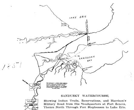
|
|
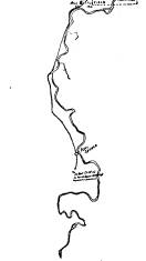
|
mand into the very heart of the Indian countryand caused the |
398 Ohio Arch. and Hist.
Society Publications.
Indians to sue for peace and agree to
restore to the whites the
captives demanded by them as the
necessary precursor of peace.
Thus it came to pass that Colonel
Bouquet with his expedition
which scarcely reached the southern
confines of the warlike
Wyandots at the head of the Muskingum
river received the
surrender of the whites and all the
glory in connection there-
with; while Colonel Bradstreet had the
humiliation of having
all his treaties disapproved by the
British commander-in-chief,
and actually returned in disgrace.
Bradstreet was undoubtedly
so chagrined at the treatment by General
Gage that he left
the Sandusky country hurriedly in a
rage, even leaving some of
his men who were engaged in hunting.
Three days later he
met with a serious disaster off the
mouth of Rocky River from
which place his command returned to
Albany after suffering
untold hardships.
Our next knowledge of Lower Sandusky
comes from Cap-
tain Samuel Brady, the scout, whom
Washington sent out for
information upon the movements of the
Indians of this region.
He approached the village under cover of
night, forded the river
and hid himself on the island, since
known as Brady's Island,
just below the present State Street
bridge. The next morning
he was an unsuspected witness at a horse
race. A war party
had just arrived from Kentucky with some
fine horses. They
were lined up along the west bank of the
river. A white
mare won race after race. Wearying of
the monotony the In-
dians put two riders upon her. Still she
came in victorious. A
third man was added, which load sufficed
to defeat her, and
seemed to delight the spectators. Brady
escaped that night and
reported to Washington that the Indians
were engrossed with
other matters than war.
In 1778 Daniel Boone and Simon Kenton
were each led
captive through this village. Both
fortunately escaped their In-
dian captors. Preceding and following
the Revolutionary War
more Indian captives were brought to
Lower Sandusky than to
any other place. The Moravian
missionaries Heckewelder and
Zeisberger as prisoners were lodged in
the houses of Arundel
and Robbins in the spring of 1781. The two English traders
Arundel and Robbins were settled at the
Wyandot village at the
|
Old Fort Sandoski of 1745. 399
foot of the lower rapids of the Sandusky river, Lower Sandusky (now Fremont), which was recorded in Hutchin's map of 1764 as Junqueindundeh. Here they observed the ordeal of running the gauntlet. Heckewelder in his History of the Indian Nations writes: |
|
|
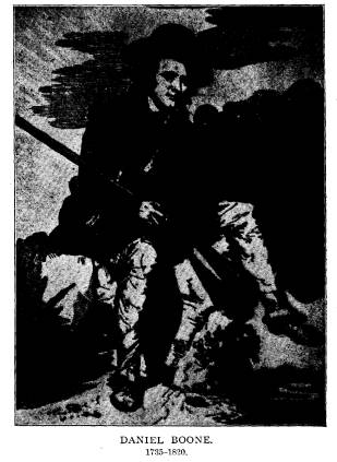
|
"In the month of April, 1782, when I was myself a prisoner at Lower Sandusky, waiting for an opportunity to proceed with a trader to Detroit, three American prisoners were brought in by fourteen warriors. As soon as they had crossed the river they were told to run as hard as they could to a painted post which was shown to them. The youngest of the three without a mo- |
|
400 Ohio Arch. and Hist. Society Publications.
ment's hesitation immediately started for it, and reached it with- out receiving a single blow; the second hesitated for a moment, but recollecting himself he also ran as fast as he could and likewise reached the post unhurt. The third, frightened at seeing so many men, women and children with weapons in their hands ready to strike him, kept begging the captain to spare him, saying he was a mason and would build him a fine large house or do any work for him. "'Run for your life,' said the chief to him, 'and don't talk now of building houses!' The captain turned his back upon him and our mason now began to run, but received many a hard blow. one of which nearly brought him to the ground, which if he had |
|
|
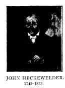
|
foot it every step of the way." The kindhearted Frenchman, Levallie, who received Girty's order disobeyed it, however, sent a runner to the commandant at Detroit representing the situation of the large band of captives and got boats to take them from Lower Sandusky down the Sandusky river and thence to Detroit. The massacre of the Moravians in their villages on the Mus- kingum, which occurred in 1782, falls outside the limits of this sketch, as does Crawford's expedition and awful death at Upper Sandusky in May, 1782. Crawford, though ten years the senior, had learned surveying under Washington and had recently, in his humble cabin on the banks of the Youghiogheny, been visited by the commander-in-chief. Butler's Rangers were sent by De Peyster, the British commandant at Detroit, to support the In- dians against Crawford's advancing force of American volun- |
|
Old Fort Sandoski of 1745. 401
teers. The Rangers were mounted and took two cannon and a mortar. Their horses were sent around the lake by land, while they with their arms and cannon took boat to Lower Sandusky, where their horses met them for the advance. At the lower village, too, were the traders who, at Crawford's approach, had fled from Upper Sandusky. In Western Reserve Historical Tract, No. 22, entitled Cleve- land in the War of the Revolution, though the compiler is obliged |
|
|
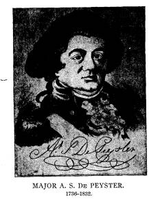
|
established a post at Lower Sandusky." It reads: "FORT PITT, Nov. 11, 1782. "SIR:-I have received intelligence through various channels, that the British have established a post at Lower Sandusky; and also informa- tion that it is suspected they intend erecting one either at Cuyahoga Creek or Grand River, (Fairport). But as these accounts are not from persons of military knowledge, nor to be fully relied upon in any par- ticular, and I am anxious to have the facts well established; you will therefore proceeded with Lieutenant Rose,* my aid-de-camp, and six active * Lieut. Rose, it will be remembered, was sent by Gen. Irvine as his representative with the ill-fated expedition of Col. Crawford against the Vol. XVII- 26. |
|
402 Ohio Arch. and Hist. Society Publications.
men, in order to reconnoiter these two places, particularly Cuyahoga. As your party is so small you will use every precaution to avoid being dis- covered, which service I expect you will be able to perform, as they will probably be relaxed in discipline at this advanced season of the year. |
|
|
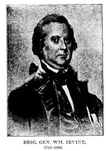
|
prevent future discovery. As it may be necessary for you to detach or separate from Mr. Rose, it will be proper for you to give him a cer- tified copy of this order. I am sir your obedient humble servant, WM. IRVINE, B. GENERAL. "Major Craig."
In 1785 the masterful Brandt held a great council fire at Sandusky villages in June, 1782. He was fortunate enough to escape the clutches of the savages. He was by birth a Russian nobleman, Baron Gustave Henri de Rosenthal. Having killed a fellow-nobleman in a duel near the palace in St. Petersburg, he fled in disguise to America, where the Revolution was in progress, and fought long and gallantly for Amer- ican Independence, being the only Russian officer on the American side. He was pardoned by Czar Alexander and in April, 1784, returned to Russia, married an early love and was appointed Field Marshal of the Province of Livonia. |
|
Old Fort Sandoski of 1745. 403 Lower Sandusky and here formed the league which six years later defeated the American army under Arthur St. Clair. Within a year after holding this council fire, Brandt visited London and was feted and encouraged by all the British authorities in his undertaking to drive the Americans south of the Ohio. St. Clair's defeat was followed two years later by that of General Harmar, and the Indians' onslaught continued unchecked till Maj. General Wayne on Aug. 8, 1794, at the Battle of Fallen Timbers, finally vanquished them with frightful slaughter. The Wyandots were the bravest of the Indians. "With other tribes, flight in battle was no disgrace and was sometimes |
|
|
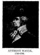
|
taining information. Wells, who spent his early life among the Indians as a captive, was perfectly acquainted with their character and answered that he could capture a prisoner, but not one from Sandusky. 'Why not from Sandusky?' asked the General. 'Be- cause there are only Wyandots at Sandusky,' he answered. 'Why will not a Wyandot do?' 'A Wyandot will never be taken alive.' General Wayne in a letter to Tarhe the famous Wyandot war- rior of Lower Sandusky, who had been the first to espouse the American cause after the defeat of the Indians at the Battle of Fallen Timbers, wrote: |
404 Ohio Arch. and Hist. Society Publications.
"To Tarhe and all the other Sachems
and War Chiefs at Sandusky:
"Brothers:-You express some
apprehension of injury from some
of the hostile tribes on account of the
part you have lately taken. Your
father General Washington, the President
of the fifteen Fires of America,
will take you under his protection and
has ordered me to defend his
dutiful children from any injury that
may be attempted against them on
account of their peaceable disposition
towards the United States, and for
which purpose he will order a fort or
fortification to be built at the foot
of the rapids of Sandusky on the
reserved lands as soon as the season
and circumstances will permit.
"ANTY. WAYNE.
"Major General and Commander in Chief
of the Legion of the U. S.
Commissioner Plenipotentiary of the said
United States for settling
a permanent peace with all the Indian
Tribes and Nations northwest
of the Ohio.
"Greenville, 1st January, 1795.
"RD. ENGLAND.
Colonel Commanding.
"Endorsed In Lt. Governor Simcoe's
No. 21 to the Duke of Port-
land."
On the 25th November, 1808, the Indian
tribes in a treaty
concluded at Brownstown, in the
Territory of Michigan, ceded
to the United States a tract of land for
a road of 120 feet in
width, from the foot of the rapids of
the river Miami of Lake
Erie (now Ft. Meigs on the Maumee),
through Lower Sandusky,
to the western line of the Connecticut
Reserve (Bellevue), and
all the land within one mile of the said
road on each side thereof;
and also a tract of land, for a road
only, 120 feet in width, to run
southwardly from Lower Sandusky to the
boundary line estab-
lished by the treaty of Greenville.
The former road known as the Western
Reserve and Maumee
Pike was in course of time constructed
and became especially
famous from having no ascertainable
bottom when used by the
Ohio militia in the Michigan war. The
road from Lower San-
dusky south was not constructed under
the authority granted by
this treaty; but after the declaration
of war with Great Britain,
June 18, 1812, Maj.-Gen. Wm. H.
Harrison, commanding the
northwestern army, directed the laying
out of a military road fol-
lowing the old French and Indian trail,
known to historians
as the Sandusky-Scioto trail from Lake
Erie, near old Fort San-
|
Old Fort Sandoski of 1745. 405
dusky, thence down the west bank of the Sandusky and along the Scioto to the Ohio. This trail from Lake Erie to the Ohio fol- lowed the Sandusky-Scioto watercourse, which had but two land portages: one the de Lery portage of two miles from the lake at the mouth of Portage river to Sandusky bay near the mouth of the Sandusky river; and the other the portage of less than four miles from the headwaters of the Sandusky to that of the Scioto. Capt. James Smith, one of the early white prisoners, was taken |
|
|
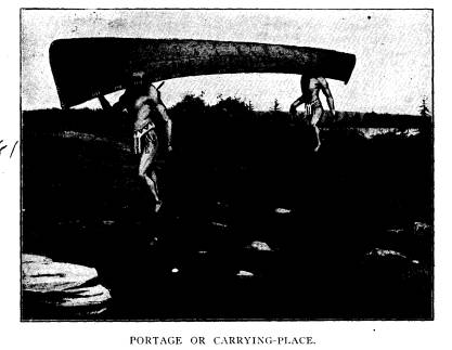
|
over this watercourse and portage several times during his cap- tivity, 1755-59. The old French and Indian trail later became generally known as the Harrison military trail of the war of 1812, and extended from Gen. Harrison's headquarters at Franklinton, now Colum- bus, the county seat of Franklin county, as well as the capital of the state; from which point it extended through what have since become the county seat towns of Delaware, Delaware county; Marion, Marion county; to Ft. Ferree, 1813, now Upper San- |
406 Ohio Arch. and Hist.
Society Publications.
dusky, the county seat of Wyandot
county; to Ft. Ball, 1813, now
Tiffin, the county seat of Seneca
county; to Ft. Seneca, 1813, on
the Sandusky river, where General
Harrison made his permanent
headquarters during the northwestern
campaign. The military
road continued thence northwardly to
Fort Stephenson, built in
1812, at Lower Sandusky, now Fremont,
the county seat of San-
dusky county; and thence to the mouth of
the Portage river on
Lake Erie, now Port Clinton, the county
seat of Ottawa county,
near which are the ruins of old Fort
Sandusky of 1745. From
Ft. Seneca a shorter military trail was
cut directly through to
Fort Meigs, built in 1813.* From Fort Stephenson at Lower
Sandusky, there was a trail much used by
the military, extend-
ing from Fort Meigs to Fort Stephenson
and on to the mouth
of the Huron river and to Cleveland; and
also a trail, one
of the earliest in Ohio, from the old
French fort, Junundat, built
in 1754, up the easterly bank of the
Sandusky river, to the
Wyandot village of Junquindundeh, later
Lower Sandusky and
now Fremont.
The suggestion has recently been made to
preserve the old
French and Indian trail, later known as
the Harrison military
trail of the War of 1812, from the State
Capitol at Columbus,
to Lake Erie at Port Clinton and the
Camp Perry rifle range of
the present day, as an automobile
highway. Such a road would
not only be of great utility and
pleasure to the automobilists of
the State, but would also preserve this
historic military road made
so famous by General Harrison, and over
which his soldiers of
the regular army, reinforced by the Ohio
militia under Governor
Meigs and the Kentucky militia under
Governor Shelby, marched
to victory, driving the British and
their Indian allies forever
from Ohio soil. A section of the
original Indian trail, over a
* On this route an enormous flat boulder
was passed which was
named the Harrison rock because of the
story that General Harrison
with the officers of his Staff used it
as a mess table on his frequent trips
between Fort Seneca and Fort Meigs.
Prof. G. F. Wright, president of
the Ohio Arch. and Hist. Society,
visited the rock recently, and found it
to be 34 feet in circumference and approximately
10x13 feet face, weigh-
ing some 80 tons. It is of magnesian
rock, syenite rather than granite, the
syenite of Egypt. It belongs to the
Laurentian age, the oldest of the
world and came down from north of Lake
Huron.
|
Old Fort Sandoski of 1745. 407 half mile in extent, is preserved through Spiegel Grove. In fact, since the agitation for the preservation of this famous Indian trail, that portion of it which extends through Spiegel Grove has been offered to the Ohio Archaeological and Historical Society to be forever preserved. This gift ought to serve as an incentive to the preservation and marking of the entire trail. The gallant defence of Ft. Stephenson by Major George |
|
|
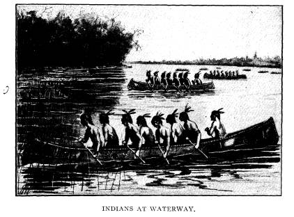
|
Croghan, 17th U. S. Infantry, with but 160 men against 2,000 British and Indians under Proctor and Tecumseh, on the 1st and 2d of August, 1813, was followed by the immediate retreat of Proctor's force of regulars on the ships of Captain Barclay's fleet down the Sandusky river to Lake Erie, where on the 10th of September Commodore Oliver Hazard Perry captured the entire British fleet in the sanguinary battle of Lake Erie. General Har- rison ordered his entire command to Ft. Stephenson at Lower Sandusky and then marched down the left bank of the river to old Ft. Sandusky and across the de Lery portage to Lake Erie |
|
408 Ohio Arch. and Hist. Society Publications.
The American commander followed the example of the French expeditions of earlier times and caused the vessels on which his supplies had been brought down the Sandusky river from Ft. Stephenson to be hauled across the famous de Lery portage from old Ft. Sandusky to the mouth of the Portage river at Lake Erie. He further caused the construction of a fence across this peninsula by regiments of militia formed in column so as to stretch across from the Sandusky to the Portage rivers. Within the Marblehead peninsula thus enclosed, he turned loose the several thousand horses of his command to be guarded by a small force, while with the remainder of his command he embarked on |
|
|
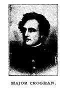
|
up their horses and supplies, and taking up their march over the de Lery portage and the old French and Indian trail back through Ft. Stephenson to Ft. Seneca. Here many of the militia were honorably discharged, and the victorious soldiers of Ohio and Kentucky resumed their march over the old trail to the new State Capital at Columbus. It is an interesting fact that in the military expeditions of the Indians, French, British and Americans, in the "Sandusky country," the British alone used the present day entrance to the Sandusky river, through Sandusky bay from Lake Erie. Brad- street's expedition in 1764, in large, unwieldy batteaux carry- ing twenty-seven men each, entered Sandusky bay and sailed up Sandusky river as far as the lower falls of the Sandusky (now Fremont), in his effort to make a juncture with the Bouquet ex- pedition which started from Ft. Pitt. He was unable to get his |
|
Old Fort Sandoski of 1745. 409
cumbrous batteaux over the low falls and thus it happened that he made his westernmost camp at this very point as previously narrated. Again the British under Proctor in July, 1813, on the ships of Captain Barclay's fleet, after making a feint against Ft. Meigs at the lower rapids of the Maumee, sailed back to Lake Erie, around to Sandusky bay and up the Sandusky river. For- tunately for Major Croghan, Proctor mistook the wider mouth of Muddy Creek for the true channel of the Sandusky, and thereby lost a day. However, on the evening of July 31, Proc- |
|
|
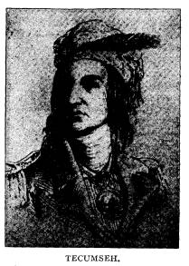
|
his wounded, burying most of his dead on the banks of the San- dusky, near the present W. & L. E. R. R. cut, and sailed down the river to Lake Erie. He stopped, however, long enough to pillage the Whitaker home and destroy the storehouse out of revenge for the information alleged to have been given the Americans by Mrs. Elizabeth Foulks Whitaker, wife of the first permanent white settler in Ohio, as detailed later. The French, and later the Americans, imitating the Indians, employed frailer craft than did the British, and in their expedi- tions to and from Detroit skirted the islands or hugged the |
410 Ohio Arch. and Hist. Society
Publications.
western shore of Lake Erie around to the
mouth of the Portage
river; whence as heretofore shown, the
Indians, the numerous
French expeditions under de Lery and
others, and the Americans
as late as 1813, under General Harrison,
used the land portage and
hauled their boats across to the mouth
of the Sandusky. They
did this rather than risk their frail
crafts in the stormy passage
of forty-five miles around the
Marblehead peninsula and up the
Sandusky bay.
The best description extant of Major
Croghan's defense of
Fort Stephenson and of General
Harrison's expedition into Can-
ada is that contained in "A History of the Late War in the
Western Country," by Robert B.
McAfee, Lexington, Ky., a
rare and valuable volume.
"General Harrison had returned from
Cleveland to Lower Sandusky
(July, 1813) several days before the
arrival of the enemy, and received
at that place from the express the
information that Camp Meigs was
again invested. He then immediately
removed his headquarters to Seneca
town, about nine miles up the Sandusky
river, where he constructed a
fortified camp, having left Major
Croghan with 160 regulars in Fort
Stephenson and taken with him to Seneca
about 140 more, under the
immediate command of Colonel Wells. A
few days afterward he was
reinforced by the arrival of 300
regulars under Colonel Paul, and Colonel
Ball's corps of 150 dragoons, which made
his whole force at that place
upwards of 600 strong. He was soon
joined also by Generals McArthur
and Cass; and Colonel Owings with a
regiment of 500 regulars from
Kentucky, was also advancing to the
frontiers; but he did not arrive at
headquarters before the siege of Fort Meigs
had been abandoned by the
enemy.
* * *
"The force which Proctor and
Tecumseh brought against us in this
instance has been ascertained to have
been about 5,000 strong. A greater
number of Indians were collected by them
for this expedition than ever
were assembled in one body on any other
occasion during the whole war.
"Having raised the siege of Camp
Meigs, the British sailed round
into Sandusky bay, whilst a competent
number of their savage allies
marched across through the swamps of
Portage River, to co-operate in
a combined attack at Lower Sandusky,
expecting no doubt that General
Harrison's attention would be chiefly
directed to forts Winchester and
Meigs. The General however had
calculated on their taking this course,
and had been careful to keep patrols
down the bay, opposite the mouth
of Portage River, where he supposed
their forces would debark.
"Several days before the British
had invested Fort Meigs General
Harrison, with Major Croghan and some
other officers, had examined the
|
Old Fort Sandoski of 1745. 411 |
|
|
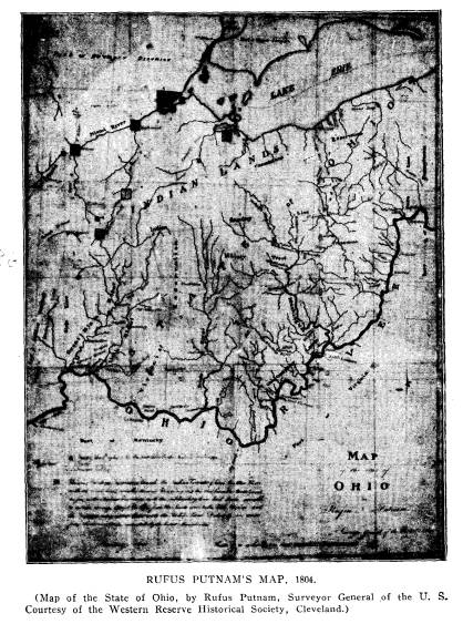
4l2 Ohio Arch. and Hist. Society
Publications.
heights which surround Fort Stephenson;
and as the hill on the opposite
or southeast side of the river, was
found to be the most commanding
eminence, the General had some thoughts
of removing the fort to that
place, and Major Croghan declared his
readiness to undertake the work.
But the General did not authorize him to
do it, as he believed that if
the enemy intended to invade our
territory again, they would do it be-
fore the removal could be completed. It
was then finally concluded, that
the fort which was calculated for a
garrison of only two hundred men,
could not be defended against the heavy
artillery of the enemy; and that
if the British should approach it by
water, which would cause a pre-
sumption that they had brought their
heavy artillery, the fort must be
abandoned and burned, provided a retreat
could be effected with safety.
In the orders left with Major Croghan it
was stated,-'Should the
British troops approach you in force
with cannon, and you can discover
them in time to effect a retreat, you
will do so immediately, destroy-
ing all the public stores. * * * You
must be aware that the attempt
to retreat in the face of an Indian
force would be vain. Against such
an enemy your garrison would be safe,
however great the 'number.'"
On the evening of the 29th, Gen.
Harrison received intelli-
gence by express from Gen. Clay, that
the enemy had abandoned
the seige of Fort Meigs, and as the
Indians on that day had
swarmed in the woods round his camp, he
entertained no doubt
but an immediate attack was intended
either on Sandusky or
Seneca. He therefore immediately called
a council of war, con-
sisting of McArthur, Cass, Ball, Paul,
Wood, Hukill, Holmes and
Graham, who were unanimously of the
opinion that Fort Stephen-
son was untenable against heavy
artillery, and that as the enemy
could bring with facility any quantity
of battering cannon against
it, by which it must inevitably fall,
and as it was an unimportant
post, containing nothing the loss of
which would be felt by us,
that the garrison should therefore not
be reinforced but with-
drawn and the place destroyed. In
pursuance of this decision
the General immediately despatched the
following order to Major
Croghan:
MAJOR GEORGE CROGHAN.
"Sir, immediately on receiving this
letter, you will abandon Fort
Stephenson, set fire to it and repair
with your command this night to
headquarters. Cross the river and come
up on the opposite side. If
you should deem and find it
impracticable to make good your march
to this place, take the road to Huron
and pursue it with the utmost
circumspection and despatch."
Old Fort Sandoski of 1745.
413
This order was sent by Mr. Conner and
two Indians, who
lost their way in the dark and did not
arrive at Fort Stephenson
before 11 o'clock the next day. When
Major Croghan received
it, he could not then retreat with
safety, as the Indians were hov-
ering round the fort in considerable
force. He called a council
of his officers, a majority of whom
coincided with him in opinion
that a retreat would be unsafe, and that
the post could be main-
tained against the enemy at least until
further instructions could
be received from headquarters. The major
therefore immediately
returned the following answer:
"Sir, I have received yours of
yesterday, 10 o'clock P. M., ordering
me to destroy this place and make good
my retreat, which was received
too late to be carried into execution.
We have determined to maintain
this place and by heavens we can."
In writing this note Major Croghan had a
view to the prob-
ability of its falling into the hands of
the enemy, and on that
account made use of a stronger language
than would otherwise
have been consistent with propriety. It
reached the General on
the same day, who did not fully
understand the circumstances
and motives under which it had been
dictated. The following
order was therefore immediately
prepared, and sent with Colonel
Wells in the morning, escorted by
Colonel Ball with his corps of
dragoons:
"JULY 30, 1813.
"SIR. - The General has received
your letter of this date, informing
him that you had thought proper to
disobey the order issued from this
office, and delivered to you this
morning. It appears that the informa-
tion which dictated the order was
incorrect; and as you did not receive
it in the night as was expected, it
might have been proper that you should
have reported the circumstance and your
situation, before you proceeded
to its execution. This might have been
passed over, but I am directed
to say to you, that an officer who
presumes to aver that he has made
his resolution and that he will act in
direct opposition to the orders
of his General can no longer be
entrusted with a separate command.
Colonel Wells is sent to relieve you.
You will deliver the command to
him and repair with Col. Ball's squadron
to this place. By command
etc.; A. H. Holmes, Asst. Adj.
General."
The squadron of dragoons on this trip
met with a party of
Indians near Lower Sandusky and killed
11 out of 12. The In-
|
414 Ohio Arch. and Hist. Society Publications. dians had formed an ambush and fired on the advance guard con- sisting of a sergeant and five privates. Upon seeing the squadron approach they fled, but were pursued and soon overtaken by the front squad of Captain Hopkins's troop. The greater part of them were cut down by Colonel Ball and Captain Hopkins with his subalterns, whose horses being the fleetest overtook them first. The loss on our part was two privates wounded and two horses killed. |
|
|
|
Colonel Wells being left in the command of Fort Stephen- son, Major Croghan returned with the squadron to headquarters. He there explained his motives for writing such a note, which were deemed satisfactory and having remained all night with the General who treated him politely, he was permitted to return to his command in the morning with written orders similar to those he had received before. A reconnoitering party which had been sent from headquart- ers to the shore of the lake, about 20 miles distant from Fort Stephenson, discovered the approach of the enemy by water on the evening of the 31st of July. They returned by the fort, after |
Old Fort Sandoski of 1745. 415
12 o'clock
the next day, and had passed it but a few hours when
the enemy made their appearance before
it. The Indians showed
themselves first on the hill over the
river, and were saluted by a
6-pounder, the only piece of artillery
in the fort, which soon
caused them to retire. In half an hour
the British gunboats came
into sight; and the Indian forces
displayed themselves in every
direction, with a view to intercept the
garrison should a retreat
be attempted. The 6-pounder was fired a
few times at the gun-
boats, which was returned by the
artillery of the enemy. A land-
ing of their troops with a 51/2 inch
howitzer was effected about a
mile below the fort; and Major Chambers
accompanied by Dick-
son was despatched towards the fort with
a flag, and was met on
the part of Major Croghan by Ensign
Shipp of the 17th Regi-
ment. After the usual ceremonies Major
Chambers observed to
Ensign Shipp, that he was instructed by
Gen. Proctor to demand
the surrender of the fort, as he was
anxious to spare the effusion
of human blood, which he could not do,
should he be under the
necessity of reducing it by the powerful
force of artillery, regu-
lars and Indians under his command.
Shipp replied that the com-
mandant of the fort and its garrison
were determined to defend
it to the last extremity, that no force
however great could induce
them to surrender, as they were resolved
to maintain their post
or to bury themselves in its ruins.
Dickson then said that their
immense body of Indians could not be
restrained from massacring
the whole garrison in case of success -
of which we have no
doubt, rejoined Chambers, as we are
amply prepared. Dickson
then proceeded to remark that it was a
pity so fine a young man
should fall into the hands of the
savages - sir, for God's sake
surrender, and prevent the dreadful
massacre that will be caused
by your resistance. Mr. Shipp replied
that when the fort was
taken there would be none to massacre.
It will not be given up
while a man is able to resist. An Indian
at this moment came out
of an adjoining ravine and advancing to
the Ensign took hold of
his sword and attempted to wrest it from
him. Dickson inter-
fered, and having restrained the Indian,
affected great anxiety
to get him safe into the fort.
The enemy now opened their fire from
their 6-pounders in
the gunboats and the howitzer on shore,
which they continued
|
416 Ohio Arch. and Hist. Society Publications.
through the night with but little intermission and with very little effect. The forces of the enemy consisted of about 500 regulars, and about 800 Indians commanded by Dickson, the whole being commanded by Gen. Proctor in person. Tecumseh was stationed on the road to Fort Meigs with a body of 2,000 Indians, expecting to intercept a reinforcement on that route. Major Croghan through the evening occasionally fired his 6- pounder, at the same time changing its place occasionally to induce a belief that he had more than one piece. As it produced very little execution on the enemy, and he was desirous of saving his ammu- nition, he soon discontinued his fire. The enemy had directed |
|
|
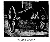
|
accomplished this object in secrecy. The embrasure was masked, and the piece loaded with a half charge of powder and double charge of slugs and grape shot. Early in the morning of the second, the enemy opened their fire from their howitzer, and three 6-pounders which they had landed in the night, and planted in a point of woods about 250 yards from the fort. In the evening, about 4 o'clock, they concen- trated the fire of all their guns on the northwest angle which con- vinced Major Croghan that they would endeavor to make a breach and storm the works at that point; he therefore immediately had that place strengthened as much as possible with bags of flour and sand, which were so effectual that the picketing in that place sustained no material injury. Sergeant Weaver with five or six gentlemen of the Petersburg Volunteers and Pittsburgh Blues, |
|
Old Fort Sandoski of 1745. 417
who happened to be in the fort, was entrusted with the manage- ment of the 6-pounder. Late in the evening when the smoke of the firing had com- pletely enveloped the fort, the enemy proceeded to make the as- sault. Two feints were made toward the southern angle, where Captain Hunter's lines were formed; and at the same time a col- umn of 350 men was discovered advancing through the smoke, within 20 paces of the northwestern angle. A heavy galling fire |
|
|
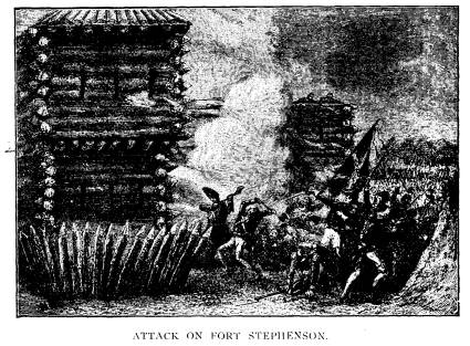
|
of musketry was now opened upon them from the fort which threw them into confusion. Colonel Shortt, who headed the prin- cipal column soon rallied his men and led them with great bravery to the brink of the ditch. After a momentary pause he leaped into the ditch, calling to his men to follow him, and in a few minutes it was full. The masked porthole was now opened, and the 6-pounder, at a distance of 30 feet, poured such destruction upon them that but few who had entered the ditch were fortunate Vol. XVII -27. |
|
418 Ohio Arch. and Hist. Society Publications.
enough to escape. A precipitate and confused retreat was the immediate consequence, although some of the officers attempted to rally their men. The other column which was led by Colonel Warburton and Major Chambers, was also routed in confusion by a destructive fire from the line commanded by Captain Hunter. The whole of them fled into the adjoining wood, beyond the reach of our small arms. During the assault, which lasted half an hour, the enemy kept up an incessant fire from their howitzer and five 6-pounders. They left Colonel Shortt, a lieutenant and 25 privates dead in the ditch; and the total number of prisoners |
|
|
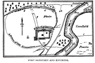
|
taken was 26, most of them badly wounded. Major Muir was knocked down in the ditch, and lay among the dead, till the dark- ness of the night enabled him to escape in safety. The loss of the garrison was one killed and 7 slightly wounded. The total loss of the enemy could not be less than 150 killed and wounded. When night came on, which was soon after the assault, the wounded in the ditch were in a desperate situation. Complete relief could not be brought to them by either side with any degree of safety. Major Croghan however relieved them as much as possible - he contrived to convey them water over the picketing |
|
Old Fort Sandoski of 1745. 419
in buckets, and a ditch was opened under the pickets through which those who were able and willing were encouraged to crawl into the fort. All who were able preferred of course to follow their defeated comrades, and many others were carried from the vicinity of the fort by the Indians, particularly their own killed and wounded; and in the night about 3 o'clock the whole British and Indian force commenced a disorderly retreat. So great was their precipitation, that they left a sail boat containing some clothing and a considerable quantity of military stores; and on the next day 70 stand of arms and some braces of pistols were picked up around the fort. Their hurry and confusion was caused by the apprehension of an attack from Gen. Harrison, of whose position and force they had probably received an exaggerated account. |
|
|
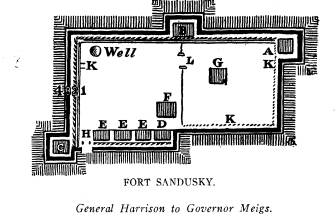
|
HEADQUARTERS, SENECA TOWN, 2d August, 1813. "DEAR SIR: The enemy have been since last evening, before Lower Sandusky, and are battering it with all their might. Come on, my friend, as quickly as possible, that we may relieve the brave fellows who are defending it. I had ordered it to be abandoned. The order was not obeyed. I know it will be defended to the last extremity; for earth does not hold a set of finer fellows than Croghan and his officers. I shall expect you to- morrow certainly. Yours, etc., WM. H. HARRISON [Governor Shelby.] |
420 Ohio Arch. and Hist.
Society Publications.
HEADQUARTERS, SENECA, 12 Sept., 1813.
"You will find arms at Upper
Sandusky; also a considerable quan-
tity at Lower Sandusky. I set out from
this place in an hour. Our fleet
has beyond all doubt met that of the
enemy. The day before yesterday
an incessant and tremendous cannonading
was heard in the direction
of Malden by a detachment of troops
coming from Fort Meigs. It
lasted two hours. I am all anxiety for
the result. There will be no
occasion for your halting here. Lower
Sandusky affords fine grazing.
With respect to a station for your
horses, there is the best in the world
immediately at the place of embarkation.
The Sandusky Bay, Lake Erie,
and Portage river form between them a
peninsula, the isthmus of which
is only a mile and a half across. A
fence of that length, and a sufficient
guard left there, would make all the
horses of the army safe. It would
enclose fifty or sixty thousand acres,
in which are many cultivated fields,
which have been abandoned and are now
grown up with the finest grass.
Your sick had better be left at Upper
Sandusky or here.
HARRISON."
Within half an hour after the above
letter was written, the
general received the following laconic
note from the commodore.
by express from Lower Sandusky:
"U. S. BRIG NIAGARA, OFF THE WESTERN SISTER, ETC.,
September 10, 1813.
"DEAR GENERAL-We have met the enemy and they are ours-
two ships, two brigs, one schooner and a
sloop.
"Yours with great respect and
esteem,
OLIVER HAZARD PERRY."
The exhilarating news set Lower Sandusky
and camp Seneca
in an uproar of tumultuous joy. The general immediately pro-
ceeded to the former place, and issued
his orders, for the move-
ment of the troops, and transportation
of the provisions, military
stores, etc., to the margin of the lake,
preparatory to their em-
barkation.
In bringing down the military stores and
provisions from
the posts on the Sandusky river, to the
vessels in the lake, a short
land carriage became necessary to
expedite the embarkation.
The peninsula formed by the Sandusky Bay
on the right and by
the Portage river and Lake Erie on the
left, extending between
fifteen and twenty miles from the
anchorage of the shipping in
the mouth of the Portage; at which place
the isthmus on which
Old Fort Sandoski of 1745. 421
the army was encamped was less than two
miles across from one
river to the other. The boats in going
round the peninsula to
the shipping, would have to travel
upward of forty miles, and to
be exposed to the dangers of the lake
navigation. It was there-
fore deemed the most safe and
expeditious to transport the stores
and drag the boats across the isthmus,
which was accomplished
between the 15th and 20th of the month,
whilst the army was
detained in making other necessary
arrangements.
The Kentucky troops were encamped across
the narrowest
part of the isthmus, above the place of
embarkation; and each
regiment was ordered to construct a
strong fence of brush and
fallen timber in front of its encampment,
which extended when
finished, from Portage River to Sandusky
River. Within this en-
closure their horses were turned loose
to graze on ample pastures
of excellent grass. The preparations for
the expedition being
nearly completed, it became necessary to
detail a guard to be left
for the protection of the horses. The
commandants of regiments
were ordered by the governor to detach
one-twentieth part of their
commands for this service; and Colonel
Christopher Rife was
designated as their commander. In
furnishing the men, many
of the colonels had to resort to a
draft, as volunteers to stay on
this side the lake could not be
obtained.
On the 20th, Gen. Harrison embarked with
the regular troops
under Generals McArthur and Cass, and
arrived the same day
at Put-in-Bay in Bass Island, and about
10 miles distant from
the point of embarkation. Next morning
the governor (Shelby)
sailed with a part of his troops, having
ordered Major General
Desha to remain at Portage and bring up
the rear, which he per-
formed with great alacrity and
vigilance. On that and the suc-
ceeding day all the militia arrived at
Bass Island. Colonel Rife
was left in command at Portage, with
Doctor Maguffin as his
surgeon. The whole army remained on Bass
Island on the 24th,
waiting for the arrival of all necessary
stores and provisions at
that place.
On the 25th, the whole army moved to the
Middle Sister, a
small island containing about five or
six acres of ground, which
was now crowded with men, having about
4,500 upon it. Whilst
the transport vessels were bringing up
the military stores and
|
422 Ohio Arch. and Hist. Society Publications. provisions on the 26th, Gen. Harrison sailed with Commodore Perry in the Ariel to reconnoitre off Maiden, and ascertain a suit- able point on the lake shore for the debarkation of his troops. On Monday the 27th, the whole army was embarked early in the day, and set sail from the Middle Sister for the Canada shore, Gen. Harrison having previously circulated a general order among the troops in which he exhorted them to remember the fame of |
|
|
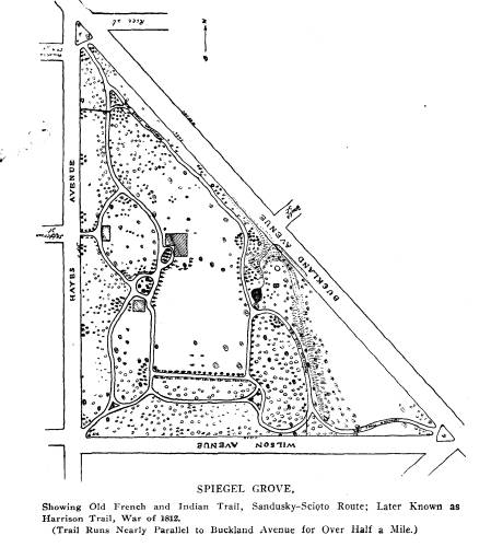
|
Old Fort Sandoski of 1745. 423
their ancestors and the justice of the cause in which they were engaged. Soon after the British force had surrendered and it was discovered that the Indians were yielding on the left, Gen Har- rison ordered Major Payne to pursue Gen. Proctor with a part of his battalion. * * * But Proctor was not to be taken. His guilty conscience had told him that his only chance for safety from the vengeance of those whose countrymen he had murdered |
|
|
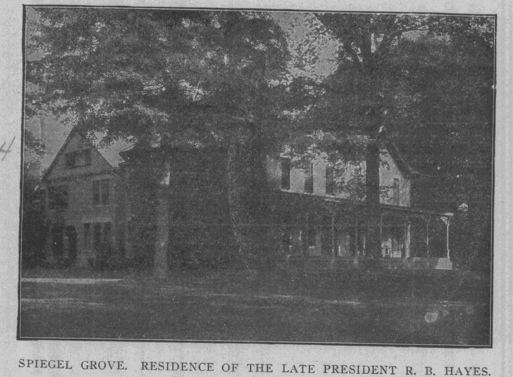
|
lay in the celerity of his flight. The pursuers, however, at last pressed him so closely that he was obliged to abandon the road, and his carriage and sword were captured by the gallant Major Wood. Six pieces of brass artillery were taken, three of which had been captured in the Revolution at Saratoga and York, and surrendered again by Hull in Detroit.
Lieut-Colonel Eleazer Wood was one of the first graduates of the military academy at West Point, 1806, and was a dis- |
424 Ohio Arch. and Hist.
Society Publications.
tinguished engineer. In 1812 he built
the fort at Lower San-
dusky, which was later named after Col.
Stephenson, and was so
gallantly defended by Major George
Croghan on the 2d of
August, 1813. He was also the engineer
who planned Fort Meigs
in 1813, and participated most gallantly
in its siege and also in
the Battle of the Thames. He was killed
September 17, 1814.
Proctor's carriage, captured by Major
Wood, was brought
to Lower Sandusky, and for many years
was shown upon all
public occasions as one of the trophies
of the war, second in
interest only to "Old Betsy."
One of the "six pieces of brass
artillery" referred to above,
is now one of the most cherished relics
in the museum on Fort
Stephenson. It is a handsome brass
piece, evidently a French
gun originally, as it has near its
muzzle the royal cipher of King
Louis of France. It was presented to
King George of England,
or was captured by him, and has the
monogram G. R., with the
crown, near its base. It was captured
from the British under
Burgoyne at Saratoga, and in common with
other trophies was
elaborately inscribed, as captured by
Benedict Arnold:
TAKEN AT THE STORM OF
THE BRITISH LINE NEAR SARATOGA.
BY
October 7, 1777.
After Benedict Arnold turned traitor at
West Point, his
name was carefully erased from all
trophies. This gun was one
of the number so ignominously
surrendered at Detroit by Gen.
Hull, August 16, 1812, to the British
Major General Brock. After
being captured for the second time from
the British under Proctor,
by the Americans under Gen. Harrison at
the Battle of the
Thames, October 5, 1813, it was retired
from active service and
has now for more than twenty-five years
been an object of the
greatest interest in the museum on the
site of old Fort Stephenson.
Old Fort Sandoski of 1745. 425
The first permanent white settlers in
Ohio were James
Whitaker and Elizabeth Foulks, who were
captured in western
Pennsylvania in 1774 and 1776
respectively, by the Wyandot
Indians, by whom they were adopted and
taken to Lower San-
dusky, now Fremont, Ohio, where they
were brought together
as adopted members of the Wyandot tribe.
They were married
in Detroit, in 1781, and returned to a
tract of land which had
been given to them by the Wyandots on
the Sandusky River,
three miles below the lower rapids known
as Lower Sandusky.
Here they lived and raised a family of
eight children. One
of their grandchildren and several great
grandchildren are resi-
dents of Fremont and vicinity.
James Whitaker, who became an Indian
trader, died in 1804,
at Upper Sandusky, where he had a store;
but his remains were
brought to his home established in 1781,
where he was buried on
a tract originally given him as a
wedding gift by the Indians,
which tract, containing 1280 acres, was
set aside to his widow
by the treaty made at Fort Industry,
September 29, 1817. His
tombstone was brought from the old
Whitaker farm and placed
in Birchard Library, just one hundred
years after its erection
over his grave. It bears the following
inscription:
IN MEMORY OF
JAMES WHITACRE
WHO DIED
DEC. 17, 1804
In the 48th year of his age.*
The Whitaker Reserve is of especial
interest to the Daugh-
ters of the American Revolution owing to
the fact that Major
Nathan Goodale, one of the most gallant
officers of the Revolu-
tionary army, who emigrated to Marietta
with the Ohio Company
was buried there. Major Goodale was a
native of Brookfield,
* For a full account of James Whitaker
and his family, see Ohio.
Arch. & Hist. So. Quarterly,
January, 1907.
426 Ohio Arch. and Hist.
Society Publications.
Mass., but joined the Ohio Company in
1788. He removed to
Belpre, near Marietta, in 1789, where he
was captured March
1, 1793, while working on his farm
within fifty rods of the garri-
son, by eight Wyandot Indians, who
hurried him off toward
Detroit, in order to secure a large
ransom. While en route, near
Lower Sandusky, he fell ill and could
not travel. The Whitakers
learning of his condition took him to
their home, where Mrs.
Whitaker carefully nursed him until he
finally died and was prob-
ably buried in what afterward became the
Whitaker family grave-
yard. Mrs. Whitaker said that "the
Indians left him at her
house where he died of a disease like
pleurisy without having re-
ceived any very ill usage from his
captors other than the means
necessary to prevent his escape."
On "Croghan Day," 1885, the
Sandusky County Soldiers'
Monument in Fort Stephenson Park,
Fremont, Ohio, was un-
veiled, with Gen. Rutherford B. Hayes,
late President of the
United States, as presiding officer.
Before presenting the speak-
ers of the day, he read numerous letters
of regret, among which
was one from Gen. W. T. Sherman, which
contained the follow-
ing interesting statement as to the
importance of the victory
gained by Croghan:
"The defense of Fort Stephenson, by
Croghan and his gallant little
band, was the necessary precursor to
Perry's victory on the Lake, and
of General Harrison's triumphant victory
at the battle of the Thames.
These assured to our immediate ancestors
the mastery of the Great
West, and from that day to this the west
has been the bulwark of this
nation.
"The occasion is worthy a monument
to the skies, and nothing
could be more congenial to me personally
than to assist, but, as I hope
I have demonstrated, it is
impossible."
On "Croghan Day," 1906, the
remains of Colonel Croghan
were reinterred at the base of the
Soldiers' Monument. The
grave was covered with a large block of
Quincy granite bearing
this inscription:
George Croghan
Major 17th U. S. Infantry,
Defender of Fort Stephenson.
August 1st and 2d, 1813.
Old Fort Sandoski of 1745. 427
Born Locust Grove, Ky., Nov. 15, 1791.
Died New Orleans, La., Jan. 8, 1849,
Colonel Inspector General
United States Army.
Remains removed from
Croghan Family Burying Ground,
Locust Grove, Ky.,
August 2, 1906.
Two cannon and a commemorative tablet
mark the spot from
which the British cannon bombarded Fort
Stephenson.
The tablet reads as follows:
Near this spot
British cannon from Commodore Barclay's
fleet bombarded
Major Croghan in Fort Stephenson August
1, and 2, 1813.
General Proctor attempted to capture the
fort by assault with
his Wellington veterans, assisted by
Indians under Tecumseh.
Major Croghan with only 160 men and one
cannon
"Old Betsy," repulsed the assault.
The British retreated to their ships
with many killed and wounded,
but leaving Lt. Col. Shortt, Lieut.
Gordon
and 25 soldiers of the 41st regiment
dead in the ditch.
Commodore Barclay was wounded and with
his entire fleet including
the cannon used against Fort Stephenson
was captured by
Commodore Perry at the battle of Lake
Erie, Sept. 10, 1813.
General Proctor, with his British
regulars, was defeated and
Tecumseh with many of his Indians, was
killed by
General Harrison at the battle of the Thames, Oct.
5, 1813.
Major Croghan was awarded a gold medal
and each
of his officers a sword by the Congress
of the United States
for gallantry in the defense of Fort Stephenson.
Erected by the George Croghan Chapter,
D. A. R.
A pretty little scene links that battle
of nearly a century ago
with our own present. A group of
distinguished visitors one day
entered the Blue Room of the White
House, at Washington, un-
announced, during the administration of
President Hayes, and
were surprised to find the beautiful
mistress of the house sitting
on the floor, needle and thread in hand,
while before her half
reclining on the central divan, sat an
old soldier in the uniform
of an ordnance sergeant of the United
States Army.
The callers, who were Sir Edward
Thornton, the British
428 Ohio Arch. and Hist. Society Publications.
Minister, with some English friends,
were about to retire, when
the lady looked up from her work, saw
them, and laughingly
called them to stay. She rose from the
floor, shook hands warmly
with the old soldier, and assuring him
that his uniform was now
perfect, handed him over to the care of
her son.
The lady was our own Mrs. Lucy Webb
Hayes, and the old
soldier was Ordnance Sergeant William
Gaines, U. S. Army, re-
tired, the last survivor of the gallant
defenders of Fort Stephen-
son, who, after an active service of
over 51 years, had become an
inmate of the Soldiers' Home in
Washington as a reward for his
long service in the regular army. A full
dress uniform for an
ordnance sergeant was purchased and
ordered sent to the White
House, so that a photograph in uniform
could be taken of the old
soldier. To his great distress he
discovered that the sergeant's
stripes, indicative of his rank, had not
been attached to the seam
of his trousers, but had been sent loose
to be used at the wearer's
discretion.
Mrs. Hayes, who had come down to greet
him in the Blue
Room, learning the cause of his
distress, at once sent for needle
and thread, saying she would herself
stitch them on. She was
just finishing the task, sitting on the
floor with the old soldier
standing before her, when the British
Minister and his guests
entered, and caught the charming picture
to carry away to their
English home.
The great love which Mrs. Hayes bore for the Amer-
ican soldier was one of the
characteristics of her life. The
beautiful young wife and mother of but
thirty years, was "the
mother of the regiment" to her
husband's old regiment, the 23d
Ohio Infantry, from the breaking out of
the war until the day of
her death, nearly 30 years later, when
the survivors acted as a
guard of honor at her funeral in Spiegel
Grove. Her sympa-
thetic care for the wounded was
commemorated in the oil paint-
ing placed in the Soldiers' Orphans'
Home at Xenia, and typified
her devoted service in the hospitals
after the bloody Antietam
campaign in which her own husband was so
severely wounded.
I feel sure that a principal pleasure of
your conference so-
journ in Fremont is the picture you will
carry away of the beauti-
ful home at Spiegel Grove, the home of
our loved and honored
Old Fort Sandoski of 1745. 429
citizens, Rutherford Birchard Hayes and
Lucy Webb Hayes. The
hospitality of the Hayes home is
proverbial, and many distin-
guished persons have shared it before
you. Many of these are
recalled to the visitor by the giant
oaks, the graceful elm, the
beautiful maple and the sturdy hickory,
which bear the names of
the more prominent of General Hayes'
comrades in arms, or in
the executive office in Washington, who
have been visitors at
this beautiful home. Almost every object
in it is historic or stor-
ied. Its library of Americana is one of
the finest extant. The
grove in which it stands is a primeval
forest, full of legends of
the Indians and their captives, and
frontiersmen and soldiers of
the early wars. The noble old mansion
and its grounds will,
we hope, long remain as a typical
American home of the latter
half of the 19th century, and
as a lasting memorial to our most
honored citizens.
The patriotic city of Fremont, at the
request of the local
Chapter of the Daughters of the American
Revolution, has placed
an historical tablet at the station of
each of the steam railroads
passing through that historic city.
While few if any cities in
Ohio can present so historically
interesting a Tablet, yet the cus-
tom is well worth following. The Tablet
reads:
FREMONT,
County Seat of Sandusky County, Ohio
The JUNQUINDUNDEH of the Indians, and
the LOWER SANDUSKY of the Revolutionary
War and the
War of 1812.
An old NEUTRAL TOWN of the ERIES used as
a refuge on
the destruction of the HURON Confederacy
by the IROQUOIS in 1650.
Westermost point reached by the BRITISH
and COLONIAL
TROOPS from New York, New Jersey and
Connecticut under ISRAEL
PUTNAM in BRADSTREET'S Expedition
against Pontiac in 1764.
A BRITISH POST established here during
the REVOLUTION-
ARY WAR
|
430 Ohio Arch. and Hist. Society Publications.
DANIEL BOONE, SIMON KENTON, the Moravians HECKE- WELDER and ZEISBERGER, and over 1000 whites held here as PRISONERS by the Indians. FORT STEPHENSON built in 1812, and gallantly defended by Major GEORGE CROGHAN, 17th U. S. Infantry, with 160 men, against 2000 British and Indians under PROCTOR and TECUMSEH, Aug. 1st and 2d, 1813. SPIEGEL GROVE, the home of RUTHERFORD B. HAYES, 19th President of the United States. |
|
|