Ohio History Journal
NORRIS F. SCHNEIDER
The National Road:
Main Street of America
A way to the West-where was the best
route?
George Washington pondered that question
anew in September 1784 as he sat in a
land agent's cabin near present-day
Morgantown, West Virginia. Gathered about
him were settlers from that
near-wilderness area on the Cheat River, who had come
at his request to offer their opinions
on the best route for a portage between the up-
per waters of the Potomac and a
tributary of the Ohio River.
Land speculator and visionary as well as
victorious general, Washington had long
been concerned with easy access to the
trans-Allegheny region. While inspecting
his western Pennsylvania land holdings,
he had decided to traverse northwestern
Virginia (now northern West Virginia) to
find a passage through the mountains that
would join the two river systems.
Now, while interrogating the Cheat River
area settlers on the most satisfactory
land route, Washington was surprised to
hear a bold young surveyor in the group
affirm one suggestion with, "There
is the best crossing!" Washington frowned at
the interruption, but after concluding
the interviews, he responded to the young
man, "You are right, sir."
The young surveyor, Albert Gallatin, was
later to help realize Washington's
dream of a route westward, for, as
Secretary of the Treasury under President
Thomas Jefferson twenty-two years hence,
he administered the congressional legis-
lation for construction of the National
Road, the first highway to the West.
It was Jefferson in 1784 who suggested
that Washington look for a route to the
West, because both Virginians were
apprehensive that New York would forge a link
with the Ohio Valley settlers and pull
trade with them to the north.
Not only did Virginia and other seaboard
states want this trade, but settlers al-
ready living in western Pennsylvania
were demanding access to markets for their
surplus crops. At the same time,
thousands of Revolutionary War veterans, who
had been paid for their military service
partly in land warrants, were loudly implor-
ing the government to open the territory
northwest of the Ohio River to settlement.
Their future produce would also require
a route to reach eastern markets.
Washington, who frequently heard these
complaints, wrote in his diary of the
1784 trip, "The Western
Settlers-from my own observation-stand as it were on a
Mr. Schneider, longtime resident and
teacher in Zanesville, has authored twenty-five books and
pamphlets on Zanesville and Muskingum
County in the past forty years. The article was edited by Mari-
lyn G. Hood, editor of special
publications at The Ohio Historical Society.
|
pivet [sic]-the touch of a feather would almost incline them any way .. ." He feared that they might form commercial and political ties with "the Spaniards on their right or Great Britain on their left." To avoid that danger he suggested that the nation "open a wide door, and make a smooth way for the Produce of that Country to pass to our Markets before the trade may get into another channel...." After the National Road became that door, Washington was called the Father of the National Road. The title has been applied to Gallatin also, and perhaps no one man deserves it. But Washington was intimately involved in four enterprises that were precursors of the National Road before Gallatin and other statesmen in- troduced their plans to Congress. First, in the colonial period, Washington and his half-brother Lawrence were among the members of the Ohio Company of Virginia which, in 1752, engaged Colonel Thomas Cresap to supervise the blazing of a path from Cumberland, Mary- land, to its trading post on the Monongahela River (at present-day Brownsville, Pennsylvania). Since Cresap employed the Delaware Indian Nemacolin to do the work, this narrow predecessor of the National Road was called Nemacolin's Path. Second, as a messenger of Virginia Governor Robert Dinwiddie in late 1753, young Major Washington rode on horseback over the future course of the National Road to order the French at Fort Le Boeuf (Waterford, Pennsylvania) to withdraw immediately from British territory. Since the French felt no obligation to obey the British, they ignored Dinwiddie's warning. On his next two trips over the route of the future National Road, Washington was trying to drive out the French by military force. In 1754 Governor Dinwiddie sent him in command of a small army to expel the French from Fort Duquesne where Pittsburgh now stands. However, Washington was ambushed and forced to retreat to a hastily built Fort Necessity, where he surrendered to the French. A year later Washington was an aide to British General Edward Braddock, who dispatched five hundred axmen to cut a road for the infantry and supply wagons which were en route to capture Fort Duquesne from the French. But Braddock also was ambushed, his army routed, and the general killed. Today's Braddock, Pennsylvania, near Pittsburgh, marks the end of Braddock's Road, which was |
|
merely a slash through the forest, obstructed by stumps, brush, and deep gullies. Without repair and hard surface, it became impassable, so that the indomitable pio- neers who subsequently trekked to western Pennsylvania preferred to depend on packhorse trails. Every year these settlers organized a caravan with a master driver to carry local products to market. The packhorses, loaded with hides, gingseng, snakeroot, bear's grease, and rye, wound slowly around swamps and clambered up steep mountain- sides to reach merchants at Hagerstown or Cumberland. On the return trip to their lonely cabins the pioneers carried salt, nails, iron, and gunpowder. The western settlers complained-and listened to promises for obtaining better methods of transportation. Many of the proposals advocated waterways for travel. Anyone who tramps through entangling briers and mazes of high weeds and spongy swamps and scrambles over rocky slopes will conclude, as the pioneers did, that wa- ter travel is easier. They looked for rivers whose headwaters were close enough for |
|
a portage or "carry." The National Road was conceived as such a portage between the Potomac and branches of the Ohio River. Benjamin Franklin had pointed out that only forty miles separated the streams running into the Atlantic from westward flowing rivers, but the headwaters of some rivers were too shallow for boats. Scouts and traders found two suitable ports on the "western waters"-Redstone Old Fort (now Brownsville) on the Monongahela River about seventy-two miles from Cumberland, and Wheeling on the Ohio River, an estimated 112 miles from the Potomac. Western settlers demanded that a por- tage road be built from the Potomac to the Ohio. No one state could afford to construct such an enterprise alone and the individual states were too jealous of each other to cooperate. While the arguments continued, Washington as President faced one of his most perplexing problems because of the lack of such a road from outlying settlements to eastern markets. Farmers west of the Alleghenies could send to market only four bushels of rye on |
118 OHIO
HISTORY
each horse, but the same animal could
carry the product of twenty-four bushels in
the form of whisky. However, after
Washington's Secretary of the Treasury, Alex-
ander Hamilton, imposed an excise tax on
distilled liquor, taxes siphoned off the
farmers' profit. Irate farmers around
Brownsville, Pennsylvania, molded bullets for
their hunting rifles and grimly dared
the tax collectors to come. Washington had to
send a small army to put down this
Whisky Rebellion.
Washington, who died in 1800, did not
see the beginning of the "smooth way" he
had long advocated. Nevertheless, his
effort to "open a wide door" from the Atlan-
tic Ocean to the Northwest Territory had
far-reaching consequences for the future
of the colonies as well as for
transportation. Out of a 1785 meeting of commission-
ers from Virginia and Maryland, to
discuss making the Potomac River navigable
between the Chesapeake Bay and
Cumberland, Maryland, "sprang the movement
for the Constitution of the United
States," according to Hugh Cleland in George
Washington in the Ohio Valley.
Because some Americans considered
federal financing of internal improvements
to be unconstitutional, congressional
leaders devised a method to circumvent oppo-
sition by means of a compact between
Congress and the states which were to be
carved out of the Northwest Territory.
While Congress was deliberating the admis-
sion of Ohio, first of those states to
be created, the territorial legislature sent its
member, Thomas Worthington, to urge
Congress to admit Ohio and to join it to the
East by a road.
Favoring the road was William B. Giles,
dynamic Congressman from Virginia,
who was chairman of the committee for
admitting the Northwest Territory into the
Union. He was receptive to suggestions
made by Albert Gallatin, Secretary of the
Treasury, in a letter dated February 13,
1802.
In brief, Gallatin proposed that if the
states would exempt the lands sold by Con-
gress from taxation for ten years, ten
(later reduced to five) percent of the net pro-
ceeds from sale of those public lands in
the new states would be used for construc-
tion of roads, "first from the
navigable waters emptying into the Atlantic to the
Ohio, and afterwards continued through
the new State." Gallatin proudly en-
dorsed this letter "Origin of
National Road."
The enabling act, passed in April 1802
for admission of Ohio to the Union in
1803, contained provisions for
construction of such a road linking East and West.
Because these two events were
inseparably related, Judge J. M. Lowe said in 1924,
"All hail the Wonderful State of
Ohio. Her admission to the Union made possible
the construction of the road."
From the 1803 Ohio constitutional
convention came the stipulation, which was
accepted by Congress, that three-fifths
of the five percent fund be used for roads
within the state and two-fifths for roads to and through
the state.
Worthington, as a Senator from Ohio,
helped Senator Uriah Tracy of Connecticut
prepare an 1805 committee report, which
predicted the road's mission: ".. . to make
the crooked ways straight, and the rough
ways smooth, will, in effect, remove the in-
tervening mountains; and, by
facilitating the intercourse of our Western brethren
with those on the Atlantic,
substantially unite them in interest, which, the committee
believe, is the most effectual cement of
union applicable to the human race."
Many cities hoped to be the starting
point of that "cement of union." Washing-
ton, D.C., leaders expected that the
proposed National Road would begin in the na-
tion's capital. The merchants of
Richmond, Virginia, wanted the produce of the
western settlers to fill their
warehouses. Philadelphia, already a supplier of goods to
|
the Ohio Valley through Pittsburgh, took it for granted that the new road would start in front of Independence Hall. But Cumberland, Maryland, had been the starting point for the Nemacolin, Washington, and Braddock expeditions. Originally a fort named for the com- mander in chief of the British army in colonial days, the settlement had grown rap- idly after peace with the Indians was established in 1766. A small but thriving county seat, Cumberland was already the proposed terminus of a road under con- struction from Baltimore westward. Plans for making the Potomac River navigable to Cumberland also favored the choice of that place as the beginning point of the National Road. Statesmen from the rival cities leaned forward in their seats to hear what Senator Tracy would say in his report. The committee proposed "a road from Cumberland, on the northerly bank of the Potomac, and within the State of Maryland, to the river Ohio, at the most convenient place between a point on the easterly bank of said river, opposite to Steubenville, and the mouth of Grave Creek" below Wheeling. By omitting definition of a precise route, the committee left the specifics open to contention by rival factions and cities. But those problems were in the future. The immediate task before Congress was consideration of "An Act to Regulate the Laying Out and Making a Road from Cumberland, in the State of Maryland, to the State of Ohio." The Senate passed the bill December 27, 1805. However, because the road did not cross the South, southern Representatives op- posed the bill. Virginians voted against it 16 to 2 because the road did not originate at Richmond and would not help her seaports. Though the Pennsylvania delega- |
120 OHIO HISTORY
tion knew that the road would cross the
southwestern corner of their state, they op-
posed the act 13 to 4 because it missed
Philadelphia. Nevertheless, the House
passed it 66 to 50 on March 24, 1806,
and it became law five days later.
The law prescribed the method of
construction. Funds were not available for
building an enduring surface like the
Appian Way, and the system developed by the
Scottish expert, John McAdam, had not
yet been tested. The act specified the
methods practiced in 1806: No slope
could be steeper than an angle of five degrees
with the horizon, a right-of-way
sixty-six feet wide was to be cleared of trees and
brush, and along the center a strip twenty
feet wide was to be covered with "stone,
earth, or gravel and sand, or a
combination of some or all of them."
Though the act required that the
President "obtain consent for making the road,
of the State or States through which the
same has been laid out," it did not mention
compensation to the owners of the land.
Congress did not consider it necessary to
secure title to the right-of-way or
condemn by eminent domain because the road
brought "nothing but benefits and
blessings in its train." Not only did land values
along the route increase, but
construction gave work to farmers and their teams.
Every farmer in the nation would have
been happy to see surveyors driving stakes
in front of his cabin. Consequently,
owners of land along the route gladly donated
a strip sixty-six feet wide through
their farms.
One important provision of the act
directed the President "to appoint, by and
with the advice and consent of the
Senate, three discreet and disinterested citizens
... to lay out a road from Cumberland
... to the river Ohio." In compliance with
this provision President Thomas
Jefferson on July 16, 1806, signed a proclamation
which has been called "the
beginning of government participation in road construc-
tion." He named Eli Williams and
Thomas Moore of Maryland and Joseph Kerr of
Ohio as road commissioners.
The first report of the commissioners in
December 1806 proved that they were
"discreet," as well as hardy.
They tramped through underbrush, climbed moun-
tains, and forded streams to find the
best route. In mapping a survey of the esti-
mated 112-mile long route, they were
guided by sound principles: Shortness of dis-
tance between navigable points on the
eastern and western waters, crossing the
Monongahela River at a point convenient
to the area, reaching the Ohio River
where that stream was navigable and
where emigrants could cross, and "diffusing
benefits with least distance of road."
The official name of this "cement
of union," this portage between eastern and
western waters, was the Cumberland Road.
On the reports of David Shriver, first
superintendent of construction, the term
United States Road was written. It was
also called the National Pike and the
Old Pike, but the most popular term was the
National Road, which was in general use
by 1825.
The National Road has been called the
Appian Way of America-with good rea-
son to recall the beginning of that
historic route. When Shriver's surveyor pointed
his transit from the corner of lot No. 1
in Cumberland he was carrying on a tradition
that started when roads were marked from
the golden milestone in the center of the
Roman Forum. From lot No. 1, where a
marker stands today, surveyors trudged
westward, conscientiously hacking their
way through brush and carrying their tran-
sits and chains up steep slopes to
diffuse the "benefits with least distance."
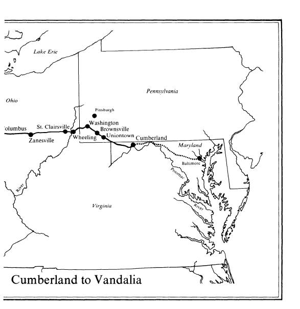
The shortest route did not always meet
with local approval, however. When
Pennsylvania gave permission for the
road to pass through that state, she requested
that it deviate from the most direct
route in order to pass through Uniontown on its
National Road 121
way to Brownsville, and through
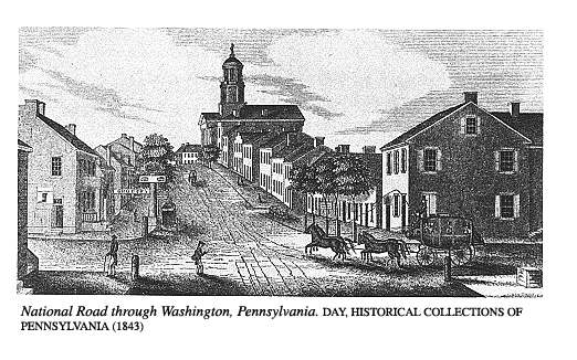
Washington before it reached Wheeling.
Brownsville had been specified as the
most favorable place to cross the Mon-
ongahela River because, as Redstone Old
Fort, it had long been the place where
pioneers had embarked on flatboats to
reach Ohio and Kentucky. After President
Jefferson approved the deviation through
Uniontown in February 1808, Washing-
ton area citizens demanded that the
route be altered to include them. Jefferson's
Secretary of the Treasury, Albert
Gallatin, joined the chorus in July 1808, pointing
out that his home county, Washington,
had a majority of two thousand Democratic
votes. He warned that "if this be
thrown, by reason of this road, in a wrong scale,
we will infallibly lose the State of
Pennsylvania at the next election;..."
Jefferson concluded that if
"inconsiderable deflections from this course will ben-
efit particular places, and better
accommodate travelers," the change in route
should be made. Since both deviations
were short and followed already existing
roads, the principle of "diffusing
benefits with least distance of road" was not de-
stroyed. The changes did set precedents,
however, for future requests to satisfy
other "particular places."
When the site of the Ohio River crossing
was to be determined, several places
battled violently to be selected. In the
thirty-five mile stretch delineated by Con-
gress, the topography of the eastern
bank offered eight possible approaches to the
river. Among the area towns, Charlestown
(the former name of present Wellsburg)
waged a full-scale bombardment of public
officials with demands to be designated
as the terminus. Even Ohioans were
concerned about the crossing because of its ef-
fect on future roads through their
state. When Steubenville residents withheld no
verbal artillery that would promote
their interests, a Zanesville editor warned that a
road through Steubenville would extend
through Newark and thus make Zanesville
a ghost town.
In all this maneuvering, Wheeling's
leaders looked out confidently from their po-
sition of superior advantage and
location. Since the days of the Revolution, pack-
horse trails had led overland to their
town. Also, it was a principal crossing of the
Ohio River because Zane's Trace, the
first road in Ohio, started on the west bank of
the river just across from Wheeling, and
threaded its way southwest through the for-
est to the Ohio River opposite
Maysville, Kentucky.
The trace had been blazed by Colonel
Ebenezer Zane, founder of Wheeling, who
had been authorized by Congress in 1796
to cut a bridle path that would be shorter
and less expensive for mail carriers
than the river route to Maysville and would be
passable when the Ohio River was blocked
by ice. As compensation Zane had re-
ceived 640 acres of land wherever his
trace crossed an important river. Zanesville,
Lancaster, and Chillicothe grew up on or
near those tracts.
Because of Wheeling's importance as a
crossroads and the influence of Henry
Clay, the leading advocate of internal
improvements, Congress chose Wheeling as
the terminus of the National Road on the
Ohio River. On March 28, 1816, Wheel-
ing residents appropriately celebrated
their good fortune, and later Clay's apprecia-
tive friends erected a monument in his
honor.
Wagons and emigrants were already on the
way. While the river towns had
wrangled about the crossing point,
contracts for construction of the first ten miles
west of Cumberland had been, signed in
April and May 1811--nine years after pas-
sage of the enabling act which had
contained provisions for construction of the road.
Laborers swung mighty blows with
mattocks and grunted as they struck gashes in
huge tree roots. Farmers along the route
earned a few dollars by hauling earth to fill
|
gullies. Stonemasons played a day-long rhythmical tapping of hammer against chisel as they shaped stones for culverts and bridges. On the Allegheny Mountains, rising from seven hundred feet at Cumberland to more than two thousand feet near Keyser's Ridge, the road builders met their greatest challenge. Not only was it nec- essary to fell and grub out towering trees, but sixty-six foot wide passages had to be cut through rock-ribbed ancient precipices. Finally, in 1818, workmen graded and scattered stone on the last foot of the road to the steamboat landing at Wheeling. Washington's dream had been realized-the eastern and western waters were joined. The National Road immediately became a well traveled highway. Stagecoaches carrying passengers and mail ran on schedule between Cumberland and Wheeling and, by branching off, to Washington, D.C., and other cities. Conestoga wagons loaded with freight rumbled over cobblestones to landings to meet steamboats which chugged up and down the Ohio River. From Wheeling, emigrants to the western states also could embark on flatboats down the Ohio or could cross the river by ferry and bump over Zane's Trace or the Ohio state road to new farms. Travelers praised the new road, Uria Brown of Maryland, who rode horseback over the Pennsylvania section in 1816, wrote in his diary:
This great Turnpike road is far superior to any of the Turnpike roads in Baltimore County for Masterly Workmanship, the Bridges & Culverts actually do Credit to the Executors of the same, the Bridge over the Little Crossings of Little Youghegany River is possitively [sic] a Superb Bridge; The goodnes [sic] of God must have been in Congress unknownst to them; when the[y] fell about to & Erected a Lane for the Making of this great Turnpike road which |
National Road
123
is the Salvation of those Mountains or
Western Countrys & more benefit to the human fam-
ily than Congress have any knowledge....
Brown called the road
"handsome" and "ellegant."
The cost of construction had exceeded
the estimate of $6,000 a mile. On the high
peaks between Cumberland and Uniontown
the average expenditure was $9,745
per mile. West of the Allegheny
Mountains where less grading was needed, too lib-
eral contracts were awarded to
profiteers. As a result the average cost per mile
from Cumberland to Wheeling was $13,000.
In the years since authorization of the
National Road, settlers had been pouring
into central Ohio, Indiana, and
Illinois. Those who traveled overland found both
Zane's Trace and the Ohio state road to
be inadequate. The latter, which the state
built in 1804 with an appropriation of
$15 per mile provided by the three percent
fund from the sale of public lands,
generally passed through the same towns as the
trace, though it veered from that path
when surveyors found a better route. Speci-
fications permitted contractors to leave
stumps a foot high in the twenty-foot width.
Whenever a vehicle hit such a stump, the
driver longed for a good road. Travelers
besieged Congress with petitions to
extend the National Road directly westward to
the Mississippi River.
That proposal, however, was held up by a
roadblock-interpretation of the Con-
stitution. The most hotly debated
question of the early nineteenth century was
whether the Federal Government had the
authority to appropriate money for inter-
nal improvements. In the early years
when all the states bordered the Atlantic
Ocean, Congress had made appropriations
for piers, lighthouses, beacons, and
buoys. But now that new states in the
West could be reached only by overland
routes, the question arose-could the
Federal Government allocate funds for a road
project?
Senator John C. Calhoun said yes in
1816. "Let us, then," he urged, "bind the
republic together with a perfect system
of roads and canals. Let us conquer space."
He insisted that authority for Congress
to finance roads was implied by the provi-
sion of the Constitution granting power
to establish post offices and post roads.
President James Madison stood on the
other side. When Congress voted to use a
bonus, paid by the Second Bank of the
United States, for internal improvements in-
cluding the National Road, Madison
vetoed it because he considered it uncon-
stitutional.
While Ohio waited for extension of the
road, the 131 mile section east of Wheel-
ing was being ground by the wheels of
heavy wagons into a lane of deep ruts. In
1820 friends of the National Road
introduced into Congress the "gate bill" which
provided for collection of tolls to keep
the road in repair. Two years later both
houses passed the "gate bill,"
but President James Monroe vetoed it because he be-
lieved that Congress did not have the
right of jurisdiction and construction. He
proposed a constitutional amendment to
authorize federally supported internal im-
provements.
This was a period of splitting
constitutional hairs. When President Monroe later
suggested that Congress could
appropriate for internal improvements under the
general welfare clause of the
Constitution, as long as the benefits were of national
dimension, he offered a solution to the
dilemma. In 1824 he signed a bill which
provided funds to repair the road and to
extend it west of the Ohio River. At last
the people of Ohio could expect to see
surveyors with transits and chains marking
124 OHIO
HISTORY
the right-of-way through their farms. In
Indiana, which had been admitted to the
Union in 1816, and Illinois, admitted in
1818, citizens also anxiously awaited the
road crews.
Congressional friends of the road had
not been idle. Although in 1820 they had
appropriated $10,000 to survey a road
from Wheeling to the Mississippi River, that
resulted in only a row of stakes. It was
not until March 3, 1825, that Ohioans could
cheer the news that Congress had
appropriated $150,000 to build the first section of
the road west from the Ohio River to
Zanesville, paralleling the inadequate existing
Ohio state road.
When ground was broken at St.
Clairsville, Ohio, on July 4, 1825, the program in-
cluded reading of the Declaration of
Independence, a volley by the Belmont Light
Cavalry, and an eloquent address by
William B. Hubbard, later a state senator, in
which he prophesied that the road was
destined to reach the Rocky Mountains.
Construction by this time was under the
direction of engineers in the War Depart-
ment, who found that the method of
sprinkling sand or gravel, which had been used
east of Wheeling, did not make a lasting
roadbed. Secretary of War James Barbour
announced, "After the most mature
consideration, I have determined that [we shall
complete the road] on the McAdam plan
...." That Scotsman, John L. McAdam,
opposed the use of gravel because
revolving wheels moved it. By his method the
grade was covered with layers of broken
stone "which shall unite by its own angles
so as to form a solid, hard
surface."
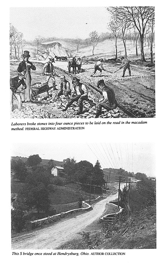
The thirty foot wide roadbed was paved
with layers of broken stone by the maca-
dam method. Gangs of laborers, mostly
Irishmen, were paid $6 a month to break
limestone with round-headed hammers into
pieces that would pass through a three-
inch ring. They wore metal goggles with
slits to protect their eyes. There is a tradi-
tion that some members of farm families
who earned pin money by breaking stone
charged the government twice for the
same stone heap until officials poured white-
wash over stone that had been paid for.
The Corps of Engineers realized that
water rushing down the steep Pennsylvania
mountains and Ohio hills during heavy
rains could erode the stone surface of the
road. They tried to divert the
destructive torrents by building diagonal trenches
called catchwaters across the macadam
paving. Stagecoach passengers, bounced by
the ditches, sardonically named them
"thank-you-marms."
On the eastern Ohio section of the road
the stonemasons built several S-shaped
bridges. According to a folk story, John
McCartney, an Irish stonemason, met the
English architect, Benjamin H. Latrobe,
an engineer for the government, at an inn
one night and solicited the contract for
a bridge. Latrobe quickly drew a sketch
and handed it to McCartney with the
sneering challenge, "Build that if you can."
And McCartney built the S-shaped
structure. Another legend relates that the
bridges were built to stop runaway
horses.
The true explanation is less romantic.
Either the stonemasons did not have the
skill or they did not want to take the
time to cut huge sandstone blocks in the he-
licoidal shape to cross a stream on the
skew. They built an arch at a right angle
with the stream and curved the
approaches into it. The resulting shape resembled
the letter S.
The stonemasons who squared and dressed
the huge blocks in the bridges also
made the milestones in Ohio. A number at
the top of each stone informed the pas-
sengers speeding past at six to twelve
miles an hour how far they were from Cum-
berland. On the angular sides of the
markers were cut the mileages to the towns
126 OHIO HISTORY
east and west. Many of these milestones
still remain on the north side of the road.
When the original milestones in
Pennsylvania disintegrated, they were replaced by
iron mile markers cast at foundries in
Brownsville and Connellsville.
Pennsylvania had set a precedent for
changing the route of the road to satisfy lo-
cal preference. When the layers of
broken stone had been spread as far as Zanes-
ville in 1830, Newark held mass meetings
and petitioned Congress to curve the road
up through its main street, but the
attempt failed.
Then the northern and southern parts of
Columbus competed for the road. By a
compromise it entered that city in 1833
on Friend (now Main) Street, turned north
on High Street, and continued westward
on Broad. West of Columbus, Dayton and
Eaton made desperate efforts to bend the
road southward for their benefit. But the
surveyors followed the order of Congress
to aim their transits directly westward
through the state capitals.
The average cost per mile in eastern
Ohio was much less than the $13,000 per
mile in Pennsylvania. Averaging $3,400
per mile, the eastern Ohio figure included
three inch layers of broken stone,
masonry bridges, and culverts.
In Indiana the National Road was built
east and west from Indianapolis, capital
of the state. Jonathan Knight, the
surveyor in charge, sent out his crews in 1827.
Because he permitted no deviation from a
straight line, the route passed through
few towns.
As workmen began to cut through the
heavy forest in 1829, farmers were em-
ployed at sixty-two and a half cents a
day, blacksmith and wagon shops and taverns
were built to accommodate travelers, and
towns sprang up along the road. Though
Washington Street in Indianapolis was
macadamized, most of the federally-sup-
ported work in Indiana was limited to
cutting timber, grubbing stumps, and digging
ditches, which were completed by 1834.
Federal work was suspended in 1841 be-
cause of lack of congressional appropriations.
After the road was turned over to the
jurisdiction of the state, Indiana
completed its intrastate segment in 1850.
William Greenup, supervisor of
construction in Illinois, let his first contracts in
1830. Progress was slow because of cold
winters and prairie flies that tortured
horses in summer. As in Indiana and
Ohio, trees were felled in a strip eighty feet
wide and the stumps were grubbed out for
a thirty foot roadbed.
The Illinois road surface was dry, hard
clay because stone was not plentiful. The
unfinished eighty-nine mile section from
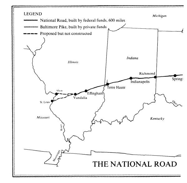
Indiana to Vandalia, then capital of the
state, was opened in 1839 and federal
work was suspended the next year for lack of
money.
Though Congress considered extending the
National Road from Vandalia across
the Mississippi River into Missouri, the
extension was halted by controversy over
the route. Since the act of 1806
provided for approval by the states through which
the road passed, Illinois and Missouri
were deadlocked-the former demanded a
crossing at Alton, and the latter
insisted that the road enter that state at St. Louis.
Congressional opposition also delayed
action, especially when Henry Clay, former
proponent of the National Road, spoke
against the extension. The issue was
brought up in Congress for the last time
in 1847. Nine years later the Federal Gov-
ernment transferred the road to Illinois
control.
By that time the Illinois Central
Railroad had roared into Vandalia and made
stagecoaches and Conestoga wagons
obsolete. Also, in 1839, with the support of
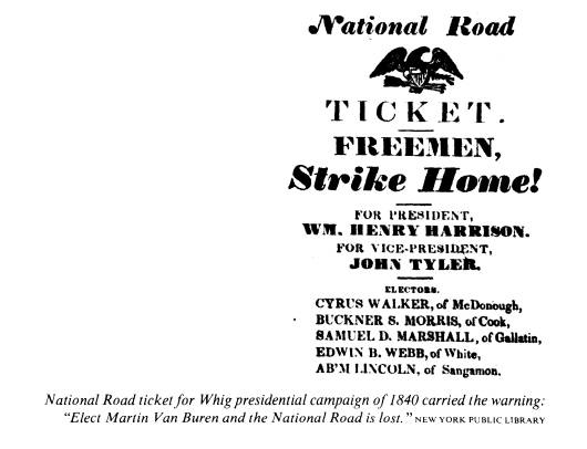
the young legislator Abraham Lincoln,
the Illinois General Assembly had moved
the capital to Springfield. However, the
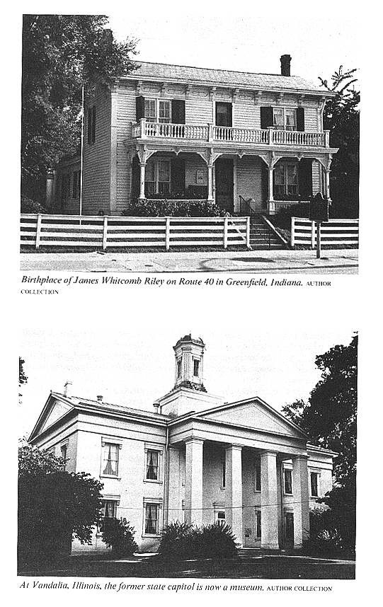
western terminus of the National Road re-
|
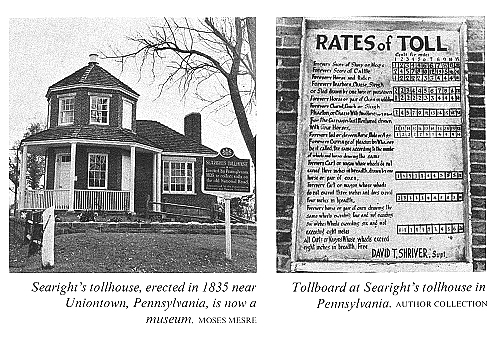
mained Vandalia, where the former state capitol has been restored as a historic mu- seum. Congress made its last appropriation for the road in 1838. The total amount spent on its construction by the Federal Government was $6,824,919.33. Before the stones of the last bridges and culverts in Illinois were laid in place, however, the eastern section had been cut to pieces by thousands of turning wheels. It was generally agreed that the cost of repair should be paid by users of the road in the form of tolls. After years of debate Congress decided that it was uncon- stitutional for the Federal Government to collect toll. Instead, in the 1830's Con- gress began to turn the road over to the states for administration and maintenance, though some of the states required that extensive repairs be made before they would accept ownership. As the states accepted their sections of the National Road, they started to collect toll. Pennsylvania built six tollhouses about fifteen miles apart. The one called Searight's five miles west of Uniontown has been restored as a museum. In that state a horse and rider paid four cents toll; every score of light-footed sheep, six cents; a score of cattle with sharp hooves that cut holes in the road, twelve cents; a stagecoach with two horses, twelve cents; any vehicle with four horses, eighteen cents. Because narrow wagon tires gashed ruts in the road, drivers of those con- veyances paid higher rates. Wagons with tires six or eight inches wide, which acted as rollers, passed the gates free in some states. In Ohio tollhouses stood about ten miles apart. Though rates were slightly higher than in Pennsylvania and the Buckeye state collected nearly a million and a quarter dollars in toll from 1831 to 1877, that amount was insufficient to maintain the road adequately. Travelers reached into the pockets of their jeans to pull out hard money to pay for the cost of riding on a solid road, although some handed over the coins under protest. When clay roads paralleled the National Pike, farmers took the longer route to save the cost of toll. Or, they could "compound"-pay a year's toll in advance and travel for a year and a quarter. Not only did travelers complain about the toll, but some tollkeepers drew their |
National Road 129
ire. A Zanesville man asserted that one
toll collector "feels that because he is
dressed in a little brief authority, he
has a right to insult with impunity; or to shoot
his neighbor's cows if they happen to
pass the gate without paying toll."
Free passage over the National Road was
granted for special uses, depending on
the time and place. Free travel was
frequently permitted for going to or returning
from public worship, military muster,
funerals, mills, voting places, and business
establishments. Although Congress
granted some states the right to make the road
free as early as 1879, tolls remained in
force in certain areas as late as 1910.
A picturesque cavalcade of horse-drawn
vehicles clopped and rumbled over the
six hundred mile length of the road.
Some wagons branched off at the Mon-
ongahela or the Ohio to continue their
journey on flatboats by water. Many kept
their place in the endless caravan that
rolled all the way to Vandalia. Those who
wrote diaries remarked about the
historic and scenic wonders they passed.
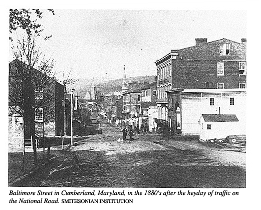
Starting from Cumberland, the early
travelers curved down on Green Street
south of Wills Mountain and turned
westward at the Six Mile House. In 1834 the
U. S. Engineers diverted the route
through the nine hundred foot deep Narrows and
across a new stone bridge over Wills
Creek.
Soon after passing St. John's Rock just
west of Frostburg, the horses strained
against the harness to pull one thousand
feet in fourteen miles up Big Savage
Mountain, then caught their breath over
the Long Stretch of undulating straight
road for two and one-half miles before
entering a dark tunnel under the arching
branches of white pine forest called
Shades of Death because of the holdups and
murders there.
West of these Appalachian heights,
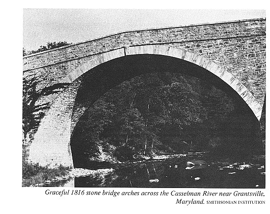
before entering Grantsville, travelers rode
over the picturesque stone bridge across
the Casselman River called Little Crossings
to distinguish it from the Big Crossings
of the Youghiogheny River at Somerfield.
Between those crossings the road passed
the border from Maryland to Pennsyl-
vania.
Immediately beyond Somerfield, Gobbler's
Knob rose abruptly. West of the
knob the road traversed a level stretch
called Jockey Hollow where horse races and
cockfights were held.
In the days before traffic signs and
markers, travelers knew from their school
books when they were passing Fort
Necessity at Great Meadows where Washington
had surrendered to a superior French
force. And west of that historic site they saw
where the brave and obstinate General
Braddock had been buried in the roadbed.
After resting the horses several times
over Laurel Hill, travelers reached Union-
town, midway between Cumberland and
Wheeling. Many guests were entertained
at its famous taverns. It was the home
of Lucius W. Stockton, manager of the Na-
tional Road Stage Company, and Thomas B.
Searight, author of The Old Pike, the
first book about the National Road.
Brownsville, the next town on the
westward journey, was in the area where the
Whisky Rebellion had erupted in pioneer
times. At Brownsville in 1839 the Corps
of Engineers built the first cast-iron
bridge in the nation to carry the National Road
across Dunlap's Creek.
From Scenery Hill, about ten miles west
of Brownsville, travelers gazed at beauti-
ful landscapes. Six miles west of
Washington, the largest city between Cumberland
and Wheeling, they drove on an S bridge
over Buffalo Creek. At Elm Grove, in
present West Virginia, they saw Colonel
Moses Shepherd's monument to Henry
Clay in appreciation for his influence
in routing the National Road to Wheeling.
|
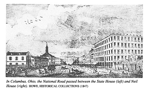
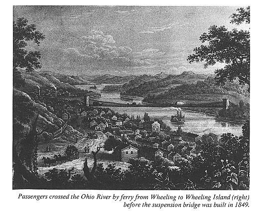
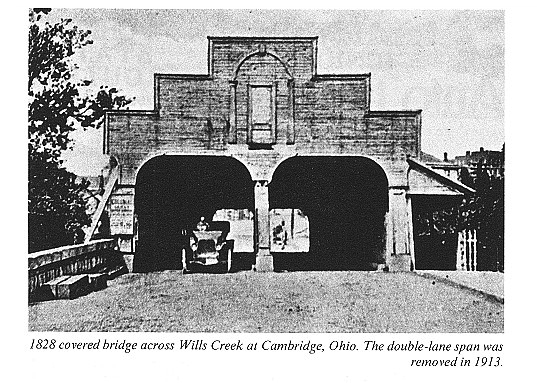
All traffic through Wheeling crossed to Wheeling Island in the Ohio River by ferry until the suspension bridge was completed in 1849. West of Bridgeport on the Ohio side the traveler rode through hilly country. When he was not roller coastering up and down, he was zigging and zagging through S bridges. On the way he passed through St. Clairsville, where work on the road in Ohio had begun in 1825. At Cambridge travelers heard about Joseph C. Dylks, who preached in the surrounding leatherwood shrub country, proclaiming his divinity and earning the sobriquet "Leatherwood God." In Zanesville the road crossed the Muskingum River on a Y bridge that forked in the middle. The National Road traversed the left fork which led through the cen- tral Ohio plains, where glaciers long before had smoothed the land by slicing off the hills and filling up the valleys. Just as travelers had viewed the smoke rising from hundreds of log cabins in the Pennsylvania mountains, here on the level plains from central Ohio to Vandalia, they saw more cabins in vast deadenings. After settlers had killed the trees by girdling, they had planted corn and other crops around them. On farms that had been settled a quarter of a century earlier, stumps still dotted the fields though the trees had been laboriously chopped down and rolled into piles or burned. At Columbus, Ohio, the National Road passed on High Street between the Neil House and other taverns on the west side and the State House on the east. Trav- elers who drove through Springfield after 1845 saw Wittenberg College, and at Richmond, Indiana, after 1847, they passed by Earlham College. Driving along Washington Street in Indianapolis past the state capitol, a visitor could hardly dream that the future Motor Speedway in that city would offer speeds far in excess of his five to ten miles an hour. Before reaching the Illinois border, the traveler drove down the streets of Terre |
|
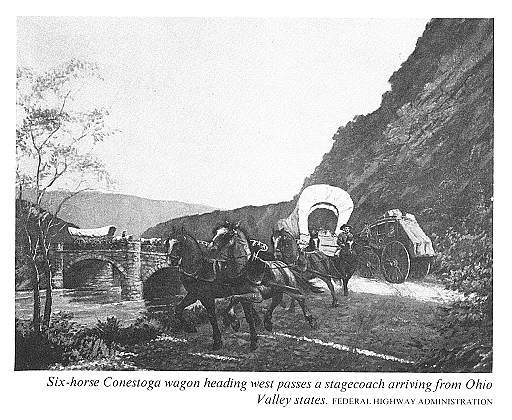
Haute and crossed the Wabash River, which later inspired the state song of Indiana. If stagecoach passengers arrived at Vandalia in 1839, they might have seen Abra- ham Lincoln among the legislators striding across the State House lawn. Over the six hundred mile length of the National Road horses pulled many types of vehicles. Paton Yoder wrote in Taverns and Travelers that "movers" were "the largest single class of travelers." Poor families from the worn-out farms in the east- ern states packed their pots and clothes and blankets in covered wagons and started for the land of promise. At night they pulled off the National Road to camp. While father and sons un- harnessed and fed the horses or oxen, mother and daughters cooked the evening meal in an iron kettle over an open fire. Women and children slept in the wagon and men spread blankets on the ground. Occasionally a family of movers could see down the road the campfire of a man who was transporting his belongings to his new home in a pushcart. Freight was hauled in huge Conestoga wagons, named for the Conestoga River Valley of Pennsylvania where they were first made. With deep wood beds sloping upwards toward the ends to prevent the shifting of loads and with canvas tops drawn tightly over bent wood bows, these wagons could carry from six thousand to ten thousand pounds of freight. They were pulled by six-horse teams controlled by a driver who rode or walked beside the left wheel horse and guided the team by a single line to the left lead horse. Some wagoners painted the wagon body blue and the wheels red. They also hung brass bells from an arch fastened to the hame of the harness over the neck of each horse. Conestoga wagons hauled flour, wool, hemp, and tobacco from the western fron- tier to eastern markets and on the return trip carried calico, sugar, and coffee to fill the shelves of merchants. Hauling freight was a profitable business. Both regular wagoners and "sharpshooters," farmers who made occasional trips, engaged in the trade. One commission house at Wheeling in 1822 received loads from 1,081 wagons, averaging about 3,500 pounds each, and paid out $90,000 in transportation charges. |
|
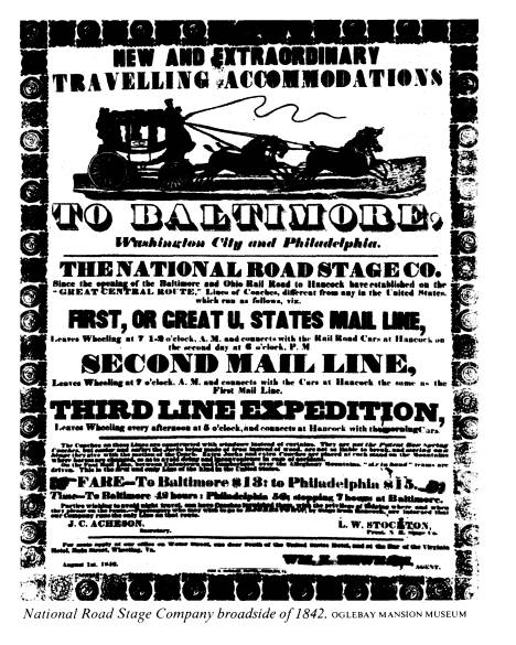
Inasmuch as there were five other commission houses in Wheeling, it has been esti- mated that nearly five thousand wagons were unloaded and that $400,000 was paid to the drivers of Conestogas that year. The drivers considered themselves lords of the road. These stanzas from a poem entitled "The Waggoner" express this pride: The golden sparks, you'd see them spring Beneath my horses' tread; Each tail I'd braid it up with string Of blue or flaunting red; So does, you know, the mountain boy Who drives a dashing team. Wo, hoy! Wo, hoy! I'd cry. Each horse's eye With fire would seem to burn; With lifted head And nostril spread They'd seem the earth to spurn. Freighters made more profit than stagecoaches on the National Road. Although cross-country travel for pleasure was not as popular in the golden age of the Na- tional Road as it is today, stagecoaches ran on regular schedules. Passengers in- cluded merchants on annual visits to eastern markets, legislators shuttling back and forth between their districts and the halls of Congress, foreign visitors, and a few lo- cal travelers. Lucius W. Stockton operated the National Road Stage Company east of Wheel- |
|
National Road 133
ing from headquarters in the National House at Uniontown, Pennsylvania. West of the Ohio River Neil, Moore and Company ran regular schedules until they consoli- dated with the Ohio Stage Company. Neil not only retained a large interest in that company but also started a hotel in Columbus which still bears his name. Small local lines often took the road in competition with the big companies. These competitors called themselves the Good Intent, Defiance, Pilot, or June Bug line. Their rivalry took the form of price cutting and ridicule. J. T. Rowe an- nounced in 1844 that his "sober and attentive drivers" would speed passengers fifty- five miles from Zanesville to Columbus in eight hours for $2. Though fares varied somewhat, they remained rather constant during the stagecoaching heyday, when one could travel from Cumberland to Indianapolis, a distance of about 450 miles, for $18.25. |
|
134 OHIO HISTORY
The drivers circulated sarcastic rhymes about each other, such as: If you take a seat in Stockton's line, You are sure to be passed by Peter Burdine. The early stage wagons with three board seats across the bed were replaced about 1830 by the egg-shaped Troy and Concord coaches, which cost between $400 and $600 each. The driver held the reins on his high front seat, and a leather "boot" at the rear carried luggage. These coaches, brightly painted on the outside, were up- holstered with silk on the inside. Side lamps for night driving avoided collisions but did not illuminate the road. Coaches were identified by names painted in gold letters on the doors. Their names are preserved on bills in the Darius Tallmadge Collection at The Ohio His- torical Society, where are found such notations as: Repairing hind boot, P. Henry, $.50; 2 New front wheels for Boliver, $10.00; Drawing braces for Jefferson, $1.00; Repairing lamp iron, Marion, $.50; Driver's cushion for Elliott, $4.00. When residents in a town on the road heard the driver's horn, they crowded around the stage tavern as the team stopped. They saw many notables step down from the coaches. Sam Houston, Davy Crockett, John C. Calhoun, Daniel Web- ster, John C. Fremont, and James G. Blaine lost no time at every stop in winning political followers. There were no bullet-proof limousines in those days. Ordinary citizens riding in coaches on the National Road literally rubbed elbows with these Presidents before or after their elections-John Quincy Adams, Andrew Jackson, James Polk, Zachary |
National Road 135
Taylor, Millard Fillmore, William Henry
Harrison, Martin Van Buren, and Abra-
ham Lincoln.
When Henry Clay, champion of the road in
its early years, stumbled and fell
from a stagecoach at Uniontown, he
remarked as he brushed his clothes, "This is
mixing the Clay of Kentucky with the
limestone of Pennsylvania."
Joseph Jefferson, famous actor, and many
other stage celebrities traveled along
the National Road. The "Swedish
nightingale" Jenny Lind and her impresario
Phineas T. Barnum hired ten coaches to
haul them, their entourage, and costumes
to the East after a southern tour.
Less famous travelers also patronized
the National Road. Among them was J. S.
Buckingham, an Englishman, who wrote of
his travels in Ohio in 1840:
In the course of our journey from
Wheeling to Zanesville, we found the road admirable all
the way, as good indeed as the road from
London to Bath.... it was no ordinary luxury to
travel on this smooth and equable
National Road, where we were driven at an uniform rate
of about seven miles an hour.... and I
must say, a better road than the one on which we
were now travelling, could not be found
in England.
Versifiers romanticized the
stagecoaches. When passengers switched their prefer-
ence to the new railroad cars at
mid-century, people like Sidney Dyer looked back
longingly at the old vehicles:
The old stage coach in its golden day
Rolled proudly on with its cheerful
load,
And claimed from all the full right of
way,
A monarch then of the turnpike road.
But now the day of its pride is o'er;
It yields the palm to the railway train;
The dear old friend so loved of yore,
We ne'er shall look on its like again.
Then, ho! for the days of the turnpike
road,
The prancing steeds and the brisk
approach,
The mellow horn, and the merry load
That used to ride in the old stage
coach.
Stagecoaches carried the U. S. mail,
which provided a great temptation for rob-
bers to waylay the coach at a dark and
lonely spot. Newspapers frequently re-
ported such robberies. In one case,
however, it was the general agent of the Ohio
Stage Company who stealthily robbed the
mailbags for years. After his discovery
and forfeiture of $10,000 bond, the
accused moved to the distant shores of Australia.
To speed important mail Postmaster
General Amos Kendall started operation of
a pony express on the National Road in
1836. His riders, boys fifteen to seventeen
years of age, whipped their horses to a
gallop and changed mounts every six miles.
The time for the fifty-five mile trip
between Zanesville and Columbus was cut from
nine to five hours. But the pony express
ran for only two years.
The express riders and all vehicles were
slowed frequently by droves of livestock.
When stagecoach passengers saw a cloud
of dust in the distance, they knew they
were approaching a drove. Although
farmers salted part of their surplus meat and
sent it to New Orleans by flatboat, freight
rates were too high and progress too slow
to haul it to eastern cities by wagon.
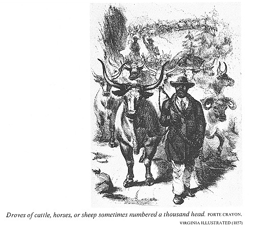
Therefore, western farmers delivered meat to
Baltimore on the hoof. They drove herds
of a thousand hogs, cattle, sheep, and
|
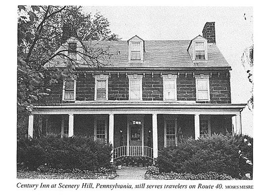
even turkeys over the National Road. The drivers spent several weeks heading off the stragglers that strayed into the woods. At night they stopped at drovers' stands where the stock was fed and the drivers slept on blankets in front of the fireplace. Stagecoach passengers "fed" and "slept" at taverns. In Pennsylvania Searight counted enough of these hostelries to locate an average of one for each mile of road. West of the Ohio River they stood about five miles apart in the country, and several genial hosts welcomed travelers in each town. The tavern on the National Road was a popular and romantic institution. Local residents visited its public rooms for news and gossip and crowded those halls for court sessions, dances, theatrical per- formances, lodge meetings, and even church services. Artistic signboards invited travelers to the taverns. Many of the hosts used their own names, such as Uzal Headley west of Zanesville or Huddleston west of Cam- bridge City, Indiana. Others displayed their patriotism by calling their taverns American, National, or Constitution. Travelers saw signs picturing a Swan, White Goose, Sheep's Ear, and Bull's Head. A portrait gallery lined the road with like- nesses of Franklin, General Washington, Indian Queen, Mermaid, and The Jolly Irishman. The driver's horn brought the tavern host to his door. He knew that the ap- proaching stagecoach would stop to "water the horses and brandy the gentlemen," as Basil Hall wrote, and patronize his dining room. The menu varied from ham and eggs at country taverns to apple rolls, custard pie, sherry, claret, and cham- |
National Road 137
pagne at the Neil House in Columbus,
Ohio, the largest city on the road.
Nostalgia saddened the hearts of
visitors to the inns after the railroads robbed
them of patronage. Only verse could
express their feelings:
It stands alone like a goblin gray,
The old-fashioned inn of the pioneer
day,
In a land so forlorn and forgotten, it
seems
Like a wraith of the past rising into
our dreams;
Its glories have vanished, and only the
ghost
Of a sign-board now creaks on its
desolate post,
Recalling a time when all hearts were
akin
As they rested at night in that
welcoming inn.
When the Baltimore and Ohio Railroad
steamed westward from Baltimore,
Lucius W. Stockton resented and
belittled the competition to his coaches. He de-
cided to prove that the horse was faster
than the locomotive. With his favorite gray
horse he raced a train and won.
Eventually, however, the train proved to
be successful, reaching Cumberland
from Baltimore in 1842. As the rails
were laid farther west, passengers preferred to
ride behind locomotives rather than slow
horses. Friends of the National Road bit-
terly opposed the extension of the
railroad west of Cumberland.
Congressman Henry W. Beeson of
Uniontown, Pennsylvania, delivered an ad-
dress on the widespread unemployment the
railroad would cause. He enumerated
the number of horseshoes the blacksmiths
made annually, the amount of grain and
hay the farmers sold to drovers,
freighters, and stagecoach teams, and the number
of chickens, turkeys, and eggs eaten at
taverns. His arguments failed to stop prog-
ress of railroad construction, however,
and the line reached Wheeling in 1853.
Within ten years the railroads had
captured all the cross-country passenger and
freight traffic to the Mississippi
River. No longer did the National Road echo with
the shouts of drovers, the clatter of
six-horse teams hitched to Conestoga wagons, or
the shrill notes of the stagecoach
driver's horn. Instead, the silence of the road that
had been called the Appian Way of
America was broken only by the wagon of a lo-
cal farmer driving to market with no
other vehicle in sight.
Harper's magazine in November 1879 commented that "The
national turnpike
that led over the Alleghanies [sic] from
the East to the West is a glory departed, .. ."
though "octogenarians who
participated in the traffic will tell an inquirer that never
before were there such landlords, such taverns,
such dinners, such whiskey, such
bustle, or such endless cavalcades of
coaches and wagons ...."
Sentimental friends of the National Road
poured out their feelings in poems like
"The Old Pike":
We hear no more the clanging hoof,
And the stagecoach rattling by,
For the Steam King rules the traveled
world
And the Old Pike's left to die.
The grass creeps o'er the flinty path
And the stealthy daisies steal
Where once the stage horse day by day
Lifted his iron heel.
In the stagecoach and Conestoga wagon
period of rapid national expansion, rich
|
and poor had streamed westward along the road. "Indiana and Ohio received more than ninety thousand inhabitants a year for a generation and at least ninety per cent of them came by way of the Pike," according to Mrs. Carroll Miller in "The Romance of the National Pike" (Western Pennsylvania Historical Magazine, 1927). She estimated that "the average number traversing the Cumberland Road every year was close to two hundred thousand." During those years the National Road served the nation effectively in other ways also. As a wilderness was transformed into populous states, the road made it pos- sible for commercial and political ties to be maintained with the United States as a whole. Stagecoaches carried statesmen to the halls of Congress and sped the deliv- ery of mail and newspapers. Exchange of agricultural surplus from the Ohio Valley for the manufactured goods of cities in the East increased the prosperity of both sec- tions. And, as George R. Stewart observed in U. S. 40, "Constitutionally, it set a precedent for the use of national funds for internal improvement." After the National Road had deteriorated under a generation of local use and neglect by the states, some writers penned mournful encomiums of that highway in the belief that it was dead. Searight in 1894 wrote, "The glory of the old road has departed." In 1907 W. J. Massey told a Zanesville audience, "Its life was short; its work is done; its greatness is of the past." They could not foresee that the greatest period of the road was yet to come. To Searight and Massey, the two inventions that were destined to restore its greatness- the bicycle and the automobile-were only frivolous novelties. In the late 1870's courageous riders began mounting the pennyfarthing or "ordi- |
National Road 139
nary" bicycle to prove that
"walking is on its last legs." Perched on a seat above a
front wheel five feet high, a rider
pumped pedals attached to the axle, and "traveled
while sitting" over smooth city
streets. To take a header from one of these vehicles
without broken bones and a mashed face
required the skill of an acrobat.
By 1880 the safety bicycle was being
developed, with a pedal-operated sprocket
and chain system. The diamond frame and
pneumatic tires added comfort to
safety. On this machine cyclists rode
out of the cities and along the old National
Road and other highways. Though these
contraptions frightened horses and
threatened the lives of pedestrians,
owners of the safeties were making "century"
rides of one hundred miles and traveling
the entire length of the National Road by
1885. In 1897 Sherman Granger rode his
wheel, and walked; from Zanesville to
Cumberland in four and one-half days.
Women found knee-length knickerbocker
trousers were appropriate attire for cy-
cling, but still, riding outside the
cities was not a comfortable venture. Cyclists jol-
ted over ruts and crashed into
chuckholes because the National Road and other
roads were in deplorable condition.
Though cyclists demanded better roads, farm-
ers objected violently to being taxed
for the riders' convenience. Why pay taxes for
the passing fad of citified dandies?
The dandies, whose ranks included
engineers and lawyers, organized the League
of American Wheelmen in 1880 for unified
effort to reform the American road sys-
tem. With their magazines L.A.W.
Bulletin and Good Roads, a National Com-
mittee on Highway Improvement, and
allocation of funds to the Good Roads
Movement, the Wheelmen became the first
ongoing organization to advocate im-
proved highways and methods of
construction. L.A.W. members fought for the
right to ride on public thoroughfares
and against the requirement that they dis-
mount when meeting horses. Their persistent
and organized efforts inspired a na-
tional crusade for better roads.
In response to this effort, Congress
created the Office of Road Inquiry in the De-
partment of Agriculture in 1893. With a
budget of only $10,000, it was charged
with gathering and circulating
information on road construction and maintenance.
Devotees of a second invention
collaborated with the cyclists in the crusade for
good roads. They clattered, vibrated,
and roared in four-wheeled "horseless car-
riages" over city streets and
country roads. However, these proponents of good
roads had to fight for federal help much
as their ancestors had done earlier in the
century because constitutional barriers
again stood in the way. It was a long
struggle before income from gasoline
taxes and licenses at last provided funds that
could be used for road construction.
New methods had to be devised since the
macadam surface was no longer satis-
factory. The faster autos fanned the
dust binder from crushed stone surfaces and
blew it away. Some pioneering efforts in
the use of other materials took place in
Ohio. In 1893 the first brick surface on
a rural road was laid on four miles of the
Wooster Pike in Cuyahoga County. That
same year the first Portland cement con-
crete pavement was applied to four
Bellefontaine streets, after a two-year-old test
strip had proved durable. When Congress
appropriated a half million dollars in
1912 for the improvement of mail routes,
$120,000 was allotted for construction of a
sixteen foot wide concrete experimental
pavement on the National Road from
Zanesville westward twenty-four miles to
Hebron.
Neglect of the road by the states had
permitted farmers to encroach on the right-
of-way. Fences, chicken coops, and barns
had been built on the eighty foot width.
140 OHIO
HISTORY
To handle the growing automobile
traffic, engineers needed the entire right-of-way.
Some farmers protested giving up the
land their predecessors had gladly donated
when the road was built.
Since new methods of paving were adopted
slowly, tourists in the early 1900's
prepared for a hazardous adventure over
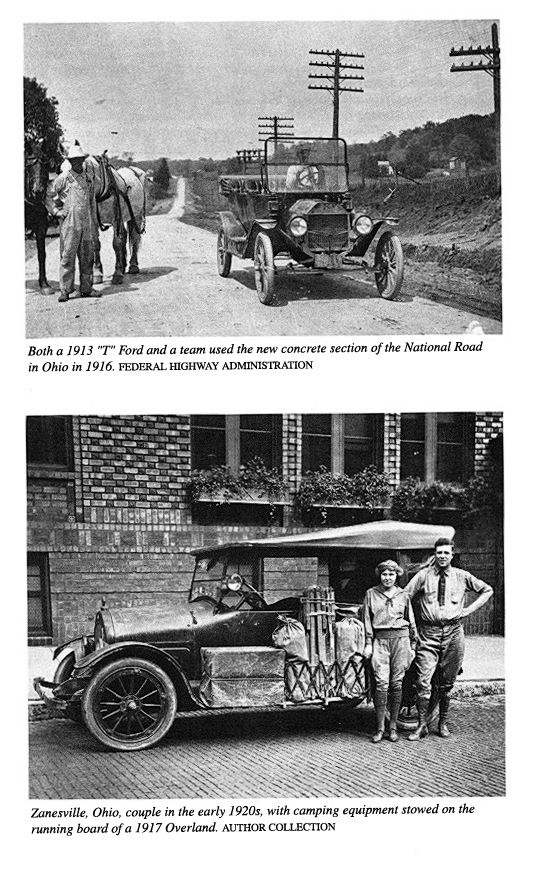
bad roads. In their Maxwells or Model T
Fords they stowed extra gasoline and a
kit of tools wrapped in a canvas roll.
Donning a long linen duster, a driver
vigorously turned a crank at the front of the
machine, sometimes breaking an arm if
the engine backfired. When the motor
coughed, he ran to the dashboard and
advanced the spark. Climbing into the seat,
he pulled goggles over his eyes,
squeezed a large rubber ball that honked a horn to
clear the track, and lurched forward.
Such brave adventurers roared boldly
into the wild rough yonder without road
signs or maps. They chugged through
flocks of squawking chickens and they terri-
fied horses to bolt, wild-eyed and
snorting, while angry farmers pulled desperately
on the reins. Farmers were again
infuriated when auto drivers helped themselves
to rails from fences to pry their cars
out of ruts. They got even by charging high
prices when autoists knocked on their
doors and begged for a team of horses to pull
their machines out of mudholes.
In the towns pioneer motorists faced
ridicule rather than anger. Boys yelled,
"Get a horse!" A popular song
urged drivers to "get out and get under" when the
engine stopped. Another song title said,
"I'd rather go walking," to an invitation
for an auto ride.
Almost every horse-drawn vehicle of the
early period of the National Road had
its counterpart in the automobile era.
Public transportation was provided at first by
jitney buses. They were touring cars
that waited at public squares for passengers
who sometimes overflowed the seats to
the hood. Later, large buses ran on sched-
ule from city to city and from coast to
coast.
Freight that had been hauled in
cumbersome six-horse Conestoga wagons filled
huge trucks in the automobile age. The
drivers, with headlights that illuminated
the road, drove both day and night.
Instead of the wagon stands of 1840, truck
stops provided lunches and parking space
where drivers could sleep in their cabs.
With faster speeds and heavier loads,
these drivers of Brobdingnagian semis needed
more skill than the wagoners that
Searight praised in The Old Pike. They also pro-
vided a temptation to hijackers. Most
states organized highway patrols to make
roads safer for truckers, family cars,
and tourists.
In response to the demands of auto
owners, roads were gradually improved. In
1916 Congress passed the federal aid
road act and the Bureau of Public Roads was
activated. Of this period Albert C.
Rose, senior highway engineer of that bureau,
later wrote, "The Old Cumberland
Road before long was to be restored to more
than its earlier prestige."
That prestige soon came. More people
traveled on the National Road in au-
tomobiles than by stagecoach in the
earlier period. Then, when few persons had
been able to afford private vehicles,
most travelers had patronized coaches. In the
automobile age, a car usually carried a
single family, or perhaps only the driver.
No road signs directed the early auto
tourists. A copy of The Official Automobile
Blue Book, published by the American Automobile Association
beginning in 1901,
was almost as indispensable as gasoline.
Roadside landmarks guided the tourists.
In the 1910 edition the driver was
informed that 2.2 miles west of Effingham, Il-
linois, he would come to "prominent
crossroads-2 mail boxes on left." At 0.7 miles
142 OHIO
HISTORY
west of Springfield, Ohio, he would
arrive at "Diagonal crossroads, cement works on
left; turn left with telephone poles;
cross trolley." At Hebron, Ohio, "Trolley ends
(1909); continue straight ahead through
covered wooden bridge."
East from Zanesville at 0.4 miles:
"Left-hand branch road, church in center, bear
left with trolley, curving right past
cemetery." When he arrived 9.7 miles east of
Cambridge, Ohio, he found: "Toll-gate,
25�; follow main travel all the way, curving
right and left across stone
bridge." This was an S bridge.
Though rich people patronized city
hotels, most travelers strapped tent, folding
cots, blankets, and food on the running
boards. They camped at night in a school
yard or in a grove near a farmhouse. As
the number of cars increased, the National
Road was paved with a patchwork of dirt,
brick, concrete, and asphalt. Blacksmiths
learned to make repairs on cars, and
country stores sold gasoline.
As the paving improved and the number of
cars increased, gasoline companies is-
sued maps and guides. The 1924 Mohawk
Guide listed campsites, prices, and loca-
btions of stores and garages that sold
gas-at Cambridge City, Indiana: "City camp
free; 50� after third day; cook house;
good grass." In Ohio, where the National
Road had been designated State Road No.
1, the Neil House charged $3 to $6 for a
room and $1.25 for dinner. East of
Columbus thirty-six miles was "Majestic camp,
50�; tables under roof and shower;
cabins." Star Camp two miles east of Zanesville
charged 50�; "shower bath,
10�." Many families added to their income by accom-
modating travelers in tourist homes.
Motel luxuries came later.
More cars and faster speeds created a
demand for highway signs. Drivers did not
always have beside them a navigator to
read The Blue Book, and it was dangerous
to read directions and watch the road at
the same time. Long before the speed of
cars reached seventy miles an hour,
there were wrecks. Governor Vic Donahey of
Ohio ordered white crosses erected on
the sites of fatal accidents in the hope of mak-
ing drivers more cautious. Maps of
highway routes and road signs became neces-
sary, though road atlases of the entire
country were not generally available until the
1920's.
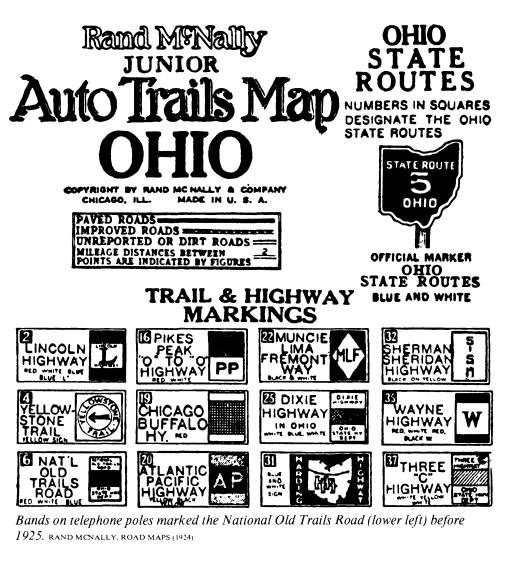
In the absence of any governmental
action, private commercial promoters linked
together strings of existing roads and
gave them names. The routes were marked
by bands of different colors on
telephone poles. George R. Stewart stated in U. S.
40 that there were at least 250 of these routes. Among them were the
Lincoln High-
way, Old Spanish Trail, and Dixie
Highway. Merchants, restaurants, and hotels
paid the promoters to route these
highways past their places of business.
In 1907 the Missouri Old Trails Road
Association advocated restoration of the
National Road and its extension from
coast to coast. At Kansas City in 1912, under
the inspiration of Judge J. M. Lowe, the
association included the National Road as
part of its designation of the National
Old Trails Road. That route, which extended
3,096 miles from Washington, D.C., to
Los Angeles, was identified by red, white,
and blue bands on telephone poles. With
a few changes, such as the dip through
Dayton, Ohio, the old National Road was
the main segment of the National Old
Trails Road.
Pages of verse have been written about
the romantic old stagecoaches-which had
some charm when viewed at a distance. In
reality, the passengers were bumped up
and down and jolted right and left. How
much more comfort and freedom the
drivers of autos enjoyed on the Old
Trails Road!
They could stop for sightseeing at Fort
Necessity and Braddock's tomb in Penn-
sylvania, at the Zanesville art
potteries in Ohio, and at James Whitcomb Riley's old
|
swimmin' hole in Greenfield, Indiana. If an antique shop or roadside stand ap- pealed to them, they pulled to the side of the road to browse. At mealtime they could eat a picnic lunch in an oak grove or dine at a nearby restaurant. The National Road did not quite lose its identity in the National Old Trails Road, which was one of the better commercially promoted highways. Because these roads were linked together by private effort, they lacked coordination and official sponsor- ship. In 1925 a Joint Board on Interstate Highways recommended a national grid system for numbering east-west routes with even numbers by tens and north-south highways with numbers ending in one or five. Thus, in 1926, the old National Road became part of U. S. 40. Ohio can claim several "firsts" in highway progress. Considering these records and the original enabling act which contained the provision for a highway con- necting the Northwest Territory with the eastern states, it is appropriate that a Na- tional Road Museum to memorialize the historic importance of the famous highway should be located in Ohio. The museum ten miles east of Zanesville on Route 40 |
|
portrays the history of what for more than a century was the Main Street of Amer- ica, "the first major road-building venture of the Federal Government." Today Interstate 70 parallels the old National Road. For speeding over the most miles in the shortest time, I-70 offers the best route. But to enjoy the scenery, meas- ure the distance by old milestones, browse in antique shops, dine at picturesque roadside inns, and enjoy leisurely travel over historic ground, the six hundred mile stretch of Route 40 between Cumberland, Maryland, and Vandalia, Illinois, is the best choice. You will be following in the stagecoach tracks of the pioneers. James Ball Naylor celebrated the route in his poem, "The Old National Road": From the sweet-smelling Maryland meadows it crawled, Through the forest primeval, o'er hills granite-walled; On and up, up and on, 'till it conquered the crest Of the mountains-and wound away to the West. 'Twas the Highway of Hope! And the pilgrims who trod It were Lords of the Woodland and Sons of the Sod; And the hope of their hearts was to win an abode At the end-the far end of the National Road. |
National Road 145
BIBLIOGRAPHY OF NATIONAL ROAD SOURCES
Bailey, Kenneth P., The Ohio Company
of Virginia and the Westward Movement 1748-1792.
Glendale, Arthur H. Clark Company, 1939.
Bruce, Robert, The Old National Road.
Washington, D.C., American Automobile Associ-
ation, 1915.
Burns, Lee, "The National Road in
Indiana," Indiana Historical Society Publications, VII
(1919), 209-37.
Cleland, Hugh, George Washington in
the Ohio Valley. Pittsburgh, University of Pittsburgh
Press, 1955.
Davis, Charles Henry, National Old
Trails Road, Ocean to Ocean Highway. Boston, Everett
Press, 1914.
Freeman, Douglas Southall, George
Washington, Vol. VI. New York, Charles Scribner's
Sons, 1954.
Fuller, Wayne E., "The Ohio Road
Experiment 1913-1916," Ohio History, LXXIV (1965),
13-28.
Gallatin, Albert, The Writings of
Albert Gallatin, edited by Henry Adams, Vol. I. New
York, Antiquarian Press Ltd., 1960.
Gray, Ralph, "From Sea to Shining
Sea," National Geographic, 120 (1961), 1-61.
Hardin, Thomas L., "The National
Road in Illinois," Illinois State Historical Society Jour-
nal, LX (1967), 5-22.
Hatcher, Harlan, The Buckeye Country.
New York, H. C. Kinsey & Company, 1940.
Hulbert, Archer Butler, The Cumberland
Road, Vol. X, Historic Highways of America.
Cleveland, Arthur H. Clark Company,
1904.
---"The Old National Road-The
Historic Highway of America," Ohio Archaeological
and Historical Quarterly, IX (1901), 405-519.
---Washington's Road (Nemacolin's
Path), Vol. III, Historic Highways
of America. Cleve-
land, Arthur H. Clark Company, 1903.
Hunt, John Clark, "Over the
Alleghenies into History," American History Illustrated, V
(1970), 24-33.
Jefferson, Thomas, The Works of
Thomas Jefferson, collected and edited by Paul Leicester
Ford, Vols. II, III, X, XI, XII. New
York, G. P. Putnam's Sons, 1904-05.
Jordan, Philip D., The National Road.
Indianapolis, Bobbs-Merrill Company, 1948.
Lowdermilk, Will H., History of Cumberland,
Maryland. Washington, D.C., James Anglim,
1878.
Lowe, J. M., The National Old Trails
Road. Kansas City, Mo., the author, 1924.
Mason, Philip P., The League of
American Wheelmen and the Good-Roads Movement,
1880-1905. Ann Arbor, University Microfilms, 1957.
McKee, Harley J., "Original Bridges
on the National Road in Eastern Ohio, Ohio History, 81
(1972), 131-44.
Miller, Mrs. Carroll, "The Romance
of the National Pike," Western Pennsylvania Historical
Magazine, X (1927), 1-37.
Ristow, Walter W., "A Half Century
of Oil-Company Road Maps," Surveying and Mapping,
XXIV (1964), 617-37.
Searight, Thomas B., The Old Pike. Uniontown,
Pa., the author, 1894.
Searight, Thomas B., The Old Pike; An
Illustrated Narrative of the National Road, edited, de-
signed, and illustrated by Joseph E.
Morse and R. Duff Green. Orange, Va., Green Tree
Press, 1971.
Smith, Catherine Blaskovich, "The
Terminus of the Cumberland Road on the Ohio," West
Virginia History, XIV (1953), 193-264.
Smyth, Pauline, The Geology Along
Route 40 in Ohio. Columbus, Division of Geological
Survey, 1955.
146 OHIO
HISTORY
Stewart, George R., U. S. 40. Boston,
Houghton Mifflin Company, 1953.
Thomas, James W. and T. J. C. Williams, History of
Allegany County, Maryland. L. R. Tits-
worth & Company, 1923.
Washington, George, Washington and
the West, Being George Washington's Diary of Septem-
ber, 1784... and a commentary ... by Archer Butler Hulbert.
New York, Century Co.,
1905.
Withers, Alexander Scott, Chronicles
of Border Warfare, edited by Reuben Gold Thwaites.
Cincinnati, Robert Clarke Company, 1908.
Yoder, Paton, Taverns and Travelers;
Inns of the Early Midwest. Bloomington, Indiana Uni-
versity Press, 1969.
Young, Jeremiah Simeon, A Political
and Constitutional Study of the Cumberland Road.
Chicago, University of Chicago Press,
1904.
